/
ENVIRONMENTAL STUDY OF DEGRADATION IN THE SOOL PLATEAU AND GEBI VALLEY ENVIRONMENTAL STUDY OF DEGRADATION IN THE SOOL PLATEAU AND GEBI VALLEY

ENVIRONMENTAL STUDY OF DEGRADATION IN THE SOOL PLATEAU AND GEBI VALLEY - PDF document

layla
layla . @layla
Follow
345 views
Uploaded On 2021-09-08

ENVIRONMENTAL STUDY OF DEGRADATION IN THE SOOL PLATEAU AND GEBI VALLEY - PPT Presentation

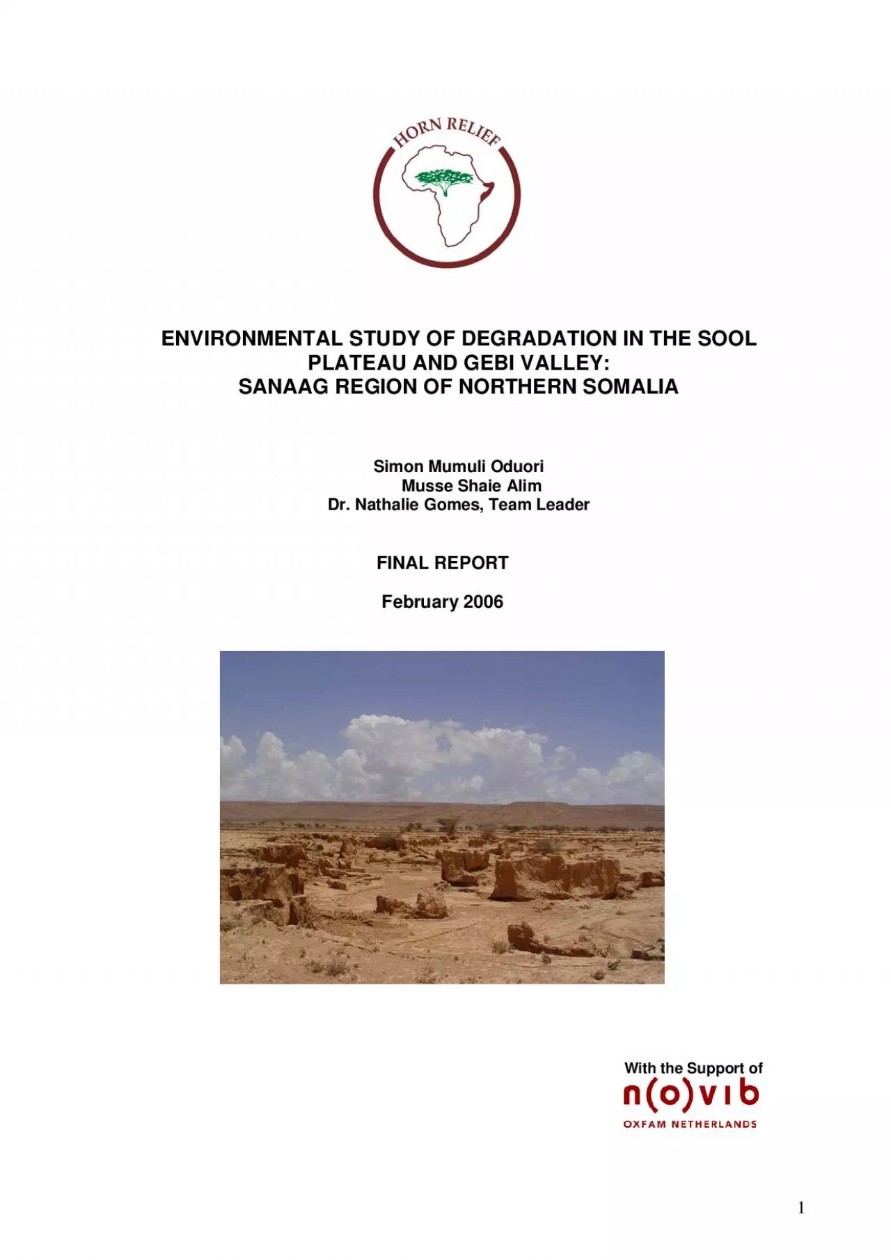
SANAAG REGION OF NORTHERN SOMALIA Simon Mumuli Oduori Musse Shaie Alim Dr Nathalie Gomes Team Leader FINAL REPORT February 2006 With the Support of 1TABLE OF CONTENTS Testimonial 5 Acknowledg ID: 877026

drought water plateau sool water drought sool plateau soil land areas area valley gebi study vegetation rainfall environmental grazing

Share:

Link:

Embed:

Download Presentation from below link

Download Pdf The PPT/PDF document "ENVIRONMENTAL STUDY OF DEGRADATION IN TH..." is the property of its rightful owner. Permission is granted to download and print the materials on this web site for personal, non-commercial use only, and to display it on your personal computer provided you do not modify the materials and that you retain all copyright notices contained in the materials. By downloading content from our website, you accept the terms of this agreement.


Presentation Transcript

1 ENVIRONMENTAL STUDY OF DEGRADATION IN TH
ENVIRONMENTAL STUDY OF DEGRADATION IN THE SOOL PLATEAU AND GEBI VALLEY: SANAAG REGION OF NORTHERN SOMALIA Simon Mumuli Oduori Musse Shaie Alim Dr. Nathalie Gomes, Team Leader FINAL REPORT February 2006 With the Support of 1 TABLE OF CONTENTS Testimonial 5 Acknowledgements 6 Acronyms and Abbreviations 7 Introduction to Horn Relief 8 Executive Summary 9 Introduction 12 1. 2004 Humanitarian Crisis 12 1.1 Major Identified Causes of Environmental Degradation 12 1.2. Local Awareness of Environmental Degradation 13 2. Gaps and Research Questions 14 3. Objectives of the Study 14 4. Description of the Study Area 15 The Gebi Valley 15 The Two Parts of the Sool Plateau 16 The Sool Plateau Proper 16 Xadeed 16 5. Methodology of the Study 18 5.1 General Bibliographical Review 18 5.2 Interpretation of Satellite Imagery and Identification of Hot Spots 18 Defining Hot Spots and Bright Spots 18 Pre-Fieldwork Analy

2 sis 18 5.3 Methodologies for the Fi
sis 18 5.3 Methodologies for the Field Survey 20 5.4 Procedure for Field Survey Work 23 Notes on the Ecological Survey 24 Notes on the Soil Survey 24 Chapter 1: Identifying and Tracking Hot Spots from Remote Sensing (1988-2003) 25 1. Methodology for Field-data Analysis 25 1.1 Land-Cover Classification 25 1.2 Estimates for Herbaceous Biomass 25 1.3 ERDAS Imagine Land Cover Classification 25 2. Results 25 2.1 Galool Forest 25 2.2 Shrubs Open 25 2.3 Sparse Herbs/Shrubs 26 2.4 Grassland 26 2.5 Bare Lands (soils and rock) 26 Chapter 2: Drought 30 1. Conceptual Framework 30 1.1 Typology of Droughts 30 1.2 Drought Characteristics and Severity 31 1.3 Drought Preparedness 31 2. Rainfall Patterns in the Gebi Valley and Sool Plateau 32 2.1 Rainfall Analysis 32 2.2 Local Oral Memory since the 1950s 34 3. Drought and Vegetation Decline 34 3.1 Normalised Difference Vegetation Index (NDVI) 34 3.2 Indigenous Knowledge and Field Observations 35 2 TABLE OF CONTENTS (continued)

3 4. Quantity and Quality of Water fr
4. Quantity and Quality of Water from the Aquifer 36 4.1 Physiography 36 4.2 Water Quality 37 4.3 Factors Affecting Recharge 38 5. Drought’s Impact on Pastoralist Livelihoods 40 5.1 Loss of Livestock 40 5.2 Famine and Malnutrition 41 5.3 Scarcity and High Cost of Water 42 6. Coping Strategies and their Limitations 43 6.1 Inward and Outward Migration 43 6.2 Displacement of the Destitute to Settlements and Urban Centers 44 6.3 External support 44 6.4 Alternative Livelihoods 44 Conclusions 44 Chapter 3: Soil Erosion 46 1. Conceptual Framework 46 2. Soils of the Gebi Valley and Sool Plateau 46 2.1 History of Soil Erosion in the Gebi Valley and Sool Plateau 46 2.2 Field Observations on Soil Degradation 47 2.3 Physical and Chemical Properties of Soil Samples Taken from the Gebi Valley and Sool Plateau 50 Physical Properties 50 Chemical Properties 50 3. Major Causes of Environmental Degradation and their Impact 51 3.1 De-vegetation of Prime Grasslands in the Gebi Valley 51 3.2. Dec

4 reased Soil-Water Retention 51 3.3
reased Soil-Water Retention 51 3.3 Rate of Formation and Expansion of Gullies 53 3.4 Wind Erosion 53 Conclusions 54 Chapter 4: The Breakdown of Governance 55 1. Conceptual Framework 55 1.1 The Tragedy of the Commons 55 1.2 Customary Pastoral Land Use and Tenure 56 1.3 Disruptive Factors 56 2. The Collapse of Range-management Systems 57 2.1 Water Development and Settlements 57 2.2 Overgrazing and Waste pollution 61 3. The Spread of Range Enclosures 62 4. Anthropogenic Deforestation and De-vegetation 63 4.1 Deforestation 63 4.2 Grass Harvesting 68 5. Damage caused by the Proliferation of Road Networks 68 Conclusions 69 Chapter 5: Conservation and Rehabilitation Initiatives 70 1. Community Initiatives 70 Community Policing of Deforestation 70 Policing and Regulating Charcoal Burning 70 Controlling Grass Harvesting 72 1.1 Small-scale Homestead Tree Planting 73 1.2 Soil Conservation 75 3 TABLE OF CONTENTS (continued) 2. Horn Relief’

5 s Commitment to Environmental Health 75
s Commitment to Environmental Health 75 2.1 Emergency Relief and Drought Vulnerability Reduction Programme 75 Summary of Micro-Projects 75 Conclusions 78 Overall Conclusions 79 Major Environmental Issues 79 Environmental Awareness and Community Initiatives 80 Government and NGO Initiatives 80 Recommendations 81 Reducing Drought Vulnerability 81 Drought Preparedness 81 Further Studies to be Undertaken 82 Annexes 83 Annex 1: Questionnaire 83 Annex 2: Drought Trends in Local Memory 88 Annex 3: Vegetation Decline Estimates 90 Annex 4: Estimates of Livestock Losses 94 Annex 5: Berked Information 95 Annex 6: Soil Analysis 98 Annex 7: Charcoal Production Estimates 103 Bibliography 104 4 Testimonial “In the area of Badhan/Xubeera, fifty years ago, I endured mosquitoes, swampland and grass so tall that the families sometimes lost their baby camels from the herd. I remember being tied to the family hut to prevent me from wande

6 ring away and being lost in the foliage.
ring away and being lost in the foliage. In Xubeera, the remnants of the Sultan’s palace can still be found in a vast wasteland that once produced the best grassland and the best horses in Somalia”(Fatima Jibrell, Horn Relief). 1 “Before, in the area of Hadaaftimo, the cattle could get lost in the Doomaar. This grass was very tall. Now, it can’t even hide a kid (goat) because of soil erosion” (Hadaaftimo). “‘In front of us, the area was a very thick woodland with high grasses. A camel of five years could disappear in it. The area was degraded over the years with the reduction of the rain, cutting of trees and livestock coming for water, which increased overgrazing” (Ceel-Buh). 1 Somalia Natural Resources Management Network, workshop 3, September 20th-October 3rd 1997, p 6 5 Acknowledgments Horn Relief would like to thank Novib/Oxfam Netherlands for recognising the importance of such a study and providing the funding needed to undertake this study. The environmental experts wish to express their profound gratit

7 ude to: Fatima Jibrell, Degan Ali, Liesl
ude to: Fatima Jibrell, Degan Ali, Liesl Inglis, Lesley Bourns, Reginauld Cherogony, Crispin Kinga, Abduba Mollu Ido, Pauline Bwire and Fred Monari of Horn Relief for their collective support; Zoltan Balint, Laura Monaci and John Cody of SWALIM for their encouragement; Thomas Gabrielle of FSAU, Patrick Berner, Harold Weepener and Joab Nyakwana of FAO Somalia, Craig von Hagen and Gabriel Sanya of FAO-AFRICOVER, K. Nair and Richard Ngetich of UNDP Somalia, Sidow Ibrahim and Gideon Galu of FEWS NET, Christian Omuto of The World Agroforestry Centre (ICRAF) and Patrick Gicheru of KSS, KARI for their assistance, information exchange and hospitality. The experts are most grateful to FAO AFRICOVER for providing Landsat Satellite Imageries (MSS, TM, and ETM) that were used in this desk study. We wish to acknowledge with gratitude the help and provision of valuable document copies and information of: Eng. Ali Abdi Odawaa, Director General of the Ministry of Mining and Water Resources of Somaliland, Mohamed Jaamac, Director General, and Abdulkadir Abdi Aware, of the Ministry of Pastoral Development and Environment of Somal

8 iland, Dr. Ahmed Abdullahi Elmi, Program
iland, Dr. Ahmed Abdullahi Elmi, Programme Officer of Danish Refugee Council in Hargeisa, Mrs Sadia Mohamed Ahmed, Director of PENHA, Dr. Harun Ahmed Yusuf, Head of ACTIONAID, Hargeisa, Mr. Ahmed Ibrahim Ali, Programme Manager of Candlelight, Mr. Abdullahi Yusuf, and Mr. Ali Ismail of Oxfam, Mr. Mohamed Said Gees, Chairman, Ali Eghe Duale and Ali Jibril Hirsi, of the Academy for Peace and Development (APD), Dr. Hassan Mohamed Ali of VETAID. We would like also to thank our assistants in Nairobi and in the field: Fred Monari, Eng. Omar Mohamud Irbad, Ali Hussein Mohamed, Abdishakur Mohamed Ali, Fatah Mohamed Abdullahi, Kadro Adbdullahi Dhakthar, Abdirisak Mohamed Isse and Mohamed Farah Ahmed. We would also like to thank the local communities that welcomed and guided us during the fieldwork. Particular thanks go to Fred Monari for participating in the preparation of the training manual. Also, we would like to thank Olufemi Terry for editing the report. We are very grateful to the members of the technical review committee of this study, namely Zoltan Balint (SWALIM), Friedrich Mahler (EC-Somalia), Edmund Barrow a

9 nd Chihenyo Mvoyi (IUCN), Chris Print (U
nd Chihenyo Mvoyi (IUCN), Chris Print (UNICEF) and Nicolas Haan (FSAU), and to the members of the SACB who attended our presentation on 15 December, 2005, for their constructive comments. 6 Acronyms and Abbreviations AGNPS Agricultural Non Point Source Pollution Model ASAL Arid and Semi Arid Lands BRI Buraan Rural Institute CIGR International Commission of Agricultural Engineering EC European Commission ERDVR Emergency Relief and Drought Vulnerability Reduction ETM Enhanced Thematic Mapper FAO Food and Agriculture Organisation of the United Nations FEWSNET Famine Early Warning System Network FSAU Food Security Analysis Unit of the FAO FEZ Food Economy Zone GoK Government of Kenya GTZ Deutsche Gesellschaft für Technische Zusammenarbeit ICRAF International Centre for Research on Agroforestry IIASA International Institute for Applied Systems Analysis IRIN Integrated Regional Information Network ITCZ Inter Tropical Convergence Zone ITF Inter Tropical Front IUCN World Conservation Union KARI Kenya Agricultural Research Institute KENSOTER Kenya Soils and

10 Terrain KSS Kenya Soil Survey LADA
Terrain KSS Kenya Soil Survey LADA Land Degradation Assessment Programme MSS Multi-Spectral Scanner NDVI Normalised Difference Vegetation Index NGO Non-Governmental Organisation NOVIB OXFAM Netherlands PINEP Pastoral Information Network Programme PYL Pastoralist Youth Leadership RMSN Resource Management Somali Network SWALIM Soil, Water and Land Information Management SEPADO Somali Environmental Protection and Anti-Desertification Organisation SACB Somalia Aid Coordination Body TM Thematic Mapper TNG Transitional National Government UNDP United Nations Development Programme UNEP United Nations Environment Programme UNICEF United Nations Children’s Fund UNOCHA United Nations Office for the Co-ordination of Humanitarian Affairs USAID United States Agency for International Development WB World Bank WFP World Food Programme 7 Introduction to Horn Relief Horn Relief is an African-led international organisation with a mission to support pastoral livelihoods in pursuit of a peaceful, self-reliant and greener future. Since its inception in 1991 in response

11 to Somalia’s devastating humanitari
to Somalia’s devastating humanitarian crisis and civil war, Horn Relief has grown from a small grassroots organisation to one able to advocate for and leverage much-needed resources for its partner communities internationally and regionally. Horn Relief is based in Nairobi, operational throughout northern Somalia and is currently expanding its operations to include southern Somalia and Kenya. In recognition of the central role that the natural environment plays in the lives and livelihoods of pastoralist communities, and in Somalia’s future in general, environmental protection and rehabilitation is at the core of all of Horn Relief’s work. To that end, the organisation has closely monitored the status of gullies, water sources, and rangelands for over a decade. Also, Horn Relief has been a leader in the campaign to develop alternative energy sources such as energy improved stoves and solar lighting and cookers, which led to the first large-scale distribution of highly efficient solar cookers to poor households in Somalia in 2005-2006. The organisation has also engaged in extensive lobbying and advo

12 cacy efforts against the charcoal trade,
cacy efforts against the charcoal trade, resulting in the ban of charcoal exportation from Puntland in 1998. Horn Relief’s results-oriented actions with rural communities, their livestock, and their environment have won awards, including the largest global environmental prize, the Goldman Environmental Prize in 2002, and gained recognition from the international community as a whole. 8 Executive Summary Horn Relief began alerting the international community, in particular the Somalia Aid Coordination Body (SACB) of the looming humanitarian crisis, caused in part by environmental factors, in northern Somalia since 2001. In 2003, the international community began to acknowledge the crisis and its environmental component, particularly as a result of reports from the Food Security Analysis Unit (FSAU). This dire situation was linked to a persistent drought affecting the primary source of livelihood for the population: transhumant pastoralism. Numerous studies undertaken have associated environmental degradation processes in the Sool Plateau livelihood zone with both natural and anthropogenic factors,

13 mainly natural disasters and change in l
mainly natural disasters and change in land use. A multidisciplinary team comprising an ecologist, a soil specialist and a social anthropologist was tasked to assess and ultimately increase understanding of the complexity of the environmental problem. The broad objective of this study was to assess the status (nature and severity) of environmental degradation, particularly land degradation and the socio-economic impacts thereof on the pastoralists of the Gebi Valley and Sool Plateau. The study consisted of two phases: Phase one began with a two-week desk study in Nairobi involving literature review, rainfall data analysis and preliminary interpretation of satellite imagery of Gebi Valley and Sool Plateau (Sanaag Region); In Phase two, the team undertook a 21-day field study in collaboration with Horn Relief field staff. Field work was carried out in 21 sites selected from the desk study, hot-spot analysis and from consultation with Horn Relief staff. Field survey methodologies included: (1) Interviews based on a qualitative questionnaire; (2) FAO/Africover land cover classification forms; ( 3) Line transe

14 ct and quadrant techniques for vegetatio
ct and quadrant techniques for vegetation sampling; (4) SWALIM water source survey forms; (5) Reference to a Kenyan soil-survey manual for land and soil description; and (6) Soil sampling and analysis to assess physical and chemical properties. Land-cover changes over a 15-year period (1988-2003) were assessed using Computer Aided Land Cover Classification by ERDAS Imagine software; FAO’s Africover Land-Cover Classification System; and ground observations for species composition, land cover and herbaceous biomass. The main findings on land-cover changes over the period in question are: 52% of forest has been lost on the Sool Plateau A 32% decrease in shrubs open (20 to 65% of total cover), especially in the Gebi Valley and Xadeed A 40% decrease in grassland, especially in the Gebi Valley and Xadeed A 4% decrease in sparse vegetation (1 to 5% of total cover) in the Sool Plateau, Gebi Valley and Xadeed A 370% increase in bare land in the Sool Plateau, Gebi Valley and Xadeed Dry herbaceous biomass in 2005 by vegetation type stood at 120 kilograms per hectare (kg/ha) of sparse vegetation; 460kg/h

15 a.of grassland; 200kg/ha.of trees open a
a.of grassland; 200kg/ha.of trees open and 1400kg/ha.of shrubs open The last prolonged drought (2000-2004) in the area in question, as reflected in the NDVI data, dried up all the palatable vegetation used as forage by the different categories of livestock (cattle, camels and shoats). Livestock died of starvation and, according to the local community, there was deterioration in water quality, which the study has not conclusively linked to the drought. Global Acute Malnutrition reached alarming rates. Due to scarcity, water prices increased as did the need for water trucking to settlements and grazing areas. Animals were too weak to walk to water sources and there were heavy losses of pack camels, which are used to carry water and goods. 9 Recourse to coping strategies for the drought was limited: migration became difficult due to the geographic and temporal extent of the drought. Many destitute and poor pastoralists relied on charcoal production and grass harvesting as alternative livelihoods. The study area is currently undergoing considerable land degradation as a result of soil erosion, negative l

16 and-cover change, increasing bare lands,
and-cover change, increasing bare lands, overgrazing, heavy runoff during rainy seasons, strong winds in dry seasons and the clearing of vegetation. The major causes of soil erosion include water (flash floods in the 1971-1972 cyclone; El Nino in 1997-1998; and heavy downpours in 2004), wind, trampling by livestock, vehicles tracks on innumerable unpaved roads, and the clearing of vegetation. The localities most affected by all types of soil erosion are: Ceel-Doofaar, Cawsane, Mindigaale, Raad-Laako, Badhan, Hadaaftimo and Yuube, in the Gebi Valley; and Carmaale, Ceel-Buh, Buraan, Dhahar, Sherbi and Waaciye, in Sool Plateau. The rugged and steep topography surrounding the floodplains facilitates runoff water forming flash floods, accelerating various forms of water erosion including splash, sheet, rill and gully. Rills and gullies have damaged or destroyed almost 50% of floodplains, which were the primary grazing lands for livestock during dry seasons. Strong winds erode about 190-300 mt/ha. of soil annually from an already denuded bare surface, per the team’s calculations. The impact of wind

17 erosion can be observed in the Xubeera
erosion can be observed in the Xubeera area of Gebi Valley: drifting sands accumulate around shrubs and dry wood lying on the ground whenever a path is blocked, forming sand mounds. Sinkholes are also characteristic of the study area and contribute considerably to water and sediment loss by diminishing the water- retention capacity of the soils. Sinkholes have been observed in soils with an underlying shallow limestone formation in Mindigaale and Xingalool areas (Gebi Valley and Xadeed). The major consequences of soil erosion are numerous. There is direct loss of thousands of tonnes of productive topsoil in every flash flood, which in turn causes hundreds of hectares of land surface to be dissected by gullies or newly formed streams on the flood plains. Grass and trees are swept away from the primary grazing lands (for example, in Cawsane). Large quantities of rain water are lost as runoff through streams and gullies to the ocean or through percolation into sinkholes. Soil fertility and soil water retention are diminished, thereby hampering the productive capacity of the floodplains that formerly were the

18 primary grazing lands in the areas. Last
primary grazing lands in the areas. Lastly, soil deposition occurs in riverbeds and berkeds whereas settlements and roads are threatened by gullies. The collapse of the Somali government led to the neglect or abandonment of range management systems or Seere (reserve grazing land for dry periods) in Gebi Valley and modern rotational grazing on the Sool Plateau. At the same time, since 1991 efforts at water development by drilling boreholes and digging permanent wells as well as constructing underground and house berkeds (water reservoirs) especially on the Sool Plateau coincided with an increase in permanent settlements. The consequences of these factors are intensified overgrazing and land denudation around settlements and water points, water pollution affecting livestock and degraded water quality of surface water sources and storage facilities. Many new illegal enclosures have been established on communal rangelands outside of the areas designated for enclosure in rangeland established by the British (47 farms) and the government of Somalia in 1975 as part of rangeland concessioning and the formulation of a

19 post-drought recovery strategy. These po
post-drought recovery strategy. These post-1991 illegal enclosures are used for grass harvesting (Raad-Laako) and for small-scale farming (Ceel-Doofar, Mindigaale, Hadaaftimo, Yuube, Damala-Xagarre, Dhahar). During the drought, charcoal burning intensified as an alternative source of livelihood for destitute pastoralists and in response to internal market demand. The study estimates that approximately 10 80,000 trees are cut every month in the Sool Plateau. While this figure is much lower than elders’ estimate of 400,000, it is still a considerable amount. The communities of Gebi Valley and Sool Plateau have attempted to conduct several conservation and rehabilitation initiatives including control and policing of charcoal burning and grass harvesting. Elders convinced local residents to stop burning and to destroy kilns with the help of local patrols sponsored by the community. However communities require considerable external support to have more impact. Over the last 14 years, Horn Relief has participated in environmental campaigns against charcoal burning, and successfully convinced the Pu

20 ntland Authority and other local organis
ntland Authority and other local organisations to ban charcoal exports in 1988. Horn Relief has also worked hard to raise environmental awareness among local communities, to promote resolution of resource-based conflicts (typically over charcoal and water), and to support small-scale soil and water conservation projects. Many advancing and destructive gullies in the most damaged areas of Gebi Valley villages (Cawsane, Mindigaale/Dawli, Badhan, Hadaaftimo and Carmaale) and Sool Plateau villages (Ceel-Buh, Xingalool, Wardheer, Baraagaha-qol, and Dhahar) were contained or managed through Horn Relief micro-projects to construct: rock dams, check dams, stone-protected soil bunds, regular soil bunds, drop structures, excavated drainage channels, semi-circular soil bunds and to rehabilitate roads and diversion works. Most of the interventions were successful in diverting water, reducing gully head advancement, promoting soil deposition and enclosing sinkholes in the different sites. It was noted that an increase in water detention and soil water retention for about 50 square kilometres in the rehabilitated areas ensured

21 sufficient moisture for pasture growth
sufficient moisture for pasture growth and the increase of biomass production. Only 20% of the sited structures were destroyed by heavy rainfall and floods (Cawsane, Mindigaale, Raad-Laako and Hadaaftimo in the Gebi Valley; Ceel-Buh on the Sool Plateau). The recent prolonged drought, predictably, affected the vegetation and the livelihood of the local communities. Water became scarce and perennial palatable vegetation dried out. More than 80% of livestock was lost through starvation or water-scarcity related stress. Primary grazing land was lost (almost 50% in the floodplains) due to gully expansion or the removal of productive topsoil by floods and increased loss of rain water running off into streams and then to the Indian Ocean. Additionally, there is an ongoing increase in new settlement centers, with construction of berkeds occurring in primary grazing lands, and undiminished charcoal burning for income generation by the destitute population, collectively contributing to land-cover destruction and the shrinking of seasonal grazing areas. The study’s recommendations Restock destitute pastora

22 lists with animals and pack camels to al
lists with animals and pack camels to allow them to recover economically and to allow migration to areas with good pasture and adequate water Restore the practice of reserved grazing lands and/or apply modern rotational grazing systems to allow regeneration of vegetation Support initiatives to increase water retention and soil conservation Combat commercial deforestation and illegal de-vegetation and promote reforestation. Monitor water availability and quality for human and livestock use Monitor and evaluate the durability of soil conservation structures Strengthen mechanisms for forecasting drought and floods Promote consensus on interregional migration 11 Introduction FSAU and Horn Relief understood early the environmental dimension of the humanitarian crisis in the north, especially in the Sool plateau (FSAU Flash, 2004:1/Horn Relief Drought Assessment Report, 2003). This dire situation was linked to a persistent drought affecting the primary source of livelihood for the population: transhumant pastoralism. 1. The 2004 Humanitarian Crisis The Food Security Analysis Unit (FS

23 AU) has developed a methodology to analy
AU) has developed a methodology to analyse food security in Somalia. The organisation divided Somalia into livelihood zones, also called Food Economy Zones (FEZ) and established indicators that could be monitored to assess levels of food security. In early 2004, a part of the Sool Plateau livelihood zone was declared a humanitarian emergency area requiring urgent humanitarian assistance. Global acute malnutrition climbed as high as 20%. Heavy livestock losses (80% of camels, 40-50% shoats), displacement of pastoralists to urban centres and increasing outbreaks of human disease were reported. The situation was attributed to a persistent drought affecting the prime source of livelihood of the population: transhumant pastoralism. In fact, FEWS-NET indicated that the Normalised Difference Vegetation Index (NDVI) or vegetation profile in the FEZ had been sub-normal for seven seasons. 1.1 Major identified Causes of Environmental Degradation Several assessments have concluded that environmental degradation in the Sool Plateau livelihood zone is attributable to natural and anthropogenic factors, mainly n

24 atural disasters and changes in land use
atural disasters and changes in land use. Among these: The occurrence of drought In 1974, Somalia is reported to have experienced its worst ever extended drought. The drought, known to Somalis, as “Daba Dheer” (long-tailed) due to its severity and long duration affected many thousands of families in central and northern Somalia. Many lost all their livestock and were relocated by the Somali Government to the fertile southern areas and adapted to new livelihoods as farmers and fishermen. The most recent drought, which persisted for four years (2000-2004) in northern 12 Somalia, also devastated livestock (FSAU, 2005). The large number of livestock deaths from this drought pushed tens of thousands of people into destitution and dependence on social support with minimal prospects of returning to pastoralism. Soil erosion When flooding from the Golis Mountains occurs during rainy seasons, soils in the Gebi Valley and Sool Plateau experience severe sheet, rill and gully erosion. The soils of the Gebi Valley are of alluvial origin and hence are highly susceptible to soil erosion during the rai

25 ny seasons. However, these soils become
ny seasons. However, these soils become encrusted and compacted in dry seasons. Alkalinity and salinity are also common soil problems in the region (Hassan-Sufi, March 2005). The cyclones of 1971-1972 (Duufaan), flooding related to El Nino (1997-1998) and heavy rainfall in 2004 exacerbated extensive erosion in prime rangelands. Sand-dune formation is evident wherever strong winds prevail in areas of degraded and bare, sandy soil surfaces (UNDP, 2001). Establishment of settlements in wet grazing lands The establishment of settlements in wet grazing lands has devastated vegetation that would otherwise serve as a windbreak (IUCN, 1997). This trend has been heightened by an increase in the number of permanent water sources. Around settlements and water points range degradation is notably more severe (EC, 2005). Deforestation of critical tree species The most-severe environmental degradation process, prevalent in almost every part of Somalia, is the depletion of acacia tree species. A UNDP study claimed deforestation throughout Somalia reduced forest cover to as low as 10% over the last decade (UNDP,

26 2001). Deforestation is attributed to: f
2001). Deforestation is attributed to: fuel wood and charcoal production; cutting of timber for construction, clearing of land for new settlements and dry-land agriculture; excessive browsing and grazing by livestock; and vegetation clearing for building materials in new settlement areas (UNDP, 2001). Deforestation leads to loss of biodiversity (i.e. loss of important wildlife habitat) and soil degradation (i.e. erosion, reduction in water-retention capacity, soil encrustation and compaction). Vegetation degradation leads to an increase in soil and ambient thermal conditions. The occurrence of these conditions exacerbates the problem of drought vulnerability and increases the burden on residual open range, which is being exhausted. 1.2. Local Awareness of Environmental Degradation A household survey conducted on environmental concerns in Somalia (UNDP/WB, 2003) revealed that most households are aware of local environmental problems. Survey correspondents ranked specific environmental concerns as follows: 1) Drought (28.5%), 2) Deforestation (13.8%), including charcoal production (7.8%) 3) Soil erosio

27 n (8.2%), 4) Uncollected garbage (4.8%
n (8.2%), 4) Uncollected garbage (4.8%), especially nylon bags in the supply of Khat in the study areas, which has affected the livestock as well as the vegetation. However, conservation and rehabilitation initiatives are few: overall, little is currently being done by agencies or local authorities to stop the continuous land degradation in Somalia. Because of the lack of central government (and non-recognition of the Somaliland and Puntland States), none of the UN Conventions such as the Convention to Combat Desertification (CCD) and the Bio-diversity Convention (BDC) have been ratified. In addition, there is no national environmental action plan. Although Somaliland has introduced a strategic range-management plan, it has yet to be implemented due to lack of resources (UNICEF, 2002) 13 2. Gaps and Research Questions Horn Relief has undertaken environmental initiatives in the Sool Plateau and Gebi Valley areas of Sanaag Region of Northern Somalia for over ten years and recognises that the growing environmental crisis in the area threatens the very survival of local communities. Although there is a weal

28 th of information available on the livel
th of information available on the livelihoods, climate, food security and to a degree, the environment in the region, there are several existing gaps in background intelligence and information, particularly quantitative data to gauge the level of the environmental crisis. These are due in part to four key issues of concern: 1. Existing data is inadequately centralised, consolidated and documented 2. Detailed information regarding key environmental issues of concern and their scale remains unavailable (particularly at the level needed for project planning in a given area) 3. Pastoralist communities’ indigenous knowledge of historical trends in environmental change and how they have affected livelihoods in the region is undocumented. Existing information systems are inadequate to track environmental change, an essential element to effectively recognise and avert environmental crises 4. Awareness creation and training in natural-resource management is clearly lacking from project planning aimed at improving food security and addressing issues of drought vulnerability, mainly due to the gaps mentioned in po

29 ints 1, 2 and 3 The environment is th
ints 1, 2 and 3 The environment is the natural, social, cultural and economic surroundings of a certain area of interest (Trust, 1979). In this study, environmental degradation encompasses land degradation as well as human pollution and invasion of vegetation predators. The UN CCD defines land degradation as a natural process or a human activity that results in land no longer being able to sustain properly its economic functions or the original ecological functions (ISO 1996, FAO 1988). 3. Objectives of the Study The broad objective of the study was to assess the status (nature, extent and severity) of environmental degradation, especially land degradation and its socio-economic impacts on the pastoralists of the Gebi Valley and Sool Plateau. The specific objectives of the study are fivefold: 1. Determine the environmental issues in the area 2. Determine the main causes of the environmental problems 3. Determine the effects of the outlined environmental problems on the livelihood of the communities 4. Outline the strategies for coping with drought in the study area 5. Outline the main environm

30 ental threats to the livelihood of the l
ental threats to the livelihood of the local communities in the area This exhaustive study was intended to provide a better understanding of the mechanisms available and measures taken to counter environmental degradation and the effects of drought and desertification on communities in the two study areas. The outcome of this study should, going forward, constitute a baseline against which the results of future annual environmental surveillance can be measured. 14 4. Description of the Study Area The study area is located between latitudes 10 o 43’ 40.4” and 9 o 14’ 1.4” north and longitudes 41 o 51’ 43.8” and 43 o 45’ 51.6” east. It covers an area of about 307,000 ha. It is bounded in the north by the escarpment of the Golis Mountains, in the east by the Daroor Valley, to the south by the Karkar Mountains and in the west by a strip of Sool Plateau and the upper edge of the Nugaal Valley. This is the ecological definition of the Gebi Valley and Sool Plateau, which differs from FSAU’s Food Economy Zoning (FEZ) definition. The Gebi Valley The Gebi Valley

31 landform comprises barren whitish and pi
landform comprises barren whitish and pinkish weathering hills, eroded into round-topped hills occurring singularly or in rows surrounded by gently sloping pediments separated by outcropped ravines, plains and recently formed alluvial plain between them. The hills are of Karkar formation with some layers of anhydrites near the top of the range. The anhydrites weather into naturally rolling mostly flat downland and small flat-topped hills formed of thin limestone. The plains consist of quaternary deposits, mainly formed in a continental environment with some marine influence. The composition is mainly silty clay with secondary fine sands. Many streams (toggas) cross the plains flowing toward the coastline of Indian Ocean, and rounded stones, gravel and sandy deposits typify their course. Coarse deposits are predominant in the areas out of the toggas and close to the hills, while clay and silts are dominant in flood plains. The recent alluvial plains constitute parcels or narrow strips of relatively smooth land created from flood deposits formed adjacent to many river channels in the area distributed between the hi

32 lls. The altitude in the Gebi Valley
lls. The altitude in the Gebi Valley area ranges from 1,300m above sea level (a.s.l) from Yuube in the North to 1000m (a.s.l) at Ceel-Doofar in east; and from 1,300m (a.s.l) from the north foot slope of Al Madow at Raad-Laako to 900m (a.s.l) at Ceel-Buh to the south at Togga Saar. The overall shape of the terrain is characterised by generally sloping topography, varying from gently undulating (2-5% slope gradient) to very gently undulating (0-2% slope) mostly on the alluvial plains. Soils are developed commonly on the flat to very gently undulating terrain with depths ranging from shallow to very deep. They are low to moderately drained with variable levels of fertility, but lack of sufficient rain and occasional floods hinder potential production of good pasture. Although human activity has removed most of the original trees and tall shrubs in many parts of the territory and the surface of the hills is totally bare, the plains and floodplains present variable degrees of vegetation cover. The vegetation of the plains is predominantly herbaceous varying from fairly dense to sparse cover; while in t

33 he flood plains there is a range of spar
he flood plains there is a range of sparse to dense trees along the rivers and scattered in small depression sites, their composition mainly of Acacia species. Large tracts of the flat and depressed areas (45% of total surface) in the floodplains have fairly dense grasses and herbs, this area encompasses part of the target area of Horn Relief’s rehabilitation efforts to halt gully erosion and sinkholes; other portions have sparse herbaceous plants or are totally bare. The area is used as communal grazing land, excepting a small proportion of illegal enclosures used for grass harvesting by people living close to the settlement of Raad-Laako. There is newly introduced farming in small plots in areas close to water-source points in a few settlements like Mindigaale and Ceel-Doofar, but this is negligible. In the areas surrounding Hadaaftimo and Yuube villages much of the grasslands are privately owned or have been appropriated since 1990 following collapse of the government. These are used for grass harvesting or grazed by family stocks. 15 The Two Parts of the Sool Plateau The Sool plateau forms a l

34 arge part of eastern Sanaag that can be
arge part of eastern Sanaag that can be divided into two main parts, namely Xadeed, which is plains land bisecting two tracts of forest plateau, one to the north (Sool Plateau North) and one to the south (Sool Plateau South). Both have the same landscape evolution and distinctions between the two are based on lithological and ecological differences. Topography ranges from a large, nearly flat plateau to a gentle slope nearer the direction of the Indian Ocean. The altitude of this area ranges between 1,100m (a.s.l) and 900m (a.s.l). The Sool Plateau Proper The Sool Plateau is mainly covered by the Karkar Formation constituting sedimentary rocks of limestone and gypsum, not dissected by valleys. Its eastern side is delineated by the Buraan scarp, while the south-eastern side joins with the north-eastern edge of the Sool Hawd Plateau. It is characterised by flat and gently undulating topography covered by quaternary alluvial deposit fill depressions. Overall slope is usually from 2-5%. Soil development in the alluvial plain is of variable depth, from shallow to moderate, and often not dissected by valleys and

35 it is underlain by shallow marine depos
it is underlain by shallow marine deposits that extend into the eastern highlands of Karkar. Land in the Sool Plateau has consistent vegetation, locally called Ood, comprising Acacia woodlands and tall grasses, which becomes progressively thinner before disappearing altogether at the point of confluence with Xadeed. In this zone the only accepted land use is communal grazing, but there is intensive tree cutting and charcoal burning for sale to the major urban settlements in North-eastern Somalia (Puntland). Xadeed Xadeed is a tract of land that covers the middle of a large area of the Sool Plateau, beginning south of Carmaale village and extending as far as the depression zone south of Xingalool village. It has a rock formation of Gypsum and anhydrite of the Taleex formation underlain by Nubian sandstone and Auradu limestone, which outcrops along the northern margin of the Sool Xadeed Plateau. Most of this area is covered by gypsum and gypsiferous soils with minor areas of limestone. The areas covered by gypsum are completely bare, with some pebble layers covering a few places. Drainage is nearly absen

36 t in areas covered by gypsum; karstic de
t in areas covered by gypsum; karstic depressions and sinkholes are widely spread in these zones. Runoff water from toggas draining the area between Jiidali and Yuube at the western Hadaaftimo floods in transitional flat depressions before it spreads to the large Xadeed Plain area southwest of Carmaale, Shimbiraale, Damala-Xagarre and Xingalool to Baragaha-qol. Among settlements in Sool Xadeed are Xingalool, Sibaayo and Damala-Xagarre. This flood-prone area is covered by gypsiferous soils and thin reddish sand-covered limestone. It is characterised by dense herbaceous vegetation cover, but areas featuring gypsum outcrops are entirely bare. Many sinkholes are found scattered around in the area, but are more concentrated in areas surrounding Xingalool and often coincide with patches of Acacia trees. The land is used for communal grazing of livestock and for wildlife; local communities practice wildlife conservation in the region. 16 17 n September 21, 2005 and October 11, 2005, which coincides with the end of the short dry (Xagaa) and the beginnin Betweeseasong of the short rainy season (Deyr), th

37 e team assessed a total of eera, Hadaaf
e team assessed a total of eera, Hadaaftimo and Yuube) asta 20 settlements and their surrounding environments. These comprised: Seven settlements in Gebi valley (Ceel-Doofaar, Cawsane, Mindigaale, Raad-Laako, Badhan/Xub One settlement in the Karkar mountains (Buraan) Nine settlements in Sool plateau (Ceel-Buh, Mindhicir, Bali-Busle, Carmaale, Dhahar and Sherbi in Sool Plateau North; and Wardheer, Sarmaanyo and Baraagaha-qol in Sool Plateau South) Three settlements in Xadeed (Xingalool, Sibaayo and Damala-Xagarre) Due to time constraints, the team was unable to visit the Golis Mountains (Al Madow) and the col areas (Guban), which form part of the local pastoral ecosystem. 21 All the localities visited are in Sanaag region except Sarmaanyo, which falls within Sool region, and Sherbi and Ceel-Doofar which form part of Bari region. Yuube, Carmaale and Damala-Xagarre are located in Cerigaabo district. Hadaaftimo, Badhan/Xubeera, Mindigaale, Raad-Laako, Ceel-Buh, Mindhicir and Wardheer are part of Badhan district. Cawsane, Buraan, Bali-Busle, Baraagaha-qol, Xingalool and Dhahar are situated in Dhaha

38 r district. The majority of the settleme
r district. The majority of the settlements are home to the Warsangeli, except Sarmaanyo which is inhabited by Dhulbahante, and half of Damala-Xagarre, in which Dhulbahante also predominate. The village of Sherbi belongs to a group called Dishiishe. 22 The estimersons. However, these figures may not be entirely accurate for the following reasons: ements on the Sool Plateau located in Sool Region and Puntland (along the tarmac road and east of this road) were not assessed .4 Procedure for Field Survey Work ttlement centres or villages. Gatherings occurred in elected positions like in the shade of trees, halls, spacious rooms or school classrooms. The field urvey exercises in each settlement were conducted as follows: 1. Discussions were held with the most respected local community elders, women and youth behalf of 2peeches from the three experts (namely Nathalie, Simon and Musse). During these introductions, a detailed account was made of the aim of the field visits. 3ted the full cooperation of the elders during the field visits with respect to the research in general and to responding to the questionnaire 45

39 ght, cyclones, land-resource-use-related
ght, cyclones, land-resource-use-related problems and desertification, traditional environmental ervation techniques used and modern approaches to soil conservation. 6e end of the session elders were asked to identify from among their number three ded assessment of the most serious damage in terms of: soil erosion; tree cutting and charcoal burning; grass harvesting for sale; and local water sources points. 7embers (Nathalie, Simon, and Musse) of the original team then separated from and formed three new teams each with two assistant enumerators and the 8 Kenya Soil Survey data form was used to collect data on soils while a modified FAO-ta form was used to collect data on land cover and land use. Specially rms were used to collect data on charcoal burning and vegetation. 9. ated population of the study area as of 2005 is 21,509 households, or 150,000 p They do not necessarily include all pastoralists A number of permanent settl 5 The study applied a routine procedure throughout the process of fieldwork for Gebi Valley and Sool plateau. The first part of the morning session was used to mobilise the res

40 pected resident elders, women and youth
pected resident elders, women and youth groups of the various se s s who were able to converse clearly about relevant local environmental problems onthe community. . The gatherings were preceded by introductory s . Following the introduction, the team reques specifically. During this session the team moderated debate, undertook interpretation and took notes. . The qualitative portion of the general questionnaire was administered. (See annex 1) . Elders were asked to share their local knowledge of their environment, and to respond to specific questions pertaining to settlement history, population estimates, local land degradation, droughts, impacts of drought, local coping strategies for drou cons. At th individuals familiar with local environmental problems. Each of the three would then serve as a guide to a member of the team during the field exercises in the vicinity. Areas of focus inclu . The three meach other guide picked from among the elders. This was to allow each expert to undertake a practical and specialised observation and investigation. Nathalie’s (social anthropology) team visited water-sourc

41 e sites in the area used both for domest
e sites in the area used both for domestic needs and to water animals. Musse’s (soil) team investigated areas with problems of soil erosion. Simon’s team (ecology) visited sites where tree cutting, charcoal burning and grass harvesting were carried out. The ecology team also collected data on land and vegetation cover and frequency, and herbaceous biomass. . The SWALIM-designed questionnaire was used to collected data on water sources. The Africover dadesigned fo Data collection was supervised by the three experts with the help of the assistant enumerators. 23 Notes on the Ecological Survey The results of the preliminary interpretation made in Nairobi formed the basis of the ecological fieldwor. Samples sites for field verification were selected based on the different land cover hot spots identified in th interpretation of the preliminary satellite image. kehe output of the initial satellite-image interpretation was a preliminary land cover map showing hot pots in the study area. Subsequently, stratified random sample points were selected in each land-y coordinates of these points were entered in t

42 he handheld Garmin lobal Positioning Sys
he handheld Garmin lobal Positioning Systems, GPS, as waypoints. These waypoints were used for navigation to the ss, data on the constituent lassifiers was collected. FAO’s Land Cover Classification software was then used to classify the nd-cover classes. All the land-cover types were visited and ground truth data collected on the ibutes. Selection of the sample points was based on accessibility. tation ttributes determined: species name, frequency, crown cover and height class. At 20-metre tervals, basal clipping of the herbaceous plants was done. otes on the Soil Survey r suitable interventions aimed at soil conservation. The survey, which began n September 16, 2005 was not aimed at making a detailed survey of the land degradation of the tudy areas, but to acquire corroboration on the ground in selected areas identified on the desk-s in line with tandard methods used for soil survey and utilised in the Manual for Soil Survey and Land Evaluation of Kenya, 1987. The field survey focn the fo Geology Landform Slope Vegetation cover d use Physicarties (depth, colour, tetructure , ompaction, sealing/crusting) Ch

43 emical analysis (pH, salinity and sodici
emical analysis (pH, salinity and sodicity, content os T s cover stratum. The x and G sample points for field-data collection. Data was collected on land cover, land use and vegetation frequency, cover, height and species composition, and clippings of herbaceous material for dry herbaceous biomass estimation. Classification of the various land-cover classes was based on the Africover-FAO Land Cover Classification System, LCCS. For each cla c la above listed attr The line transect method (Heady 1983, Crocket 1963, Johnston 1957) was used to estimate both woody and herbaceous vegetation parameters. The line transects measured 100m in length. The woody layer was sampled along the same transect. The woody crown interceptions (McIntrye 1953, Heady 1983 and Westman 1984) were recorded and the following woody vege a in N The soil survey was undertaken to explore and map the severity of soil erosion, particularly in the gullies of Gebi Valley and Sool Plateau. Findings could then be used to form conclusions and recommendations fo o s study satellite images as hot spots. The methodology used for the fieldwork wa s uo

44 sed llowing: Lan Soil l Prop
sed llowing: Lan Soil l Prope xture, s c f carbonate ) 24 Chapter 1: Identifying and Tracking Hot Spots from Remote Sensing The gathered plant samples were classified using the Africover-FAO Land Cover Classification software, (LCCS), for easier establishment of classes from field data. Several classes were merged to produce manageable classes. Merging of the classes was done because of the small scale at which the mapping was carried out. 1.2 Estimates for Herbaceous Biomass Clipped vegetation matter was later oven dried at 80C for 48 hours and then weighed to determine the dry herbaceous biomass (Muchoki 1988). Appendices 2 and 3 show the data forms used to collect data on the herbaceous vegetation layer. As mentioned previously, a computer-aided classification was performed using the ERDAS Imagine 8.3 software. In this process, the classification was controlled. The process involved giving the system knowledge in form of training sites, from the field samples, out of which the spectral signature of each class was calculated. The classification was done using the Maximum Likelihood Algorithm.

45 The computer-aided classification was m
The computer-aided classification was more precise and rapid, and is one that can be repeated easily. After several trials, final land cover/hot spot maps were generated for 1998 and 2003. The computer-aided classification process produced maps (see below) with the following classes of vegetation: Galool Forest comprised 5.2% of the focus area in 1988 but only 2.9% in 2003. The forest is called Galool forest because Acacia bussei (Galool in Somali) is dominant. Other woody species in this forest included Acacia tortilis (Qurac), Boscia miniimifolia (Meygaag), Salvadora spp (Cadey), Acacia nilotica (Maraa), Cadaba herterotricha (Higlo), Ziziphus Mauritania (Gob) and Cadaba somalensis (Qaalanqal). Galool Forest covered an area of about 162,467.5 ha. in 1988(Figures 4 . However, by 2003, Galool Forest covered an area of about 78,211.89 ha.A total of 84,255.61 ha. of Galool forest were lost in the 15 years, equal to a loss of 52%. Shrubs Open comprised 45.1% or1,397,528.28 ha. of the focus area in 1988 and 34.8%94, 9957.83 ha. 15 years later, a 30% decrease. The dominant woody species here include Acacia bussei, Acacia

46 tortilisSolana spp Other woody species
tortilisSolana spp Other woody species in this forest included, Boscia miniimifolia (Meygaag), Salvadora spp. (Cadey), Acacia nilotica (Maraa), Cadaba herterotricha This chapter discusses the results of the final interpretation of satellite images. These results are based solely on the field observations. 1. Methodology for Field-data Analysis (Higlo), Ziziphus Mauritania (Gob) and Cadaba somalensis (Qaalanqal). Herbaceous species include Anthropogon spp. (Duur), Chrysopogon aucheri (Dureemo), Sporobolus variegatus (Duxi), Dactyloctenium spp. (Saddexo), Sporobolus spp. (Sifaar), Eragrostis haraensis (Gubungub), Cynodon Dactylon (Doomaar Madow), Paspalidium desertorum (Gargaro), Digitaria scalarum (Xul or Domar Cad), Olea chrysophylla (Weyrax), and Chloris spp. (Xarfo). 2.3 Sparse Herbs/Shrubs Sparse Herbs/Shrubs constituted 33.5% (1,038,259.89 ha.) and 36.3% (993,558.69 ha.) of the study area in 1988 and 2003 respectively, a decrease of 44,701.2 ha. (4%). The woody plant species included Euphorbia spp. (Xagar), Boswellia spp. (Moxor), Balanites spp. (Kidi), and Acacia spp. Herbaceous species included Sifaar,

47 Gubungub, Rako, and Yamaarug. 2.4 Gr
Gubungub, Rako, and Yamaarug. 2.4 Grassland In the focus areas, grassland constituted 402,896.52 ha. or 13% in 1998 and 236,149.74 ha. (8.6%) in 2003. This represents a decrease of 166,746.78 ha. (roughly 40%) in grassland cover between 1988 and 2003. The dominant species included Sifaar, Chrysopogon aucheri (Dureemo), Spropolus variegates (Duxi), Anthropogon kelleri (Duur), Gubungub, Rako, and Yamaarug. 2.5 Bare Lands (soils and rock) Bare soils and bare rock constituted 3.3% or 100,715.49 ha. in 1988, and 17.4% (475,901.73 ha.) in 2003, of the target areas. In other words, bare land increased by 375186.24 ha. or 370% during the period in question. Table showing Size and Proportion of land cover in study area and Herbaceous Biomass 1988 attributes Bare Soil Forest Shrubs Open Grassland Sparse Herbs/Shrubs TOTAL Ha 100715.49 162467.46 1397528.28 402896.52 1038259.89 3101867.64 % 3.3 5.2 45.1 13 33.5 100.1 2001 attributes Bare Soil Forest Shrubs Open Grassland Sparse Herbs/Shrubs TOTAL Ha 623342.97 66960.45 107245.96 485887.14 824070.15 2107506.67 % 29.5 3.2 5.1 23.

48 1 39.1 100 2003 attributes
1 39.1 100 2003 attributes Bare Soil Forest Shrubs Open Grassland Sparse Herbs/Shrubs TOTAL Ha 475901.73 78211.89 949957.83 236149.74 993558.69 2733779.88 % 17.4 2.9 34.8 8.6 36.3 100 2005 Herbaceous Biomass (Kg/Ha) NA 200 1400 460 120 26 he table and results above show distinct trends in land-cover dynamics in the study area. However, no T conclusions can be drawn about the causes of these changes. For example, bare lands increased between 1988 and 2003 whereas Galool Forest decreased over the same period. Possible causes for these changes in land cover, based on qualitative data gathered, will be addressed in the following chapters. The table also shows the herbaceous biomass, in each land cover type, for the year 2005. Sparse Vegetation had the lowest herbaceous biomass estimate (120 Kg/ha) while Shrubs Open had the highest, at 1400Kg/ha. Other herbaceous biomass estimates were 200Kg/ha.and 460Kg/ha.for Galool Forest and Grassland, respectively. 27 28 Chapter 2: rought rought has been identified as one of the major environmental problems in the Gebi Valley and international

49 agencies. This chapter will present a an
agencies. This chapter will present a analysing drought hazards and trends in the study areas using information from rainfall analysis and indigenous knowledge compiled during fieldwork. Lastly, this section will also capture the effects of the recent drought on the vegetation and on local livelihoods as revealed by NDVI analysis and interpretations of satellite imagery, supported by field observations and interviews with pastoralists. 1. Conceptual Framework Camilla Toulmin (IIED, 1993) drew clear distinctions between drought and desiccation. Drought iswhich rainfall is below average, and in which water hortages reduce growth and the final yield of staple crops or pasture. Humans and livestock are ri, 2003): sub-normal rainfall is reflected in reduced biomass, low levels of surface runoff in rivers and streams, scarcity of pasture and the drying up of small streams. Hydrological drought is a condition in which aggregate runoff is less than average runoff. It refers to a period during which stream flows are inadequate to supply established uses under a given water management system. This type of drought has a

50 direct impact on the operation of multip
direct impact on the operation of multipurpose dams, irrigation schemes, water-generated energy sources and water-driven industries such as water mills. Socio-economic drought refers to the effects of droughts on the supply and demand of goods. Drought, according to the socio-economic definition, occurs when supply falls below an established level of requirement demand due to rainfall shortages. The supply of agricultural, animal products, silvocultural products falls short of normal demand. The impact of drought in this case is frequently exaggerated, as there is a tendency to blame drought wrongly for all types of shortages that may be actually associated with other factors, such as hoarding. Agricultural drought refers to conditions in which the water needs of plants and animals are not met. This category is further divided into: incipient drought, permanent drought and seasonal drought. Incipient drought is considered drought only in instances in which the objective is to achieve the maximum possible yield from a given crop variety. It is important only at the experimental level and with respect to modern, l

51 arge and specialised farms. Permanent dr
arge and specialised farms. Permanent drought occurs in arid areas where rain fed agriculture is impossible. In these areas, cultivation is only possible through irrigation. Seasonal droughts are droughts that D D S ool Plateau both by local communities andconceptual framework of drought, before defined as a period of one to two years in s affected by drought in two ways. They endure food and water shortages. Desiccation, by contrast, is defined as a process of aridification resulting from a dry period lasting decades. The risk of drought is a product of both exposure to the hazard (climatology) and the vulnerability of livestock and people to drought conditions (Wilhite, 2000). Exposure to drought is assessed through monthly and annual climatic variations. 1.1 Typology of Droughts divided into four categories (Mathuva and Oduo Drought can be Meteorological drought is a condition in which precipitation is below the expected average. This presupposes that ecosystems and human activities are adapted to the average precipitation of an area, and less will induce moisture stress on the ecosystem. Such a situ

52 ation may lead to a steady impoverishmen
ation may lead to a steady impoverishment of the quality and diversity of flora and fauna especially if frequent and persistent. The impact of 30 occur every season. Seasonal droughts arissons are disturbed and irregularity sets in. .2 Drought Characteristics and Severity Droughts differ from one another in three special characteristics: intensity, duration and spatial coverage (Mathuva, 2003). Intensity: This refers to the degree of precipitation shortfall and/or the severity of impact associated with the shortfall. This is generally measured by the deviation of some climatic nitude of drought impact is closely lated to the timing of the onset of the precipitation shortage, and its intensity and duration. differ in terms of their spatial characteristics. Areas rought should be able to account for the o reduce human suffering by providing water during the drought emergency minimise household vulnerability to future droughts to mitigate and withstand future droughts k economy. An early warning ystem is an important component of drought monitoring programmes. Drought occurs when a in time and space. Drough

53 t is best defined nced in the difference
t is best defined nced in the difference between time supply e when the normal dry and wet sea 1 index from normal and is closely linked to the duration in the determination of the impact. The simplest index in use is the percent of normal precipitation, which compares actual precipitation to normal or average precipitation for time periods ranging from one to twelve or more months. Actual precipitation departures are normally compared to expected or average amounts on a monthly, seasonal or yearly basis. Duration: This refers to the length of the time interval in which the drought occurs. Droughts usually require a minimum of one to three years to become established but then can continue for several consecutive years. The mag re Spatial coverage: Droughts also affected by severe drought evolve gradually and regions of maximum intensity shift from season to season. The effects of drought vary according to the time of occurrence, frequency (probability), severity (persistence), and duration. Recurrence of droughts can be established in circumstances where long-term weather data is available. The severity o

54 f these droughts depends on the number o
f these droughts depends on the number of dry spells within a rainy season. Temporal fluctuations in seasonal and mean annual rainfall are indicative of the persistence of drought. A good definition of d variable susceptibility of tree crops and vegetation during different development stages. 1.3 Drought Preparedness According to Mathuva and Oduori (2003), in the event of drought the objectives of intervention include the following: T o preserve asset stock in order to To build communities’ capacity T To facilitate a coordinated approach among relevant agencies in effectively targeting and providing relief assistance to affected population groups rought results in deterioration of natural resources and the livestoc D s significant water deficit takes place that is spread bothy using properties of water deficit conceived or experie b of water and water demand. Therefore, a large water deficit of significant duration for a given water user or interest is defined as drought. The process of planning for drought consists of three elements: 31 Drought Monitoring, which involves identification of ind

55 icators of drought that can be tracked i
icators of drought that can be tracked in the process. A drought forecast is part of drought monitoring and comprises four elements, amely: duration, severity, distribution, and occurrence. Thus in a drought forecast, it is portant to study the duration and severity of critical droughts using annual and seasonal rainfall time series data. In Northern Somali it is possible to forecast droughts using spatially aggregd historic NDVI data. NDVI data can be used to predict drought severity and duratiorends in the Gebi Valley and Sool Plateau livelihood zones. A time series of this isk asessment, which entails acquiring an understanding of the impact of drought severity, duration and spatial extent and community vulnerability to drought. ance of drought to reduce its long-term risk. e rainfall does not always provide sufficient moisture for green nd November, providing a second season of s requires 30 years of continuous rainfall time-series data Historical data on rainfall patterns for Sanaag and Sool is on-continuous rainfall sed in this study are Seasonal Rainfall Patterns in Sanaag Region (1996-2005)

56 n
n im a, ate n t NDVI analysis can be generated to provide long-term trends. It is however important to note that due to climatic change, it is no longer possible to forecast with certainty drought trends on the basis of time-series data. R s Drought mitigation, which is to take action in adv This requires policies, activities, plans, and programmes aimed at reducing drought vulnerability. 2. Rainfall Patterns in the Gebi Valley and Sool Plateau The Gebi Valley and Sool Plateau areas are characterised by low, highly variable rainfall and a landscape that undergoes a marked and abrupt change between wet and dry seasons within a year. The amount and duration of rainfall in the rainy season decreases southwards away from the hilly and mountainous areas. Average annual rainfall varies from 300 mm in the Golis Mountains to 100 mm south of the Sool Plateau. Averag pastures for livestock and successful rain-fed crop production. There are two rainy seasons (Gu and Deyr) bracketed by two dry seasons (Jilaal and Xagaa): Gu is a transition period between the monsoons in April and

57 May that is relatively warm a humid, an
May that is relatively warm a humid, and which marks the main rainy season of the year Xagaa is the southwest monsoon from June to September, cloudy and windy with relatively ool and dry weather c Deyr is another transition period from October toain r Jilaal is the Northeast monsoon from December to March, which is the longer dry and hot season 2.1 Rainfall Analysis Accurate and reliable rainfall analysicquired via the same methodology. a limited. Data available from before the outbreak of civil war consists of nime-series data recorded at local meteorological stations t 2 . The records u stacked time-series analysis (1996-2005) using unmarked Meteosat images (interpolated and smoothed) provided by FEWS-NET. For unknown reasons, three different sets of data for the ame period were made available and the third set is presented per season in the two tables s below. 2 Daily, monthly and annual rainfall for the Northeast Regions of Bari, Nugaal, Sanaag and Sool, Ministry of Agriculture, Flood early Warning System Department, Mogadishu (FEWS, January 1989) provided by SWALIM. In this data set, there

58 are no data available for between 1961 a
are no data available for between 1961 and 1984 and from 1987 to 1995. The rainfall data on the agro-climatology of Somalia ends in 1988. 32 0204060801001201401601996199719981999200020012002200320042005 Jilaal (Jan-March ) Gu (April-May) Hagaax (June-S e Dhey (Oct-Nov) Jilaal (Dec) Seasonal Rainfall Patterns in Sool Region Source: FEWS-Net Meteosat, 2005 020406080100120140160 180 1996199719981999200020012002200320042005 Jilaal (Jan-March) Gu (April-May) Hagaax (June-Sept) Deyr (0ct-Noc) Jilaal (Dec) Source: FEWS-Net Meteosat, 2005 (1996-2005) than Sool region, which lies in a lower altitude. In general the rainfall of both regions is t of the year, and by to year and season to season. Normally, both regions receive the highest rainfall amounts in Gu season (April-May). However, the charts clearly dicate a decrease in rainfall in both regions between Deyr 2000 and Gu 2004 (below 50mm in also experienced an exceptional Deyr. The bles also show exceptional rainfall in Gu 1996 and Gu 2000. . Since 1996, the longest dry spells nd correspondingly the largest deficit volume occurred during the last drought.

59 The figures also how more deficits (dry
The figures also how more deficits (dry spells) than surpluses (wet spells) in Sanaag region. Rainfall in Sanaag region is strongly influenced by the hilly terrain of the Golis Mountains (Al Madow). Due to the mountainous and hilly masses, Sanaag region receives slightly higher rainfall characterised by small total amounts having a bimodal distribution during mos temporal and spatial distribution variations from year in average). After the plentiful Gu of 2004, both regions ta From the above rainfall data, two graphs were formulated for this present study to illustrate the recent drought events in the study area. The two graphs indicate an increase in dry spells both in magnitude and duration (1999 and 2001-2003 dry spell) for Sanaag region a s 33 Annual Drought Events in Sanaag Region 050100150200199699719981999200020010022003 250122004 300 Annual rainfall Mean Annual Rainfall1996-2004 Mean Annual Rainfall1982-2004 Source: FEWS-Net, 2005 Annual Drought Events in Sool Region 0 50100150200250 300199619971998199920002001200220032004 350 Annual Rainfall Mean AnnualRainfall 1996-2004 Mean AnnualRainf

60 all 1982-2004 from 1982 to 2004) for t
all 1982-2004 from 1982 to 2004) for three consecutive years (2001-2003). 50s ral memory can be a very rich source of information about drought trends (see annex 2). From itative questions in the general questionnaire, it appears that several droughts ave been widely experienced in the study area since the 1950s. For example Siiga-Casse (1950- n Ceel-Doofar, it began in 1997. NDVI is a useful indicator of changes in vegetation cover. Using remotely sensed satellite imagery data sets of the Normalised Difference Vegetation Index (NDVI) going back to July 1981, FEWS-NET and FSAU conducted a historic average vegetation profile analysis for just the Sool Plateau Source: FEWS-Net, 2005 Drought events can be categorised as mild, moderate and severe using a standardised index (Gibbs, 1975; Rossi, et al., 1992; Sharma, 1997). According to Sharma (1997), a mild drought corresponds to 90 to 100% of the mean annual rainfall and may extend from 2 to 6 years over a time span of 10 to 200 years. A moderate drought corresponds to 80 to 90% of the mean annual rainfall and may persist for 2 to 4 years over the same time span.

61 A severe drought corresponds with 60 to
A severe drought corresponds with 60 to 80% of the mean annual rainfall and may persist for 1 to 3 years over the aforementioned time span. For Sanaag region, the more recent drought can be classified as a severe drought since the area received only 60% to 80% of mean annual rainfall (as measured 2.2 Local Oral Memory Since the 19 O the analysis of qual h 1952), Cadhooley (1963-1964), Daba-Dheer (1973-1974 also called Gargaaraley), Gubungubley (1984-1986), Arbaca (1990-1992) and of course the last drought (2000-2004) which has different names, the most common being Talawaa and Tuur ku qaad (meaning confusion and bear the burden on the back) because of the high death toll of pack camels. Droughts are locally described as cyclical events, which strike on average once a decade. However, the last drought has been described as the worst ever experienced in living memory, as well as the longest and most extensive (see annex 2). This is reflected in its name in some localities, such as Lama Arag (never seen before) in Hadaaftimo. In most of the settlements visited during this study, especially in the Sool Plateau, it

62 began in 2000 and lasted until early 20
began in 2000 and lasted until early 2004. However, in several other locations, especially in the Gebi Valley and Xadeed, it began even earlier, in 1999; in Cawsane, Badhan and Hadaaftimo, it began in 1998; in Mindigaale, Sherbi, Mindhicir and Baraagaha-qol, and eve 3. Drought and Vegetation Decline A decrease in vegetation cover has been noted from NDVI analysis and satellite-imagery analysis supported by field observation and interviews with pastoralists. The main issues concern low levels of regeneration of palatable vegetation despite the last good rainy seasons (Deyr 2004, Gu 2005), and the appearance and proliferation of new non-palatable species. 3.1 Normalised Difference Vegetation Index (NDVI) 34 Food Economy Zone (FEZ). Low values of NDVI represent surfaces with less vegetation. NDVI values throughout the FEZ were spatially averaged for each 10-day period star ting in 1981 to erive a single value, and this was then compared with the long-term average for the FEZ to d determine the percentage deviation from normal. In the graph above, four periods of sub-average NDVI are notable: 1981-1983

63 , 1986, 1991-1992 and 2001–2004, wh
, 1986, 1991-1992 and 2001–2004, which represent drought events characterised by low vegetation cover. The years 1997-1998 coincided with the El Nino rains, which were characterised by abnormally high rainfall. The result of this was manifested in high vegetative photo synthetic activity and hence high NDVI alues. d Field Observations es also dried. ajor concern and many species do not seem to have fully recovered from the cent drought despite good Gu and Deyr rains in 2004-2005. Non-regeneration of Duur grass (Anthropogoful wind and water break, , 1951). “f trees did not re like Damal, Dhuur, Higlo, Meygaag; Qurac, Qalaanqal. Only 30% of Daran, Duur, Saddexo and Gubungub came back” (Ceel-Doofar). “Duur and Gubungub gr recoveherbi). “Higlo, Meygaag, Qalaaay, HQansax nd Quac trees ot rege well. Duur and Duxi grasses did not fully recover” (Baraagaha-qol). “Only 60% of Duur, Dureemo, Sifaar, Duxi, and Gubungub regenerated. Geed Wacal (Commiphora) trees did not come back” (Dhahar). v 3.2 Indigenous Knowledge an Pastoralists are well aware of the impact of drought on vege

64 tation, especially on palatable vegetati
tation, especially on palatable vegetation, which is used as forage by the different categories of livestock (camels, cattle, shoats, donkeys and horses). From the analysis of responses to the general questionnaire, it appears that drought has been one of the main causes of vegetation loss. Many trees and shrubs dried. The oldest pastoralists interviewed stated that Acacia bussei (Galool) declined by an average of 80% since the 1940s and 1950s. In 60% of settlements visited, many elders mentioned drought as one of the two major causes of decline of this species, the second cause being charcoal burning (see annex 3). Much of the perennial grass Regeneration is a mre n spp.) is particularly alarming due to its special properties: It is a usestopping linway (Hunt es of grass seed from being blown or floating right a A lot o generate asses did not r” (S nqal, Jiic, Duk iil, a r did n nerate 35 “80% of Dhuur are dead “t comi and Siere al lost”ardhee “Higlo, Meygaag, Qalaanqt come back as well as Dureemo, Duur, Sifaar and Duxi. Only 30% of the grasses returned” (Sarmaa “Dureem

65 o and Duur grasse back” ayo). &#
o and Duur grasse back” ayo). ” (Mindhicir ). Duur plants did no e back. Dux faar w so (W r). al, did no nyo, Sool Plateau Sou th). es did not com (Siba Strip of Duur/Galool near Sarmaanyo, with dead palatable Duur (Anthropogon spp.), Sool Plateau North Nomadic settlement in the degraded perennial grassland of Xadeed between Xingalool and Sibaayo On the other hand, many intruder species appeared. In Yuube, Halamash grass appeared after the 1950 locust invasion from Ethiopia. In Raad and Mindigaale, pastoralists mentioned the intrusion of another non-palatable grass species called Aftoxolle (Zygophyllum Hildebrandtii) after the 2000-2004 drought. ndtii) intruder in 4. Quantity and Quality Regional and local grouhe target areas were investigated by Faillace & Faillace (1986). The authors obtaiof their information from German and Chinese borehole-completion reports (Von Hoyer & Eckart, 1981; (CWDT, 1986). Sool Plateau groundwater is linked to ph 4.1 Physiograp

66 hy The study area can be divided into t
hy The study area can be divided into two physiographic provinces: (a) the plateaus and (b) the Valleys of the Gebi Valley (and part of Daroor Valley), on the one hand, and the Sool Plateau on the other. The geological formation of the plateaux belongs to the Eocene period and is widely exposed in these areas. On a regional scale, the movement of groundwater is better defined Aftoxolle (Zygophyllum Hildebra Raad (Gebi Valley) of Water from the Aquifer nd water conditions in tned most ysiographic, geology, and recharge processes. 36 according to the two major physiographic provinc es. The hydrology of Taleex Plateau and Sool Plateau is as follows: The Taleex Plateau rises gently towards the edge of the escarpment, which the uppermost part of the Togga Nugaal catchment zone. Water infiltrates rapidly into fractures, fissures, sinkholes and karstic depressions in both the Auradu limestone, which ahar, Qardho and Adinsoone among others. Sool plateau in the floodable area of Xingalool occurs at depths of approximately 60 metres. The middle and the upper sections of the Karkar Formation consist of spit

67 e of the low rainfall in the Sool platea
e of the low rainfall in the Sool plateau and the great depths of water-bearing strata, the The results of boreholes drilled in the Sool plateaus show that groundwater resources are Water that falls as rain in the study area is very pure. As it runs off from and along the hills, plains ck layers dissolves various materials. (Water containing more than 50 parts per million (ppm) of calcium and magnesium salts is considered hard and more than 100 ppm causes it to be and lowfactor frk lalong smdry perccordf the aquifer. Drilled in 1987 by the Italian Development Agency, the borehole of Baraagaha-qol constitutes the uppermost part of the Togga Nugaal catchment areas. Most of the area is covered by gypsum and gypsiferous soils and to a lesser extent by limestone. The areas covered by gypsum are completely bare, with some pebble layers covering a few places. Drainage is nearly absent in areas covered by gypsum; karstic depressions and sinkholes are widely spread in these zones. Sinkholes in the area of Cerigaabo and south of the town often coincide with Berda trees. Groundwater recharge by direct infiltration in these

68 regions occurs mainly in constitutes t
regions occurs mainly in constitutes the edges of the escarpment, and also in the overlying Taleex formation. According to the knowledge obtained from nine water wells drilled by the Chinese government in 1985 in Sool Plateau for rural water supplies, depth ranged from 113.5m in Xingalool to 230m in Guud Cad, which lies within the Karkar Formation. Most of the Chinese wells were drilled in the vicinity of previous deep wells. The new wells were drilled in Ceel-Buh, Dh The water table in the limestone with intercalations of marls, and are generally dry since aquifers are below 100 metres. The section is constituted mainly of marls and shales, with occasional intercalations of water-bearing limestone layers. These few, thin layers yield very little water. In semi-confined water-bearing layers intercalated with marls and clay layers supply water with low mineralisation. The Chinese boreholes have a TDS ranging from 1250 mg/l in Awrculus to 1730mg/l in Ceel-Buh. The borehole in Xingalool has a TDS value of 3300mg/l and taps water from the gypsiferous alluvial sediments, which accounts for the high TDS value, and f

69 rom the Karkar Formation. somewhat sc
rom the Karkar Formation. somewhat scarce and limited to small water-bearing layers of limestone intercalated with marls and clay of the of Karkar Formation. 4.2 Water Quality and floodplains, it erodes soil and picks up a significant load of sediment. Water that seeps through soil and ro classified as hard water because much soap is required for cleaning purposes). Streams pick up more and more discharge water and dissolved salts as they flow into flatter areas elevations. The salt content increases more rapidly in arid regions because the dilution or water is smaller. Salt concentration increases as less water and more salt go to the water table or to the streams. The highest concentration of salts occur in the dry periods because the ocyers and sediments of these arid soils contains more leached salt, and in the lower parts of all rivers the length permits several leaching cycles to occur and the low water volume in iods provides minimal dilution. ing to local communities, the last prolonged drought also decreased the quality of the water A o 37 w as abandoned in 2002 just after its rehabilitation

70 by Horn Relief3. A sudden and massive d
by Horn Relief3. A sudden and massive death of ya in October 2003 shows high electro-onductivity (5.3mS) and high PH levels (8.2), high Calcium carbonate content (1550 mg/l), ing water. Chloride concentrations of above 250 mg/l give water a salty taste. ulphate content in excess of 250-500 mg/l gives the water a bitter taste. Above 300 mg/l of alcium carbonate, water is said to be very hard. However, from the Faillace report, one of the old igher figures (for example EC=6.7mS). Therefore, it is not clear hether high salinity; bitterness or hardness were direct cause of livestock deaths. e permanent echanised shallow well providing hard water that is located inside the settlement for domestic In Badhan, the manager of a spring reported that water levels had decreased by 10 meters. gas). The groundwater level coincides with the water table and its shape correlates closely to the surface topography of the region, reaching its highest elevations ubsides and gradually approaches the level of the valleys. Also, in times of extended drought, the water table may drop enough to dry up shallow Water that passes straight into

71 an aquifer is known as direct recharge,
an aquifer is known as direct recharge, whereas water that els may nevertheless be variable and seasonally controlled. This recharge mechanism (sub-surface flow) occurs along the ult/fracture zones and the toggas. Sub-surface flow eventually reaches the vast plains, where it indirectly replenishes the various types of aquifers underlying them. Indirect recharge also occurs where hydraulic continuity exists between the alluvial topsoil and the deeply seated weathered or fractured basement aquifers; there will also be recharge from infiltrating surface water (streams and flood areas). livestock occurred and was attributed by the local community to a deterioration of the water quality. The chemical analysis ordered by Horn Relief in Ken c Chloride (1150mg/l) and Sulphate (1800 mg/l). All these recordings exceed international standards for human drink S C boreholes of Xingalool had h w The quality of water from the 228-meter deep borehole of Yuube drilled in 1978 by the Italian Development Agency and rehabilitated by Horn Relief in 2004 is said to have deteriorated

72 , albeit to a lesser extent, since the d
, albeit to a lesser extent, since the drought. The local population increasingly uses th m water use. No analysis is available. 4.3 Factors Affecting Recharge Lack of rainfall diminishes the recharge rate of springs, boreholes and permanent wells. However, this is also due to high levels of water removal for trucking to settlements for filling berkeds or directly to grazing sites. In the study area, primary recharge water only comes from rain, while secondary recharge may occur via seasonal rivers (tog beneath the hills and descending towards valleys in response to gravity. The slope and the material through which the water drains determine its velocity and direction of movement. When rainfall decreases, the water table in the hills s wells. So the variations in rainfall permeability of rocks and sediments from place to place are contributory factors to the unevenness of the water table. percolates laterally from higher elevations into aquifers at lower elevations, or that leaks from rivers is known as indirect recharge. Direct recharge from rainwater is unconfined recharge to phreatic or water table aqu

73 ifers and the indirect recharge is rainw
ifers and the indirect recharge is rainwater infiltrating directly into the surface on relatively high ground flows under gravity towards the lower plains. The rate of flow is determined by both gradient and geological material. Due to the limited storage volume, water lev fa 3 Horn Relief’s rehabilitation of the various borholes involved only provision of new gensets and infrastructure sorrounding the exterior (e.g. water troughs, engine house, etc.) where appropriate and did not involve any work on the interior of the borehole. 38 Data on water quality from underground water sources in the study area4: N.B: 1mmho/cm 750 ppm 0.075% 10 meq /litre 0.01 N Zone Location Depth PH EC Taste Recharge rate Ceel-Doofar borehole 70 Hard NK Badhan spring 10 8 2.64 ms Hard NK Ceelaayo 18 Hard Poor Mindigaale wells 5 Hard Good Body Cadet well 14 Hard Poor Yuube borehole 228 Turned Hard 15 minutes Gebi Valley Qoraley well 27 Hard Poor Buraan borehole 36 7 2.5 ms Sweet 15 minutes Karkar Buraan spring 5 Sweet NK Carmaale 160 Sweet immediate Ceel-Buh old 194 7.4 2.7 ms Sweet 1 hour borehole

74 Ceel-Buh new borehole 250 7.3 1.3 ms S
Ceel-Buh new borehole 250 7.3 1.3 ms Swe et 4 hours Baraagaha-qol le 160 8.2 5.3 ms Turned very hard in 2002 immediate abandoned boreho Sool Plateau North NK Sweet NK Dhahar borehole Xingalool old borehole 120 Hard immediate Xingalool new borehole 110 Hard immediate Xadeed Sibaayo well 16.5 Very Hard NK 4 All measurements were taken during fieldwork, except for Baraagaha-qol borehole. For this borehole, chemical water analysis was done in Kenya by the Government Chemists Department in October 2003 at the request of Horn Relief. 39 5. Drought’s Impact on Pastoralist Livelihoods The last prolonged drought, particularly during the last two years, (2003-2004) had severe impacts on pastoralism, which is the main economic activity in the study area. Drought dried up all the palatable vegetation used as forage by the different categories of livestock (cattle, camels and shoats), which died from starvation and a decrease in water, as reported by pastoralists and Horn Relief. The main causes of camel death are malnutrition and related diseases.

75 Large camel deaths are a result of the
Large camel deaths are a result of the lack of quality pastures for three consecutive years. (Horn Relief, op cit, June-July 2003). In Buraan, elders reported that camels ate the denuded branches of trees and died from gum infection. Migration, which is the usual coping strategy, was not practica area; the dearth of pack camels and donkeys and k to grazing tes; and also restriction of movement d to its own territory. The main coping strategy of , many of which essentially faced destitution, has been to turn to alternative sources of velihood using local natural resources: charcoal burning and grass harvesting. %, and even higher mortality rates among pack camels (over 80%), which increased vulnerability of pastoralist households by reducing their oats died. Even more alarming was the drop in livestock uture viability and recovery (FSAU, 2003). The average size of camel herds before the drought was 79; afterward it fell to 4. Settlements with higher mean camel herd sizes were: Baraagaha-qol (300); and Dhahar, Mindhicir and Ceel-Doofar (all 100) Settlements most affected by camel losses were Baraagaha-qol (99.3%)

76 , Wardheer (98.7%), Cawsane and Dhahar (
, Wardheer (98.7%), Cawsane and Dhahar (98%), Ceel-Buh (97.7%), Sarmaanyo (97.5%) and Carmaale (97.1%). All these settlements are located in Sool Plateau North and South, except Cawsane, which is in the Gebi Valley The settlements least affected by camel losses were Badhan (83.3%) and Sherbi (85.5%) Loss of pack or burden came by a nickname of the last drought in Sarmaanyo (Tuur rarato, meaning: carry everything on your back) l due to a coincidence of several factors: the extent of the drought in the affectedthe high cost of hiring truck to transport livestocfollowing the civil war, when each clan returnepastoralists si li 5.1 Loss of Livestock A multi-agency team (FSAU/FAO, UNICEF, WFP, UNOCHA, FEWS NET, Horn Relief and VSF) conducted an emergency humanitarian assessment in Sool Plateau October 9-13, 2004. The objective was to ascertain the severity and extent of the humanitarian problem and make recommendations concerning appropriate responses. The principle findings showed that cumulative livestock losses (mortalities and distress sales) over the past four drought years decimated herds and altered herd

77 composition. Most critically, camels we
composition. Most critically, camels were particularly affected, with losses of 60-70 mobility. Nearly half (40-50%) of shreproduction, on which hopes rest for f From the study, the uniqueness of the last drought is that it eradicated the majority of the livestock and not only killed drought- vulnerable categories of livestock such as cattle, but also camels. The drought was nicknamed Xoola Dhamays meaning “eradication of all animals” in Sibaayo; Mariso or “it emptied everything,” in Badhan, and Geel Baabi’iso in Mindhicir, meaning “Camel Killer.” These losses induced considerable trauma; many wealthy camel owners who have lost their beloved animals suffer from psychological harm, for example, drawing camels on rocks (Xingalool). In the study area, pastoralists provided us with the following information on livestock losses (see annex 4): Pastoralists lost on average 97% of cattle, 95% of camels, including pack camels, 82% of shoats and 71% of donkeys ls is a major issue, as reflected 40 “The pack camels died because they carried water back and forth. They could not

78 find enough forage with the drought, no
find enough forage with the drought, not enough forage” (Ceel-Buh) . To date, the only category of livestock that has recovered is shoats (estimated at 50% of pre- 2005. ites surveillance, malnutrition levels within the Sool plateau were gradually decreasing with the exception of Xingalool and Awrboogays; 5.4% of the women were malnourished, significant decline from April- 2004 levels. (FSAU Nutrition update, January 2005). The ur-five mortality and crude mortality rates were 0.9/10000/day and 0.2/10000/day es were indicative of a situation approaching the lassification alert. (IIA, 2003). tree of a type known as Carmo. In Mindhicir, pastoralists resorted to consuming hyenas. In Ceel-Buh, before the provision of food aid, women were forced to feed f malnutrition provided several explanations. e other hand, these two locations benefited from small rains in Deyr 2003 and Gu 2004. Some coal burning was used as a source of livelihood in Bali-Busle on the Sool Plateau North from 1991 until February 2004. drought levels). 5.2 Famine and Malnutrition Loss of livestock affected the diet of pastoralists. A 6

79 0-70% drop in income from livestock sale
0-70% drop in income from livestock sales drastically reduced the purchasing power of producers (FSAU, 2003). The lack of livestock products, which are the main source of food and income, especially milk, considerably increased malnutrition rates, which remained high in some surveillance sites as of early Approximately 15,500 households in the Sool Plateau of Sool, Sanaag and Bari Regions, Gebi Valley and Lower Nugaal livelihood zones have experienced food insecurity (FSAU). In November 2004, all sites in the Sool plateau reported global malnutrition rates below 16.5%. Compared to the last rounds of sentinel s a nde respectively, lower than those observed in previous surveys (FSAU, Nutrition Update, January 2005). In May/June 2003, there were respectively 1.9 deaths per 100,000 children under five and 0.88 deaths per person per day. Both mortality rat c In Cawsane, women cooked a young children a diet of black tea, exclusively. However, it is interesting to observe that Global Acute Malnutrition trends vary greatly among the FSAU-monitored sites as shown in the table below. Staff who have been involved in FSAU

80 ’s monitoring o Firstly, the drou
’s monitoring o Firstly, the drought did not affect all the settlements at the same time and with the same severity. Xingalool, Awrboogays and Sarmaanyo began to feel the effects of lack of rain in Jiilaal 2004 while other localities, such as Bali-Busle and Shimbiraale were already affected in Jiilaal 2003. On th settlements received food aid and had more opportunities to turn immediately to an alternative source of livelihood. For example, char 41 051015 2025 30Dec-03Feb-04Apr-04nov-04jan-05 35 Shimbilale Hingalool Arwbogays Sarmanyo Balibulsle Global Acute Malnutrition levels in sites within the Sool Plateau Livelihood zone (2004), Source: FSAU, 2005 5.3 Scarcity and High Cost of Water Most of the pastoralists facing water shortages moved to permanent water sources, especially springs and boreholes: “The area of Buraan was overcrowded not only with the Warsangeli but also the Cisman Maxamuud (Majeerteen) and Dhulbahante gathered here because of permanent water. Some boreholes were

81 broken down; others could not provide e
broken down; others could not provide enough yields like Ceel-Buh. The area of Badhan was dry and the spring of Badhan could not give enough water.” (Badhan) However, some pastoralists decided to remain in their home areas because of poor livestock condition or owing to the assumption that Buraan would be overgrazed. In villages without permanent water (berkeds or broken boreholes like in Carmaale in 2003), water prices for both human and animal consumption increased considerably with water tankering. Water tankering had to be introduced in grazing sites and pastoral settlements. In 2003, during the drought, villagers of Sool dependant on water trucking spent 60% of their income on water (Horn Relief, Sanaag Drought Assessment Report, July 2003). Aggravated by the long distance between pasture and water points, households remaining on the plateau had to rely on water trucking, an expensive undertaking that costs 30,000-50,000 Somali shillings per drum of water. This has gone up from 10,000 Somali shillings in a normal year (FSAU food security report, July 2003). The typical price of one drum of water ranged

82 from 10,000 to 70,000 Somali shillings d
from 10,000 to 70,000 Somali shillings depending on distance from the source of tankered water. This price increase forced pastoralists to divert their financial resources away from other requirements such as food purchases and animal- health services to water. Ninety percent of pastoralists were purchasing water on credit and carrying debts (FSAU, 2003). In Sanaag region, in dry seasons and during the droughts, much of the sweet water for domestic use is tankered from the spring of Buraan because it is free of charge. To date, households with small herds remain in serious distress due to a lack of pack camels and donkeys (more expensive than camels today), which are used to carry household items to grazing areas, and for water transportation. Water trucking was still needed to supply pastoralist settlements in grazing lands at the end of this short dry season (Xagaa). 42 Dru m s in front of a nomadic settlement near Water being trucked from Buraan spring to Mindhicir berked Duringsistavernurtunyears orced to be self-reliant: “We are between Somaliland and tward Migration Carmaale ready to re

83 ceive water trucked from the berkeds of
ceive water trucked from the berkeds of Carmaale, ahead of the next Deyr hort rains s 6. Coping Strategies and their Limitations previous droughts especially Dhaba-Dheer (1973-1974), pastoralists received considerable nce from the Somali g asovernment, which resettled a large number of destitute people in Goment irrigation schemes built in the fertile riverine areas of Juba and Shabeelle regions -Waarey, Sablaale, Dujuuma and the coastal town of Baraawe). During the las (Kt drought, in the absence of a strong government, and before humanitarian assistance was provided (after 3 f drought), pastoralists were fo P untland, in the middle, we are abandoned by the two administrations and only Horn Relief came to assist us with limited capacities.” (Mindigaale) 6.1 Inward and Ou Normally, the main coping strategy during drought is migration. From 2000 to 2002, pastoralists tried to migrate outside Sanaag region but due to the extent and severity of the drought, a majority returned, and most of their livestock died in their home areas. In 2002, some pastoralists from Ceel-Buh decided to migrate to the Haw

84 d in Ethiopia but due to the extent of t
d in Ethiopia but due to the extent of the drought, many of them did not survive. Some camels from Cawsane were left in Guban but these were also lost. Elders reported that the pastoralist movements were later restricted by the loss of pack camels and the high cost of truck hiring for livestock transportation. Some pastoralists from Garoowe came to Sanaag region hoping to find Gubungub (Eragrostis haraensis) for their livestock; consequently this grass species declined due to overgrazing. It is interesting to note that the drought that affected the study areas between 1984 and 1987 was nicknamed Gubungubley because of overgrazing of Gubungub by migrants. Gubungub (Eragrostis Haraensis) between Badhan and Ceel-Buh. 43 Hadaaftimo gully The local community, the previous regime and the problems posed by gully formation but tend to neglect it. enough to affect the rangeland as well as various Mindigaale, Raad-Laako, Hadaaftimo, Yuube and Ceel-Buh. 2.3 Physical and Chemical Properties of Soil Sample

85 s Taken from the Gebi VallePlateau he t
s Taken from the Gebi VallePlateau he table in Annex 6 describes some of the physical and chemical properties of the typical soils in soil surface of the Gebi Valley and Sool Plateau are e crumbly, powdery or granular textures which are present on most of the bare grounds replaced bi Valley areas of Cawsane, Mindigaale, Raad-Laako, Badhan-Gungumaale, Hadaaftimo and Yuube are deep to very deep, and vary greatly in texture from surface to depth, eed-Cilmi and Kalxileed), soil texture is finer and varies with depth often from silty clay loam to claylike, while in other parts it is mphasis, during the chemical analysis, was placed on assessment of salinity through Electrical onductivity Measurement and exchangeable Sodium and other cations associated with the soil. ost of the soils in the region are calcareous or gypseous. Cawsane gully the current regional administrations are aware of As a result, gullies have become big urban settlements like Waaciye, Ceel-Doofar,y and Sool T the area. The properties are less variable. Physical Properties The most obvious physical properties of the th by crusting and s

86 ealing. Surface crusts are generally wel
ealing. Surface crusts are generally well developed in all the areas where the texture is silty clay loam and therefore soft and friable. The presence of this crusting on sloping areas (gradient of more than 1%) is a sign of increased runoff water and erosion susceptibility. Surface sealing is also noticeable, as fine silt grains plug the pores, making it difficult for seeds to germinate, root penetration and water infiltration. The soils in the Ge being often silt loam at the surface and changing to silty clay loam or clay with depth. In colour, these range from pink to pinkish white or reddish yellow. The structure of the surface soil (a horizon) consists of loose, powdery or fine-crumb soil. In soil profiles at crack and gully sites respectively in Xubeera and Mindigaale, the structure was massive throughout its depth and very friable. Owing to the silt loam texture on the surface and finer texture (having much smaller pores) at depth, they are infiltrated and permeated more slowly and moderately. Therefore a moderate storm often produces more runoff and these soils are liable to erosion because of being on

87 gently sloping surfaces. In a larger
gently sloping surfaces. In a larger part of Sool Plateau, in and around Carmaale, Ceel-Buh (Habar-Humbulle and Ceel-Haqay), Baraagaha-qol, Damala-Xagarre, Bali-Busle and Dhahar (G claylike all through the depth. Soil colour is often reddish brown to reddish yellow. Water infiltration and permeability is slow, and it is more resistant to erosion; consequently there is rarely gully development. Chemical Properties E C M 50 S oil pH was measured in a suspension of ratio 1:2.5 soil to water, in the field and also in a boratory (ICRAF). Nearly all the soils in the Gebi Valley have a mild to alkaline pH ranging from e non-saline (1.2 mS) with no sodicity problems. However, in small ockets around Mindigaale, Gungumaale (near Badhan), Xubeera and Hadaaftimo areas, salinity aries with depth from slight to moderately saline (1.5-3.9 mS). In Sool Plateau, soils are alkaline Concentrations of individual cations varied widely among different sites. The overall trends of the exchangeable cation contents, though, are worth noting: the dominant cations are calcium (ranging from between 16.20- 4.35 me/100g soil), follo

88 wed by magnesium (1.3-7.6 me/100g) and d
wed by magnesium (1.3-7.6 me/100g) and do not regularly increase with depth. Exchangeable sodium is almost zero, giving low ESP readings. Levels of organic carbon in all the soils are high, meaning that much of the carbon is derived from inorganic materials. Total nitrogen is fairly low (0.02-0.09%), whereas the total phosphorous levels are fairly high. However, only little amounts of phosphorous are readily available, because at moderately high pH values, phosphate fixation is common due to the formation of highly insoluble ence, the soils in the study areas are characterised by low soil fertility (low in organic matter content is possible, in the form of flood water from seasonal streams (toggas), where soils are deep and well drained, until such time as an maintain soil fertility and impede land and environmental val of alatable species of grasses were uprooted and swept d Soil-Water Retention source of water necessary for human domestic use, watering livestock and pasture and crop production. Rainfall is characterised by temporal and spatial variability from season to season and year to year. Often rainfall occ

89 urs in short periods of la 7.6 to 8.5.
urs in short periods of la 7.6 to 8.5. All the soils ar p vand have no salinity or sodicity problems. calcium phosphates. H and deficient in macro nutrients such as nitrogen, phosphorus and potassium), high susceptibility to crusting and compaction, high soil-moisture deficits and a tendency to severe wind and water erosion. The soils of the Gebi Valley and Sool Plateau are suitable for grazing and must be preserved as rangeland. Introduction of crop irrigation intermittent a cceptable system is used todegradation. 3. Major Causes of Environmental Degradation and their Impact The available rainfall data shows that three heavy rainfall events have unleashed immensely powerful floods, causing some extensive damage including: settlement destruction (for example, Xubeera’s population was relocated to Badhan town by the Siyad Barre government); remo v egetation; and soil erosion, which formed huge gullies in places, and covered others in sediment. “Hadaaftimo was a very rich flood plain before the cyclone. The cyclone destroyed the vegetation and the soils. The gullies transformed the area into a

90 desert. All the water is lost with the
desert. All the water is lost with the gullies and the togga. Soil cannot produce vegetation because the water cannot stay anymore” (Hadaaftimo). 3.1 De-vegetation of Prime Grasslands in the Gebi Valley The oral memory of elders interviewed corroborates that the floods of 1971 and 1972 overflowed all riverbanks and submerged floodplains until water reached the margins of the surrounding hills. According to local oral memory, several p a way, consequently disappearing from many areas (Sifaar from Ceel-Doofar, Dureemo from Raad-Laako, Gargaro from Raad-Laako, Doomar from Ceel-Doofar and Mindigaale; Xul from Mindigaale). 3.2. Decrease The greatest resource constraint in the Gebi Valley and Sool Plateau is water and its retention in the soil. Throughout the year, rainfall is the sole 51 high intensity and, becaunt of rainfall is lost as runoff into the Indian Ocean through rivers carrying a heavy sediment load from the fertile soils. No less common is the loss of huge amounts of water through tunnels or sinkholes located in the g droughts, aggravated loss of egetative cover, water and wind erosion of s

91 oil, animal overgrazing and trampling, i
oil, animal overgrazing and trampling, illegal urce management. ll. Such streams flow for only a few days or perhaps just a few hours during the year. In some dry years, these channels might carry no water at all. nt hit the study area in 1971-72 and was followed by several thers. These cyclones supplied the streams in the area with runoff and underground water and Hadaaftimo, now it reaches Xubeera” (Hadaaftimo). “The cyclone destroyed a lot of land and increased erosion. The streams which were formed drain all the water with no water he fouplandn” use of the rugged local topography, a large amo depressions. Apart from the negative aspects of the sloping and over-steep topography that promotes increased water runoff through surface drainage and subterranean cavities, the major cumulative impact of reduced water retention is very much attributed to the long-lastin v rangeland use and poor reso The landform of the Gebi Valley region is in evolution as it is dissected by many ephemeral streams, which cause a combined effect of mass wasting and soil erosion by running water following occurrences of

92 abundant rainfa In recent history, t
abundant rainfa In recent history, the first cyclone eve o eventually changed the physical features of the landscape, causing soil erosion over large areas to varying degrees, by dissecting new stream channels and gullies. The heavy rains caused some streams to broaden their channels or divert from their original courses as riverbed deposits obstruct the water flow and produce new stream valleys, as in areas of Xubeera, Bocooda, and Ceel-Doofaar. At Xubeera a new channel was formed that joins two sections of the togga Gebi (Gebi stream), which flows to the Daroor Valley downstream. “Before the cyclone, the togga Gebi ended 10 km from going to the lowlands” (Badhan). The Durdur river, created by the 1971/72 cyclone flows towards Ceel-Doofaar and many toggas avrmed new small tributary channels. “The flood plain of Cawsane is destroyed by floods from s. Many streams are expanding” (Cawsane). Every year, the grazing valleys are destroyed It goes to the ocea by the floods. There are new rivers and gullies and the water doesn’t stay. (Ceel-Doofar).

93 Degraded prime grassland in B
Degraded prime grassland in Bocooda; The new river Durdur, which was created by the cyclone of 1971/72 The saturation of river-bank material with water and the steepening of slopes beyond the angle of repose reate sufficient gravity to overcome inertia and trigge cro rs downward movement in various forms: slump, ptible to this chemical weathering, because of its high calcium carbonate content. he rain water, which dissolves some carbon dioxide as it falls through the atmosphere (more is released by ckslide, debris flow and soil overwashing. Another problem of water retention is manifested by the presence of sinkholes. Sinkholes are depressions formed in areas where soluble rocks have been removed by ground water. The dissolving action of ground water at surface depressions slowly removes rocks at sinkholes and also creates subterranean caverns. Limestone is most susce T 52 d ecaying organic matter), is a naturally weak carbonic acid that ionises to form the very reactive hydrogen which is then carri

94 ed away. (H + ) and produces soluble b
ed away. (H + ) and produces soluble bicarbonate (HCO 3 - ) of lime, Much of the water infiltrates rapidly into fractures, fissures, sinkholes and karstic depressions and then moves slowly underground into stream channels. Such sinkholes are found in both Auradu limestone and in the overlying Taleex formation. The formation of sinkholes occurs in different locations of the study area such as Mindigaale, Badhan and Xingalool. Sinkhole in Mindigaale, the Gebi Valley Xingdixiri sinkhole near Xingalool 3 .3 Rate of Formation and Expansion of Gullies “Land degradation began with the 1971-1972 cyclone. It destroyed the land and formed gullies on both sides of the settlements” (Mindigaale). The 1971-1972 cyclone and other recent flood events created gullies with their great gravitational force. The gullies formed in these areas are reported to have been expanding since 1972 and were exacerbated by El Nino in 1997/1998 and then heavy rainfall in 2004. In most cases, soils examined in the most gully-afflicted areas have a low organic-matter content, low clay content, and a weak structure with c

95 onsistency varying from very friable to
onsistency varying from very friable to friable; consequently when moist, they are more susceptible to being washed away. 3 .4 Wind Erosion winds blow from the southwest to the northeast during the Xagaa dry g them to dry out rapidly and us reducing their palatability for animals. In the study area, strong s eason (Jun-Aug) and in Jiilaal (Dec-Feb) every year. Dust devils also frequently occur at this time. The average wind velocity (from measurements taken by Hunt in the 1950s and Agroclimatology, 1988) in the study area ranges from 40 to 75 km/h and thus the wind-erosion hazard is considerable. The moving air picks up loose debris and fine soil particles, mainly silt fractions, which remain in suspension, and transports them to other locations. These winds spread sediments over large areas, as well as high into the atmosphere and can often be seen from as far away as 70 miles (112.7km); perhaps further if they form a thick cloud of dust. Wind removes about 190-300 mt/ha of soil annually from denuded bare surfaces. Fine soil particles are commonly removed from the bare and overgrazed soil softened and

96 pulverised by livestock trampling and fr
pulverised by livestock trampling and from the numerous dry, unpaved country roads overrun by vehicles. Signs of wind erosion’s effects are observable in the Gebi Valley where drifting sands accumulate around shrubs and dry wood lying on the ground. As wind velocity falls, sand mounds are formed due to the obstruction posed by vegetation in its path. Sand mounds are very common in Xubeera. Dust also encrusts the plant leaves and reduces transpiration, causin th 53 Chapter 4: The Breakdown of Governance Drought vulnerability has increased considerably in the Gebi Valley and Sool Plateau in part due to anthropogenic factors, esp ecially overgrazing and commercial deforestation. After the presentation of a conceptual framework, this chapter will, based on interviews with pastoralists and field . Conceptual Framework erspectives critical of the mainstream paradigms of modernisation can be termed “alternative development thinking.” This study addresses the debate on one of these perspectives: pastoralists' management of their natural resources. 1.1. The Tragedy of the Commons For many years, a vast

97 body of literature depicted pastoralist
body of literature depicted pastoralist production as economically irrational, and nomadic livestock management systems as environmentally destructive. The old orthodoxy (Lane and Swift, 1989) and the dominant approach in terms of pastoral development (Standford, 1983) described herders as individuals without economic rationale using harmful land-tenure methods. They were inspired by the famous “tragedy of the commons” theory developed by Hardin in 1968. The main principles of this theory, which greatly influenced policy-makers in Africa can be summarised thus: In pastoralist areas, herds are owned individually and trekking routes (parlours) belong to everybody and thus nobody The pastoralists suffer from “the cattle complex” (Herkovits, 1926) and irrationally accumulate herds for social and religious purposes rather than for economic purposes. Benefits accrue to the individual but all users assume the cost of over-grazing Pastoralists are not able to create their own management institutions Resource privatisation is necessary and should be imposed from the outside Hardin’s assumption

98 s about free access land tenure regimes
s about free access land tenure regimes in pastoral areas were drawn from the “Theory of Games” and more specifically “The Prisoner Dilemma.” According to these: If two users in competition for the same common good have the choice between two strategies: conserve or degrade the resource, each of them will choose the latter assuming that if one of them conserves the resource, the other will cheat and use the caution of the other to maximise his own profits. In his study, he qualifies the second type of user as free riders (Morehead and Lane, 1994). In fact, Hardin confused the common-property regime, defined as a collective property, with a free-access regime in which common property is a rest nullius (a thing that does belong to anyone, a public property) and which he characterised, in the pastoral context, by the absence of rules regarding the use of the resource and the absence of institutions to enact sanctions and enforce them (Lane, 1996). This confusion legitimated the imposition of modern range management systems such as grazing blocks among the Somali of North-eastern Province in Kenya

99 and in Northern Somalia (Helland, 1980,
and in Northern Somalia (Helland, 1980, Unruh, 1996) and even privatisation of rangelands amongst the Maasai of Kajiado district of Kenya (Rutten, 1992). This paradigm has been seriously questioned and is now recognised as an erroneous base on which to establish future development for pastoral areas (Moorehead and Lane, 1995, p 421). New approaches, the school of property rights (Benkhe, 1988) or the approach of the insurance problem (Bromley, Cernea, 1989), insist on building on customary resource-management institutions. observations, analyse the effects of sedentarisation of pastoralists on land use and tenure, especially following the overthrow of the Siyad Barre government. 1 P 55 1.2 Customary Pastoral Land Use and Tenure Since this shift, many recent studies have tried to understand pastoralists’ customary land use and tenure systems, defined as collective rules governing land occupation and land distribution. In fact, these rules usually apply to a vast range of resources beyond the soil and the land alone, including surface water and systems of access to underground water (shallow wells,

100 hand-dug wells and modern deep water po
hand-dug wells and modern deep water points), fauna and herbaceous or ligneous vegetation, crops, minerals, and wild-gathered products (Thébault, 1995a). Yet, few studies have pinpointed the crucial role of access to water in pastoral natural-resource anièle Kintz, any study of pastas n important issue in the though991). In fact, dry season herds can only access pater points and thus the water point is not a wealth but a means to access the true wealth at is pasture. This also means that water access management can regulate the influx of animals ekking routes to wet-season grazing before returning to their sedentary base, where families live sources such as permanent wells and riverside grazing, and specific areas bearing palatable more detail the management. For Duch as land, as a oralist land tenure should consider water m t and the practice of the pastoralists (Kintz, located within a radius of permanent 1 asturesin itself w th and control the rate of pasture depletion (Thébault, 1995b). This network of permanent water sources used in dry seasons represe

101 nts a clear “land-tenure web”
nts a clear “land-tenure web” (trame foncière). Amongst transhumant pastoralists, Bourgeot identified specific transhumance patterns (“space economy”) with seasonal movements of herds and flocks accompanied by herdsmen along more or less fixed tr permanently in the dry seasons (Bourgeot, 1994). The territories of pastoral communities are closely associated with their permanent water points. Thébault makes a distinction between the large “territories of transhumance” (wet grazing areas) and the more restricted “territories of anchorage” (dry grazing areas), which enclose strategic re salty species. The resources found in dry grazing areas represent secure areas of withdrawal, and are subject to more defined access rights, which give priority to a restricted community and can even evolve toward individual appropriation (Thébault, 1995a). These dual pastoral territories are constituted by different types of groupings depending on the social organisation of each pastoral community. For example, Somalis practice patrilineal descent. However, the physical and social boundaries

102 of these territorial groupings are flex
of these territorial groupings are flexible enough to adapt to climatic aridity as well as natural disasters such as droughts or floods. 1.3 Disruptive Factors Even if these new analyses can be considered a step in the right direction, they often underestimate the adverse effects of modern water development on customary pastoral-resource management: Thébault observed that the maitrises foncières 5 of the herders was affected by the lack of recognition of the indigenous access rights and by the adverse effects of the modern pastoral hydraulic systems. In fact, the implementation of new water-tenure practices disrupted customary forms of grazing management: “Because of their public access, cemented wells and fuel-driven boreholes have contributed to dismantlement of the space management tools of the pastoral communities” (Thébault, 1995a and 1990). Daniele Kintz explains in changes brought about by modern water-tenure practices: The appropriation (by drilling, sale or allocation of ground water is individual, for a family or for the use of a restricted group, especially in dry areas. Only the well

103 s and boreholes drilled by outsiders (ad
s and boreholes drilled by outsiders (administrative services, NGOs for example) are not subject to any explicit allocation. However, this trend is changing. These wells and boreholes are now distributed by name to specific groups, in order to limit the influx of herds and over-grazing at the vicinity of these water sources (Kintz, 1991). 5 The concept of “maitrises foncières” has been developed within Le Roy’s model of tenure relations. It is used in anthropology in an all-embracing sense, to describe all forms of appropriation, powers of management and social control over land, including customary or contractual forms and not only private ownership as recognised under the official laws (IIED Land Tenure Lexicon, 2000) 56 On the other hand, diversification into agriculture around new water infrastructure has also been associated with the physical enclosure of agricultural land and rangelands by a wealthy minority. When the self-perpetuating logic of enclosure gains momentum, even individuals who do not want to enclose are forced to do so to prevent others from expropriating all the communal lan

104 d. The pastoralists also start to fence
d. The pastoralists also start to fence rangelands as reserved grazing areas to prevent agricultural encroachment and rangeland clearing (Behnke, 1988). The sharp increase in charcoal production due to urbanisation, overseas demand, and as a drought-coping strategy also contributes to palatable-tree deforestation and shrinking of rangelands (native grasses, forbs, shrubs and trees used for forage). rom the literature review it is clear that anthropogenic range degradation is linked to changes in settlement, grazing patterns and land use promoted by the introduction of new permanent water ncentration of livestoc, mainly camels and shoats (FSAU Food Security Report, September 2002). Historically, the lack of permanent water on the Sol Plateau meant that it could only be used as a et-season pasture area and pastoralists spent the dry seasons near the permanent water sources n the edge of the plateau, particularly in the Gebi, Daroor, and Nugaal valleys. Consequently, the 2.1. Water Development and Settlements In Sanaag region, the areas of influence of the three main modifferent ecological zones used as seasonal

105 grazing areas:Madow (Golis) and Karkar M
grazing areas:Madow (Golis) and Karkar Mountains; and the Gebi Valley and the Sool Plateau (including Xadeed). Guban and Al-Madow/Karkar were used for dry-season grazing and the Gebi Valley and the Sool Plateau for wet-season grazing. However, according to local communities, prior to colonialism, the Gebi Valley used to be a reserved grazing area: “We had a traditional technique for range conservation. For centuries, the sultans of the Warsangeli sed to protect the grasslands of the Gebi Valley. They were reserved grazing (seere) to preserve 2. The Collapse of Range-management Systems F sources (boreholes, permanent wells) and water storage technologies (houses and underground berkeds). Historically, the plateau was used as a wet-season grazing area due to its low water table and lack of permanent water sources. However, the increasing number of livestock and people over the last decades has led to the proliferation of berkeds and an increase in water availability. The increasing population has clustered into villages where public agencies have drilled new boreholes to support additional people and anima

106 ls. These developments and the prolifera
ls. These developments and the proliferation of berkeds have converted the Sool Plateau into a year- round grazing area and attracted a relatively higher co k o w o regular migratory patterns tended to restrict grazing pressure on the plateau and allow pasture near to permanent water to recover during the rains to be utilised later in the dry seasons. The advent of permanent water in the form of boreholes and berkeds changed the use pattern of the plateau dramatically. Instead of regular migration off and on the plateau, pastoralists were now able to stay throughout the year, and people were able to settle and create villages around water sources. The result of this, in combination with increased human and livestock population generally, has been the typical overgrazing pattern seen throughout Somalia. (IAA, 2003). Warsangeli comunities encmpassed Guban coastal areas; the Al u g razing for dry seasons and droughts. In Gu, when the rains came, we used to go and graze in Sool Plateau (Ogo and Xadeed) first to allow the grass of the Gebi Valley to grow and then come to the plains in the Gebi Valley. The British an

107 d the Somali governments maintained the
d the Somali governments maintained the system, which collapsed after the fall of Siyad Barre” (Hadaaftimo). 57 “In the old days, we had law and order. We, the Warsangeli, used to go far away from the Gebi Valley and from the permanent water sources (springs6, permanent wells and Laaso in riverbeds7) in rainy seasons and come back in dry seasons. The rule changed. The government of Somalia reduced the power of the Sultan, allowed permanent settlement for political reasons and drilled boreholes in the Sool Plateau” (Ceel-Buh). “The Sool Plateau near Sarmaanyo was a thick waterless woodland, good for grazing and drought resistant. There were a lot of antelopes. Dhulbahante people use to migrate here from their permanent water points in the Nugaal Valley”8 (Sarmaanyo). 6 Badhan (Gebi Valley), Buran (Karkar), Qarajele (Karkar) 7 Warat, Got Rabobe, Bihin, Magebakarcho, Gabargeli, Labax Hadile, Buuk, Ceel Haralay, Ceel Cad,, Dudimo, Lasso Ingiye, Qohable, Buglore, Mingifa, Yalomaha, Rubadle, Afyer, Mindigale, Dudur, Domo, Lasso Edad, Togo

108 Ror, Biyo Arare, Ebafure, Ceel Lahaley,
Ror, Biyo Arare, Ebafure, Ceel Lahaley, Gardabaris, Sibayo for Warsangeli 8 Kalacat, Haran, Lasso Urban, Lasso daworo, Talex and Dobogley springs in the Nugal Valley 58 Old spring in Badhan Laaso in Dudh River, Mindigaale equipped by Johanitor in 1994 and rehabilitat ed by Horn Relief en tsystemteauqol), mainly by providing engine-driven boreholes 00-250m) and permanent wellsDuring and Celi government created four settlem12 settlemBaraag fter independence, many boreholes were drilled by the central government to ensure political upport from the local communities. In order to minimi overgrazing around the new settlements, the national authorities enforced new range-management systems. For example in Ceel-Buh, pastoralists were instructed to follow a new rotational grazing system: “We used to supervise and control rangeland. We had a rotational grazing system. The road from Ceel-Buh to Xingalool was divided into two grazing areas. The pastoralists used to graze on one side and, after the rains they moved to the other side” (Ceel-Buh). Since the collapse of the government in 1991, settleme

109 nt construction has been proceeding in a
nt construction has been proceeding in a haphazard manner in the study area. Before the most-recent drought (2000-2004), at least six new villages were created in Sool Plateau North and South, Bali Busle 1 (1992-1993) and Bali Busle 2 Qoyan (1994), Gooran (1997), Jiingadda (19) and ere are at least , Raad 98) oralists clearly wish to remain near the pastures. Some ommunities such as the Warlable established Mindhicir to have a separate permanent anchorage on tablishment of these settlements is that they of income. The elders of Bali Busle told us under construction. Sweet water is trucked from Xingalool, Baraagaha-qol (2002). Evhough the British and the Somali governments both tried to maintain the traditional seere , they also promoted permanent settlement both in the Gebi Valley (Yuube) and in the Sool (Carmaale, Ceel-Buh, Dhahar, Baraagaha- Pla(1 . the colonial period, four main settlements existed in the study area: Buraan in Sool Plateau; el-Doofaar, Xubeera, and Hadaaftimo in the Gebi Valley. The Soma ents in the Gebi Valley: Badhan 9 , Mindigaale, Raad-Laako and Yuube; and at least ents in the Sool

110 Plateau and Xadeed: Carmaale, Ceel-Buh,
Plateau and Xadeed: Carmaale, Ceel-Buh, Alxamdulillah, Waaciye, Sherbi, aha-qol, Sarmaanyo, Shimbiraale, Sibaayo, Damala-Xagarre and Xingalool. A s se (1995), Habar S 99), Awrboogays (1995), Mindhicir (1997nts: Carmo, (1995) hire (1999). In the Gebi Valley, than Cawsane 1 (1998). Past three new settleme (19dc the Sool Plateau. However, the major reason for the esoffer ne opportunities for charcoal burning as a source w that the settlement was created in 1992-1993 specifically for charcoal export. This pattern of uncontrolled settlement continued during the drought as a coping strategy. For example, the village of Wardheer was established in 2002 by destitute people and pastoralists who remained with small herds and wished to stay close to the pastures. They rely on nine underground erkeds; another 15 are b and Damala-Xagarre berkeds. Hard water is trucked from Xingalool borehole. (see annex 5). 9 Badhan was created after the 1971-1972 cyclones destroyed the settlement of Xubeera. Xubeera was the re sidence of sultan Mohamud Ali Shire from 25 to 1971. 19 59

111 Carmaale: created in 1962 following the
Carmaale: created in 1962 following the drilling of a borehole (Sool Plateau North) Wardheer: created in 2002 by destitutes (Sool Plateau South) nderground or house berkeds and/or direct water trucking both for domestic and livestock rage capacity of underground berkeds assessed in the sy area is 320 m.Meant as a seasonal water supply, berkeds have been converted into All post-1991 permanent settlements on the Sool Plateau, except Awrbooga ys, rely entirely on private u consumption. Reservoirs, generally lined with waterproof masonry walls, and berkeds have been constructed to harvest runoff and rain water. The ave3 tud permanent water storage tanks earmarked both for human and animal consumption. This development is associated with the introduction of water trucking. Filled with water from permanent water sources (springs and boreholes), the berked can now function almost perennially and allows permanent settlement in waterless areas such as the Sool Plateau (see annex 5). In the study area, underground private berkeds appeared in the 1960s in Sherbi, Baraaga ha-qo