/
Developing landscape change scenarios from long-term monitoring databases Developing landscape change scenarios from long-term monitoring databases

Developing landscape change scenarios from long-term monitoring databases - PowerPoint Presentation

liane-varnes
liane-varnes . @liane-varnes
Follow
343 views
Uploaded On 2019-11-29

Developing landscape change scenarios from long-term monitoring databases - PPT Presentation

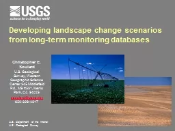
Developing landscape change scenarios from longterm monitoring databases Christopher E Soulard US Geological Survey Western Geographic Science Center 345 Middlefield Rd MS 531 Menlo Park CA  ID: 768505

scenarios change land spatial change scenarios spatial land future lulc state australia national rates projections agricultural transition science climate

Share:

Link:

Embed:

Download Presentation from below link

Download Presentation The PPT/PDF document "Developing landscape change scenarios fr..." is the property of its rightful owner. Permission is granted to download and print the materials on this web site for personal, non-commercial use only, and to display it on your personal computer provided you do not modify the materials and that you retain all copyright notices contained in the materials. By downloading content from our website, you accept the terms of this agreement.


Presentation Transcript

Developing landscape change scenarios from long-term monitoring databases Christopher E. SoulardU.S. Geological Survey, Western Geographic Science Center 345 Middlefield Rd., MS #531, Menlo Park, CA  94025csoulard@usgs.gov 650-329-4317 U.S. Department of the InteriorU.S. Geological Survey

USGS Programs + Acknowledgments Climate and Land Use Change (CLU) Mission Area:Land Change Science ProgramResearch & Development ProgramPresentation AcknowledgmentsWestern Geographic Science Center’s Ben Sleeter (PI) and Tamara Wilson

What is a Scenario? A coherent, internally consistent and plausible description of a possible future state of the world. It is not a prediction or projectionProjections: Any description of the future and a pathway leading to it (e.g. climate projection).Prediction/Forecast: When projection is branded “most likely” with level of confidence.A set of scenarios is often adopted to reflect the range of uncertainty in projections. (adapted from http://www.new.dpi.vic.gov.au/energy/policy/june-2010) Uncertainty around scenarios expands with increasing time

Quantitative and Qualitative Robust scenarios incorporate both quantitative modeling and qualitative contextQuantitative parameterization is the focus of this talk Qualitative context usually comes in the form of storylines or narrativesYour vision is a narrative/storyline Nakićenović, N.  et al.  eds.  Special Report on Emissions Scenarios: A Special Report of Working Group III of the Intergovernmental Panel on Climate Change  (Cambridge Univ. Press, 2000) “Scenarios draw from the human imagination as well as science to provide an account of the flow of events leading to a vision of the future. In essence scenarios are plausible stories about how the future might unfold from existing patterns, new factors, and alternative human choices.” Paul Raskin , 2005

Research Questions What are the historical rates of land change? NLCD, LCT, US Census, Long-Term Monitoring PlotsWhat are the major causes of past/future land change?How will climate affect land use/land cover (LULC)? Consequences: How will changes in LULC affect the ability of ecosystems to provide goods and services? How will the future resemble or differ from the past in terms of LULC rates, causes, and consequences? Mitigation: How might LULC change be managed to minimize negative impacts and maximize positive outcomes on natural and human systems?

Agricultural Scenario Options Regional/local data and narratives connect “on the ground” users/issues better than a national frameworkMitigation/adaptation scenarios (e.g. CRP)OR“Business as usual” scenarios based on most recent observed trends“Worst case” scenarios (e.g. persistent drought)Historical reconstructions (back-cast and model validation) and empirical projections

Existing Projections FAO IPCC World Bank Etc .

State & Transition Modeling Goal: Develop an integrated, easy-to-use, free, and open-shared model emphasizing spatial and temporal variability of LULC change. State and Transition Simulator (ST-SIM; APEX Resource Management Solutions)Spatial and non-spatial functionalityCommercially available and maintained, distributed free of charge, robust and stable code, WIKI, extensive community of users, Windows X64 application State and transition attribute tracking (e.g. forest age, carbon, albedo, water use, population)

ST-SIM Model – LULC Change National carbon assessment incorporates existing strata based on ecoregions used in Land Cover Trends and scenario development.State classes defined as LULC.Probability or area target based transitions between states.Incorporation of uncertainty in historical measurements.Monte Carlo simulations.Spatial or non-spatial simulation. ST-SIM box and arrow diagram showing state classes and modeled transitions.

Agricultural Change in Australia National agricultural assessment incorporates annual change mapping from 2001-2014Trial intended to explore how mapping can be applied in national/global models

Australia: Non-Spatial Trial #1 Input -> Annual from/to map conversions used as transition area targets in projections, starting land use from 2014 map 1 sq km cell size<9% of Australia used for agriculture in 2014

Australia: Non-Spatial Trial #1 Output -> Annual rates randomized to project change from 2014 to 2064 (50 years) using 100 MC simulations

Australia: Non-Spatial Trial #1 Ouput -> Annual rates randomized to project change from 2014 to 2064 (50 years) using 100 MC simulations

Australia: Non-Spatial Trial #1

Questions Going Forward How will land use rates change into the future?Are 14 years of empirical data enough to encapsulate future uncertainty?Do we use longer-term agricultural census data (FAO STAT) where available?How will national/global driving forces differ moving forward?What are the consequences or benefits of trends moving forward?More/less reliance on fertilizersSpatial migration into more vulnerable lands?As for the spatial component, how do we allocate projections geographically?

Future Refinements for National or Global Scenarios