/
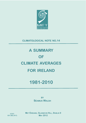
CLIMATOLOGICAL NOTE NO  A SUMMARY OF CLIMATE AVERAGES CLIMATOLOGICAL NOTE NO  A SUMMARY OF CLIMATE AVERAGES

CLIMATOLOGICAL NOTE NO A SUMMARY OF CLIMATE AVERAGES - PDF document

lindy-dunigan
lindy-dunigan . @lindy-dunigan
Follow
389 views
Uploaded On 2015-05-02

CLIMATOLOGICAL NOTE NO A SUMMARY OF CLIMATE AVERAGES - PPT Presentation

DC 551582 417 brPage 2br 19812010 AVERAGES ET IREANN INTRODUCES NEW LONG TERM AVERAGES FOR DAY TO DAY WEATHER AND CLIMATE COMPARISONS Longterm averages decribe the climate of IrelandIt is usual to place current weather events in context by comparing ID: 59358

551582 417 brPage 2br

Share:

Link:

Embed:

Download Presentation from below link

Download Pdf The PPT/PDF document "CLIMATOLOGICAL NOTE NO A SUMMARY OF CLI..." is the property of its rightful owner. Permission is granted to download and print the materials on this web site for personal, non-commercial use only, and to display it on your personal computer provided you do not modify the materials and that you retain all copyright notices contained in the materials. By downloading content from our website, you accept the terms of this agreement.


Presentation Transcript

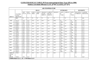
CLIMATOLOGICALNOTENOASUMMARYCLIMATEAVERAGESFORIRELAND ALSH LASNEVIN U.D.C. AVERAGES IREANNINTRODUCESNEWLONGTERMAVERAGESFORDAYTODAYWEATHERANDCLIMATECOMPARISONS Long-term averages decribe the climate ofIreland.It is usual to place current weatherevents in context by comparing them to long-term averages or Normals. These aredefined as 30 year averages of a weather ele-ment e.g. rainfall, sunshine etc. The period of30 years is considered long enough to smoothout year-to-year variations.Standard Climatological Normals or averagesare compiled in 30 year cycles e.g. 1931-1960,1961-1990 etc., and allow for comparisons ofcurrent weather elements with long-term averages. Every country which is a member ofthe World Meteorological OrganisationClimatological Normals. However ClimateNormals may also be calculated for any 30year period of complete decades e.g. 1971-2000Met Éireann has compiled a set of long-termaverages for the period 1981 to 2010, covering arange of weather elements. From May 2012onwards, weather and climate statistics quotedwill reference the new long-term average These will replace the 1961-1990 long-termaverages currently in use. (The 1961-1990 averages will still be referenced occasionally,particularly in climate change studies). HOWARETHEAVERAGESCALCULATED Averages are calculated from readings taken atweather stations operated by Met Éireann andits voluntary observers. Values are averaged foreach month over a 30 year period to obtain thelong-term average. Where there are gaps indata, estimates are made using data from WHATPRODUCTSAREAVAILABLERainfall: Long-term averages of monthly, sea-sonal and annual rainfall totals and days ofrainfall greater than 0.2mm, 1mm and 10mmhave been calculated at stations with sufficientrecords. Gridded maps with values at 1 km resolution have also been produced. Temperature: Long-term averages of monthly,seasonal and annual maxima, minima andmean temperatures have been calculated atstations with sufficient records. Gridded mapswith values at 1 km resolution have also beenproduced. Long-term averages of monthly,seasonal and annual sunshine duration havebeen calculated at stations with sufficientrecords. Gridded maps with values at 1 kmresolution have also been produced. Wind: Monthly mean values have beencalculated and 30-year wind roses have alsobeen produced. WHATISTHESIGNIFICANCEOFDIFFERENCESINTHELONGTERMAVERAGES Because we are comparing two 30 year periodswith an overlap of 10 years, the differencesrelate to the non-overlap periods i.e. 1961-1980 WHATDOESTHISMEANINTERMSOFCLIMATECHANGE Changes in climate are reflected in the long-term averages, however their main use is as abaseline to put current weather in context, it isnot possible to detect changes in extremevalues from long-term averages. WHERECANIFINDMOREDETAILSOFTHEANALYSISTECHNIQUES Details of the methods used to infill formissing data, and information on how thegridded data was produced are in preparationand will be published in due course. AVERAGES WHERECANIGETSOMEOFTHEDATA Maps and underlying data for the long-termaverages will be made freely available on www.met.ie as will a selection of stationaverages. For other data requests please e-mailClimate Enquires at ACKNOWLEDGEMENTS We are grateful to our voluntary observers atclimatological and rainfall stations withoutwhom this work would not be possible.Thanks also to the United KingdomMeteorological Office for Northern Irelandstation data for gridding purposes. RAINFALLRAINFALLANDTEMPERATURERAINFALLTEMPERATUREANDSUNSHINELOCATIONOFSTATIONSUSEDINCALCULATINGAVERAGES AVERAGES ANNUALTEMPERATURE WINTERMEANTEMPERATURE(°C) SPRINGMEANTEMPERATURE(°C) AUTUMNMEANTEMPERATURE(°C) SUMMERMEANTEMPERATURE(°C) ANNUALMEANTEMPERATURE The temperature regime in Ireland is greatly affected by themoderating effect of the sea, and height above sea level. Meanannual temperatures generally range between 9°C and 10°Cwith the higher values in coastal regions. Mean annual minimashow a stronger coastal effect than mean maxima. SEASONALMEANTEMPERATURE Summer is the warmest season, followed by Autumn, Springand Winter. Highest temperatures occur inland during thesummer, with mean seasonal maxima between 18°C and 20°Cwhile highest values occur in coastal regions during the Winter. MONTHLYMEANTEMPERATURE July is the warmest month, followed by August and June; thecoldest month is January followed closely by February and thenDecember. AVERAGES MONTHLYMEANTEMPERATURE AVERAGES WINTERRAINFALL(mm)ANNUALRAINFALL SPRINGRAINFALL(mm) AUTUMNRAINFALL(mm) SUMMERRAINFALL(mm) ANNUALRAINFALL Highest rainfall occurs in the Western half of the country andon high ground; rainfall generally decreases towards theNortheast. Averaged over all Ireland, the average annual rainfallis approximately 1230 mm. SEASONALRAINFALL The driest seasons are Spring and Summer, with an all Irelandaverage of approximately 260 mm, Autumn and Winter have allIreland averages of approximately 350 mm. MONTHLYRAINFALL The driest months are April, May, June and July, with an allIreland average of approximately 80 mm each month.February, March, August and September have average rainfalltotals of approximately 100 mm, while October, November,December and January have all Ireland averages ofapproximately 130 mm. AVERAGES JANUARY MONTHLYRAINFALL AVERAGES TOTALWINTERSUNSHINE(hours)TOTALANNUAL(hours) TOTALSPRINGSUNSHINE(hours) TOTALAUTUMNSUNSHINE(hours) GLOBALSOLARRADIATIONTABLE TOTALSUMMERSUNSHINE(hours) STATION VALENTIA MALIN HEAD BELMULLET CLONES AVERAGES JANUARY MONTHLYAVERAGEDAILYSUNSHINE(hours) AVERAGESWINDROSESMALINHEADDUBLINAIRPORTCASEMENTAERODROMECORKAIRPORTSHANNONAIRPORTVALENTIAOBSERVATORY WINDROSE CALM0.9% CALM0.2% CALM1.5% CALM3.1% CALM0.2% CALM0.3% CALM2.4% CALM0.9% CALM1.9% 5-10 kt10-20 kt20-35 kt AVERAGESMALINHEADSHANNONAIRPORTVALENTIAOBSERVATORY DAYMOVINGAVERAGEDAYMOVINGAVERAGEDAILYTEMPERATURERAINFALLDAYMOVINGAVERAGETEMPERATURETEMPERATURETEMPERATURETEMPERATURETEMPERATURETEMPERATURERAINFALLRAINFALLRAINFALLRAINFALLRAINFALLRAINFALL AVERAGES WINTERCOMPARISON (%) SPRINGCOMPARISON (%) AUTUMNCOMPARISON (%) SUMMERCOMPARISON (%) ANNUALRAINFALL On an annual basis, averaged over the country, there has beenan increase of approximately 5% in rainfall totals between thetwo normal periods (1961-1990 and 1981-2010), with the higherincreases in the Western half of the country. SEASONALRAINFALL All seasons show an overall increase in rainfall but there areregional differences. There are decreases of up to 10% in rainfall in the South and East in Winter, with correspondingincreases in the West and Northwest. Spring and Summer showincreases of 5-10%. MONTHLYRAINFALL While most months show an increase in rainfall of 5-10%,January and February had decreases of 5-10% in the South andEast while September had a general decrease of up to 10%. InJuly the average increase in rainfall was in the order of 15%. ANNUALSEASONALCOMPARISONSOFLONGTERMAVERAGERAINFALLAVERAGESASAPERCENTAGEOFAVERAGESANNUALRAINFALLCOMPARISON AVERAGES WINTERCOMPARISON (°C) SPRINGCOMPARISON (°C) AUTUMNCOMPARISON (°C) SUMMERCOMPARISON (°C) ANNUALMEANTEMPERATURE Generally, there has been an increase of approximately +0.5°Cin mean temperature between the 1961-1990 and the 1981-2010 periods, with the highest increases in the Southeast. Maximumand minimum temperatures have also increased by approximately +0.5°C. SEASONALMEANTEMPERATURE All seasons show a rise in mean temperature with the Spring andSummer seasons displaying the largest differences between thetwo periods of approximately +0.7°C . MONTHLYMEANTEMPERATURE Almost all mean monthly temperatures show an increase exceptOctober and December which show small decreases of up to -0.2°C in the West and Northwest. ANNUALSEASONALCOMPARISONSOFLONGTERMAVERAGETEMPERATURESDIFFERENCEBETWEENAVERAGESANDAVERAGESANNUALTEMPERATURECOMPARISON CASEMENTAERODROMEMONTHLYANDANNUALMEANANDEXTREMEVALUES TEMPERATURE (°C) JAN MAY AUG NOV MEAN DAILY MAX MEAN DAILY MIN MEAN TEMPERATURE LOWEST MAXIMUM LOWEST MINIMUM MEAN NO. OF DAYS WITH AIR FROST MEAN NO. OF DAYS WITH GROUND FROST RELATIVE HUMIDITY (%) MEAN AT 0900 UTC MEAN AT 1500 UTC SUNSHINE (hours) MEAN DAILY DURATION GREATEST DAILY DURATION MEAN NO. OF DAYS WITH NO SUN RAINFALL (mm) MEAN MONTHLY TOTAL GREATEST DAILY TOTAL MEAN NO. OF DAYS� WITH = 0.2 mm MEAN NO. OF DAYS� WITH = 1.0 mm MEAN NO. OF DAYS� WITH = 5.0 mm MEAN MONTHLY SPEED MEAN NO. OF DAYS WITH GALES WEATHER (MEAN NO. OF DAYS WITH...) SNOW OR SLEET SNOW LYING AT 0900 UTC VALENTIAOBSERVATORYMONTHLYANDANNUALMEANANDEXTREMEVALUES TEMPERATURE (°C) JAN MAY AUG NOV MEAN DAILY MAX MEAN DAILY MIN MEAN TEMPERATURE LOWEST MAXIMUM LOWEST MINIMUM MEAN NO. OF DAYS WITH AIR FROST MEAN NO. OF DAYS WITH GROUND FROST RELATIVE HUMIDITY (%) MEAN AT 0900 UTC MEAN AT 1500 UTC SUNSHINE (hours) MEAN DAILY DURATION GREATEST DAILY DURATION MEAN NO. OF DAYS WITH NO SUN RAINFALL (mm) MEAN MONTHLY TOTAL GREATEST DAILY TOTAL MEAN NO. OF DAYS� WITH = 0.2 mm MEAN NO. OF DAYS� WITH = 1.0 mm MEAN NO. OF DAYS� WITH = 5.0 mm MEAN MONTHLY SPEED MEAN NO. OF DAYS WITH GALES WEATHER (MEAN NO. OF DAYS WITH...) SNOW OR SLEET SNOW LYING AT 0900 UTC TABLESOFMONTHLYANDANNUALMEANEXTREMEVALUESFOROTHERSYNOPTICSTATIONSAREAVAIALBLEATHTTPCLIMATEIRELANDAVERAGES