/
THE SOUTHERN EMIGRANT TRAILFALL 2010 THE SOUTHERN EMIGRANT TRAILFALL 2010

THE SOUTHERN EMIGRANT TRAILFALL 2010 - PDF document

lindy-dunigan
lindy-dunigan . @lindy-dunigan
Follow
391 views
Uploaded On 2016-03-20

THE SOUTHERN EMIGRANT TRAILFALL 2010 - PPT Presentation

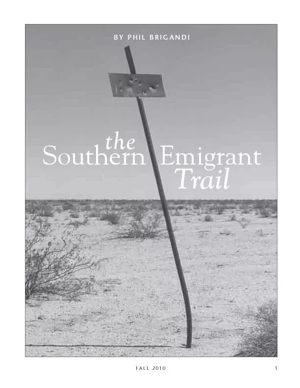
BY PHIL BRIGANDISouthern EmigranttheTrail PHIL BRIGANDIOVERLAND JOURNAL more than a century Its most famous era was the period from the start of the Mexican War through the California Gold Rush an ID: 263438

PHIL BRIGANDISouthern EmigranttheTrail PHIL

Share:

Link:

Embed:

Download Presentation from below link

Download Pdf The PPT/PDF document "THE SOUTHERN EMIGRANT TRAILFALL 2010" is the property of its rightful owner. Permission is granted to download and print the materials on this web site for personal, non-commercial use only, and to display it on your personal computer provided you do not modify the materials and that you retain all copyright notices contained in the materials. By downloading content from our website, you accept the terms of this agreement.


Presentation Transcript

THE SOUTHERN EMIGRANT TRAILFALL 2010 BY PHIL BRIGANDISouthern EmigranttheTrail PHIL BRIGANDIOVERLAND JOURNAL more than a century. Its most famous era was the period from the start of the Mexican War, through the California Gold Rush, and on to the days of the Buttereld stage. But unlike many other early over-land trails, the Southern Emigrant Trail survived the coming of the railroad, and was still being used to cross the California desert well into the twentieth century. The trail has been known by a variety of differ-ent names over the years. In Mexican times it was the Sonora Road. Later it was the Gila Trail, the Fort Yuma Road, or simply the Southern Route. It rst came to be known as the Emigrant Road, or the Emigrant Trail, during the Gold Rush years. The name Southern Emigrant Trail did not become popular until the 1930s, but it captures the history of the trail very well.East of the Gila River, there was no single overland trail. Instead, a network of trails crossed the South-west, combining to eventually converge on the Gila River. From there, a single trail followed the Gila down to Yuma Crossing. After crossing the Colorado, the Southern Emi-grant Trail dipped south into Mexico to avoid the Algodones sand dunes, re-entering the United States along the New River at Calexico. Most overland travelers agreed that the worst stretch of the trail was from there to Carrizo Creek, across what is now Imperial County. Carrizo was the rst dependable water after ninety miles of hand-dug wells and intermittent streams. Not good water, mind you, just dependable. From there it was on to the oasis at Vallecito, then the tough, rocky climb over the Campbell Grade to Mason Valley. Next came the squeeze through Box Canyon, and the easy pull across Blair Valley—now a popular camping spot in the Anza-Borrego Desert State Park.The long grade up the San Felipe Valley to War-ners Pass (today’s Teofulio Summit) nally brought travelers out of the desert. At Warners Ranch, the main trail divided, with one branch heading off to San Diego, and the other continuing on through Temecula and Isaac Williams’ Rancho del Chino on its way to Los Angeles. First to follow the trail were the Indians, who probably followed animal trails to nd the water-ing places along the way. The trail served as a trade route between the mountain valleys and the Colo-rado River, and connected the villages and gather-ing sites scattered across the desert. An American soldier in 1846 noted, “The constant seeing of pieces of pottery [along the trail] shows that the Indians have traversed it [since] time out of mind.”The famed Anza Trail also crossed the Colorado River at Yuma, but then turned north and east, across the Borrego Valley, eventually leaving the desert by way of Coyote Canyon. For a few brief years, the Anza Trail was the major overland route in and out of California. Two Spanish settlements were even established on the Colorado River, near the Yuma Crossing, to guard and develop the area. But relations with the Yuma people soon soured, and in 1781 both settlements were destroyed, and most of the settlers killed. he Southern Emigrant Trail has a long and interesting history. In its heyday, it was the major overland route in and out of Southern California, and it played a part in every era of California history for 1.Abraham R. Johnston, “Journal of Captain A. R. Johnston,” in W. H. Emory, Notes of a Military Reconnaissance, House Execu-tive Document #41 (Washington: Wendell and Ven Benthuy-sen, 1848), p. 612. Capt. Johnston was killed at the battle of San Pasqual a few days later. THE SOUTHERN EMIGRANT TRAILFALL 2010 Spanish military forces were soon marching down the Anza Trail to launch a series of reprisals, and to free the settlers who had been taken captive. In April 1782, Captain Pedro Fages led a group of soldiers out to the river along the Anza Trail. But on their return, at San Sebastian Marsh (Harpers Well), Fages and his men turned west to Carrizo, and continued up past Vallecito into Mason Valley, and then followed Oriamme Canyon into the Cuy-amaca Mountains, nally reaching San Diego.Fages explored this Oriamme-Vallecito-Carrizo route again in September 1782, and apparently in 1785. Two years later, while serving as governor, Fages Alamo Mocho (the chopped cottonwood), was one of the best-known watering places along the Mexican portion of the trail. Today it is within sight of the Mexicali Airport. Author photo, 2007.on page 99) An old desert signpost along Coyote Wash in Imperial County, probably erected in the early 1900s. Author photo, 2002. PHIL BRIGANDIOVERLAND JOURNAL proposed that a garrison be stationed at Vallecito, in hopes of reviving the overland route to Mexico. But with the Yuma Crossing still closed to the Spanish, nothing came of the plan. It was not until Mexico broke away from Spain in 1821—taking California with it—that the govern-ment again began to take an interest in the old des-ert trails. Talk of reopening an overland route across the desert began in the early 1820s. Then in July 1824, Lt. Santiago Argüello led a contingent of sol-diers out from the San Diego Presidio to the Colo-rado River, chasing horse thieves. They entered the desert via Warner Pass, and continued down past Vallecito and Carrizo and on to the river.Soon after, Mexican soldiers sought a new route to the Yuma Crossing over the San Gorgonio Pass and down the Coachella Valley. To try to hold the route open, a crude fort was established in Imperial Valley, on the west bank of the New River. It was abandoned after an Indian attack in April 1826 that left three soldiers dead and three wounded. It soon became apparent to the Mexican explorers that the Vallecito-Carrizo route was a better choice than the San Gorgonio Pass, and in 1826 Gov. The Southern Emigrant Trail (highlighted) as shown on “Bancroft’s Map of the Colorado Mines,” published in 1863. Courtesy Los Angeles Corral of The Westerners, Brand Book #10, 1963. THE SOUTHERN EMIGRANT TRAILFALL 2010 Echeandía recommended it as the ofcial overland mail route to Sonora. The trail became known as the Sonora Road, and by the 1830s was a regular route of travel.The Mexicans were not the only ones following the Sonora Road. American fur trappers and traders were on the trail by 1831. J. J. Warner came over the trail late that year in a party led by David Jackson, to buy mules for the New Mexican market. Isaac Wil-liams came with trapper Ewing Young a few weeks later. Both Warner and Williams would later return to settle along the trail.In 1832, English botanist Dr. Thomas Coulter (the namesake of the Coulter Pine) went to the Colorado River and back along the trail, collecting specimens. In his notes, he mentions both San Felipe and Car-rizo by those names. Vallecito probably also received its name around this time. In 1834, Luis Arenas received a provisional rancho grant to the San Felipe Valley, and may have moved some of his cattle into the area. After Arenas aban-doned his claim, the land was granted to Felipe Cas-tillo in 1846. Castillo’s ten-thousand-acre Rancho Vallé de San Felipe was the easternmost rancho in California, and it was hoped that by occupying the valley, Castillo and his vaqueros could help “keep vigilance on that part of the frontier.”It was the Mexican War that rst brought the Southern Emigrant Trail to the attention of most Americans. Soon after the outbreak of war in 1846, General Stephen Watts Kearny and his “Army of the West” set off from Ft. Leavenworth, Kansas, to attempt to capture the Mexican territories of New Mexico and California.New Mexico was quickly subdued, and leaving most of his men there, Kearny continued on to Cali-fornia with 110 men from the First Dragoons. They reached Carrizo Creek on November 28, 1846. Lt. William H. Emory, whose ofcial account of the march was later widely read, reported the next day, while marching to Vallecito:The day was intensely hot, and the sand deep; the animals, inated with water and rushes, gave way by the scores; and, although we advanced only sixteen miles, many did not arrive at camp until 10 o’clock at night. It was a feast day for the wolves [coyotes?] which followed in packs close on our track, seizing our deserted brutes and making the air resound with their howls as they battled for the carcasses.General Kearny believed California was already rmly in American hands, but he found out differ-ently on December 6, 1846, when his men were over-run by a force of California lancers at San Pasqual. In California the war was not yet over.In an effort to reinforce Kearny’s Army of the West, the army turned to Brigham Young and his Mormon followers, recently exiled from Nauvoo, Illinois, and now preparing to begin their migra-tion west. The Mormon leadership agreed to allow nearly ve hundred men to enlist for one year in what became known as the Mormon Battalion. Besides serving as a convincing display of their loy-alty during wartime, the enlistment also meant the U.S. government would be footing the bill for mov-ing these men across the continent. Their army pay would also help fund the migration of the rest of the Mormons to their new Zion on the shores of the Great Salt Lake.2.Letter from Luis Arenas, who had previously occupied the Ran-cho Vallé de San Felipe, February 20, 1846. Included among the documents led with Land Commission case #329 , available at the Bancroft Library at the University of California, Berkeley. 3.Quoted in E. I. Edwards, Lost Oases Along the Carrizo (Los Ange-les: Westernlore Press, 1961), 29. PHIL BRIGANDIOVERLAND JOURNAL 5.Lt. Colonel Philip St. George Cooke, “Journal of the March of the Mormon Battalion,” in Ralph P. Bieber, Exploring South-western Trails, 1846–1854 (Glendale: The Arthur H. Clark Co., 1938), 222. [hewed a passage] Cooke, “General Order No. 1” in Ricketts, The Mormon Battalion, 304.The Mormon Battalion was under the command of a regular Army ofcer, Lt. Col. Philip St. George Cooke. His orders were to march the battalion to California; but unlike Kearny’s troops, they would be traveling with heavy supply wagons. The battalion left Fort Leavenworth six weeks after Kearny, and reached Carrizo Creek on January 16, 1847, after three days and two nights without nding any water on the desert. “We were all weary & fatigued,” Private Henry Boyle wrote in his diary, “nearly naked & barefoot but our burning thirst drowned every other suffering. At the Summit of every hill . . . how eagerly did we look forward and around us for the long expected watering place, but we were as often disappointed.”By then, the battalion had abandoned all but ve of their wagons. After refreshing themselves in the slightly alkali waters of Carrizo Creek, they pushed on up the sandy wash to “Bajiocito” (as Cooke spelled it)—“altogether, it is the worst 15 miles of road since we left the Rio Grande,” he noted.While they were camped at Vallecito, word reached the battalion that the Mexican forces at Los Angeles had capitulated ve days before. The war was over.But the next day, the Mormon Battalion discov-ered they still had one last obstacle to face. When they reached Box Canyon on January 19, they found their wagons simply would not t through the nar-row, rocky gap. With Cooke leading the work, the men used axes and, he reported, “hewed a passage through a chasm of living rock.” The rst wagon was unloaded, pulled apart, and carried through the pass. The second wagon, also emptied, was lifted by hand over the rocky barriers. But by the end of the day the trail had been widened, and the nal wagons were driven through—the rst wagons ever driven across the desert into Southern California.Or were they? Cooke noted in his journal a few days before, “The guides had told me it was a good, rm road, with a very narrow canyon for a short dis-tance, but that a Mr. Ward’s wagon from Sonora had passed it, and no doubt we could.” Blair Valley, just above Box Canyon. The trail crossed the bottom edge of the valley. Author photo, 19914.Quoted in Norma Baldwin Ricketts, The Mormon Battalion(Logan: Utah State University Press, 1996), 113. THE SOUTHERN EMIGRANT TRAILFALL 2010 Box Canyon (also sometimes called Cooke’s Pass, or Devil’s Canyon) remained a famous landmark on the trail for years to come. John R. Bartlett came through the canyon with the U.S. Boundary Com-mission in 1852, and left this description:This dele consists of perpendicular walls of rock about fteen feet high, and of a width barely suf-cient for wagons to pass. In its bed are large masses of rock reaching to the axletrees. At the narrowest point one of the wagons stuck fast: but after tak-ing out the mules, by dint of lifting and prying, we at length got through. The space here was but two inches wider than the axletrees of the wagons. There were also several steep and rocky descents where the wheels had to be locked and the wagons held back with ropes.Lorenzo Aldrich put it more succinctly in 1849—“It is the most hideous road I ever saw.”Though the Mexican War was over, in the fall of 1848 Major Lawrence Graham and his Second Dra-goons were dispatched from Chihuahua to California 6.John Russell Bartlett, Personal Narrative of Exploration and Inci-dents in Texas, New Mexico, California, Sonora and Chihuahua(New York: D. Appleton & Co., 1854; reprinted by the Rio Grande Press, 1965), v. 2, pp. 123–24.7.Lorenzo D. Aldrich, A Journal of the Overland Route to California and the Gold Mines (Lansingburgh: Alexr. Kirkpatrick, Printer, 1851; reprinted by the Readex Microprint Corporation, 1966), 36. PHIL BRIGANDIOVERLAND JOURNAL 8.Cave J. Couts, Hepah, California! The Journal of Cave Johnson Couts . . . 1848–49, ed. by Henry F. Dobyns (Phoenix: Arizona Pioneers’ Historical Society, 1961), 85.to reinforce the troops stationed there. With 275 soldiers and 160 wagons tended by more than 200 teamsters, Graham’s men made a formidable force crossing the desert. Even crossing in wintertime, water was a problem. Cave Couts (who later settled in San Diego County) reported that across the eighty-seven miles from Yuma Crossing to Carrizo Creek, only one spot—thirty-ve miles from the river—had water which “can be used.”Graham and his dragoons spent most of Decem-ber 1848 camped at Vallecito; they threw up some sod walls for shelter, and both man and beast tried to recover from the rigors of the desert. They noticed Box Canyon, 1912. This narrow cut between Mason Valley and Blair Valley, on the Anza-Borrego Desert, was one of the most notorious stretches of the Southern Emigrant Trail. Courtesy the Hemet Area Museum. THE SOUTHERN EMIGRANT TRAILFALL 2010 9.Couts, Hepah, California, 87.10.Cave J. Couts, “From San Diego to the Colorado: The Diary of Cave J. Couts,” in Gold Rush Trails to San Diego and Los Angeles in 1849, Brand Book #9 (San Diego: San Diego Corral of West-erners, 1995), 69.11.Cave J. Couts, “From San Diego to the Colorado,” 68.that the trail into California was growing busier and busier each day. Before long, they found out the rea-son why. In January 1848, a carpenter named James Mar-shall had picked up a few ecks of gold out of the tailrace of a sawmill he was building for John Sut-ter. Within a few weeks, the word had leaked out. Gold! Gold from the American River! The Califor-nia Gold Rush was on.The ’49ers have become a part of our American mythology, but the Gold Rush was nearly a year old before they began to arrive. The rst outsiders to reach the new California gold elds came from Mexico in 1848, and they came across the Southern Emigrant Trail. Cave Couts noted in December of 1848, “The whole state of Sonora is on the move, are passing us in gangs daily, and say they have not yet started.”Between October 1848 and April 1849, an estimated ve to six thousand miners left Sonora for California. In April 1850, Yuma Crossing ferryman A. B. Lincoln claimed he had transported more than twenty thousand Mexicans across the river since rst of the year.The Mexican miners mostly worked the southern mines in the Mother Lode country, leaving behind towns with names like Sonora, and Hornitos. Some had already made their pile (or simply given up) and were returning home along the Southern Emigrant Trail as the American ’49ers were on their way in. Others were eventually driven out of the gold elds by the American miners, who saw no reason to share the rich ground with those they considered outsiders.About a third of the sixty thousand or so ’49ers who came overland to California came by way of the Southern Emigrant Trail—perhaps as many as twenty thousand of them. Thousands more followed in their wake as the Gold Rush continued on into the 1850s. Yet the trail is hardly mentioned in most histories of the Gold Rush. Most of the ’49ers who traveled the Southern Emi-grant Trail came from the South. About three thou-sand miners came by way of Texas in 1849, another three thousand left through Arkansas that spring and summer, and about twenty-ve hundred more came via Missouri on the Santa Fe Trail (though some of them traveled south from Salt Lake City and followed the Old Spanish Trail into California across the Mojave).Back on the desert in ’49 with the United States Boundary Commission, Cave Couts met so many Southerners on the trail that he began to wonder if there was anyone left in Arkansas. If there were, the former Tennessean joked in his journal, “it is more numerously populated than I had anticipated.”Many of the ’49ers carried Lt. Emory’s newly pub-lished journal of the Kearny march. Others simply made their way as best they could. Camped at Val-lecito in September 1849, Couts complained, “[I] have been troubled nearly to death by the emigrants inquiring the route to Los Angeles and San Diego. If I have made one I have made a hundred way-bills [maps] for them in the last three days.”Unlike the northern route, the Southern Emigrant Trail was open all year. The ’49ers, their passionate goal driving them, crossed the southwestern deserts in the heat of summer and on into the following winter. Traveling down the Gila River, their rst obstacle before entering California was the cross-ing of the Colorado River—a challenge any time of year. Steep banks, swift water, and quicksand made it a dangerous proposition. PHIL BRIGANDIOVERLAND JOURNAL 12.Arthur Woodward, Feud on the Colorado (Los Angeles: Western-lore Press, 1955), 20.The rst of several ferry boat operations at Yuma was established at the beginning of 1850. It was soon taken over by what historian Arthur Woodward called “a gang of greedy, unscrupulous hoodlums” who were all murdered in April 1850.Soon after that, a new company was formed under the management of William Ankrim and Louis Jaeger. They began service in August 1850, with a boat built of local cottonwood lumber. Within the rst year, they carried more than forty thousand passengers over the river. Eventually Jaeger took over the entire operation, and by buying out his competitors, took control of all the ferry business on the lower Colorado. It was a booming business until 1877, when the Southern Pacic built the rst bridge across the river. To help keep the crossing open, Fort Yuma was established in 1850. Army supply trains now regu-larly crossed the desert, and a supply depot was established at Vallecito. By 1852, a one-room “soddy” had been built there. The Army also maintained a semi-weekly mail service between San Diego and Fort Yuma for most of the 1850s.William B. Chamberlain kept one of the most detailed journals of the Southern Emigrant Trail. On August 15, 1849, he and his companions reached the dry lower stretches of Carrizo Creek. He writes:The sight of the dry creek bed would not allay our thirst, and we made all haste up it until we reached the head, where a small rivulet is formed by the water oozing out of the ground in several places, owing a short distance, and then disappearing in the sand. In our eagerness to reach water, it was the The ruins of the old Buttereld station at Vallecito, circa 1912. Courtesy the Hemet Area Museum. THE SOUTHERN EMIGRANT TRAILFALL 201011 13.William B. Chamberlain, “From Lewisburg to California in 1849” in The New Mexico Historical Review (July 1945), 248–49.best man, or rather, the best animal foremost. We were scattered all along the way, and the last of the company did not get up for two hours after the rst. We reached this point at 11 a.m. The water, though clear as crystal, has a peculiar and unpleasant taste. We ate a piece, but we could nd nothing for our animals to feed upon. There are a large number of Senorians [sic] encamped here, resting their stock, before they undertake crossing the desert. . . . They gave us glowing accounts of the gold diggings, and had large quantities of the dust in their possession. This appears to be a general encamping place, but the stench arising from the number of dead animals strewed about is almost sickening. Packed up and left Carrizo creek at 3 o’clock p.m. Traveled up a narrow valley in a N.W. direction. The mountains on either side have a barren aspect, and the only vegetation in the valley is the mezcal [sic] plant and a few stunted, prickly bushes. Seeing some palmetto trees on our right [Palm Spring] we judged we should nd water there, and we were not disappointed. There are sev-eral springs, but the water was very bad, beside being polluted by the dead horses and mules that lay in and about them. We were obliged to encamp for the night, and left our animals to browse upon the few bunches of bear grass that grew around. Satised that we are now across the much dreaded desert, we lay down early and enjoyed the most comfortable night’s rest we have had in a long time. . . .As Chamberlain suggests, miners were not the only travelers on the Southern Emigrant Trail. The The restored Buttereld station at Vallecito, circa 1940. Today it is a San Diego County park. Courtesy the San Jacinto Museum. PHIL BRIGANDIOVERLAND JOURNAL Gold Rush had opened up a vast market for beef and mutton in California, and cattlemen and sheepmen from Texas, New Mexico, and northern Mexico soon took to the trail, driving their animals overland to sell to hungry miners. Sheep made up most of the trafc, many of them coming from Mexico. In 1853 some 135,000 sheep were driven across the desert; they sold in the mines for about $10 a head. Fewer came over the trail in 1854–55, but in 1856 some 200,000 sheep came to California on the Southern Emigrant Trail, followed by 130,000 more in 1857 (though by then the price had dropped to just $3–4 a head). Losses were always heavy crossing the desert—sometimes reaching 70 percent of the herd—but the potential prots made it worthwhile.The rst cattle were said to have come over the Southern Emigrant Trail in 1848. During the Gold Rush, cattle prices in California jumped from just $2 to $20–30 a head. Cattle drives on the trail peaked around 1854, when over sixty thousand head crossed the river at Yuma. Most of the cattle came from Texas.The desert crossing was especially hard on the THE SOUTHERN EMIGRANT TRAILFALL 201013 14.Asa B. Clarke, Travels in Mexico and California (Boston: Wright & Hasty, 1852; reprinted by Texas A&M University Press, 1988), 90.15.Quoted in Aurora Hunt, “Overland by Boat to California in 1849,” in Historical Society of Southern California Quarterly, Sep-tember 1949.16.Quoted in Robert G. Cleland, “An Exile on the Colorado,” in The Westerners Brand Book #6 (Los Angeles: Los Angeles Corral of Westerners, 1956), 25.livestock. On his arrival at Carrizo in June of 1849, Asa B. Clarke wrote, “The whole distance, we passed carcasses of mules and horses, particularly at the end of the route; I should judge at least 30 or 40 a day.”14 That fall, Lewis B. Harris noted in his diary:It was really sickening to see the dead animals scat-tered along the road. For over 150 miles we were hardly ever out of the sight of a carcass and at the watering places it was almost impossible to remain on account of the stench. They were mostly pack mules but along the last part of the desert the oxen failed very fast.Lt. Thomas Sweeny, who was stationed at Fort Yuma in 1851, wrote, “I have christened it ‘Bone Desert’ because the route is marked out by the line of bones and skeletons of oxen, mules, sheep and other animals that have perished while traversing it.”Beginning in the 1850s, several stage lines rolled along portions of the Southern Emigrant Trail. The rst was the “Jackass Mail” (properly, the San Antonio and San Diego Mail Line), launched in July 1857 by James E. Birch. Stage coaches were run as far as Yuma, then parcels and passengers were loaded on mules to cross the desert—hence the line’s insulting nickname. The route left the trail above Vallecito and climbed the mountains on its way to San Diego. opposite) Looking down from the top of the Campbell Grade across Vallecito. The old trail ran on the left, the modern highway is on the right. Author photo, 1995.Several old roadbeds are still visible along the walls of Box Canyon. Author photo, 2009. PHIL BRIGANDIOVERLAND JOURNAL 17.Waterman L. Ormsby, The Buttereld Overland Mail, ed. by Lyle Wright and Josephine Bynum (San Marino: The Huntington Library, 1942), 108–109, 111.But the Jackass Mail was quickly supplanted by the famous Buttereld overland stage, which ran 2,700 miles from Tipton, Missouri to San Francisco. Like the Jackass Mail, the Buttereld was subsidized by a substantial government mail contract. Service began in September 1858. The fare for passengers averaged about $150, and the jolting ride took about twenty-three days. The coaches were almost con-stantly on the move, day and night, pausing only to change horses. Passengers had to grab what sleep and meals they could along the way.Reporter Waterman L. Ormsby was the only through passenger on the rst west-bound stage, and left a detailed account of his journey. “Vallecito,” he wrote, “or Little Valley, is a beautiful green spot—a perfect oasis in the desert; it is about ve miles square, surrounded by rugged timber-less hills, and the green bushes and grass and hard road are a mostrefreshing relief from the sandy sameness of the desert.” “In the valley of San Felipe,” he adds, “we saw a number of prosperous Indian ranches, where they raise corn and melons and live much like white folks.”The classic Concord-style stagecoaches were too heavy for the long pull across the California desert, so the Buttereld relied on open “mud wagons” to make the trip. Even so, a change station was needed at Palm Spring, between Carrizo and Vallecito, to switch out the tired horses.The start of the Civil War in the spring of 1861 marked the end of the Buttereld. Yet despite its short history, the name has become ubiquitous in Southern California, leading to no end of confusion, with almost any staging operation likely to be called “the Buttereld” by some forgetful old timer or care-less historian. A “mud wagon” style of stagecoach, as sketched by Carl Eytel for George Wharton James’s Wonders of the Colorado Desert, 1906. Author’s collection. THE SOUTHERN EMIGRANT TRAILFALL 201015 But the end of the Buttereld did not mean the end of the Southern Emigrant Trail. Military travel-ers now made use of the trail.In the early days of the war, the South made a concerted effort to control the Southwest and ulti-mately—they hoped—the rich gold mines of Cali-fornia. Rebel forces from Texas marched across New Mexico and declared Arizona a Confederate terri-tory. This took them right to Southern California’s back door at the Yuma Crossing, and Fort Yuma and the Southern Emigrant Trail suddenly became stra-tegic points.Several new military outposts were established in 1861 to guard Southern California from Rebel forces. One of these was Camp Wright, rst established at Warners Ranch in October 1861, but just ve weeks later moved twenty miles up the trail to Oak Grove, where the former Buttereld station was converted into a supply depot and hospital.Along with Confederate forces moving into the Southwest, there were also groups of Californians heading east along the trail to join the Confederate Army. One of these parties was led by Dan Showalter, a former state assemblyman. But one of the men made the mistake of sending a letter ahead telling of their plans. It was intercepted by the Army, and soldiers from Camp Wright were deployed to stop Showalter and his men. They were captured on November 29, 1861, in the hills above Warners Ranch, and were imprisoned for quite a while at Fort Yuma.Camp Wright was manned until June 1862. After that there was no regular garrison stationed there, but it was used as a way-station by military supply trains and mail riders, and troops would occasionally stay there for a few weeks at a time—one of the last was a company of the California Native Cavalry in early 1865. Camp Wright was ofcially abandoned in December 1866.Even with the war on, civilian travel continued over the Southern Emigrant Trail, and several of the old stations remained active. At Warners Ranch a new store appeared, built in 1862 by Cyrus Kimble a mile and a half above the old Buttereld station. The adobe ruins are still there, but are rapidly melt-ing away.After the war, there was a new rush of settlers along the trail. Many were from Texas, or the South-ern states, looking to start a new life in California. Some of the best-known pioneer families in the Southern California backcountry came here during those years.Several of the desert stations along the trail remained open for years. Carrizo was still occupied on into the late 1860s, and Vallecito seems to have stayed in business until shortly after the completion of the Southern Pacic railroad in 1877.James E. Mason, a former “conductor” on the Jack-ass mail, returned to the area about that same time and took up residence in the old Buttereld station at Vallecito. He helped with the rst full survey of the area in 1879, and immediately led a homestead on the site, proving up his claim in 1884. Later his family moved up to the nearby valley that still bears their name. The old Vallecito station eventually fell into ruins, but was rebuilt in the 1930s, and is now a popular San Diego County park.At Warners, Cyrus Kimble ran his store until his murder in 1865. In later years, Henry Wilson—who had previously been down at Carrizo—took over the store and ran it until about 1920. Author J. Smeaton Chase visited there around 1916:An old pioneer, Wilson by name, keeps a pretence of a store on this road, about midway between Warners and the San Felipe. As a store it is merely a joke, and I take its real purpose to be that of a trap to detain the passer-by until the old fellow has satised PHIL BRIGANDIOVERLAND JOURNAL 18.J. Smeaton Chase, California Desert Trails (Boston: Houghton Mifin Co., 1919), 241.his curiosity. He is the antiquity of the region, but unfortunately is so deaf that conversation, short of roaring, was impossible.18A few miles further on, at the fork of the trail, was the headquarters of the Warner Ranch. The adobe that still stands there was long assumed to have been built by J. J. Warner, who received a Mexican grant to the valley in 1844. But in fact, it was built in 1857 or ’58 by Ramon and Vicenta Carrillo, the new own-ers of the ranch. It also served as a Buttereld stage stop. Warner’s adobe was across the creek; he was burned out by the Indians in 1851, and his home has long-since melted away.Some of the other Buttereld stations in the area later became private homes. Joseph Gilfthaler moved into the abandoned stationed at Aguanga in the early 1860s. Since he was from Germany, the place became known as “the Dutchman’s.” To complicate things, Gilfthaler sold out in 1864 to another Ger-man immigrant, Jacob Bergman, so the Dutchman name survived, and has misled many people as to just when the Bergmans arrived. The family is still in Aguanga to this day.The last important cattle drive along the trail was in 1890, when Walter Vail sent over 900 head from The old Buttereld stage station at Oak Grove as it appeared in the 1930s. It still stands today along Highway 79, south of Temecula. Author’s collection.opposite) Looking up the San Felipe Valley from the top of Granite Mountain. The trail ran close to the modern highway (Route S-2). Warner Pass is located at the upper left. Author photo, 1999. THE SOUTHERN EMIGRANT TRAILFALL 201017 his Empire Ranch near Tucson, Arizona, to the War-ner Ranch. He had been shipping cattle by rail, but the Southern Pacic had raised their rates, so Vail decided to prove to the railroad that he didn’t need them. It worked, and the old rates were resumed.Local travel continued on the Southern Emigrant Trail in the 1890s, and so San Diego County erected a series of directional signs, giving the mileage to the nearest water. One of the old signs still stood on a rise above Vallecito Creek in the 1940s, when some wag painted “Hollywood & Vine” on it. The name stuck, and the original pole (now topped with a new sign) still survives.Trafc along the trail increased after 1900, with the opening of the Imperial Valley for farming. Some prospective farmers even tried their luck as far north as Carrizo and Harpers Well. Harpers Well was one of several oil wells drilled on the desert during a short-lived oil boom in 1900–1901. None of them were ever particularly successful, but oil exploration continued on the desert on into the 1930s.Local cattle drives, desert homesteaders, prospec-tors, and even a few hearty tourists continued to fol-low the Southern Emigrant Trail between Warners and the Imperial Valley in the 1910s and ’20s. The automobile was coming along by then, and so in 1929 a group of road boosters selected part of the PHIL BRIGANDIOVERLAND JOURNALold trail as the route for the new Imperial Highway, hoping to give Los Angeles its own link to the des-ert. For more than forty years, the Imperial Highway Association lobbied state and local agencies to build the road, and bits and pieces got paved or improved. But it was not until 1961 that the nal stretch was paved up over Sweeny Pass.The last of the old Southern Emigrant Trail had been replaced by a highway. It had been more than 130 years since the rst Mexican explorers found their way across the desert on a sandy, winding trail.This article originally appeared in the Branding Iron, Los Angeles Corral of The Westerners, Fall 2009, Number 256.Phil Brigandi has been researching the Anza-Bor-rego Desert area in the archives and in the eld for almost thirty-ve years. He is the author of more than a dozen books, including Borrego Beginnings, a history of the Borrego Valley in the early twentieth century, and has served as a historical consultant for the Anza-Borrego Desert State Park. He is also the author of Temecula, At the Crossroads of History, and serves on the advi-sory board for the Temecula Valley Museum. He lives in Orange County, California, where he served until recently as County Archivist. The old Warner Ranch adobe (center) served as a Buttereld stage station and headquarters for the ranch for many years. Recent research has shown that it was not built by J. J. Warner. This photo was taken looking south from the site of Warner’s 1849 adobe, across the creek. Author photo, 2005.