/
Lower Fraser River Corridor Project Lower Fraser River Corridor Project

Lower Fraser River Corridor Project - PDF document

min-jolicoeur
min-jolicoeur . @min-jolicoeur
Follow
429 views
Uploaded On 2015-11-26

Lower Fraser River Corridor Project - PPT Presentation

1 
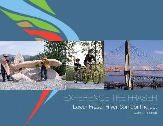
x201Cit x0066006Cows majestically unhurriedly Fraser River at Harrison and Pegleg Bars Chilliwack Experience the Fraser 150 Concept Plan 147AT HOPAST SWINGS WT FACELLY UNDLY TO ID: 205679

1 “...it �ows majestically unhurriedly Fraser

Share:

Link:

Embed:

Download Presentation from below link

Download Pdf The PPT/PDF document "Lower Fraser River Corridor Project" is the property of its rightful owner. Permission is granted to download and print the materials on this web site for personal, non-commercial use only, and to display it on your personal computer provided you do not modify the materials and that you retain all copyright notices contained in the materials. By downloading content from our website, you accept the terms of this agreement.


Presentation Transcript

1 Lower Fraser River Corridor Project “...it �ows majestically, unhurriedly, Fraser River at Harrison and Pegleg Bars, Chilliwack Experience the Fraser – Concept Plan “AT HOPAST, SWINGS WT FACELLY, UNDLY, TOW IS ONLY LT WKLY OVLY, TOW, ST, TPACEOM LT.” Experience the Fraser – Concept Plan Table of Contentsink and inspire experiences along the river emonstration Projects L from aterfront Recreational BluewayAmenity and Feature Points ore BPhoto CreditsList of FiguresFigure 1: he Project AreaFigure 2: Connected Figure 3: Experience the Fraser: Concept Plan Figure 4: EFigure 5: Bridges along the 5West 6 Experience the Fraser – Concept Plan EXECUTIVE SUMMARYF) is a recreational, cultural and heritage project that ea. F Concept Plan expresses the Project’s oals and presents a framework for the long-term development of this land and water-based initiative that aims to showcase the Fraser River and its rich natural and cultural heritage. t presents rail and Blueway routes which form the signature backbone of the project, and which link communities and Fraser River themed features, amenities he Concept Plan presents a number of opportunities to add to and build upon these experiences, therefore in sum creating an outstanding he Plan also offers an llustrative Foundational Program provide a solid presence and framework from which to continue to build the project. A series of egic priorities to move the project toward implementation. 7 8 orthern Experience the Fraser – Concept Plan Experience the Fraser is a recreational, cultural and heritage project de�ned by the Fraser River that seeks to connect communities and the places where Fraser River themes and stories can be experienced from canyon to coast. At its heart, ETF is de�ned by over 550 kilometres of trails and a recreational blueway with ample amenities to support both land and water-based use. rail will connect existing points of interest, amenities and features along the ower Fraser River Corridor, and once in place, will also be a catalyst for others to package and add he result will be the creation of a unique product that provides unprecedented opportunities to celebrate shared culture ower Fraser River Corridor and its landscapes, features, wildlife and people as one of the great river communities of the world; to link and create a suite of outstanding tourist attractions; encourage active and healthy living; and to enhance land and water-based recreational opportunities throughout the region. D ULTU Centre Creek, urrey Bend Regional Park Experience the Fraser – Concept Plan he Project Area extends 160 km from Hope to the ts width varies to capture as many Fraser River communities and points of interest as possible and to allow for trail routing. Additionally, the following areas were intentionally included: elta waterfronts; Pitt River past the Pitt anaka Creek to Rolley ake and south along the Hayward tave River; Harrison River to Harrison ilson Bridge; and routing options through ent and Electoral Area he Project Area is more than 100,000 hectares in size, and about 20% of the shoreline is in public ownership. orth Arm of the Fraser was added as part of the Concept Planning process. ancouver, Burnaby, and the northern part of Richmond into the Project. he planning work for this addition will be undertaken in the early phases of mplementation, and the results will be added to this plan as an addendum.he Fraser River travels nearly 1,400 kilometres from its headwaters in the Rockies to the ighty Fraser’ drains a quarter of British Columbia and is the tenth longest river in the world. By the time the river runs past Hope, it has �owed from rushing river to alluvial plain, characterized by large gravel reaches, and soon slows and stretches further into the Fraser estuary. The Lower Fraser is home to more than 2.3 million people and is the con�uence of a myriad of cultures, values, interests, and activities that interact with, and are often dependent on, the river. he Fraser River has an incredible history and continues to be a de�ning feature in the Province of British Columbia, playing an integral role in the ower Fraser River residents. Here are just some of the values, interests and activities associated with the river: The Province of BC, jointly with Washington State, of�cially named the area covered by the inland waterways of the Strait of Georgia and ch and ations have lived, travelled and traded along the lower reaches of the river for thousands of years. he , whose traditional territory spans beyond the entire project area, are known as the People of the River. By éméxw te íkw’élò - Xólhmet te mekw’ e have to look after everything that belongs to us,”protecting, preserving, and managing heritage and environment in values, beliefs, and traditions, is an overarching guiding principle.Named after Simon Fraser, the �rst European to fully travel its waters in 1808, the Fraser River was designated as a Canadian Heritage River in 1998 to honour its rich ower Fraser were initially dyked in the 1860s and 1870s by early settlers to create and protect agricultural lands. Early dyking efforts were found in atsqui prairie areas as well elta has some of the richest agricultural soils in Canada, is home to diverse agricultural operations growing over 130 different products, and although it comprises only 1.5 percent of the total agricultural land in BC, it generates over a quarter of the Province’s gross farm income. he Fraser River estuary, one of the largest along the orth America, is recognized as a globally T) Board, made up of private citizens and of�cials appointed by federal and provincial governments was established in 1984 to conserve rivers with outstanding natural, cultural and recreational heritage, to give them national recognition, and to encourage the public to enjoy and appreciate them. oday, there are 41 Canadian t has the largest wintering concentrations of water birds and raptors in Canada, and provides signi�cant habitat and feeding areas along the Paci�c Flyway. It is the largest salmon producing river along the Paci�c Coast and is one of three rivers in BC in which white sturgeon spawn. he Fraser River is integral to industry as a transportation corridor and location for businesses, including pulp and sawmills, piling and dredging companies, �sheries, and �sh processing. It plays a vital role the region’s economy contributing to 80% of the provincial economic output. etro ancouver cargo terminals and other port activities are essential to the functioning of our economy and metropolitan region. heir jurisdiction stretches across 600 kilometres of shoreline and waterways anaka Creek. he Port trades $75 billion in goods annually with more than 160 trading economies, generating over 125,000 jobs, and P.A number of communities line the banks of the river and people continue to be drawn to live along its edge. ower Fraser River Corridor also provides ample recreation opportunities including wildlife viewing, �shing, hiking, geocaching, cycling, camping, boating, or horseback riding. ower Fraser River Corridor is an integral part of BC’s ourism industry which generates $12.7 billion in revenues annually. People come from all over the world to experience a combination of the interests and themes F will create an even greater draw to this part of the province. ildlife Area has been designated nternational mportance; proposed as a estern horebird Reserve etwork, an international initiative that identi�es and protects habitats used by migrating shorebirds. Experience the Fraser – Concept Plan here are four goals that guide the realization of the Experience the Fraser vision: Goal 1 Connect Hope to the Salish Sea ea along the Fraser River by means of a network of over 550 kilometres of trail, 43% of which is already in place along regional, municipal and community trails. n addition, the river itself and associated stream networks provides an incredible recreational opportunity and adds a Blueway component to this goal of connectivity. rail and Blueway networks are the backbone of the project and will connect communities, parks, natural areas, historic and cultural sites and other experiences along the river. he intent of the goal is to draw upon the rich natural and cultural heritage along the river, to better integrate the waterway into the lives of residents and visitors thereby fostering a stronger sense of place and stewardship. rail and Blueway networks will provide a wide variety of recreational opportunities that promote ower Fraser River residents. Also, this network will enhance land and water-based recreational amenities positioned strategically to �ll 12L Goal 2 Link and inspire experiences along the river here are already a multitude of existing opportunities to experience the Fraser River. For example, there are Circle Farm tours, farm gate sales, and wineries. From an outdoor recreation and environmental perspective, there are parks and trails that provide river access, and amazing �shing spots and that interpret the river’s ecological importance to salmon, raptors, and bird migrations. Heritage and culture can be explored at the Xa:ytem nterpretive Centre, Fraser River iscovery Centre, Britannia hipyards, Fort eorgia Cannery ites, Hyack’s Fraserfest, the Fraser alley Bald Eagle Festival and the Artists on the River, all of which provide opportunities to celebrate the river’s heritage and cultural values. to knitting them together with a common Experience the Fraser brand and to recognizing the appeal and promotional value in their synergy. EF offers a way to build on and he second part of the goal is about enhancing and adding to what is already in place – about utilizing the rail and existing experiences and amenities as a catalyst upon which to build an integrated suite of recreation, cultural and heritage amenities and features. he outcome will be a world-class tourism destination that can be traveled end to ower Fraser River Corridor will be promoted and known as one of the great river destinations of the world, inspiring participation, generating economic growth and jobs, and fostering pride and sustainability. 13 Goal 3 Develop enduring and committed partnerships F is reliant on developing and nurturing long-term partnerships among different levels of government, First ations, other agencies, the private sector, non-pro�t organizations and citizens. Because Experience the Fraser is a long-term vision that will be realized over a number of decades, building understanding and support helps ensure that the EF concept is a shared vision and at the forefront of people’s minds when planning and developing local projects. ntegral to the success of the project is the development of sustainable governance Bedford Channel 15 Goal 4 Build and deepen connections to the river Experience the Fraser strives to build and deepen people’s physical, emotional, and spiritual connections to the river. tility and transportation corridors and industrial, residential and agricultural uses separate communities and people from the river so that its physical closeness is often imperceptible. e cross over the river in our cars on our daily commute, but how often do we dip our toes in it, walk along its edge or understand the diversity and dynamism that it represents? his goal is about celebrating the river itself and its rich cultural and natural heritage – it is about exposure and reconnection, Through exposure and experience come understanding and appreciation – and from these come a sense of ownership and protectionConnectivity is important from an ecological perspective, and linking parks and open space helps to protect habitat, remedy the effects of fragmentation and support biodiversity. EF embraces environmental sustainability objectives ower Fraser River Corridor, and is committed to enhancing awareness and stewardship of these values through education and interaction with river ecology. Extrapolated from Freeman ilden’s “through interpretation, understanding, through understanding, appreciation, through appreciation, protection” (1957) Fish release at anaka Creek Regional Park Experience the Fraser – Concept Plan ower Fraser River Corridor has been the focus of attention and planning for many people, agencies, businesses, groups and partnerships for years. here is a substantial body of work, research and relationships to draw upon. EF hopes n F complements a number of existing initiatives associated with the iscovery Centre, the rail, F seeks to highlight and link the multiple values and interests Fraser River stakeholders embody through a tangible, overarching vision for recreation, culture and heritage.F was the idea for a continuous trail along the Fraser River ea on both sides of the river with crossings creating a series of loop options and connections to major trails beyond the region. Because of this original idea, EF is a project that is rooted in an outdoor recreation perspective - assuming that the user will be on foot, bicycle, horseback herefore, the next step was to look at what kind of support, both infrastructure and program, would be required to facilitate this form of experience in terms of staging areas, parking, washrooms, boat launches, camping he challenge was posed – if a user is travelling along this trail, what would they be interested in seeing, doing, and experiencing along the journey? hat would lead them to take the journey in the �rst place and inspire them to explore further? his prompted an inventory of existing recreational, cultural and heritage features, the result being the development of a multi-dimensional project that seeks to link together, via the Erail and recreational Blueway, the multitude of experiences ower Fraser River Corridor has to offer. Iiscovery Centre opened its doors to a 17,000 square foot space that offers displays and exhibits, a resource centre and a place showcase the living, working river. rans rail’s route through the F. ature rust of BC, BCIT, the North Growth Foundation and the Paci�c Fisheries Resource Conservation Council. It is focused on acquiring lands along the Fraser River, from Hope to ission, and it seeks to boost public awareness of this area’s outstanding attributes while promoting the need to set aside key properties 17 n April 2009, the Province of BC provided the Fraser etro ) $2.5 F planning and to implement two demonstration projects. $2 million was allocated toward developing a comprehensive Concept Plan by Fall 2011. An integral component then was to “demonstrate” the potential of Experience the Fraser in communities along the river and to provide an opportunity for people to understand what an “experience’ of the Fraser might in fact be. As a result, $500,000 was allocated for two demonstration projects to ‘get started on the ground’.Demonstration Projects WAaterfront emonstration Project, a ission, t includes an elevated square, trail, living plant wall, benches, picnic tables, banners, ations’ public art. N olden Ears Bridge rail Project, a partnership between etro ancouver, angley, and rails BC, provides an rail. The �rst project phase, from Edgewater Bar in Derby Reach treet including trail, interpretive art 18 1 5 1 99 99 Coast Millennium Trail (US)New Pathways to GoldUe�le Valley sail TrailSea to Sky TrailTrans Canada TrailTrans Canada TrailCowichan Valley Trails 3 Kent Hope Sidney Duncan Surrey Wy�on Sechelt Mission Nanaimo Whistler Squamish Pemberton Vancouver Princeton Chilliwack parksville White sock Abbotsford powell siver One of the primary objectives for trail routing is to �ll ower ea. Embodied within this objective is the desire to ensure connectivity to, and integration with, existing and planned community trail networks and waterfront community centres with an aim to improving access to the Fraser River hile these local and regional connections are vital, so is ower Fraser Corridor to help build a provincial trail network for residents and visitors alike. ntegral to the planning and development of the Experience the Fraser route is rail as it proceeds through the ower Fraser River Corridor and connects with the rest of Canada from sea to sea. ooking beyond our national border, EF seeks to make herefore, once completed and connections are put in place, Experience the Fraser will provide not only an inter-regional trail ea, but it will also link to other regional, provincial, national and international trails, effectively nesting it within other initiatives and providing connectivity at multiple levels (Figure 2).nce complete, Experience the Fraser aspires to connect to: Experience the Fraser – Concept Plan NT.” InternationalPaci�c Northwest Trail: The 1,200 mile trail runs from the Continental Divide to the Paci�c Ocean and is considered to be among the most scenic trails in the world. It is connected to the Paci�c Crest and Coast Paci�c Crest Trail (PCT): Extending from the exican border, the PCboasts the greatest elevation changes of rails and passes through six of orth America's seven t offers users a unique, varied experience and connects into Canada at anning Provincial Park.rail: A trail initiative that ashington to hite Rock along Boundary Bay with future phases envisioned to extend the trail south to ancouver connecting to other regional trails including Experience the Fraser. rail: A mosaic of local and regional trails built by provincial and territorial rails Foundation extending from the Atlantic to the Paci�c to the Arctic ceans and providing 22,000 kilometres of trail linking 1,000 communities and 33 million rail: An initiative for a pedestrian trail from Cape pear, ewfoundland hite Rock, British Columbia. rail: A partnership initiative led istrict, rail links communities from ociety: A society that supports economic development through ations Reconciliation, and community projects such as the Hudson's he trail extends from Barkerville to Hope area and through the old Rush region of BC.rails: Four regional Rail to rail rans elson he Hudson’s Bay Company Heritage rail from Hope to ettle rail from Hope to Castelgar.ochside Regional erminal oose Regional istrict where the rail currently arrives anaimo Ferry Agassiz-Rosedale Bridge Experience the Fraser – Concept Plan here are a number of projects analogous to Experience the Fraser throughout his is no surprise, as waterfront cities recognize the merit of collecting and showcasing their amazing amenities and features into a synergized, value added package. everal of these projects bill themselves as recreational, cultural and heritage initiatives that act as catalysts for tourism, economic development, active, healthy living, and partnership development. Below are three examples of visionary, successful projects.reenway rust leads and inspires action to conserve and enhance the landscape from eattle across the Cascade ashington, ensuring a long-term balance between people and nature. his project is organized around Highway -90, and since 1991, 87,000 hectares of land have been conserved and oday, the reenway rust, the body responsible for the project, encompasses a 60-member Board of irectors, a 30-member Advisory echnical Advisory Committee, a 15-member staff, and a community of hundreds of citizens and dozens of interest groups. LEARNING and DRAWING INSPIRATION from OTHER SUCCESSESreenway - Hikers in the Cascade Waterfront Trailaterfront rail stretches from ntario uebec border, along the shores of t. awrence River. rail includes 41 communities, 182 parks, 152 arts and culture heritage attractions and 37 major annual waterfront he project is run by the aterfront Regeneration rust, and partners troke Foundation, Province of ntario, rails Council, 63 local governments and Conservation Authorities, two cycling groups and three other private sector companies.f the Missouri and Mississippi Rivers, the Con�uence is a dynamic conservation, heritage and recreation corridor. he project area is 52,000 hectares. The Con�uence Project is an ambitious, long-term undertaking where investments in land conservation, facilities and public programs for this unique regional initiative will ultimately exceed $200 million. Today, the Con�uence is an evolving system of conserved open space, parks, museums, heritage sites, and recreational trails along the reat Rivers of the bi-state ouis area. By reconnecting the public to the wealth of natural, historic and recreational resources at the heart of the community, this project contributes signi�cantly to quality of life and economic competitiveness in the 21st century. Currently, over $150 million has been secured or committed by various governmental agencies and non-pro�t organizations, and the transformation of riverfronts is well underway. An impressive set of early achievements encourages community residents and tourists to care and protect the land and water in the Con�uence region as they reconnect to two of America’s great rivers. 21 he Chain of Rocks Bridge is now reat aterfront rail Adventure Experience the Fraser – Concept Plan Concept planning and trail route identi�cation included an inventory of existing Fraser River amenities, features and experiences. As this work progressed, it became apparent that these points of interest could be grouped or categorized into themes. Consequently, part of the trail routing resulted from the gathering or linking of these features, points of interest and amenities. any plan contributors and participants have identi�ed locations where these themes can be explored, illustrated, and experienced. his has led to the Concept Plan being more infrastructure or spatially based, focusing on acknowledging the venues where these themes can be experienced rather than interpreting the themes themselves. he project’s focus rail and Blueway and providing a way to link or package the experiences together. As a result, the project is informed by the following eight Fraser River themes: ULTUFarms, wineries, local food, farmers’ markets, agri-tourism, parks, museums, education and interpretationFestivals, celebration, tours and events that promote and advance river ay, educational Parks, Conservation Areas and Ecological Reserves, stewardship and volunteer opportunities, salmon runs, education and interpretation, bird and wildlife habitat, TIONS Cultural and historical interpretation, industry and commerce, tourism and 22 ND CULTUHistoric sites, museums, cultural centres, guided heritage tours, landscapes, The role and importance of the “working river”, �sheries, log booms, tug boats, debris trap, water dependent industry, port and rail operations, access and crossings, infrastructure and new technologies day-use Connecting to and integrating with the river, trail and blueway connections, river access, orientation and way�nding, education and interpretation, food and accommodation services, business development and sales, waterfront revitalization initiativesn addition, the themes provide a framework for others (e.g. the private sector or other potential partners) who want to: package and program these points of interest and utilize the trail as a means of travel or connection (e.g. a tourism opportunity such as winery or heritage tours by bike or foot); or add a new experience / amenity along the river that ‘�ts’ with one of the themes therefore creating an added value for themselves of having other similarly themed experiences be in close proximity with them connected by the trail (e.g. an economic development opportunity such as bicycle or boat rentals or a trail-side café). 24 S OLOGY LT. A STORIED RIVER… The myriad of stories related to the Fraser River are as plentiful and intertwined as the tributaries which �ow into it. Experience the Fraser recognizes the importance of these stories in enhancing the recreational and cultural experiences of each visitor. Certain stories lend themselves to being told through multiple venues over the length of the ower Fraser River Corridor. A sampling of �ve of these stories is presented here. These stories would be developed and programmed ers. They hint at the incredible in�uence the river had, and rongly among stories, people and places. The Story of the Living River...from Salmon to Sandpiper his journey highlights the story of the Fraser River’s natural history and paints an ecological picture of one of the most biodiverse areas in Canada. he Fraser produces more salmon than any other river he Fraser is one of just three rivers in British Columbia in which the white sturgeon spawn;he Fraser River Estuary is one Canada’s premier mportant Bird Areas providing a crucial staging area on he dynamic river conditions of the Fraser from the he future of the living river is another critical storyline for interpretation. Humans have put pressures on the river system, and changed it from its natural course. Much of the Fraser Valley is naturally a �oodplain, but is now protected by dykes which prevent the river from inundating the land and people have in�uenced the life of the Fraser, just as the river has permeated our lives;ower Fraser (e.g. Burns Bog); Augment the work currently being done to tell the iving River story by enhancing this work through coordinating resources and introducing new outlets.iving River stories could be presented through a our supported with a smartphone interpretive guidebook application. Experience the Fraser – Concept Plan 25 WEALTHKING The Story of the Working River...from Canneries to Catch and Releasehis journey presents storylines that relate to the commerce of the Fraser River over time from First ations fur trading through the harvesting of a variety of natural resources to the present river-based economy and industry. Fishing industry (sustenance, commercial and recreational); Salmon �shing through the ages (Aboriginal to present day; salting and canning); Forestry (sawmills, shingle mills, log booming);Agriculture and �oodplain; andPort activities (cargo terminals and goods movement).orking River storyline could be enhanced through iscovery Centre for major orking River interpretive exhibitsdeas for supporting the telling of the story could include interactive historical activities about �shing, farming, milling, and towing, an important and particularly representative industry on the ower Fraser. There are other venues where these stories could be explored and told eorgia Cannery hipyards. n addition, this is only one of many stories interpreted at the Fraser River iscovery Centre.OWING U TM & TIVITY O. ON WSY T.PA 26 The Story of Travel on the River...from Cedar Canoes to Tug Boatshis journey would tell the story of the Fraser River as the historical main transportation conduit from the coast to the Historical accounts of different British Columbians’ journeys up and down the Fraser through time imon Fraser, present day explorers);Bridges and Crossings of the Fraser;Boats of the Fraser across time: First ations canoes, steamboats, paddle wheelers, barges, tug boats, �shing boats, present day kayaks; Role in supporting the region – goods and services and Recreational Blueway.ravel on the River stories could be told through:River education and interpretation centres (i.e. ission nterpretation Centre);Bridge and crossing signage and interpretation program;A land based “shipyard” museum and playground.The Story of Communities on the River... from Village to Settlement to City his journey would tell the stories of the many communities that were and are established along the riverfront, how they came to be, and the cultural landscapes that emerged.European settlement – Fur trading (HBC), resource-based communities, dyking, �ooding and the development of agriculture based communities, historic river landings;tories of ethnically rich communities along the river RANSPORT Experience the Fraser – Concept Plan 27 IS D OUND OW DID S TO OUT FA anaka Creek, apanese ion reek community on he stories of real people of the river – First ations, immigrants and migrants, entrepreneurs and Communities of the River stories could be told through:eo-caching and Passport program telling the stories of various journeys and travel routes (i.e. gold, fur, �sh, ation, pioneer). The Story of the Fraser River Dykes… from Floods to Fortificationhis journey would tell the unique story of how the Fraser River was dyked to manage its seasonal �oods, develop rich agricultural lands from the �oodplain, and protect large parts of the region’s infrastructure and population.May, 1894, largest �ood on record, but property damage 1948 �ood led to evacuation of 16,000 people, damage or destruction of 2300 homes, and recovery costs of over Early efforts to manage �ooding and develop agricultural lands along the lower reaches;ake (4,050 hectares in size) was drained to create farmland;ower Fraser River Corridor – now over 600 km of dyke structures, 400 �oodboxes and 100 pump stations in the Future concerns given climate change and sea level rise.Given that the dyke system forms a signi�cant part of the yke story could be told through interpretive signage, viewpoints, photos of the major �oods hese stories could also be told at the iscovery Centre amongst other locations. 28 2.0 EXPERIENCE THE FRASER: THE CONCEPT Experience the Fraser – Concept Plan 2.1 THE CONCEPT he Experience the Fraser Concept is, at its heart, quite simple - it is a recreational, cultural and heritage project ea along the Fraser River and to link and inspire river and other rail and recreational Blueway serve as the connectors, linking communities, the multitude of stories, river-based amenities, and the natural, recreational, cultural and heritage features and ower Fraser River Corridor offers. he Experience the Fraser Concept builds from a strong base of existing infrastructure, amenities, features and Fraser River attractions. About 43% of the proposed rail is already in place along segments provided by regional districts, municipalities and others. here are 15 sanctioned boat launches along this stretch of the river and many riverfront parks that provide water access and amenities. here are a number of cultural and heritage attractions and festivals for residents and visitors alike and several businesses that rent bicycles, boats and offer tours. Experience the Fraser is not starting from scratch. ETF simply seeks to �ll the connectivity gaps and add to the experiences available. he result will be a project that ties together, and adds strength and dynamism to, local tourism and economic development efforts as well as cultural, heritage, and recreational amenities. All of which will be branded under one banner. Eower Fraser River Corridor will be showcased and promoted as one of the world’s great river destinations. People will be inspired to respect and protect its value. t is important to recognize that the Concept is a long-term vision and will be implemented by many, over decades. M TO MOST Experience the Fraser – Concept Plan 31 The Concept is structured around �ve elements: portals, rail, the Blueway, and amenity and feature points based on the eight Fraser River themes introduced above (Figure 3: Experience the Fraser Concept Plan ap). his structure highlights and facilitates connectivity among communities, features, amenities and ultimately, Fraser t also highlights connections to, and rail, and expresses a desire to expand the Project Area to include the orth Arm of the Fraser River in the future. In addition, Sumas Mountain is identi�ed as an Interregional Project on the Concept Plan ountain is a dominant and unique landscape feature in the Fraser alley that captures the appreciation and imagination of many. t holds special signi�cance to First Nations, is popular with he mountain also straddles regional park service areas of the Fraser etro ancouver, creating a unique opportunity for collaboration to advance outdoor recreation, cultural and conservation objectives supporting F goals, for the two regional districts and other partners.atrix serve as the repository for EF’s collected knowledge. he Planning Atlas is the tool that allows navigation of the Concept at different scales, showing the Project from the Lower Fraser River Corridor scale, to speci�c river reaches, to community nodes, right down to a speci�c segment of trail, amenity or feature (Figure 4). Although this level of speci�city cannot be shown here, the Planning Atlas is essential for providing detailed planning information as the project moves forward to implementation.NNING ATL LYST LYST NT.” S AT F Concept is spatially based around locations where the stories about the Fraser River, its history, industry, culture and environment can be told. As a result, there are �ve concept elements – “Canyon to rail, recreational blueway, amenity and feature points, nodes and portals. ‘Canyon to Coast’ Trail rail is the backbone of the project, linking together communities and points of interest along the river. nce complete, it will provide the glue, brand, and impetus enticing others to build on Experience the Fraser by adding additional businesses, recreational features and other points of interest. ver 550 kilometres of trail are a part of the project, spanning from Hope to the ea on both sides of the river. any participants in the planning process articulated that the rail needs a brand that expresses the geography, themes or intent of the project more clearly than the Experience the Fraser he rail seems to excite and resonate, since it clearly references the geography of the ower Fraser River Corridor and begins to connect people to place. nterim Route utilizes existing trails and roads and allows users to travel from end his alignment is subject to agreement and participation by the agencies, organizations, and local governments along the route. here is also a term objective of the project and is over 550 kilometres long. Although this length may sound daunting, ision Route is already in place coinciding with regional and municipal park and community ision Route will be implemented over many years. ision Route was to develop a continuous east /west connection from Hope to the he intent was to follow and feature the Fraser River as closely as possible: however, the long-term route will be aligned to harmonize with working river industrial activities, sensitive natural features, private land and First ation land interests. ost times it will mean going around these features, but creative ways of integrating the rail into such landscapes and uses can produce the richest experiences. The preferred alignment also re�ects the original partnership between the Province, the Fraser Valley Regional District and Metro Vancouver, therefore re�ecting the desire to connect provincial and regional parks and facilities and to include suf�cient amenities to facilitate multi-rail alignment through ower Fraser River Corridor. 33 rail’s ision Route status and needs in the eastern istrict) and western (etro ancouver) parts of the Project Area are somewhat different. n the eastern part of the Project Area, the ision Route is 244 kilometres long and 27% (or 66 kilometres) n the western part of the Project Area, the ision Route is 308 kilometres long, and approximately 55% (or 173 kilometres) is in place. f the remaining 313 kilometres required to complete the Erail’s ision Route, approximately 79 kilometres are located on dyke structures, which require recreational access but do not herefore, about 234 kilometres of trail need to be built to fully realize rail is the linear connection linking points of interest along the river, it facilitates the telling of stories introduced in section 1.7 and other projects that lend themselves to being explored or introduced from end to end of the trail – for example, public art expressing Fraser rail is intended to be shared-use and accommodate pedestrians and cyclists along its entire length. Equestrian and other active transportation F advocates for the provision of universally accessible trails and facilities wherever feasible, however recognizes that different standards and challenging geography will limit this objective. As time, resources, land tenure and priorities permit, the gaps in the Vision Route will be �lled.Bridges across the Fraser River are key components of the F trail network (Figure 5). esigned to function almost exclusively as vehicle conveyances, sometimes with a nod to commuter cyclists, bridges are too often a lost opportunity. EF advocates that bridges must provide safe and viable recreational connections for active transportation modes to communities, parks and trails on both sides of the river. here appropriate, bridges should also function as features providing viewpoints, educational and interpretive opportunities, public art and signage. Recreational Bluewayhe Blueway, or rail, represents the recreational n the Project Area, this includes the Fraser, Harrison and ower Pitt Rivers and their main hether meandering through a number of day paddling adventure, the Blueway is best expressed through the supporting infrastructure that facilitates water access and Blueway use such as launching sites, signage, t is this supporting infrastructure that is shown on the Concept he river connects the portals, the nodes and numerous water-based experiences. he Blueway links communities along the river and complements the coastal etwork. o accommodate multi-day journeys, there needs to be supporting infrastructure appropriately spaced along the river including water access, day-use facilities and camping or �xed accommodation. Whether kayaking the islands of the Fraser delta for the day, taking a water taxi to cross from the north to the south shore, or setting out on a multi-day journey tracing a historical storyline, the possibilities are endless. Amenity and Feature Points As part of the concept planning process, over 300 Amenity and Feature Points were identi�ed as locations to experience the river. hese points are all part of the F concept and represent discrete ‘projects’ that are either infrastructure (e.g. facilities or amenities), program-based (e.g. education or interpretive activities or events) or system-wide opportunities (to be applied across the entire Project Area). ne way of better understanding the diversity of amenity and feature points and what they consist of is by re�ecting on the demonstration projects. F Concept, and is a distinct point opportunity that helps create and solidify the EF identity. here are numerous existing amenities and features along the river, and for those that are not yet in place, many are already planned as part of municipal Of�cial Community F is well ther ‘points’ were contributed at community forums and other events. he Planning Atlas captures all of the Amenity and Feature Points identi�ed as well as both Interim and Vision Trail ithin this tool, a set of evaluation criteria F’s objectives and eight themes were used to test the �t with the project and readiness for implementation. This �ltered set of opportunities, including rails and Blueways, signage, and other highly ranked elements were consolidated to assist in the development of llustrative Foundational Program (ection 2.3). KING FA.” K Experience the Fraser – Concept Plan odes are destinations along the rail and Blueway or locations where people can come to the project hey are characterized as having a cluster of amenities, features and experiences close together, are in a location where there is an existing or planned population density or community, are intersecting with the trail, and are providing an access point and amenities for the blueway. here are 26 nodes envisioned between Hope and the ea, some of which exist, and others that are planned in municipal Of�cial Community Plans or as an integral part of F. hey are intended to motivate and facilitate engagement with the Fraser River and will have a kiosk to act as a point of introduction, information and orientation to the ravelling downstream, these envisioned nodes are: FAFAMILY OUTINGS ON TLKS, PARPARPAHope is one of British Columbia’s oldest settlements. Before the municipality was s’qo:ls existed along the banks of the Fraser River. hen visiting the local museum visitors can learn about explorer imon Fraser’s arrival in 1808 and the establishment of Fort Hope trading post by the Hudson’s Bay Company forty years later. his destination also offers ations to share their culture and heritage with visitors. oday four major highways converge at Hope, enabling it to serve as a gateway to rest of the province. Combined with stunning geography, this hub provides a key stop for visitors to experience an abundance of recreational adventures from the Fraser River up to the peaks of the surrounding B. Seabird Islandeabird sland is located along the north shore of the Fraser River in the upper Fraser alley, three kilometres northeast of the town eabird sland his storied island derived its name from the une 1858 grounding of the ea Bird’. his destination could offer visitors authentic cultural and heritage tourism experiences, and already alley Festival f the breathtaking backdrop does not give a true appreciation for the ecological importance of the area, then lough which surrounds the sland will t is known for its ecological importance for amphibians, �sh, birds, and C. Harrison Hot Springs Nestled against magni�cent mountains and ake, Harrison Hot Springs is a destination �lled with history and natural wonders. Although the hot springs were not discovered until the Cariboo old Rush in the late 1850s, the village appeared on maps several years earlier. Harrison ake is accessible for boaters via several launches and offers year round wildlife viewing with common sightings of eagles, herons, salmon, and seals. prings is brought to life with several annual events and his node provides a treat for visitors looking to relax and rejuvenate. D. Rosedale / Popkum ocated amidst Chilliwack’s agricultural lands, Rosedale presents future opportunities to experience the area’s plentiful agricultural operations and offerings along the dyke system. ount Cheam, the breathtaking ountains offer awe-inspiring scenery. nderneath the Agassiz–Rosedale Bridge is sland Provincial Park which is used for day �shing and as a boat launch. Rosedale is also a place to tell stories of the past related any of the earliest mill development took place here and before the bridge existed, travel crossing the river was done by boat and ferry.he Chehalis River delta is known for its natural beauty and serves as a prominent environmental feature along the Harrison River Blueway. his node is embedded in the ndian Band) traditional territory and is a place where culture, heritage, and the environment meld together ts’ailes is actively promoting tourism initiatives through asquatch Eco-Crossing ts'ailes alem (Chehalis Healing House), rail, and, in the future, p'óq'es (Bald Eagle) Café, which could become the country’s �rst major bald eagle orientated tourist venture. his area is also proposed by the Province to become a ildlife anagement Area since the area's river and delta habitat support important staging and wintering habitat for bald eagles and trumpeter swans and signi�cant spawning habitat for salmon and white sturgeon. his area is referred tronghold” since all species of salmon return here. ith chartered tours down the Harrison River Blueway visitors can fully immerse themselves in this node’s historic features, abundant scenery, wildlife, and other natural features.F. Harrison MillsLocated at the con�uence of the Harrison and Fraser Rivers, the only reminder of the once ills is the ite, which provides visitors with a realistic glimpse into early twentieth century pioneer history. Also tucked away in this rural ilby Provincial Park which offers beaching and boating on the Harrison River and easy access to the Fraser and Harrison Lake. With Canadian Paci�c Railway’s main transcontinental line passing right by, this is a place to tell the rural lifestyle story of 37Harrison Experience the Fraser – Concept Plan G. Chilliwack WaterfrontChilliwack Landing was �rst settled in the 1850’s and consisted of a Paddle heeler dock, hotel and service buildings. As there was limited space in this location, the town of Chilliwack was established ‘Five Corners’. his node presents an opportunity to reconnect the community with the Fraser River and to bring ations’ culture and history, early settlement, and outdoor recreation. oday, Chilliwack offers a variety of tourist attractions, world-class sports �shing, white water river rafting, beautiful lakes, hiking and biking trails, and great festivals. Adjacent to the node is a regional park, sland 22, that has the potential to be a �agship in the region.H. Barrowtown ountain, Barrowtown offers a lush array of environmental surroundings and outdoor experiences (Bert anagement Area, eastside of ountain Regional Park, Barrowtown taging Area, and umas hen connected by way umas River, visitors will be able to explore the Fraser River’s �oodplain all ountain. Barrowtown is a location that could also show how best to integrate railways and crossings in close proximity to the river.I. Mission WaterfrontCoastal mountains, sprawling farmland, and ission instant et beyond the visual, this rural alley community also boasts a thriving cultural scene and numerous recreational ission’s waterfront is undergoing redevelopment and is already a key destination for year-round �shing and experiencing the ighty Fraser’ during freshet at the ission emonstration Project. n the future visitors will be able to walk and cycle the entire foreshore as Matsqui atsqui is a small historic village located on atsqui Prairie slightly south of the Fraser River. Enjoy a stroll on the main street, pick some local blueberries at several surrounding farms, or head towards rail Regional Park for a walk along the bank of the Fraser River. ith the eastern end of rail Regional Park ountain, a future connection to this magni�cent regional park with sweeping vistas of the surrounding �at lands is foreseeable. ission Bridge was recently enhanced to improve pedestrian/cyclist access aterfront node on the other side of the river an easy, safe ride or walk. ocated in a forested setting, tave is a recreational paradise that is complimented tave Falls Powerhouse visitors can experience a historic perspective on hydroelectric power and in the surrounding mountains they can touch the huge cedar stumps that drew sawmilling and cedar shingle interests. oday and continuing into urrey Bend the future this area will grow as a recreational ake Provincial Park, ission nterpretive Forest, and BC Hydro’s ake, Hayward ake, and Ruskin recreational sites.ne of the best known heritage sites in the ower Fraser River Corridor, Fort angley has many historic buildings, the Parks Canada Fort ite, the BC Farm useum, the Fort angley sland Regional Park is part of this node, offering connections to and from the river and Bedford Channel and Fort Camping offers sites and programming on the river. he eastern end of sland he Fort erby Reach Regional Park. Port Haney is a heritage waterfront community, historically important for its rail station and regular steamboat traf�c as well as its brick he community hosts the harf and residents enjoy Fraser River access at the harf or along nature trails that weave through anaka Creek Regional Park to the riverfront.Bonson, a relatively new Fraser River community, is located in Pitt eadows in close proximity to the Pitt eadows Airport he community waterfront incorporates the Pitt River Regional reenway, a riverfront trail along the dyke olden Ears and Pitt River Bridges. A new community centre, river viewing piers, and waterfront commons allow for direct connections to the river. here are many opportunities to learn and discover stories about the surrounding agricultural landscape, the log booms on the waterfront, the atzie First O. Surrey Bend urrey Bend node is anchored by urrey Bend Regional Park, a complex wetland home to a diversity of wildlife and one of the few remaining undyked �oodplain areas on this stretch of the Fraser River. isitors can wander through the park or hop on a ferry to Barnston sland, a quiet agricultural community which is home to fewer than 100 residents, the atzie etro ancouver’s parkland. P. Citadel Landinganding is situated along Port Coquitlam's riverfront and includes a waterfront boardwalk, Peace Park and staging area. Adjacent to this node is the con�uence of the Coquitlam, Pitt and Fraser rivers, the south rail, Colony Farm Regional Park, and the Coquitlam anagement Area. hese locations provide connections to the river and the area’s rich biodiversity. ildlife anagement Area is home to one of the largest reat Blue Heron colonies in BC, and provides habitat and feeding grounds for many other birds and animals. Colony Farm Regional Park provides dyke trails, a community garden and is the former site of the historic Essondale psychiatric asylum and provincial demonstration ation lands are 39Citadel Experience the Fraser – Concept Plan located on the Coquitlam River adjacent to the regional park and the First ation operates a Colony Farm bike tour and rental business. Q. Coquitlam Waterfrontnce the site of the largest sawmill in the British Empire, the Coquitlam aterfront node is planned to become a town centre, mixing new residential, commercial and light industrial. his ills will be oriented towards the water, providing piers, a boardwalk and other recreational activities. ndustry that is est could provide for educational opportunities about solid waste management, sustainable energies and the R. New Westminster Quay estminster is an urban centre with a strong connection, both historic and present, to the Fraser River. t is the oldest city in western Canada – and the original capital ictoria named the city, thus it is also referred to as the ‘Royal here is already an extensive waterfront trail system in place here, with interpretive signs that echo the themes and stories of the Fraser. here is also a public market, the Fraser iscovery Centre, a historic downtown, a cultural and event presence and plans for anding. S. Brownsvilleurrey’s industrial lands, Brownsville presents the opportunity to expand waterfront programming and recreational opportunities and to increase connectivity to the Fraser River where public access is currently his is a key location for interpreting different marine-dependent industrial uses and their reliance on the Fraser River. his node provides a venue for small events and enjoyment of a waterfront park and beach areas.T. QueensboroughA quiet community developed on lands once set aside for a military reserve, ueensborough initially provided cheap housing for mill and cannery workers, leading to a mix of ethnicities. Recent investment and revitalization of this community helped provide a new waterfront his is a place to enjoy a stroll along the river, imagine what life would be like on a houseboat, and interpret the many bridges crossing the Fraser River and how their placements have shaped the region.A future eco-industrial development, unbury, ands, is envisioned to include a public waterfront area with shops and restaurants to attract visitors. t will showcase sustainability principles through building design and operation as well as environmental stewardship, and will be a place to express and interpret the importance of industrial land preservation in our region. unbury is adjacent to the Burns Bog Ecological Conservancy Area. V. Riverport A recreation and entertainment hub, Riverport is a place where visitors can catch a movie, play hockey, go for a swim or grab a pint estled between industrial and agricultural lands, visitors and residents can also enjoy the waterfront trail, launch a kayak at the dock, or pick up some fresh produce at the W. Stevestonteveston waterfront once lined by canneries and still home to Canada’s largest commercial �shing harbour, is now a pedestrian-oriented mix of boardwalks, piers, park areas and homes. A bustling tourist destination with bike rentals, whale watching and plethora of cafés, restaurants and shops, it charms visitors and residents with its historic feel and offers cannery and shipyard tours. here are many celebrations and events arket, the Ladner, a historic �shing and farming village, has plenty to experience including farmers markets, shops, restaurants, and adjacent environmental and agricultural areas including eorge C. Reifel igratory Bird anctuary anagement Area. A redevelopment strategy for the waterfront area is complete, with planned public access and amenity improvements. his is a key stop to or from the erminal where visitors can learn about the area’s history, explore the marshlands or check into a Bed and Breakfast.Y. Tsawwassensawwassen people, the Fraser River hey are a proud, seafaring alish people who have inhabited this he se Plan in 2009, and is presently exploring a variety lands, including residential, agricultural, commercial and industrial projects. his node is surrounded by agricultural land and is strongly connected to t borders on Roberts Bank and turgeon Banks, intertidal and marsh areas that are critical habitat for migrating waterfowl.he Ferry node includes the BC Ferries’ erminal and its Causeway and is ower Fraser River Corridor. he Causeway itself has been used for many years as an informal recreation site, and the surrounding tidal marshes make it an important place for many birds, including the reat Blue Heron, the wans, and estern andpiper. Experience the Fraser – Concept Plan Portals are the entry points to Experience the Fraser. here are three portals envisioned that anchor the project and that serve as points of estminster and at the ea. Portals are more than trailheads – they are gateways to EF where a number of amenities, features and experiences exist in close proximity. Each portal is characterized by an EF Pavilion, a place of information, interpretation and orientation, and of suf�cient scale and presence to excite users and to introduce them into their �rst ETF experience. There is also a staging area with amenities and services. Finally, portals are places of connection to other regional and provincial trail systems: to the east, ew Pathways rails, and to sland, the istrict’s East Portal As you travel south down the Fraser Canyon or west from the interior of the province, all routes converge at Hope. his corridor connects the ainland to the rest of the province and therefore is a critical hub. At this eastern portal, there are opportunities to partner with the istrict ation, BC Parks and ation’s et campsite reenwood sland) connect to the Fraser River. At these locations there is a vision to create an authentic tourism interpretation istrict of Hope is surrounded by towering peaks, mature forests, and quality trails waiting for visitors to explore. he municipality has several parks which allow for outdoor recreation opportunities such as boat launching, �shing, picnicking and birding. he Centennial Park in downtown Hope offers visitors one of the most easily accessible and best views of the Fraser River anywhere. n addition, this portal already has a thriving community network that will only be strengthened with EF. his portal is envisioned to be a place of greeting and orienting visitors by way of way�nding and interpretation features. uay is F point of entry for the urban population of the Burrard Peninsula, Richmond hore. t is also a transit and trail rain, the BC Parkway reenway. he Fraser iscovery Centre facilitates this portal’s function as a signi�cant point of entry, introduction and orientation and is an exciting location to learn about the river’s history and present. he estminster waterfront is also home to Pier Park, Fraserfest, Paddlewheeler Riverboat uay marketplace, bicycle tours and rentals, museums and theatre, and the waterfront boardwalk.West PortalThe western portal is where the Fraser River �ows into the ocean, creating rich marsh and intertidal turgeon and Roberts Banks. he ation is located at the ocean’s edge - a growing community with a strong history and dynamic future vision. he Corporation of sawwassen are also located in close proximity to the western waterfront. his area is further enlivened by BC erminal and causeway, a vibrant and busy transportation hub for the province and recreation amenity. he extensive etro ancouver and rail infrastructure at eltaport is a major terminal operation for Canada. earby there are numerous parks and community trails connecting to a myriad of historic, cultural, environmental and agricultural experiences. At the western portal, there are opportunities to partner elta, BC Ferries, Port etro ancouver, the ation, the 43West Portal Experience the Fraser – Concept Plan 2.3 ILLUSTRATIVE FOUNDATIONAL PROGRAM llustrative Foundational Program consists of 63 actions and projects essential to building a strong and recognizable ETF identity. It is a recommended set of priority actions and is intended to have the �exibility to be guided by the various partners choosing to participate in delivery. As funding is secured, the program can advance. However, if resources or priorities change, the Foundational Program can adapt and projects of similar impact may be substituted. he Illustrative Foundational Program includes the top 20% of the over 300 amenity and feature opportunities identi�ed for the Concept Plan which were evaluated for ‘�t’ and ‘readiness’ with ETF or alignment with existing plans and resources. t also includes a number of recommended projects that are already planned but which demonstrate how association opment, recreation and other bene�ts. The Illustrative Foundational Program is laid out to align with the �ve concept elements, but also includes some actions that are either not geographically based, or that span the entire project area. llustrative Foundational Program will: result in suf�cient on the ground presence that ETF has a recognizable, well branded identity that re�ects project goals; ensure that the “Canyon to Coast” rail is navigable from Portal to Portal; have Recreational Blueway support infrastructure for a daily paddling distance (approximately every �fteen kilometers); and �ll 50% of the gap in the “Canyon to Coast” Trail’s Vision Route, (completing over 70% of the total Vision Route). 4444Kalley Railway Bridge 'Canyon to Coast’ Trail rail" (from Fort angley etro ancouver and route to be determined in the Fraser alley Regional istrict) will be designated, in place and signed. Seven trail segments will �ll priority gaps in the “Canyon rail’s Hope to Agassiz along the north side of the river (waterfront) – improves connectivity for an alternate rans Canada cycling route (~34 km); ission along the north side of the river (waterfront) from ilvermere ake (~ 16 km); olden Ears Bridge (~2 km)– will improve connectivity for the reenway east to the aple Ridge waterfront at Port Hammond (~2 km); urrey waterfront between the Port ann Bridge urrey Bend Regional Park (~6 km); andRecreational access will be secured through agreements with the Province, First ations and others along six dyke structures to �ll priority gaps in the ‘Canyon to Coast’ rail’s Chilliwack from the Agassiz Bridge west to umas ountain (~20 km); ation and ation between the BC Ferry rail (~4 Five pedestrian/cycling water crossings to advance Upgrade and retro�t the Mission Railway Bridge to alley Railway Bridge underneath the Fraser Bridge (rans Canada Highway) in Hope to accommodate pedestrians and nob and Harrison 45Pegleg Bar Experience the Fraser – Concept Plan umas River Crossing between umas estminster Railway Bridge: ueensborough – acknowledged as a potential and desired connection in the City of ew Westminster’s Of�cial Community Plan. rans Canada rail (e.g. west side of the Pitt River Bridge, edder Canal and at the two Portals) are acknowledged and highlighted on the ground to Existing bridges are for more than just vehicles - they have been upgraded or modi�ed to include a dedicated trail (pedestrian and cycling access), viewpoints, theme interpretation, public art, and mproved pedestrian and cycling access on the Agassiz Bridge or replacement bridge.mproved recreational access to and on the new ann bridge for pedestrians and cyclists, ensuring dedicated ramps and improved access to communities, parks, trails and the river on mproved pedestrian and cycling access on the Pattullo Bridge or replacement bridge.f a new Fraser River bridge is built near the eorge unnel, good pedestrian and cycling access is ensured, or at the very least there is improved functionality through the All bridges are signed as crossings of the Fraser River.Recreational Blueway – Supporting InfrastructureThere are currently �fteen sanctioned, motorized boat launches in the Project Area. o facilitate recreational boating and use of the Blueway for day and multi-day trips, eight new or enhanced boat launches between the Alex Fraser Bridge and Hope are proposed in the following locations:eroche;Chilliwack – Rosedale area;ission Bridge area;anding – under etro ancouver Regional eadows; angley waterfront between Fort angley alley Regional Park – under angley; and urrey at Brownsville A Blueway Signage & Way�nding System is in All regional parks on the river will provide water access and some amenities to support Blueway n addition, the following locations will provide clear access to the Blueway and suf�cient amenities to facilitate Blueway use: et aidlaw (FH Barber Provincial Park);sland Provincial Park); andilby Provincial Park).Amenity and Feature PointsInfrastructure mproved access, trails and natural and cultural interpretation in nterregional ne enhanced and one proposed new Fregional park (andstrom Ridge).Enhanced camping for paddling groups rail Regional Park and three downstream regional parks (recommended at Barnston, sland) and new mprovements to Ferry sland Provincial Park including: boat launch, camping, and day-use ProgrammingF information is provided on BC Ferries traveling to and from the sawwassen Ferry F to nominate the ystem as a national historic event and develop associated programming at Parks Canada properties along the river. ation’s proposed et Campground in Hope. hrough this experience, ation’s culture and heritage would be shared through both land and river based tourism services and products.ts'ailes Band’s p'óq'es - Bald Eagle Café his café would be a paid viewing site for people to come and observe, appreciate, and photograph thousands of bald eagles who are feasting upon surplus spawned out salmon carcasses – a natural occurrence that could be promoted as a world class tourism experience through this café.nterpretive Centre is located at BC’s oldest known settlement and ation’s history, spirituality, and culture. ational Historic Site - one of the �rst Native spiritual sites in Canada to be formally recognized in this manner. A heritage centre at Xá:ytem re�ecting the values and the spiritual, cultural and archaeological traditions of the ation will be developed that does not compromise the natural or spiritual integrity of this very special iosks will act as a point of introduction, rail and will be in place in existing nodes where the nterim his occurs eabird sland, Harrison Hot ills, aterfront, Barrowtown, ission aterfront, angley, Port Haney, Bonson, Citadel anding, uay, ueensborough, adner, and Ferry nodes. 47 Experience the Fraser – Concept Plan Portals A pavilion will be in place at each portal to mark the rail and Recreational Blueway. These will be of suf�cient scale to denote this as an entry F and to provide information, orientation, and interpretive opportunities.here will be a staging area with services and amenities estminster will be an important point of entry from the Burrard Peninsula, hore. he Fraser River iscovery Centre will facilitate this portal’s function as a signi�cant point of entry, introduction, and orientation to ETF with a �lm and a small exhibit dedicated to promoting EF. iscovery Centre will be enhanced through the completion of its �xed exhibits featuring the bold landscapes of the Fraser River from Mount Robson to the Paci�c Ocean.F is well branded including logo, tag line, and marketing strategy.Five Fraser River stories will be developed and programmed along the “Canyon to Coast” wo annual events in different parts of the corridor will be held where Eystem will be in place from orth Arm of the Fraser River to the Project Area and undertake the planning for this addition in the early Trans Canada rail Pavilion, ancouver 2.4 ASPIRATIONS… More BIG Ideas hereas the Foundational Program is focused on practicality and priorities, the project can stretch further. here are a multitude of creative, big ideas that could help de�ne Experience the Fraser and set it apart as a world class outdoor recreation, cultural and heritage destination. his list is illustrative and is intended to inspire potential partners to see themselves in the Project. Cable Car Crossings: elf propelled cable cars speed visitors across watercourses as part of the trail experience. DeltaPort Overpass at the entrance to DeltaPort: he waterfront dyke trail is discontinuous at this location. A trail overpass will provide connectivity and interpret port Experiential Tourism: talian ‘agriturismo’ concept where people vacation on a working farm and participate in its daily ations’ longhouse and village, working on a pioneer heritage farm, becoming a Royal Engineer for the day, or living at a ETF Bus Tour from Hope to the Salish Sea.magine waking to the sound of the water lapping at your door in a �oating Fraser River hotel or Bed and Breakfast.Floating Event Venue: F barge that is used as a stage or venue moves along Fraser Ghost Ships Park: A new park highlighting the various boats used on the Fraser through history, including First ations' canoes, a paddle wheeler, steamboat, tugboat, and �shing boats. ith their hulls partially buried, visitors can come on board and explore the boats and the river’s history. Hong Port Experience the Fraser – Concept Plan 50 Fraser River Island Hopping: Paddling and camping tours through the Fraser River sland 22, reenwood, Croft, asasus, Herrling group or others with expanded First ation partnerships). A water taxi or water bus provides transportation and regulates visits.mall, riverfront parks, possibly linear, with a high level of accessibility, contain enclosed n urban areas, food carts or vendors are located in close proximity.Port Park: A new waterfront ‘Port Park’ where the industrial working river is showcased and interpreted. Proposed location is in Richmond at the Riverport Railway Park: A linear ‘Railway Park’ where historic and present railway stories are interpreted. he proposed location is in urrey at hornton Railyards. River Rail tour: ower Fraser River Corridor from end to end in one day! Snorkeling with the Salmon: iver swimming or �oating down the river in the midst of a salmon run. Underwater Viewing Cavern: ocated on the Harrison River, this facility would provide people with a window into river life – they will see spawning salmon and other types of freshwater �sh in their natural habitat. A suite of visitor or presentation centres that are multi-experiential and partnership driven (either building from existing locations or new) that interpret Fraser River themes and support Experience the Fraser.IL LT … OINT, TLY O 52 3.0 NEXT STEPS ilby Provincial ParkExperience the Fraser – Concept Plan 3.1 IMPLEMENTATION STRATEGIES etro ancouver, and the Province: however, it has always been recognized that EF is much bigger than these three parties. rowing and implementing the vision must to be a collaborative venture that involves many stakeholders including First ations, municipalities, other agencies, the private sector and motivated community groups and citizens, with ongoing support and participation from the regional districts and the Province. t has already been stated that this project’s success is contingent on strong partnerships where a common vision is shared, where partners recognize the multiple bene�ts of participation and are committed to seeing the project come to fruition. As a result, there are a number of strategies that need further discussion and development to help guide the Concept from Plan to mplementation. Ongoing partnership development must be the �rst priority. This Concept Plan illustrates what can be achieved and attempts to entice potential partners with a compelling vision, but these relationships need to be cultivated and it remains to be determined who key implementers will be and who will administer the project over time. PAR.” Experience the Fraser – Concept Plan A related strategy is developing a sustainable governance and �nancing model. As the project moves toward implementation, there is an opportunity to open up the dialogue about governance and invite others to participate in the project in different and more direct ways. EF crosses a number of administrative boundaries and has a large number of stakeholders, all of whom could be involved in realizing or facilitating implementation of the Ence it is known who is interested in participating in implementation, a sustainable governance model will de�ne the roles and responsibilities including decision-making, accountability, project management and administration, strategic planning and priority development, and the �ow of information and resources. Strongly connected to governance is a �nancing model that determines the longevity of the project and resourcing for administration, branding and marketing, outreach and public “COMING TOG IS GINNING. ING TOG IS SS. 54 here are a number of issues that challenge linear corridor and trail projects, including the fact that trails cross ts or the geography of a region. A key ETF implementation strategy is to look at some of these cross-jurisdictional and other barriers from a regional perspective, to develop best practices and to facilitate partnerships and consistently applied solutions. Examples include securing recreational dyke access through a dyke protocol, addressing recreational interfaces with agriculture and industrial land uses, and developing an effective and consistent ways of dealing with regulatory aspects of implementing the plan. trategies evolve with input from stakeholders and interested parties they will be incorporated ctions. This process will be in�uenced by the wisdom of those who are Fraser River passionates who feel strongly that: “it’s time to focus this kind of attention on the value of the river in our daily lives and as an environmental, recreation and tourism resource and source of inspiration.” Harrison River Experience the Fraser – Concept Plan haron irectorirectorirector, former Committee memberarc Provincial Government StaffFraser Valley Regional District StaffGeorge Murray, Chief Administrative Of�cerirector of Regional Programsrban, Project Metro Vancouver Staffaëtan Royer, etropolitan Planning, Environment and Parks nterregional Project Coordinatornterregional Administrative anzer, Research etro ancouver East Area Parks and angley, Photo Creditsorthern eremy PlotkinBedford Channel, Brae reat aterfront rail Adventureromoto and the aterfront Regeneration Cyclists on the Con�uence’s Chain of Rocks Bridgeurrey Bend Regional Parkeorgia Cannerymperial Boardwalkiscovery Centre Experience the Fraser – Concept Plan N 59 Fraser Valley Regional District Fraser Valley Regional District