/
SO441 Synoptic Meteorology SO441 Synoptic Meteorology

SO441 Synoptic Meteorology - PowerPoint Presentation

min-jolicoeur
min-jolicoeur . @min-jolicoeur
Follow
383 views
Uploaded On 2016-04-12

SO441 Synoptic Meteorology - PPT Presentation

Lesson 6 Potential vorticity Potential Vorticity Concept of potential vorticity Take a column of air defined by two potential temperature surfaces θ and θ Δθ Move this column of air eastward Force it to go up and over a mountain range ID: 279919

potential vorticity air column vorticity potential column air mountain depth flow constant approaches conserved spin atmosphere motion real fluid html absolute vort

Share:

Link:

Embed:

Download Presentation from below link

Download Presentation The PPT/PDF document "SO441 Synoptic Meteorology" is the property of its rightful owner. Permission is granted to download and print the materials on this web site for personal, non-commercial use only, and to display it on your personal computer provided you do not modify the materials and that you retain all copyright notices contained in the materials. By downloading content from our website, you accept the terms of this agreement.


Presentation Transcript

Slide1

SO441 Synoptic Meteorology

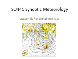
Lesson 6: Potential vorticitySlide2

Potential Vorticity

Concept of potential vorticity:

Take a column of air defined by two potential temperature surfaces (

θ

and θ+Δθ). Move this column of air eastward. Force it to go up and over a mountain range.What happens to the column of air??It compresses (“fattens”) as it approaches the mountain, and stretches again on the other side of the mountain

Figure adapted from

http://www-das.uwyo.edu/~geerts/cwx/notes/chap12/pot_vort.html

Slide3

Potential Vorticity

Mathematically, what is it?Measures absolute

vorticity

(spin) over the depth of a column of air

What does it mean that potential vorticity is conserved?Following air motion (

Lagrangian perspective!!), absolute vorticity divided by depth of the fluid must remain constant.Return to the scenario of easterly flow (a fluid column moves from west to east):

Along its path, potential vorticity must be constant.

f

, Earth’s vorticity, is constant (b/c it moves to the east)But h, depth, decreases as it approaches the mountainThus, relative vorticity zeta must also decrease. Anticyclonic turning forms a ridge as the flow goes over the mountain!After passing the mountain, depth increases againThus, relative vorticity zeta must now also increase. Cyclonic turning forms a trough downstream of the mountain.Slide4

Consequences of PV conservation for zonal (E-W) parcel motion

Physically, potential

vorticity

is a quantity that is

Useful to measure the “spin up” or “spin down” of an air column for large-scale, adiabatic motionThe very important conservation property (that potential vorticity is conserved following the fluid motion) is valid forAtmospheric motions with no friction or diabatic effects

N

E

Mountain ridge

Colder air (

h

small)

Warmer air (

h

large)Slide5

Consequences of PV conservation for meridional (N-S) parcel motion

Let’s consider a parcel moving equatorward

Starting position

Ending positions

At the starting position, let’s assume the relative vorticity

ζ

is zero.Slide6

Consequences of PV conservation for meridional (N-S) parcel motion

Let’s consider a parcel moving equatorward

A

B

C

D

ESlide7

Consequences of PV conservation for meridional (N-S) parcel motion

Let’s consider a parcel moving equatorward

For the path ending at C:

f

has decreased (f is smaller at the equator)

ζ has not changed (how do we know?)What does that mean for h?

What does a change in

h

imply for vertical motion (w) at point C? AB

C

D

ESlide8

Consequences of PV conservation for meridional (N-S) parcel motion

Let’s consider a parcel moving equatorward

For the path ending at B:

f

has decreased (f is smaller at the equator)

ζ has become more negative (how do we know?)What does that mean for h?

What does a change in

h

imply for vertical motion (w) in the atmosphere at point B? AB

C

D

ESlide9

Consequences of PV conservation for meridional (N-S) parcel motion

Let’s consider a parcel moving equatorward

For the path ending at A:

f

has decreased (f is smaller at the equator)

ζ has become significantly negative (how do we know?)What does that mean for h?

What does a change in

h

imply for vertical motion (w) in the atmosphere at point A?What about w at A compared to B? A

BC

D

ESlide10

Consequences of PV conservation for meridional (N-S) parcel motion

Let’s consider a parcel moving equatorward

For the path ending at D:

f

has decreased (f is smaller at the equator)

ζ has become positive (how do we know?)Let’s say that the changes in f and ζ are equal (and opposite in sign).

What does that mean for

h

?What does the lack in change in h imply for vertical motion (w) in the atmosphere at point D? A

BC

D

ESlide11

Consequences of PV conservation for meridional (N-S) parcel motion

Let’s consider a parcel moving equatorward

For the path ending at E:

f

has decreased (f is smaller at the equator)

ζ has become significantly positive (how do we know?)Assume the change in ζ is more than f

What does that mean for

h

?What does a change in h imply for vertical motion (w) in the atmosphere at point E? A

BC

D

ESlide12

Summary

Significant compression

Compression

Slight compression

No change

Expansion

Letter

Change in

ζVertical velA

ζ ↓↓w << 0Bζ

↓w < 0

Cζ ↔w < 0 (slight)

D

ζ

w ≈ 0

E

ζ

↑↑

w > 0Slide13

Starting position

Consequences of PV conservation for meridional (N-S) parcel motion

Summarize: where do we expect rising & sinking motions?

These vertical motions are

only

due to the southward motion and the

conservation of PV

.

w << 0

w > 0Slide14

Starting position

Consequences of PV conservation for meridional (N-S) parcel motion

What if we

reverse

the motion?

These vertical motions are

only

due to the northward motion and the

conservation of PV.w >> 0w << 0Slide15

Applications of PV in Synoptic Meteorology

Compare the relative vorticity (left image) with the pressure of the 2 PVU surface (right image)

On the right image, note areas of steep pressure gradient. These are areas with active weather (rising/sinking motion, precipitation)Slide16

Here are the average winter 500 mb

heights for the NH (left) and SH (right)Note the SH is nearly symmetric about the pole, but the NH is much more wavy (3 mean troughs, to be exact)Why is this the case? What is different about the flow from NH to SH?

Applications of PV in

Synoptic MeteorologySlide17

Applications of PV in Synoptic Meteorology

Another property of Potential Vorticity is that the amplification of heights as flow approaches a mountain is most

prnounced

in the low levels.

So 700 mb (left) is much more wavy than 200 mb (right)Slide18

Applications of PV in Synoptic Meteorology

The requirement that potential vorticity be conserved is common in both hemispheres.

Flow crossing the Andes Mountains (which are VERY tall) results in ridging over Chile and

troughing

over Argentina, Uruguay, and Brazil

Figure adapted from http://www-das.uwyo.edu/~geerts/cwx/notes/chap12/pot_vort.html