/
The Diurnal Cycle of Tropical and Monsoon Convection The Diurnal Cycle of Tropical and Monsoon Convection

The Diurnal Cycle of Tropical and Monsoon Convection - PowerPoint Presentation

min-jolicoeur
min-jolicoeur . @min-jolicoeur
Follow
380 views
Uploaded On 2017-07-31

The Diurnal Cycle of Tropical and Monsoon Convection - PPT Presentation

Richard H Johnson Colorado State University T Ushiyama Andy Newman Brian McNoldy and Paul Ciesielski MAHASRI HyARC workshop 57 March 2009 DaNang Vietnam Why do we care about the diurnal cycle ID: 574657

rainfall diurnal june cycle diurnal rainfall cycle june 1998 land morning 2007 maximum maxima ocean afternoon evening convection convergence

Share:

Link:

Embed:

Download Presentation from below link

Download Presentation The PPT/PDF document "The Diurnal Cycle of Tropical and Monsoo..." is the property of its rightful owner. Permission is granted to download and print the materials on this web site for personal, non-commercial use only, and to display it on your personal computer provided you do not modify the materials and that you retain all copyright notices contained in the materials. By downloading content from our website, you accept the terms of this agreement.


Presentation Transcript

Slide1

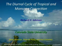
The Diurnal Cycle of Tropical and Monsoon Convection

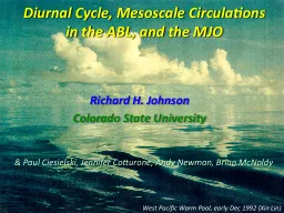
Richard H. Johnson

Colorado State University

T. Ushiyama

(Andy Newman , Brian McNoldy, and Paul Ciesielski)

MAHASRI/

HyARC

workshop, 5-7 March 2009,

DaNang

, Vietnam Slide2

Why do we care about the diurnal cycle?

Diurnal cycle is of fundamental importance for weather and climate

“Diurnal cycle is rectified onto intraseasonal

[and longer] time scales…and is poorly represented in global models” (Sperber and Yasunari 2006) For example, modeled maritime continent heat source without diurnal cycle is too weak (Neale and Slingo 2003)Slide3

Characteristics of the Diurnal Cycle

General behavior: afternoon maximum over land, nighttime maximum over ocean; important exceptions over land and ocean

Migrating/propagating signals downstream of mountain ranges and seaward from coastlines

Over ocean, amplitude of diurnal cycle is greater for larger, more-organized convective systems than for isolated convection Semidiurnal cycle observed at some tropical locationsSlide4

Mechanisms of the Diurnal Cycle

Thermodynamic processes that affect static stability

Diurnal cycle of surface heatingCloud-radiative

effectsDiurnal variation in boundary-layer moisture Processes that affect PBL convergenceSea and land breezesMountain/valley flowsWind variations at top of boundary layer

Horizontal gradients in radiative/heating coolingVertical momentum mixingSlide5

TRMM 3B42

*

10-year Mean Rainfall

* Geostationary IR precipitation estimates adjusted by optimal combination of TRMM, SSMI, AMSR, AMSU, and other microwave measurements scaled to match monthly rain gauge observations

Much of world’s heaviest rainfall in the tropics and monsoon regions

occurs within

ITCZs

/SPCZ,

and also along coastlines

diurnal cycle is important

1998-2007Slide6

Normalized Amplitude, Mean Diurnal Cycle of Annual Rainfall (1998-2007)

[Evening (12-23 LT) minus Morning (00-11 LT) Rain]

[Annual Mean Rainfall]

Afternoon

/evening maxima over land…but also interior ocean basins and other offshore areas

Nocturnal maxima generally over oceans, along coastlines

÷

(excluding areas with < 100 mm rainfall per year)Slide7

“Propagating”

signals

evident offshore

near coastlines

3B42 Annual Mean 1998-2007

3B42 Time of Maximum Accumulation 1998-2007

…and over land

Broadly speaking, afternoon/evening maxima over land, nocturnal maxima over oceans, but…

…some land areas have nocturnal maxima and ocean areas afternoon/evening maxima

In addition, …Slide8

Similar results obtained by Takayabu et al. (2008) using TRMM PR data

Local Time

Timing of maximum of first harmonic

PROPAGATING OR MIGRATING SIGNALS NEAR COASTLINESSlide9

“Propagating”

signals evident near coastlines

3B42 Time of Maximum Accumulation 1998-2007

Panama Bight: gravity waves (

Mapes

et al. 2003

)

GATE region: squall line propagation from West Africa

Papua New Guinea: gravity waves (Liberti et al. 2001; Zhou and Wang 2006)

Indian Ocean: squall lines (Yang and Slingo 2001; Webster et al. 2002)

Borneo:

(

Houze

et al.

1981; Ichikawa and

Yasunari

2006)

Sumatra (Mori et al. 2004; Sakurai et al. 2005; Wu et al. 2008)Slide10

Over the majority of the tropical open ocean areas, precipitation is nocturnal

An important exception: light-wind conditions over tropical oceans where a shallow diurnal warm layer develops in the upper ocean

Example: western Pacific during the inactive phase of the MJO, as seen during 1992-93 TOGA COARE; also during MISMO 2006Diurnal Cycle over Open OceanSlide11

MIT Radar

Gradual increase in

precipitating

cumulus and congestus cloud populations

(Johnson et al. 1999)

SST

exhibits

strong diurnal

signal

Afternoon maximum in shallow cu and cg on these days

SST increasing

Inactive, light-wind phase of MJO

NOVEMBER-DECEMBER 1992Slide12

2°S

Mesoscale

circulations (open cells)

3 December 1992 – Light-wind dayEQ

“Benard cells”~ 30 km scale

EQ

2°S

2°N

Mesoscale

circulations serve to enhance deep convection

2°N

154°E

152°E

156°ESlide13

Diurnal variation in radar echo coverage during MISMO 2006: afternoon maximum in light-wind conditions

Yasunaga

et al. (2008)

WITH SST DIURNAL CYCLE

WITHOUT SST DIURNAL CYCLEMIDNIGHTNOON

MIDNIGHT

AFTERNOON MAXIMUM

MORNING MAXIMUM

CONV

STRATSlide14

Ten-year (1998-2007) May-June Mean Rainfall

Heavy rainfall in coastal regionsSlide15

Heaviest rainfall occurs just offshore – Western Ghats and Myanmar (

Xie

et al. 2006) – not over coastal mountain ranges: suggests diurnal cycle is important (sea/land, mountain/valley breezes)Slide16

Normalized Amplitude, Mean Diurnal Cycle of May-June Rainfall (1998-2007)

Morning rainfall maxima along coastlines

Morning maxima: base of Himalayas, lee of Tibetan Plateau, interior Borneo

Afternoon/evening rainfall maxima over enclosed ocean basins

(> 50 mm)Slide17

Explanations for Nocturnal Coastal Convection

1. Land Breeze

2. Gravity Waves

BORNEO/KALIMANTAN

(Houze

et al. 1981)

(

Mapes

et al. 2003)

Panama Bight

Land breeze coupled with drainage flows and downdraft outflows from evening convection (Johnson and

Bresch

1991; Wu et al. 2008)

Diurnally varying flow separation/blocking (e.g., Wang et al. 2000)Slide18

June

Evening

Surface Winds and Divergence (2000-2007 QuikSCAT)

Coastal convergence

Divergence offshore between land massesSlide19

June

Morning

Surface Winds and Divergence (2000-2007 QuikSCAT)

Stronger coastal convergence

Convergence offshore between land masses

ConvergenceSlide20

Time of Maximum May

-June Rainfall

(1998-2007)

~10-15

m s

-1

~15

m

s

-1

~10

m

s

-1

~13

m

s

-1

~10-15

m

s

-1

Diurnally migrating or propagating convective features

Morning convergence maxima consistent with morning rainfall maxima Slide21

WMONEX25+ 4-6 April 2006

Kuala Lumpur

T

BB June 1999

Southward-Propagating Convection over Bay of BengalWebster et al. (2002)

JASMINE

Convective systems propagate from the coast of India over 2000 km!Slide22

June

Morning

Surface Winds and Divergence (2000-2007 QuikSCAT)

ConvergenceSlide23

BMRC C-POL RADAR

South China Sea Monsoon Experiment (SCSMEX) – May-June 1998

Hong KongSlide24

3rd Intl TRMM Sci Conf

8 February 2008 Las Vegas, NV

20

°N10

°EQSlide25

South China coastline

GMS Brightness Temperatures

110-120

°E (South China Sea) 1 May – 30 June 1998

35°N30

25

20

15

10

5

MAY 1

JUNE 1

NESA

Monsoon onset over northern SCS;diurnal signal

Convection shifts to central SCS; diurnal signal still presentSlide26

South China coastline

GMS Brightness Temperatures

110-120

°E (South China Sea) 1 May – 30 June 1998

35°N30

25

20

15

10

5

MAY 1

JUNE 1

1

NESASlide27

BMRC C-POL Radar Animation

15 May

1998

08-20 LSlide28

South China coastline

GMS Brightness Temperatures

110-120

°E (South China Sea) 1 May – 30 June 1998

35°N30

25

20

15

10

5

MAY 1

JUNE 1

1

2

NESASlide29

BMRC C-POL Radar Animation

5 June

1998

02-14 LSlide30

Ten years of TRMM PR-based diurnal cycle of rainfallSlide31

South China coastline

11

Afternoon convection over land

7 m s

-1

14

MAX

MIN

Slower movement near coastline, faster farther south

Possible mechanisms

Gravity currents

Gravity waves

Discrete propagationSlide32

TRMM 3B42

MONTH

OF MAXIMUM RAINFALL (1998-2007)MAY – JUNE (Meiyu-Baiu)

OCT-NOV

-DECSlide33

HEAVY RAINFALL ASSOCIATED WITH OROGRAPHIC LIFTING AND/OR COASTAL CONVERGENCE IN NORTHEAST MONSOON FLOWSlide34

Normalized Amplitude, Mean Diurnal Cycle of

Nov-Dec-Jan

Rainfall (1998-2007)

Slight preference for morning rainfall maximumSlide35

Morning-evening differences in coastal convergence are small in heavy rain areas

Suggests weak land/sea breeze effects

Possible NE coastal rainfall mechanisms:

orographic lift, upstream blocking, cloud-top radiative cooling, others?

Morning divergenceEvening divergence

NOVEMBER

NOVEMBERSlide36

Summary and Conclusions

Heavy rain areas in tropics and monsoon regions exhibit prominent diurnal cycle

Afternoon/evening rain over land, nocturnal rain over ocean predominate, but important exceptions (e.g., morning rainfall at foot of Himalayas, afternoon rainfall over tropical ocean in light winds)

Downstream propagation of convection from major mountain barriersSlide37

Summary and Conclusions

Large rainfall maxima upstream of Western Ghats and Myanmar, peaking at nighttime/morning hours

Seaward migration/propagation of convection prevalent throughout Asian summer monsoon; mechanisms unresolved – could involve gravity currents, waves, discrete propagation

Weak diurnal cycle of rainfall in coastal, heavy-rain areas during boreal winter monsoon