/
The Environment of Warm-Season Elevated Thunderstorms Assoc The Environment of Warm-Season Elevated Thunderstorms Assoc

The Environment of Warm-Season Elevated Thunderstorms Assoc - PowerPoint Presentation

mitsue-stanley
mitsue-stanley . @mitsue-stanley
Follow
395 views
Uploaded On 2016-08-07

The Environment of Warm-Season Elevated Thunderstorms Assoc - PPT Presentation

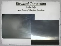
Authors James T Moore Fred H Glass Charles E Graves Scott M Rochette Marc J Singer Purpose of the article Twentyone warmseason heavy rainfall events in the central United States that developed above and north of a surface boundary are examined to define the environmental conditions ID: 437500

elevated mcs air centroid mcs elevated centroid air moisture 850 fields sfc composite located values inflow wind boundary max

Share:

Link:

Embed:

Download Presentation from below link

Download Presentation The PPT/PDF document "The Environment of Warm-Season Elevated ..." is the property of its rightful owner. Permission is granted to download and print the materials on this web site for personal, non-commercial use only, and to display it on your personal computer provided you do not modify the materials and that you retain all copyright notices contained in the materials. By downloading content from our website, you accept the terms of this agreement.


Presentation Transcript

Slide1

The Environment of Warm-Season Elevated Thunderstorms Associated with Heavy Rainfall over the Central United States

Authors:

James T. Moore

Fred H. Glass

Charles E. Graves

Scott M. Rochette

Marc J. SingerSlide2

Purpose of the article

Twenty-one warm-season heavy rainfall events in the central United States that developed above and north of a surface boundary are examined to define the environmental conditions and physical processes associated with these phenomena.

-MCS’s account for 30-70% of warm-season precipitation.

-Summer 1993Slide3

Previous Research

Colman: Defined elevated thunderstorms as those that are isolated from sfc diabatic effects and occur above frontal surfaces.

Three criteria:

Must lie on the cold side of analyzed front

Winds, temperatures and dew points must be similar to surrounding values

Surface air on warm side of analyzed front must have higher equivalent potential temps than air on cold sideSlide4

Colman cont’

Colman identified 5 characteristics of elevated thunderstorms

Strong warm air advection at 850-mb

Strong low-level veering of winds with height, from east at sfc to SSW at 850-mb, to SW at 500-mb

Extremely stable sfc air with LI values of 7°C

Shallow front exhibiting strong frontal inversion of >5°C

Sharply defined front associated with strong horizontal thermal contrastSlide5

Dataset and Methodology

Local heavy rain events from 1993-1998 were examined

Must have produced at least 10 cm of rain in a 24 hr period

Been initiated or been on going ± 4 hrs 0000 UTC or 1200 UTC.

Must have met Colman’s 3 criteria for elevated thunderstorms

A total of 21 heavy-rain events met criteriaSlide6

Dataset used during researchSlide7

Dataset used during researchSlide8

Surface and kinematic upper-air fields

A) On average the sfc boundary is located 160 km south of MCS centroid

B) Baroclinic zone is shifted more north at 850mb

C & D) Elevated MCS centroid is located within the low-level

θ

e

gradient, just to the east of a weak north-south ridge axis.

Maximum

θ

e

values to the S-SW of the active MCS.

Given the location of the elevated MCS with respect to the baroclinic zones, frontogenetical forcing likely plays a role in the existence of the MCS.Slide9

Surface and kinematic upper-air fields

A) 925-mb wind vectors and isotachs

B) 850-mb wind vectors and isotachs

C) 925-mb moisture convergence

D) 850-mb moisture convergence

The centroid is located about 600 km downstream from the 925-mb wind maximum. The favored location for the elevated MCS is just north of the maximum moisture convergence.

The 850-mb wind maximum is 400 km upstream of the MCS centroid

Composite LLJ is oriented normal to the moisture field in figure D.

Moisture convergence is maximized just south of the MCS centroid.Slide10

Surface and kinematic upper-air field

A) 850-mb mixing ratio

B) 850-mb moisture transport vectors and magnitudes

C) 850-mb

θ

e

advection

D) 850-mb temperature advection

There is a large region of positive

θ

e

advection that coincides with the MCS centroid

This is critical in the destabilization process by promoting elevated convective instability above the sfc boundary

Elevated MCSs tend to be located with a region of positive thermal advection at 850-mbSlide11

Surface and kinematic upper-air fields

A) Composite analysis of 250-mb wind vectors and isotachs

B) 250-mb divergence

The elevated MCS is located within a divergence maximum of greater than 2.5 x 10

-5

s

-1

McNulty: severe convection tends to develop in the divergence gradient south of a divergence maximum aloft

Junker/Glass: location of heaviest rainfall tends to be the gradient region of the max 250-mb divergence.

MCS-induced divergence likely increased divergence values locallySlide12

Stability and moisture fields

Elevated thunderstorms form above the boundary layer therefore would expect sfc and low level based stability to be poor indicators of atm. stability

Lifted Index, showalter index and the horizontal distribution of the mean parcel CAPE is representative of the boundary layer moisture and temp stratification

The mean LI for the MCS centroid is +4, which is expected because the MCS is located north of the sfc boundarySlide13

Stability and moisture fields

Elevated MCS centroid is located within the N-S gradient of modest CAPE values (~600 J/kg)

Using the max-

θ

e

CAPE, the MCS centroid is located at the 1200 J/kg

The CIN values at the MCS are >110 J/kg

The MCS centroid is located in a valley of max

θ

e

CIN, thus requiring less forced upward vertical motion to overcome negative buoyancy

The max-

θ

e

CAPE value is twice that of the mean parcel CAPE, which illustrates that greater positive buoyancy is realized by lifting a parcel along or above the sloped frontal zone Slide14

Vertical profiles of wind shear and stability

Composite soundings were constructed at the centroid location and at the inflow point

At the MCS centroid, the near-sfc wind is from the E-SE at ~2.5 m/s and veers to the SW at ~ 10 m/s at 850-mb

In contrast, at the inflow site, near-sfc winds are from the south at 2 m/s and veer to the SW at 15 m/s at 800-mb. Above 800-mb winds weaken and have little to no veering

Elevated MCS form downstream from the LLJ situated over the inflow siteSlide15

Vertical profiles of wind shear and stability

A)

θ

e

vertical profile for the MCS centroid

B)

θ

e

vertical profile over the inflow point

Centroid site is characterized by a convectively stable boundary layer, with convectively unstable on top.

At the inflow point, the

θ

e

profile reveals a shallow convective stable layer with a deep layer of convectively unstable air aloft

The vertical shift in the location of the

θ

e

maximum from 950-mb at the inflow site to 800-mb at the centroid location is consistent with the northward transport of high

θ

e

air above the frontal zone

The depth of the convectively unstable air also changes from 350 mb at the inflow site to 150 mb at the MCS centroidSlide16

Representativeness of composite fields

Because some mature MCSs were included in the dataset, it is important to quantify their impact

Composite fields were recomputed, using synoptic times that were either pre-MCS or less than 3 hrs after the MCS initiation, resulting in 15 events being composited

The majority of the composite fields revealed little to no difference from the full datasetSlide17

Representativeness of composite fields

To examine the strength of the composite fields, the linear spatial correlation coefficient between the individual cases and composite fields was computed

High values of the correlation coefficient indicate that there is agreement between the pattern of the composite field and that for individual analysis

In about 50% of the cases, at least 10 parameters, out of the 18, had correlation coefficients that exceeded the median correlation value for that parameter

This result provides evidence that the composite patterns presented are reliable signatures of the typical environmental conditions that are common for elevated MCSsSlide18

Summary & Conclusions

Cross-sectional schematic of the MCS environment

MCS centered 160 km north of an east-west oriented sfc front

The exact position is the function of the thermal gradient, magnitude and orientation of the low-level inflow, and moisture content

S-SW LLJ transports high-

θ

e

air northward along and above the cool, stable layer

SW midtropospheric flow advects lower-

θ

e

air over the warm, moist high-

θ

e

air, resulting in a layer of elevated convective instability

Moisture convergence within the left-exit region of the LLJ helps to initiate deep convection in the unstable layer along or above the frontal zone

The LLJ contributes to an axis of moisture convergence that’s nearly parallel to the sfc boundary, which promotes cell training and subsequently high rainfall totalsSlide19

Summary & Conclusions

Schematic diagrams that summarize the typical conditions associated with warm-season elevated thunderstorms attended by heavy rainfall

Presence of a east-west quasi-stationary front

Moderate north-south

θ

e

gradient

S-SW LLJ directed nearly normal to the boundary

SW-NE elongated moisture convergence axis at 925-mb found on and along the cool side, upstream from the MCS centroid

Positive 850-mb

θ

e

advection max nearly centered over the MCS centroid

Broad SW midtropospheric flow, with MCS centroid over inflection point

Relatively high relative humidity

MCS centroid typically located in the right entrance region of the ULJ

MCS centroid is favored just east of the max

θ

e

, in a region of WAA and moisture convergence at 850-mbSlide20

Summary & Conclusions

Analysis of max-

θ

e

CAPE shows values that are 2 times that of the mean parcel CAPE over the MCS centroid

In the vicinity of the MCS centroid, values of max-

θ

e

CIN are 1/3 of the mean parcel CIN

Relatively high correlation coefficients of individual fields confirm

that operational

forecasters can apply the patterns/signals displayed in the composites with prognostic numerical model data to help diagnose regions that are favorable for organized elevated thunderstorms that produce heavy rainfall

It is important to note the spatial distribution of the variablesSlide21

QUESTIONS?