/
The Geography of Spain Content: The Geography of Spain Content:

The Geography of Spain Content: - PowerPoint Presentation

moistbiker
moistbiker . @moistbiker
Follow
344 views
Uploaded On 2020-08-28

The Geography of Spain Content: - PPT Presentation

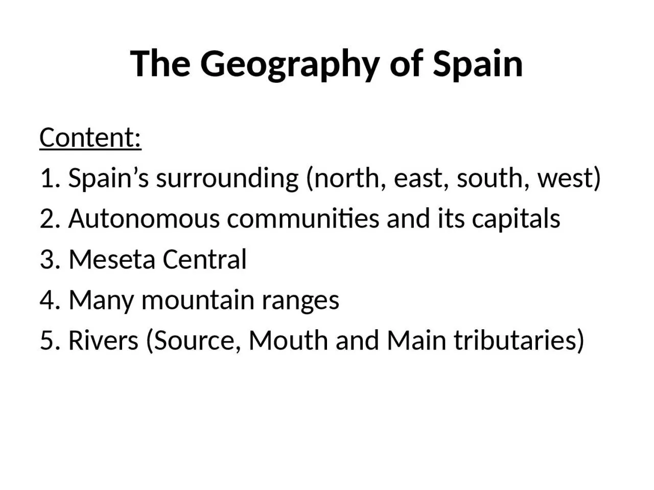
1 Spains surrounding north east south west 2 Autonomous communities and its capitals 3 Meseta Central 4 Many mountain ranges 5 Rivers Source Mouth and Main tributaries 1 Spains surrounding ID: 810310

rivers meseta watershed spain meseta rivers spain watershed north south ranges central flow watersheds tajo water duero mountain guadiana

Share:

Link:

Embed:

Download Presentation from below link

Download The PPT/PDF document "The Geography of Spain Content:" is the property of its rightful owner. Permission is granted to download and print the materials on this web site for personal, non-commercial use only, and to display it on your personal computer provided you do not modify the materials and that you retain all copyright notices contained in the materials. By downloading content from our website, you accept the terms of this agreement.


Presentation Transcript

Slide1

The Geography of Spain

Content:

1. Spain’s surrounding (north, east, south, west)

2. Autonomous communities and its capitals

3.

Meseta

Central

4. Many mountain ranges

5. Rivers (Source, Mouth and Main tributaries)

Slide2

1. Spain’s surrounding

The countries:

In the north: France and Andorra

In the South: Morocco and Gibraltar

In the West: Portugal

The seas

:

In the north: Mar Cant

á

brico

In the east and south: Mediterranean Sea

In the south and west: Atlantic Ocean

Slide3

2. The autonomous

communities and their capitals

Slide4

3. The

different

seas

that surround Spain

Slide5

4. The

Meseta

Central

Meseta

Central

, great plateau of the Iberian

Penisnsula

. With

Madrid

at its centre, it extends over 210,000 square km and has an average elevation of 660 metres.

It is the oldest and most complex geologic formation of the peninsula.

Its western slope is gently inclined toward the

Atlantic Ocean

and forms the basins of the

Duero

,

Tajo

,

and

Guadiana

rivers.

To the north the

plateau

rises abruptly into the

Cantabrian Mountains

, and to the east it becomes a series of ranges

Slide6

What other mountain ranges are there?

On the

meseta

:

Sistema

central: splits the

meseta

into north and south

Montes de Toledo: southern part of

mesta

Around the

mesta

:

Cordillera

Cantabrica

: in the north contains

Picos

de

Europa

Montes de Leon: under the

Codillera

Cantabrica

Sistema

Iberico

: eastern edge of

meseta

Sierra

Morena

: south of the

meseta

Slide7

The mountains

Slide8

What important rivers are there?

On the

meseta

:

Duero

Tajo

Guadiana

Around the

meseta

:

Guadalquivir

Miño

Slide9

The Rivers

Slide10

Spanish Watersheds

Slide11

CHARACTERISTICS OF THE WATERSHEDS OF SPAIN

Watersheds

They are areas of land which descend from high mountain ranges. A watershed is an area of land that drains or “sheds” water into a specific

waterbody

. Every body of water has a

watershed

. Rivers

on the same watershed flow into the same sea. Spain has three main watersheds:

The

Cantabrian watershed

has short, fast-flowing and rivers. Their flow is abundant and regular: the

Nervion

, the

Saja

, the

Navia

and the

Nalon

.

The

Mediterranean watershed

occupies about one third of Spain. The rivers are short and carry little water with the exception of the Ebro. Examples are the Jucar and the Segura. They flow is irregular.

The

Atlantic watershed

occupies over half of Spain. The flow of the rivers is abundant and regular: the

Miño

, the Duero, the Tajo, the Guadiana and the Guadalquivir. The Tajo is the longest river in Spain.