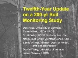
Don Ross University of Vermont Thom Villars USDA NRCS Scott Bailey USFS Northern Res Sta Nancy Burt Angie QuintanaJones USFS Sandy Wilmot Vermont Dept of Forest Parks and Recreation ID: 707800
Download Presentation The PPT/PDF document "Twelfth-Year Update on a 200-yr Soil Mo..." is the property of its rightful owner. Permission is granted to download and print the materials on this web site for personal, non-commercial use only, and to display it on your personal computer provided you do not modify the materials and that you retain all copyright notices contained in the materials. By downloading content from our website, you accept the terms of this agreement.
Slide1
Twelfth-Year Update on a 200-yr Soil Monitoring Study
Don Ross, University of Vermont
Thom Villars, USDA NRCS
Scott Bailey, USFS Northern Res. Sta.
Nancy Burt, Angie Quintana-Jones, USFS
Sandy Wilmot, Vermont Dept. of Forest, Parks and Recreation
Deane Wang, University of Vermont
Jamie
Shanley
, USGSSlide2
Project Goals:Establish five 50 x 50 m relatively uniform plots in sites associated with the VMC.
Sample plots at
0, 5, 10
, 20, 50, 100, 150 and 200 years.
Year 0 = 2002
Archive samples for later comparisons.
Analyze initial samples to determine baseline values.
Protect the plots for future monitoring.Slide3
Sites:Mt. Mansfield Ranch Brook
northern hardwood
Mt. Mansfield Forehead
high elevation spruce/fir
Mt. Mansfield Underhill State Forest
transitionalSCAN siteLye Brook “Road”northern hardwoodSCAN siteLye Brook “Trail”transitionalSlide4
Mansfield Forehead
NW
NE
91
92
93
94
95
96
97
98
99
100
81
82
83
84
85868788899071727374757677787980616263646566676869705152535455565758596041424344454647484950313233343536373839402122232425262728293011121314151617181920SW12345678910SE
50 m
5m
50 m
A typical plot plan.
Plots with red numbers were sampled in 2002 (Year 0).Slide5Sampling Scheme
2002: All samples taken by horizon (no depth increments) 2007, 2012: 4 large samples from each pitLitter layer (Oi)
Oa
or A (near-surface
humified
horizon)
Top 10 cm of B horizon60-70 cm (usually C horizon)(Also small samples of each genetic horizon)Slide6
Lye RoadSlide7
Lye RoadSlide8
Lye RoadSlide9
Lye TrailSlide10
Lye TrailSlide11Slide12
Ranch Brook
2002Slide13
Underhill State Park or ‘Polka-Dot’, 2400’Slide14
Polka-dotSlide15
Forehead, 3600’Slide16
ForeheadSlide17Slide18
60-70 cm particle size from 2012(only one sample from Forehead)All averages are fine sandy loamSlide19
60-70 cm total elemental analysis 2012(only one sample from Forehead)Slide20
Carbon in the Oa/A horizonSlide21
Carbon in the 60-70 cm samplesSlide22
Carbon in the B horizonsSlide23
Exchangeable Ca in B horizonsSlide24Slide25
Ranch exchangeable Ca in the uppermost B horizon red = 2002, blue = 2007, green = 2012
NSlide26
Challenges
facing the project:
Separating natural soil variation from actual long-term
changes
Developing
a permanent
archive
p
lan
Funding for lab work and unsupported personnel
costs
200
years??? - Institutionalizing the program into agencies and passing on the project to a new generation of scientistsSlide27
Power analysis
Lye Road B 0-10 cm
Exchangeable Ca cmolc/kgSlide28
Detecting changeSlide29
Detecting changeSlide30
(Almost) everyone involved in 2012:
Ashley Walker, UVM
Ben
Dillner
, Vermont Forest, Parks and Rec
Charlotte Ford, UVMCourtney Dyche, UVM
Dana Andrews, UVM
Deane Wang, UVM
Don Ross, UVM
Doug Morin, UVM
Emily
Piche, UVM
Meghan Knowles, UVMNancy Burt, US Forest ServiceNoah Ahles, UVM
Rebecca Bourgault, UVMRyan Melnichuk, UVMRyan Morra
, UVMSandy Wilmot, Vermont Forest, Parks and RecScott Bailey, US Forest ServiceThom Villars, NRCSVermont Youth Conservation Corp
Funding generousy provided by VMC and Green Mountain and Finger Lakes National ForestsThanks Carl Waite and Nancy Burt!Slide31
Lye TrailSlide32
Polka-dotSlide33
ForeheadSlide34
Young volunteers needed!