/
Peace Region Peace Region

Peace Region - PDF document

natalia-silvester
natalia-silvester . @natalia-silvester
Follow
387 views
Uploaded On 2015-12-04

Peace Region - PPT Presentation

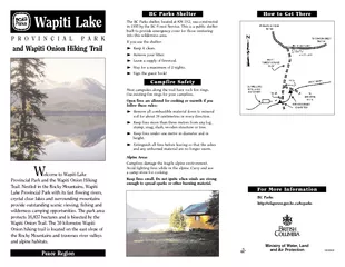
elcome to Wapiti LakeProvincial Park and the Wapiti Onion HikingTrail Nestled in the Rocky Mountains WapitiWapiti Onion Trail The 30 kilometre Wapiti Wapiti Lake PROVINCIALPARK For More Information ID: 213729

elcome Wapiti LakeProvincial Park

Share:

Link:

Embed:

Download Presentation from below link

Download Pdf The PPT/PDF document "Peace Region" is the property of its rightful owner. Permission is granted to download and print the materials on this web site for personal, non-commercial use only, and to display it on your personal computer provided you do not modify the materials and that you retain all copyright notices contained in the materials. By downloading content from our website, you accept the terms of this agreement.


Presentation Transcript

Peace Region elcome to Wapiti LakeProvincial Park and the Wapiti Onion HikingTrail. Nestled in the Rocky Mountains, WapitiWapiti Onion Trail. The 30 kilometre Wapiti Wapiti Lake PROVINCIALPARK For More Information http://wlapwww.gov.bc.ca/bcparks Ministry of Water, Landand Air Protection 02/2003 and Wapiti Onion Hiking Trail How to Get There BC Parks Shelter The BC Parks shelter, located at KM 19.2, was constructed  Keep it clean.  Remove your litter.  Leave a supply of firewood.  Stay for a maximum of 2 nights.  Sign the guest book! Campfire Safety Most campsites along the trail have rock fire rings. Use existing fire rings for your campfires. Open fires are allowed for cooking or warmth if youfollow these rules:  Remove all combustible material down to mineralsoil for about 30 centimetres in every direction.  Keep fires more than three metres from any log,stump, snag, slash, wooden structure or tree.  Keep fires under one metre in diameter and inheight.  Extinguish all fires before leaving so that the ashesand any unburned material are no longer warm. Alpine Areas Avoid lighting fires while in the alpine. Carry and use Keep fires small. Do not ignite when winds are strongenough to spread sparks or other burning material. History Wapiti Onion trail development has a rich and long history.and have trapped in the Wapiti for many years. In thecabin at kilometre 19.2. The pilotÕs cabin eventuallyBC Forest Service shelter. In the late 1960s, a Catholicnumerous treks into the solitude of the Wapiti. In 198326, 2000 it was established as a provincial park. Today, Wapiti Lake The first 19 kilometres of the trial to Wapiti Lake follows the north side of the Wapiti River and the shores of a fewto Wapiti Falls at seven kilometres. A reasonable goal wouldbe to reach Wapiti Lake in day one. Backpacking time toWapiti is variable and depending on your experience allow Onion Lake The trail from Wapiti Lake to Onion Lake ascends steeplyinto the alpine. The two kilometre climb above WapitiWapiti Lake to the south and Onion Lake to the north. Lake. Allow seven to 10 hours for the trip from Wapiti Caution This is a mountainous wilderness area. Terrain is ruggedand weather can change quickly. Expect minimal or prepared for an extended stay if necessary. Advise friends Wildlife An abundance of wildlife can be viewed in the WapitiMountain Sheep climb about Bone Mountain. Wolves, Moose at a distance, appear black. A pendant of hair-covered hangs from under the throat. At birth acopy of its mother. The calf is initially reddish brown, butand brush, consuming 12 to 18 kilograms per day. In the summer, mooseWatch forWapiti Lake. Be Bear Aware Bears human food and garbage. For your own safety, take the  Avoid all contact with bears. Never feed or approach  Dogs can annoy bears and bring them back to theirowners. ItÕs best to leave your dog at home or keep iton a leash. Be Camper Smart  Never store food in tents.  Store all food in a sealed container and hang from abranch at least four metres above the ground and  Sleep at least 50 metres from the area where you storeand cook food. Pitch your tent away from dense bush,  Keep clothes and gear free of food odours, and disposeof dishwater at least 100 metres from your campsite.  Do not cook strong-smelling or greasy foods. Burnout tin cans after a meal, if you have a fire.  Keep your campsite clean. Put all garbage in sealedcontainers and pack it out. Never bury garbage;  Clean fish in running water. Dispose of fish entrails byor rushing water after puncturing the air bladder.  Do not use or pack strong smelling, or herbal scented perfumes, deodorants, shampoos, etc.  country. Do Not Surprise Bears  Carry a bell, sing, talk or make noise along the trail toavoid startling bears. Never hike alone or after dark.  droppings or diggings. If You Are Attackedbehave differently and may have different motives.Aggressive bears are usually defending their territory, It is best to play dead. Struggling will Black Bears Fight Back! them away. Trees and Plants on the Trail White Spruce is a largetree with a narrow crown Lodgepole Pine brown to grey. Seed cones Labrador Tea in spongy bogs and grows to Nodding Onion underarm-odour. Look for the onion plant Sprucecone Gray Jay or Canada Jay Ð grey. The Gray jay sails from one wheeoo andCamp Robber. Backcountry Ethic Unspoiled backcountry areas are decreasing. Treat theWapiti Onion area as a fragile environment so it remains  Stay on established trails. Use established campsites.  Use only dead and downed trees for firewood. Do notcut live trees or branches.  Use fire safely! Ensure campfires are fully extinguished.Respect fire closures.  Do not construct buildings or structures.  Leave the trail tidy. Litter barrels and garbage pickup Watch for the Camp Backcountry Horse Use continues to grow, especially in areas of high use, impact of this activity. The following are guidelines forhorse use in the backcountry. Planning Your Trip Familiarize yourself with the area you intend to travel. ÒNo TraceÓ Techniques On the trail and in camp, employingno trace techniques allows you techniques:  Avoid wet areas if possible.  water, trails and meadows.  Use only natural materialsfor essential camp improve-  Dispose of human waste in a 10 centimetre Ò. Burn waste inthe cat-hole when there is no fire hazard. When in  Dispose of waste water at least 50 metres away fromthe nearest water source.  Confine stock at least 70 metres from streams, lakestrails and camping areas. Rotate your stock  Pack out your trash. Return the site to its naturalstate. A little effort at this time will reduce evidence mine your location along the Wapiti Onion trail. Yellow KM 0.0 Trail starts at the southwest corner of old KM 0.3 Small stream crossing. KM 1.4 Start ascent up small hogsback. Mature spruce forest changing to young pine. KM 2.4 Bridge over small creek. KM 2.5 Old trail visible to the left (south). KM 2.6 Bridge over small creek. KM 3.5 Viewpoint. KM 4.0 On a slight rise above Barber Lake, catch a glimpse of lake through trees. KM 4.2 Short trail to lakeshore. Good rest spot. KM 4.8 Trappers trail to Wapiti River. KM 5.3 Meadow and often wet ground. KM 5.4 Wet area with crossing logs. KM 5.5 Trail ascends to pine hogsback. KM 6.0 Ridge trail. Stay along ridge to avoid wet areas. KM 6.1 Meadow. KM 6.3 View of Wapiti River from ridge. KM 6.4 View of Wapiti Falls. KM 6.6 Take fork to left (south). KM 7.0 Trail to Wapiti Falls viewpoint (south). The KM 7.2 Gravel creek bed. Trail stays on right side of bed. KM 7.9 Creek. View of Wapiti River. Can be very wet. KM 8.0 View of Mountains across Wapiti River. Wet area. KM 8.3 View of Wapiti River. Existing campsite. KM 8.6 Trail along Duke Lake. View of mountains KM 9.0 Along Duke Lake. Mixed spruce and pine forest. KM 9.9 Trail narrows and leaves the lakeshore. KM 10.0 Dense, mature pine and spruce forest. KM 10.3 Trail back along river. View of mountains. KM 10.8 Trail ascends ridge above Wapiti River. KM 11.5 Trail along Wapiti River. Campsite Junction for experienced wilderness hikers only. KM 11.9 Creek bed. Often dry. KM 12.0 Old trappers shelter. KM 12.2 Creek. KM 12.5 Creek. Trail follows shore of Lost Morraine KM 12.8 Campsite. KM 13.3 Trail crosses scree slope. KM 13.6 Trail leaves Lost Morraine Lake and crosses KM 13.8 Wapiti Lake Provincial Park boundary. KM 14.0 Spruce, pine and poplar forest. KM 14.1 Creek bed. Often dry. KM 14.9 Trappers cabin. KM 15.0 Trail along shore of Fellers Lake. Scenic view of mountains across lake. Trail rises to rocky KM 15.3 View of Fellers Lake inlet and gravel bar. KM 16.0 Wapiti Lake view. Well-used campsite. KM 17.0 Short, steep ascent to ridge. KM 17.3 Trails descends to Wapiti Lake shore. KM 17.5 Well-used campsite. Trial leaves lake and travels KM 19.0 Trail descends to lake level. Catholic shrine KM 19.2 BC Parks shelter. Campsite and scenic view of Wapiti Lake. KM 20.0 Creek bed. Often dry. KM 20.3 Spring. KM 20.4 Beaver dam. Willow flats. Flat terrain. KM 20.6 Small creek crossing. Wet areas. KM 21.4 Small creek and spring. Last good water before climb. KM 21.5 May be wet sections along trail. KM 21.8 Meadows and willow. KM 22.0 Begin ascent. Spruce, pine and fir forest. KM 22.8 First view of mountain slopes to left. KM 23.0 View of mountains and valleys to west. Trees are sub-alpine and much shorter. KM 23.4 Alpine meadows. View of ridge to north east. KM 23.6 Alpine meadows and creek. Ascent continues. KM 24.0 Trail leaves forest and enters alpine meadow. Note: trail not well defined through alpine areas. Stay Spring. Trail heads slightly to east (does not KM 24.9 View of Onion Lake. KM 25.3 Trail meets creek. Alpine campsite. Follow KM 26.1 Trail heads to left, stay high to avoid drop. Note: Descending trail. Do not follow too close to KM 26.4 Trail crosses creek (now on east side). KM 27.0 Trail re-crosses creek (now on west side). KM 27.4 Trail re-crosses creek to northeast side. KM 28.0 Onion Lake visible. KM 28.1 South end of Onion Lake. Note: Choice of trails; either follow east lakeshore orcontinue through timber. KM 29.0 Timber trail dips down towards lake. Terrain but is mostly dry. KM 30.0 North end of Onion Lake. End of Wapiti Trail Guide