/
Washington DC, March 18 th Washington DC, March 18 th

Washington DC, March 18 th - PowerPoint Presentation

natalia-silvester
natalia-silvester . @natalia-silvester
Follow
351 views
Uploaded On 2018-12-18

Washington DC, March 18 th - PPT Presentation

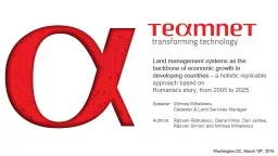
2016 Land management systems as the backbone of economic growth in developing countries a holistic replicable approach based on Romanias story from 2005 to 2025 Speaker Mihnea ID: 743390

data land registration cadaster land data cadaster registration management real years spatial cadastral time systems information evolution system application services amp public

Share:

Link:

Embed:

Download Presentation from below link

Download Presentation The PPT/PDF document "Washington DC, March 18 th" is the property of its rightful owner. Permission is granted to download and print the materials on this web site for personal, non-commercial use only, and to display it on your personal computer provided you do not modify the materials and that you retain all copyright notices contained in the materials. By downloading content from our website, you accept the terms of this agreement.


Presentation Transcript

Slide1

Washington DC, March 18th, 2016

Land management systems as the backbone of economic growth in developing countries

– a holistic replicable approach based on Romania’s story, from 2005 to 2025Speaker: Mihnea Mihailescu, Cadaster & Land Services ManagerAuthors: Răzvan Rădulescu, Diana Irimia, Dan Jantea, Răzvan Simion and Mihnea MihailescuSlide2

IndexWhat is our story on the map

Where did we start 10 years agoWhat do we do

in cadaster and land managementHow we succeeded: demo-use casesWhy is the land administration system the backbone of a modern societySlide3

Where did we start 10 years agoSlide4

Name: National Agency of Cadaster and Real Estate Publicity (NACREP)Birth: 2004, by the merging of National Office of Cadaster, Geodesy and Cartography and Land book department of Ministry of Justice (World Bank program).Main roles:cadastral map administration via surveyor work reception

registration of rights and restrictions in land bookcadastral and land book data dissemination to publicproduction of cartographic materialsTerritorial presence: 42 county offices and 140 local offices approx. 2,500 employees

Collaborators (approx.): 7,400 surveyors1,700 public notaries Who manages cadaster in Romania?Slide5

1st project: pilot implementation of an electronic integrated system for cadaster and land registrationDuration: 2002 – 2006 Target: 7 county offices (out of the total of 42)

Financing: World Bank FinancingHow did we meet in 2005?Slide6

Data

paper-based land registries

heterogeneous file-based spatial data repositoriesno central database Processes driven by local customsunpredictable durationhuge effort dedicated to archive exploration and manual processinguneven quality of the outputPeople

dissatisfied clients (citizens or companies)

stressed employees

poorly informed managers

What have we learned?Slide7

System reengineering (2007-2008) (technological update):centralized architecture (vs. distributed)

migration to Oracle DB v.10/11, ArcGIS v.9.3/10.1 new open format for capturing surveyor-produced data (XML)

New functional modules implemented:systematic cadaster projects reception modulereporting (data warehouse)e-learning HW/SW infrastructure managementNational roll-out between 2008 and 2011 in 35 countiesBilling module additionOnline application registration by surveyor and notariesDigitally-signed e-excerpts / data archiving We kept improving (2007-2014)Slide8

Data

has become an important asset can be extracted online

Processes all cadastral & land registry data updates and legal outputs are performed / produced within the systemare predictable and more efficiently run can be initiated online (application registration) Peoplecitizens and companies have their requests processed faster and more secure employees are more efficient in performing their daily tasks

managers have access to

real-time

aggregated data

Results for our customerSlide9

Methodology for drafting cadastral documentation, reception and land registration

Sale and purchase of agricultural land from the open countryside

Methodology for systematic registrationOn-line electronic application registration by notaries/surveyorsOn-line communication of land book digital signed e-excerpts

Electronic

land

book

Integrated Workflows

A

udited

business rule violations mechanism

On-line

real-time cadastral map updated by

surveyors

Interoperability

Client portal:

M

y

real estate portfolio view

Alerts

& notifications

Working protocols with Public notaries

Methodology of collection and remittance of real estate advertising fees.

2006

2012

2015

2013

2010

Legislation and features milestonesSlide10

A lot of things have changed

1900

20002014Slide11

Land registration evolution in 10 yearsSlide12

Land registration evolution in 10 yearsSlide13

Land registration evolution in 10 yearsSlide14

Land registration evolution in 10 yearsSlide15

Land registration evolution in 10 yearsSlide16

Land registration evolution in 10 yearsSlide17

Land registration evolution in 10 yearsSlide18

Land registration evolution in 10 yearsSlide19

Land registration evolution in 10 yearsSlide20

Land registration evolution in 10 yearsSlide21

Less technology is sometimes more

Technology makes people and organizations develop faster

Flexibility is a must for the IT system of developing organizationsStandardization makes people speak the same language Data is the new gold.Conclusions after 10 yearsSlide22

Statistics after 10 yearsSlide23

Statistics after 10 yearsSlide24

Statistics after 10 yearsSlide25

Overview of the systemWeb Integrated Land Management Application Slide26

Business viewSlide27

Creation of Technical Documentation

Contracting services from Surveyor

Registration of Application

Cadastral map and/or land registry update Confirmation

Technical documentation Reception

Documents Registration in Land book

Notification of Application Result / Proof for register update

Receiving Application Resolution

?

Contracting services from Public Notary

Creation of

Deed

?

Requester

Surveyor / Public Notary

PR Referent

Inspector

Assistant

Registrator

Registrator

Technical Reception Necessary?

YES

NO

Transfer of Application Resolution

Electronic resolution ?

YES

NO

Generic system workflowSlide28

Features:real-time application form registrationon-line payment (integration with payment processor)

on-line application status tracking

input / output documents upload / download Benefits: high accessibility reduced processing costs and timeprocess transparencylower waste of resourcesRegistration and paymentSlide29

Features:real-time online updated map by surveyors various import/export accepted formats (OGC, ESRI)

real-time spatial data validation (topology)

advanced GIS data query from internal and external sourcesinstant access to land registry data (land book)tools for general cadaster project reception Benefits:higher data quality reduced costs and timebetter decisions more visibility and transparency, hence fewer corruption chancesCadasterSlide30

Features:right, restrictions and responsibilities registration (RRR)automated (spatial) restrictions registration (protected areas) – real-time query of spatial data

reservation mechanism for property transfer registration

citizen and company identification in public registries Benefits:more accurate and secure registry management reduced processing costs and timeimproved data qualityLand registrySlide31

Features:property portfolio view (“my properties”)alerts settings (e.g. event = app. form registration for one property)

notifications (e.g. processing status change)

complaint registrations using map for localizationsurveyor and notaries catalog search and rating Q&A section Benefits:easy accessible valuable information for citizen and companiestransparency better public image, public satisfaction, fewer complaintsIncreased staff self estime, better organizational state of mindCitizen online interactionSlide32

Services viewSlide33

ProductsSlide34

Modeling tools for analystsHuman tasks

Long-running processesWorkflow configurations

Business rules Customizable allocation algorithmsKPI’sAudit and management processesBusiness Process ManagementSlide35

Data consistency processesFull versioning over all data catalogs

Real-time validation for textual and spatial dataSpatial data validation across external sources

Federated data exploration over legacy systemsDocument management system for all system documentsIndexing processes for data federationData managementSlide36

Government & AdministrationBusinesses

IntegrationSlide37

Web services for government & administrationWeb services for private businesses and banksStandard format for online/offline data entry based on OGC GMLStandard and non-standard spatial data integration using OGC (WFS, WMS) and proprietary (ESRI) formats. Integration with Administration Registries using web services

IntegrationSlide38

Customizable workflows and business rulesData model based on standard Land Administration Domain Model (LADM) – a model applicable to any land and cadaster system

Development using open standards (any COTS product can be replaced by using open source software and minimal adjustments)

Decoupled architecture (modular components)Full versionable code registriesFlexibilitySlide39

Technical Standards

Business Standards

LADM – oriented data model: Party package Administrative package - Spatial Unit package INSPIRE data themes: Cadastral Parcels Cadastral Zoning Cadastral Boundaries Buildings Universal data model for parties: identification, roles & relations

OGC

standards for spatial data representation & provisioning: GML, WKT, KML

OGC

standards for data services: WFS, WMS

Business Process Management:

BPMN

BPEL

Web Services:

SOAP, WSDL

,

WS-SECURITY

Adherence to standardsSlide40

How we succededDemo use-casesSlide41

Integrated cadaster and land registrySlide42

Federated query of legacy systemsSlide43

BPM controlled workflows:Slide44

Spatial data analysis and map featuresSlide45

Why is a Land Administration Systemthe backbone of a modern societySlide46

“In

SES

, location, place and other spatial information are available to governments, citizens and businesses as a means of organizing their activities and information.”“SDI is a dynamic, hierarchic and multidisciplinary concept that includes people, data, access networks, institutional policy, technical standards and human resource dimensions”“Spatially enabled society” (SES) & Spatial Data Infrastructures (SDI)Slide47

1

Political and Legal Drivers

Good Government needs accurate, easy-accessed, fast-served information for decision-making processes.A well-organized layer of parcel information in a national SDI is needed to provide immediate and accurate information about land based activities.2Environmental Drivers

Climate change scientists predict more severe and more frequent extreme weather events in the coming decades

.

Spatial information, particularly

the cadaster,

will be involved in preparation of environments, response and recovery phases in case of severe scenarios

4

Technological Drivers

Technological solutions :

3D visualization and analysis tools will enable real-time and predictive analysis of phenomena and events;

utility networks, people movements, traffic surges, social interactions and environmental flows will be captured, visualized and analyzed by decision makers in real-time.


cadaster

will continue to be an important component of these analytical systems: real-time accuracy, 3D property interests and interoperability through standardization of the cadastral domain will be essential.

3

Social-Economic Drivers

Massive urbanization will

be the greatest socio-economic trend.

Cadastral information will be needed to govern the new mega-cities.

Globalization will continue to be a significant economic force on most economies that will develop land global markets and need for reliable information.

The cadaster

must reassume the role of securing all interests in land, passed over in the race to build new commodities out of land.

Contemporary drivers for cadasterSlide48

Survey-Accurate Cadasters

Object-Oriented Cadasters

3D/4D Cadasters80s-90s crude digitization of paper-maps resulted in large errorsSub-centimeter accuracy is need for buildingmanagement, utility administration, infrastructure organization, precision farming, some navigation applications and sea-level rise responseThe prolifaration of new property RRRs => shift from parcel to objectsPractical implementation of conceptual models (CCM) will require large

investment and potentially dramatic re-

engineering of existing cadastral systems and processes

Vertical mega-cities planning and management, new

interests, efficient response to emergencies requires

3D/4D modeling and visualization of spatial data.

Legal, policy and technical barriers have been addressed

and solutions have been formulated.

Future cadaster characteristicsSlide49

Real-Time Cadasters

Global

CadastersOrganic CadastersEmergency management, property market management and navigation tools require cadastral information to exhibit real-time updates and access. Technology will further develop to support real-time measurements and effective checking and registration. Marine management solutions may be the starting point. Globalization of economic systems and land markets (through mortgage backed certificates and other complex commodities) requires global systems of management.Interoperable cadastral systems appear to offer a method for integrating and better understanding the relationship between land markets.Many new property interests are designed around natural phenomena, rather than the strict bearings and distances or Cartesian coordinates found in traditional parcels: marine environments exhibit fuzzy and changeable boundaries.Ambient Spatial Intelligence achieved through the use of Wireless Sensor Networks (WSNs) will enable the continuous movement of these boundaries to be

measured

and presented visually in real-time within the cadastral framework. 

Future cadaster characteristics (2)Slide50

Impact on other critical systemsSlide51

In Emergency management:

Quicker intervention due to addresses’ accuracy;

Relevant information emergency agencies and first responders offering up to date buildings’ plans: access points, surface details etc.;  Overview of affected properties for public utilities agents.In Environmental control:Water cadaster: water management (intakes, evacuations), bridges’ management, which provide quick damage assessment in case of floods; Support for environmental protection regulations;

Delimitation of areas: protected areas, protected waters, habitats etc.

For Agriculture management systems

Cadaster

provides technical, economic and up-to-date data of agricultural land, systematically updated with all the changes taking place in the permanent agricultural land structure.

These elements

of cadaster

agricultural fund are valued in the process of priorities of action for restructuring, modernizing and developing agricultural infrastructure

For Tax systems

The integration between the cadaster and the tax systems is very important, the cadaster system providing the necessary data system of taxes and fees for the correct tax liabilities of taxpayers requested by authorized institutions.

Cadaster as a crucial decision assistant

Impact on other critical systems