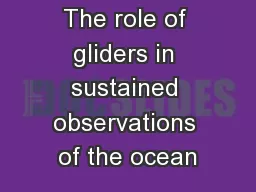
PPT-Geophysical observations of the 100 km region around
Author : olivia-moreira | Published Date : 2016-06-25
KamLAND Tohru Watanabe Dept of Earth Sciences University of Toyama Japan Todays Talk Geophysical observations around KamLAND Laboratory data on seismic velocities
Presentation Embed Code
Download Presentation
Download Presentation The PPT/PDF document "Geophysical observations of the 100 km r..." is the property of its rightful owner. Permission is granted to download and print the materials on this website for personal, non-commercial use only, and to display it on your personal computer provided you do not modify the materials and that you retain all copyright notices contained in the materials. By downloading content from our website, you accept the terms of this agreement.
Geophysical observations of the 100 km region around: Transcript
KamLAND Tohru Watanabe Dept of Earth Sciences University of Toyama Japan Todays Talk Geophysical observations around KamLAND Laboratory data on seismic velocities in rocks around KamLAND. Geophysical Survey of Bowser Field and Adjacent Lands Geophysical Survey February 2013 Report Number 1670508 brPage 2br Bedwyn Brail Geophysical Survey of Browser Field 12022013 Summary Wiltshire Archaeology and Natural History Society WANHS Archae EncomAdvanced geophysical data modelling and visualisation software applications used by geophysicists worldwide.The detection and assessment of geological anomalies and natural or unnatural subsurfac WORLD AT RISK. What you should achieve this lesson. Know some key terms in relation to the topic. Understand how to classify different hazard types. Recognise the difference between a natural hazard and a disaster. Sherif . Hanafy. (Mahmoud). Senior Research Scientist. Director of Geophysical Lab, KAUST. Geophysical Lab at KAUST. NZXP (one unit), 48 channels. Geode (24 units), 24 channels each = 576 channels. Seismic Equipment. Forward Looking Statements. Statements in this presentation that relate to forecasts, estimates or other expectations regarding future events, including without limitation, statements regarding technological advancements and our. . Observed, estimated, and predicted daily geomagnetic . AFr. -indices (A-indices from Fredericksburg, VA), and daily AP-indices (planetary A-indices). . Ap. indices are estimated in near-real time using a network of up to 12 North American stations. . Determination . I. Fall . 2015. Professor Brandon A. Jones. Lecture 37: Solution Characterization and IOD. Homework 11 due on Friday. Lecture quiz due by 5pm on Friday. Exam 3 Posted On Friday. In-class Students: Due December 11 by 5pm. infrared radiance . observations at . storm-scale: . The . 17 June 2017 severe weather event in Kansas. Yunji Zhang, Fuqing Zhang. Acknowledgements. : Masashi Minamide, David J. Stensrud. August 17, 2017. Total . Oregon Population: . 3,831,859 . people in 36 counties. Total Region 4 Population: 1,754,449 people in 20 . counties. Median Age (male & female) – 38 years old. 45% of State’s . population in Region 4. . Observed, estimated, and predicted daily geomagnetic . AFr. -indices (A-indices from Fredericksburg, VA), and daily AP-indices (planetary A-indices). . Ap. indices are estimated in near-real time using a network of up to 12 North American stations. . for Company X. Explorers. choose Geosoft. “I . felt like I had been taken from the Stone Age to the Space Age over a cup of . coffee.”. Robert . Carrington. President . and CEO of Colombian Mines. glacial cycles, Journal of Geophysical Research-Ocean, 106, 9117-9133, 2001. 3. Gildor, H. the Gulf of Eilat: a box model approach, Journal of Marine Systems, 71, 159-170, doi: 10.1016/j.jmarsys.2007 RYMER AND WILLIAMS-JONES MAGMA CHAMBER PHYSICS FROM chamber of 10 kg to 10 kg at 2-5 km depth at up to 35 kmand 10 km horizontal distance respectively Although theMogi model represents an oversimplifi Background:. In the past two decades, improved measurements of acceleration due to gravity have allowed for accurate detection of temporal gravity change. Terrestrial gravimeters can sense changes of gravity induced by elevation or mass changes, including local effects that may bias regional studies. Satellite instrumentation can detect large scale mass changes on a regular basis. The minimum resolution of the GRACE satellite is about 400 km, which is too large for the size of most, direct regional studies. Also, satellites are limited by their life of deployment. Both techniques can be scaled to (in)validate change models generated from other geophysical observations including water storage (underground and glacial), geoid definition, isostatic adjustments and tectonic activity. .
Download Document
Here is the link to download the presentation.
"Geophysical observations of the 100 km region around"The content belongs to its owner. You may download and print it for personal use, without modification, and keep all copyright notices. By downloading, you agree to these terms.
Related Documents