PDF-www.themilepost.com
Map
1
1
1
1
1
9
9
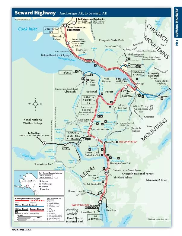
S5791kmA70113kmJ0To Sterlingsee STERLING HIGHWAY sectionLost LakeSewardSkilak LakeKenai Fjords National ParkAnchorage
S0A127204kmHerman Leirer
Download Presentation
"www.themilepost.com" is the property of its rightful owner. Permission is granted to download and print materials on this website for personal, non-commercial use only, provided you retain all copyright notices. By downloading content from our website, you accept the terms of this agreement.
Presentation Transcript
Transcript not available.