/
Self check-in station for hunting permits is located 2.9 miles from S. Self check-in station for hunting permits is located 2.9 miles from S.

Self check-in station for hunting permits is located 2.9 miles from S. - PDF document

pasty-toler
pasty-toler . @pasty-toler
Follow
394 views
Uploaded On 2015-10-30

Self check-in station for hunting permits is located 2.9 miles from S. - PPT Presentation

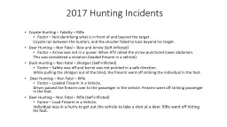
OHIO RIVER 3 2 4 5 7 6 1 56 102015 Approximate Scale in Miles County line boundarySelfservice checkinSelfservice drop boxParkingChurch RoadProperty boundaryPrivate Property Water area LEGEND ID: 176918

OHIO RIVER 3 2 4 5 7 6 1  56 10/2015 Approximate Scale Miles  County

Share:

Link:

Embed:

Download Presentation from below link

Download Pdf The PPT/PDF document "Self check-in station for hunting permit..." is the property of its rightful owner. Permission is granted to download and print the materials on this web site for personal, non-commercial use only, and to display it on your personal computer provided you do not modify the materials and that you retain all copyright notices contained in the materials. By downloading content from our website, you accept the terms of this agreement.


Presentation Transcript

OHIO RIVER Self check-in station for hunting permits is located 2.9 miles from S.R. 56 near parking lot 3. Take Doe Run Road 1.6 miles to Little Doe Run Road. Follow Little Doe Run Road 1.3 miles to parking lot 3.SWITZERLAND COUNTYSWITZERLAND COUNTYJEFFERSON COUNTYJEFFERSON COUNTYTo Brooksburg 56 2 1 3 4 5 7 6 Approximate Scale in Miles Noh LEGEND BoundaryCounty Line ChurchParkingDog Training AreaSelf-Service Drop BoxSelf-Service Check-In FISH & WILDLIFE AREAThis program receives federal aid in fish and/or wildlife restoration. Under Title VI of the Civil Rights Act of 1954 and Section 504 of the Rehabilitation Act of 1973, the U.S. Department of the Interior prohibits discrimination on the basis of race, color, national origin or handicap. If you believe you have been discriminated against in any program, activity or facility, or if you desire further information, please write to: Office of Equal Opportunity, U.S. Department of Interior, Washington, DC 20240. 01/2019 Splinter Ridge Fish & Wildlife Area, located near Brooksburg on S.R.56, is dedicated to providing quality hunting opportunities while maintaining 2,980 acres of woodland and steep hills.HISTORY Splinter Ridge Fish & Wildlife Area straddles the Jefferson and Switzerland county line in southeast Indiana, about 9 miles from Madison. The property draws its name from a major ridge and historic logging road. The DNR began looking at the 2,759 contiguous acres of wooded hills and grassy pastures in the early 1980s. With donations from the Indiana Bowhunters Association, Indiana chapter of the National Wild Turkey Federation, and the Indiana Sportsmen’s Roundtable, the DNR was able to buy the property in 1997. RULES AND REGULATIONS In addition to state sh & wildlife laws, this property is governed by posted regulations affecting the public use of lands and facilities owned, leased or licensed by the DNR. POSTED AREASSafety zones and other restricted areas are marked with appropriate signs. VIOLATIONS Violation of any law, rule or regulation governing this property may be cause for forfeiting your hunting or visiting privileges on this area.TRAPPING Call Crosley FWA for regulations. ADDITIONAL OPPORTUNITIES Additional hunting opportunities include Crosley FWA and Austin Bottoms Conservation Area.Steep terrain and limited vehicle access to the interior makes hunting difficult for disabled individuals. Contact Crosley FWA for information on accessible sites.Gathering berries, mushrooms and nuts is allowed. During spring turkey season, gathering berries, mushrooms and nuts is only permitted after 1 p.m. Dog Training is allowed between 60N andLittle Doe Run Road.Rolling hayelds, steep, wooded hills, brushy tracts and small creeks attract a wide variety of songbirds and woodpeckers.Crosley FWA provides 4,288 acres of steep to gently rolling hills and 3.5 miles of the Muscatatuck River for hunting and shing. The location is Jennings County, south of North Vernon on S.R. 3.Clifty Falls State Park offers camping, picnicking, hiking and swimming. Located near Madison, entrances are off S.R. 62 and S.R. 56.Muscatatuck County Park provides camping, picnicking and playgrounds. Located 3 miles from Crosley FWA on S.R. 3 and S.R. 7 between Vernon and North Vernon. Austin Bottoms Conservation Area, located in Scott, Jackson and Washington counties, provide hunting, shing and trapping opportunities. PLINTER R IDGE FISH & WILDLIFE AREA Managed by Crosley Fish and Wildlife AreaThe DNR Division of Fish & Wildlife will not be held responsible for any accidents or deaths occurring from the use of these facilities.In addition to a hunting and/or shing license, permission to hunt during the day on Splinter Ridge FWA must be obtained before entering the eld. Daily hunt permit cards must be in the possession of the hunter and recorded through established self-service procedures outlined at the check-in station. Self-service drop boxes are located on the property for your convenience. CAMPING/SWIMMINGCamping and swimming are prohibited at Splinter Ridge FWA.TRESPASSING ON PRIVATE PROPERTYPlease be courteous to neighboring landowners. Watch for property boundary and safety zone signs. Do not trespass on private property.TRAFFIC Traffic on public roads through the area is governed by state and county laws. No motorized vehicles, horses or bicycles are permitted beyond county roads. Traffic over service roads and trails is restricted to walking, except by authorized vehicles.TARGET SHOOTINGTarget shooting is prohibited on Splinter Ridge FWA.The steep, wooded hills of Splinter Ridge FWA provide excellent white-tailed deer and wild turkey habitat. Squirrels are also abundant. Limited hunting opportunities are available for cottontail rabbit, quail and woodcock.Check-in is required. A self check-in station is located at parking lot 3 (see map). Daily permit cards must be in the possession of the hunter to enter the eld. The cards must be returned to a drop box at the end of the day. Drop boxes are located in parking areas 1, 3, 6 and 7.All hunting seasons and bag limits apply. © 07/2019 Indiana Department of Natural Resources Your purchase of hunting and shing equipmentand motorboat fuels supports Wildlife and Sport Fish Restoration and boating access facilities. FUNDING FOR FISH AND WILDLIFE The DNR Division of Fish & Wildlife sells hunting, shing, and trapping licenses. All revenue is used for managing sh and wildlife resources in Indiana. No license money goes into the state general fund.The Division also receives money from the federal Sport Fish and Wildlife Restoration programs (sometimes referred to as Dingell-Johnson and Pittman-Robertson funds). The funds are derived from excise taxes levied on sporting arms and ammunition, bows and arrows, shing equipment and motor boat fuel. The funds are then returned to state sh and wildlife agencies using a formula that in part is based on the number of shing and hunting license buyers.FOR MORE INFORMATION WRITE: DNR Division of Fish & Wildlife402 W. Washington Street, W273 Indianapolis, IN 46204CALL: 317-232-4200wildlife.IN.gov INDIANA FISH & WILDLIFE AREAS 17 19 20 21 22 23 24 1814 5 3 6 15 9 8721012141113 16 @INshandwildlife Subscribe to Outdoor Indiana magazine today. Atterbury Blue GrassCrosleyDeer CreekFairbanks LandingGoose PondHillenbrand10.Hovey Lake11.Jasper-Pulaski12.Kankakee13.Kingsbury14.LaSalle15.Pigeon River16.Pisgah Marsh17.J.E. Roush18.Splinter Ridge19.Sugar RidgeTri-County21.WabashikiWilbur WrightWillow SloughWinamac 7 17