/
Commonwealth Electoral Division of BOWMAN FORDE BOWMAN Commonwealth Electoral Division of BOWMAN FORDE BOWMAN

Commonwealth Electoral Division of BOWMAN FORDE BOWMAN - PDF document

phoebe-click
phoebe-click . @phoebe-click
Follow
454 views
Uploaded On 2015-05-08

Commonwealth Electoral Division of BOWMAN FORDE BOWMAN - PPT Presentation

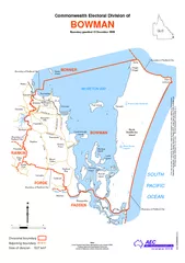
Pitney Bowes Software Pty Ltd 2009 Commonw ealth of Australia 2010 Divisional boundary Adjoining boundary Boundary gazetted 15 December 2009 Note Local Government Area descriptions are current 2006 Federal electoral boundaries follow the centre o ID: 63452

Pitney Bowes Software

Share:

Link:

Embed:

Download Presentation from below link

Download Pdf The PPT/PDF document "Commonwealth Electoral Division of BOWMA..." is the property of its rightful owner. Permission is granted to download and print the materials on this web site for personal, non-commercial use only, and to display it on your personal computer provided you do not modify the materials and that you retain all copyright notices contained in the materials. By downloading content from our website, you accept the terms of this agreement.


Presentation Transcript

Commonwealth Electoral Division of BOWMAN FORDEBOWMANBONNERRANKINFADDEN WoongoolbaAlbertonRussellIslandCarbrookCornubiaPannikinIslandShailerParkMountCottonDaisyHillLambIslandRedlandBayMacleayIslandPriestdaleVictoriaPointSheldonCoochiemudloIslandThornlandsBurbankNorthStradbrokeIslandCapalabaAlexandraHillsOrmistonChandlerWellingtonPointDunwichBirkdalePeel IslandRansomeThornesideManlyPointLookoutGreenIslandChiggilChiggilAmityE N T N Y E Black SnakeLagoonBrown Lake (bummel)n erSOUTHPACIFICOCEANMORETON BAY Boundary of Redland City Boundary of Redland City Boundary ofRedland City Boundary of Redland City Boundary of Redland CityQLD-BOWMAN-2010 404kmSize of division 537 km² QLD This map has been compiled by Terranean Mapping Technologies from data supplied by the AustralianElectoral Commission, and Pitney Bowes Business Insight 2009, under licence from PSMA Australia Ltd.© Pitney Bowes Software Pty Ltd, 2009. © Commonwealth of Australia 2010  Divisional boundary Adjoining boundaryBoundary gazetted 15 December 2009Note:Local Government Area descriptions are current 2006. Federal electoral boundaries follow thecentre of features unless otherwise advised.