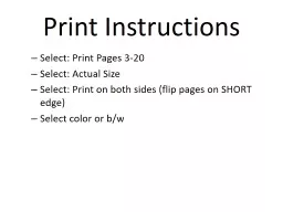
Pages 320 Select Actual Size Select Print on both sides flip pages on SHORT edge Select color or bw This page intentionally left blank EAGLE NBJ 5 TACAN RWY 33 GATESWOOD MCAS KNGW ID: 760845
Download Presentation The PPT/PDF document "Print Instructions Select: Print" is the property of its rightful owner. Permission is granted to download and print the materials on this web site for personal, non-commercial use only, and to display it on your personal computer provided you do not modify the materials and that you retain all copyright notices contained in the materials. By downloading content from our website, you accept the terms of this agreement.
Slide1
Print Instructions
Select: Print
Pages 3-20
Select: Actual Size
Select: Print on both sides (flip pages on SHORT edge)
Select color or b/w
Slide2This page intentionally left blank.
Slide3EAGLENBJ 5
TACAN RWY 33GATESWOOD MCAS (KNGW)
GATESWOOD, ALABAMA
VORTAC NBJ
Chan 60
APP CRS338°
Rwy ldg 5003 THRE 146Apt Elev 150
Aircraft are granted an exemption from AIM 1-1-19, f(1)b for this approach only and may simulate NBJ by manually entering N 30°43.37’ W 87°32.62’. If flown with GPS, then RNP is 1.0NM, 0.3NM on final.
MISSED APPROACH: Climb straight ahead to 2000, turn right and intercept NBJ R-158 to EAGLE and hold.
CATEGORY
S-33
CIRCLING
A
B
C
D
750-1
600 (600-1)
850-1
700 (700-1)
KPNS ATIS
121.25
PENSACOLA APP CON
118.6 351.825
WESTERN COMMON
311.4
/ CH 19 (CTAF)
GATESWOOD, ALABAMA
GATESWOOD MCAS (KNGW)
TACAN RWY 33
***FOR TRAINING ONLY -- VFR ONLY***
SNYPE
NBJ
0.8
(IAF)
EAGLE
NBJ
5
R-158
7 DME
3100
CROWE
NBJ
3
MSA NBJ 25NM
GATESWOOD
CHAN 60 NBJ
N 30°43.37’
W 87°32.62’
338°
338°
158°
CROWE
NBJ
3
SNYPE
NBJ
0.8
TACAN
338°
158°
338°
2000
1300
T
2.2 NM
2 NM
ELEV 150
THRE 146
TRAINING AIR WING
FIVE
STUDENT RADIO INSTRUMENT APPROACH &
DEPARTURE PLATES
FLIGHT SUPPORT
ADVANCED HELICOPTER
2019
9
ʌ
.
ʌ
1397
5 NM
ʌ
.
ʌ
2047
ʌ
.
ʌ
2000
ʌ
.
ʌ
1637
ʌ
.
1096
ʌ
.
1549
COMTRAWINGFIVEINST 3710.25
Slide4I
THIS PAGE LEFT INTENTIONALLY BLANK
Slide54.9 NM
TACAN-A
NAVIE OLF (KNVE)
CANTONMENT, FLORIDA
TACAN NBJ
Chan 60
APP CRS123°
Rwy ldg N/ATHRE N/AApt Elev 150
Caution: Utilize caution for traffic at 1000’ to 2200’ at NAVIE on the NAVIE Departure.Aircraft are granted an exemption from AIM 1-1-19, f(1)b for this approach only and may simulate NBJ by manually entering N 30°43.37’ W 87°32.62’. If flown with GPS, then RNP is 1.0NM, 0.3NM on final.
MISSED APPROACH: Climbing right turn to 2000 direct EAGLE and hold.
CATEGORY
CIRCLING
A
B
C
D
1200-1
1050 (1100-1)
KPNS ATIS
121.25
PENSACOLA APP CON
118.6 351.825
WESTERN COMMON
311.4
/ CH 19
CANTONMENT, FLORIDA
NAVIE OLF (KNVE)
TACAN-A
***FOR TRAINING ONLY -- VFR ONLY***
T
10 NM
GATESWOOD
CHAN 60 NBJ
N 30°43.37’
W 87°32.62’
123ᵒ
258ᵒ
EAGLE
NBJ 5
7 DME
158°
338°
R-158
(FAF)
ELLIS
NBJ 5
INKOM
NBJ 8.5
NAVIE
NBJ 13.4
IAF
Remain
Within 10 NM
ELLIS
NBJ 5
INKOM
NBJ 8.5
TACAN
123°
5 NM
3.5 NM
2300
2500
2500
123°
2000
NAVIE
NBJ 13.4
303°
R-303
EAGLE
2000
3100
MSA NBJ 25NM
ELEV
150
Interim Change Number
Remarks/Purpose
Change Summary
The following Interim Changes have been cancelled or incorporated into this edition:
Affected Procedure
Remarks/Purpose
Interim Change Number
Remarks/Purpose
Page(s) Affected
Remarks/Purpose
The following Interim Changes have been incorporated in this Change/Revision:
The following Interim Changes are outstanding and shall be maintained by the custodian of this manual:
II
11
ʌ
.
ʌ
1397
ʌ
.
ʌ
2047
ʌ
.
ʌ
2000
ʌ
.
ʌ
1637
ʌ
.
1096
ʌ
.
1549
078ᵒ
COMTRAWINGFIVEINST 3710.25
Slide6TABLE OF CONTENTS
INDEX OF SUPPLEMENTARY ENCLOSURES
INDEX OF INSTRUMENT PROCEDURE CHARTS
CHANGE SUMMARY………..…PAGE II
TABLE
OF CONTENTS……….PAGE III
HOT SPOTS……………………PAGE IVEASTERN AREA OVERLAY.…PAGE VWESTERN AREA OVERLAY..PAGE VI
INOP COMP/VIS AIDS TABLE..…....PAGE VIIRADAR IAP MINIMUMS ………...….PAGE VIIIEXAMPLE RADAR IAP COMMS…….PAGE IXWAYPOINT CREATION GUIDE…… PAGE 23SIAP IMPROVEMENT PROCESS…..PAGE 24CLIMB/DESCENT TABLE…………....PAGE 25
NAME PAGE BAY MINETTE MUNI (1R8) RADAR MINIMUMS…………..….…… VIII TACAN-A…………………..................... . 1 BAY MINETTE ONE DEPARTURE..….. 2CRESTVIEW NAS (KNCE) TACAN RWY 9R………………………… 3 COPTER VOR RWY 9L ………...…...… 4 TACAN RWY 18L……………….……..... 5FLORALA MUNI (1R8) RADAR MINIMUMS………….……..... VIII TACAN RWY 4…………………..….…… 6 BURRITO-ONE DEP…………………… 7 GATESWOOD MCAS (KNGW) TACAN RWY 24………………….……... 8 TACAN RWY 33…………….…………… 9GULF SHORES (KJKA) RADAR MINIMUMS…………………... VIIIJUNIPER NOLF (KNJP) VOR/DME-240…………………....……. 10
NAME PAGENAVIE OLF (KNVE) TACAN-A…………………………..……….. 11SITE 8 NOLF (KNS8) COPTER TACAN 147………………..…… 12 SITE X NOLF (KNSX) TACAN-A…………………………………... 13 SITE X DEPARTURE…………………….. 14 SOUTH WHITING FIELD (KNDZ) BAWDI ONE DEPARTURE………........... 15 NAVIE ONE DEPARTURE……………… 16SHIPBOARD APPROACHES CV-3 TACAN (HELICOPTER)……….…. 17 AIR-CAPABLE SHIPS TACAN (HELICOPTER)………….……….. 18 LH-4 (HELICOPTER)……………………… 19 EMERGENCY LOW-VISIBILITY APPROACH PATTERN (ELVA)…….…… 20 (ELVA) PATTERN - RADIO CALLS.……. 21 SHIP RESUME IX-514………………........ 22
III
`
COPTER TACAN 147°SITE 8 NOLF (CLOSED) (KNS8)
c
WELCOME STATION, FLORIDA
TACAN NBJChan 60
APP CRS147°
Rwy ldg N/A THRE N/AApt Elev 159
Aircraft are granted an exemption from AIM 1-1-19, f(1)b for this approach only and may simulate NBJ by manually entering N 30°43.37’ W 87°32.62’. If flown with GPS, then RNP is 1.0NM, 0.3NM on final.
MISSED APPROACH: Climbing right turn to 1500 direct NBJ. Contact ATC.
CATEGORY
H-147°
ELEV 159
1000-1
550 (600-1)
KPNS ATIS
121.25
WESTERN COMMON
311.4
/
CH 19
PENSACOLA APP CON
118.6 351.825
WELCOME STATION, FLORIDA
SITE 8 NOLF (CLOSED) (KNS8)
COPTER TACAN 147°
HELICOPTER
T
282ᵒ
IAF
R-327
GATESWOOD
CHAN 60 NBJ
N 30°43.37’
W 87°32.62’
102ᵒ
147ᵒ
RICHI
NBJ 10
SITE 8 NOLF is closed, operations at the field are prohibited.
RICHI
NBJ 10
147°
147°
327°
1500
TACAN
Proceed VFR
NBJ
1500
10 NM
3100
MSA NBJ 25NM
147
⁰
10 NM from
NBJ TACAN
Welcome
Station
See Inset
3907 x 20
3907 x 20
36
18
27
9
TWR
***FOR TRAINING ONLY -- VFR ONLY***
12
ʌ
.
ʌ
1397
ʌ
.
ʌ
2047
ʌ
.
ʌ
2000
ʌ
.
ʌ
1637
ʌ
.
1096
ʌ
.
1549
147ᵒ
1500
1500
CAUTION: Green route traffic
approx
4 nm south of NBJ at 500 AGL.
10 NM
COMTRAWINGFIVEINST 3710.25
Slide7***FOR TRAINING ONLY -- VFR ONLY***
AIRSPACE HAZARD SPOTSA “hazard spot” is an area of airspace with a history of or potential risk of collision where heightened attention by pilots is necessary. Hazard spots are depicted as circles or polygons designated as “HS 1”, “HS 2” , etc. and tabulated in the list below with a brief description of each hazard spot. Hazard spots will remain charted until such time that the increased risk has been reduced or eliminated.Hazard Spot 1 – Bear Lake. There is a high volume of TH-57 aircraft in the vicinity of Bear Lake performing basic instrument maneuvers. Unlit C-130 and CV-22 aircraft conduct terrain following operations from 200-1000 AGL southbound along IR-57 and IR-59, both of which intersect at Bear Lake. Participating aircraft make calls on Instructor Common and Eglin Approach.Hazard Spot 2 – Point BAWDI. There is a high volume of TH-57 aircraft converging in the vicinity of Point BAWDI on the BAWDI Departure and the Juniper VOR/DME-A approach. Unlit C-130 and CV-22 aircraft conduct terrain following operations from 200-1000 AGL southbound along IR-57 and IR-59, Participating aircraft make calls on Instructor Common and Eglin Approach.Hazard Spot 3 – KNDZ PAR final. The Point Able VFR departure and BAWDI Student Instrument Departure cross the PAR final from approximately 1 to 3 DME off I-NDZ.Hazard Spot 4 – Intersection of Burrito One Departure and the CEW and Bear Lake Transitions. The KCEW ILS17 and RNAV17 final approach courses cross the CEW and Bear Lake Transitions of the Burrito One Departure co-altitude at approximately the CEW R-054 at 8.7 DME. IFR traffic on the ILS17 and RNAV17 is typically monitoring the KCEW CTAF on 122.95. VFR traffic should contact EGLIN Approach on 124.05 for traffic advisories.
HS 1
HS 2
HS 3
HS 4
I-10
HWY 87
CEW
RNAV/ILS17
FAC
BURRITO
ONE DEP
CRESTVIEW VOR
CRESTVIEW
IV
BEAR LAKE
BAWDI
13
COMTRAWINGFIVEINST 3710.25
076°
Caution: BI traffic operating at SAWMILL at 1000’ and above. Aircraft transiting TRIGR to SAWMILL over MAVRK at 2000’. Traffic on the TACAN RWY 24 approach to NBJ are 2000’ crossing TACAN X traffic 040/5 to MAVRK.
NOTE: PENSI: NSE 289/14
MISSED APPROACH: Climbing right turn to 107◦ and 1000', proceed direct to PT Pistol (NSE 291/10) and hold west utilizing right hand turns.
SITE X
327.4 / CH 13
MAVRK
GOOSE
PENSI
076°
040°
7 DME
900
PT PISTOL
TACAN-A
SITE X (KNSX)
SITE X (KNSX)
TACAN-A
AT FAF, TUNE CH 13 AND REPORT “TRAFFIC, [C/S], TACAN-A INBOUND”. AFTER CROSSING PENSI, TURN 107, DESCEND TO 500’ AND INTERCEPT COURSE RULES AT PT PISTOL. REPORT “PT PENSI INBOUND” TO SITE X.
10 DME
(FAF)
HLYWD
076°
2.5 NM
550
(600-1)
700-1
040°
MAVRK
NBJ
1200
7 DME ARC
900
GOOSE
NBJ
HLYWD
NBJ
076°
PENSI
NBJ
800
700
220°
040°
515’ MSL
549’ MSL
Boat Ramp
Mill
***FOR TRAINING ONLY -- VFR ONLY***
13
COMTRAWINGFIVEINST 3710.25
Rwy
ldg
N/A
THRE N/A
Apr
Elev
211
PISTOL
1000
7
7
12
14.5
NBJ
GATESWOOD
60 NBJ (IAF)
N 30°43.37’
W 87°32.62’
7
NBJ
12
NBJ
14.5
NBJ
NBJ
7
211
KPNS ATIS
121.25
PENSACOLA APP CON
118.6 / 351.825
WESTERN COMMON
311.4 / CH 19 (CTAF)
SITE X
327.4 / CH 13
Slide8070°
SITE X
CH 13
SITE X: 327.4 CH 13
PENSACOLA APPROACH: 118.6 / 351.825
WESTERN COMMON: 311.4 CH 19 (CTAF)
GNSIS
KIOWA
PENSI
070°
040°
7 DME
PT PISTOL
040°
1000
7 DME ARC
PROCEDURE KEY
TACAN RWY 9R PG 3
COPTER VOR RWY 9L PG 4
TACAN RWY 18L PG 5
TACAN RWY 4 PG 6
BURRITO ONE DEPARTURE
PG 7
VOR/DME
–240
PG
10
BAWDI DEPARTURE PG 15
ILS or LOC RWY 17 VOL 19
RNAV (GPS) RWY 17 VOL 19
VOR - A VOL 19
R-2915A
HORSE FARM
CEW 314 / 12.5
NO NAME LAKE
CEW 325 / 14.2
BEAR LAKE
CEW 282 / 08
HURRICANE LAKE
CEW 329 / 7.8
LILAN
BLRUP
TANIA
EDMAC
ASHLE
BOSSE
BOWIE
BARBI
MAYOR
SEDNA
ZIGGY
MADEN
EASTERN TRAINING AREA OVERLAY
GINGR
RITEO
CLAIR
KOBRA/
GIYAT
WEDOM
ANNNA
KCEW
HS 1
HS 4
HS 2
BAWDI
1249’ MSL
616’ MSL
2000
1500
2000
1500
2000
1700
2000
1600
1500
1500
KNIFE EDGE
FIELD
PT
JUNIPER
.
.
2000
1500
1500
1200
1600
1500
1700
1500
NOTES:
:
Indicates the altitudes of intersecting student
instrument procedure segments.
2. For Hazard Spot descriptions refer to page VII of the
Student Instrument Approach and Departure Procedures
.
2000
1500
4 DME
5 DME
2200
1700
106
⁰
171
⁰
234
⁰
240
⁰
081
⁰
101
⁰
←
326
⁰
146
⁰→
175
⁰
036
⁰→
←
216
⁰
CEW 12 DME
14 DME
CEW VORTAC
115.9 / 106X
V
ʌ
.
ʌ
580’ MSL
ʌ
.
512’ MSL
6.5 DME
1500
700
030
⁰
NSE 065⁰
0J4
ʌ
.
ʌ
14
V
***FOR TRAINING ONLY -- VFR ONLY***
900
GATESWOOD, ALABAMA
GATESWOOD, ALABAMA
SITE X (KNSX
)
070°
NSE
700
10 DME
(FAF)
ONYXX
070°
TACAN
NBJ
2 NM
SITE X (KNSX)
Caution: CAL traffic operating on the NW of SITE X. Aircraft transiting from the Green Route CP 1 will be at 700’
MSL inbound
to PT Pistol. Use caution while departing and climbing to PETRO.
Caution:
Entire area is inside of A-292, high volume of training aircraft.
Caution: Traffic inbound to SITE X crossing PENSI at 700’MSL
Note: Do not overfly the RC Park or the
Odoms
Private Airport
in the vicinity of
SITE X.
DEPARTURE ROUTE
DESCRIPTION
Depart
NW corner of SITE X and turn 270. Climb to
900’ MSL.
At 18 DME, turn and intercept NBJ 075/16. Prior to PETRO, switch to CH 19, report “on Site X DEPARTURE” and state intended location, then..
SAWMILL:
Upon reaching PETRO, turn direct to SAWMILL (NBJ 066/11.9) and climb to working altitude. Monitor Western Common (CH19) and deconflict with traffic
.
GRAIN ELEVATORS:
Upon reaching PETRO,
maintain 900’ MSL and continue
north on NBJ 16DME arc to CARPI (NBJ 059/16
).
At CARPI, turn direct to GRAIN ELEVATORS (NBJ 012/10.1) and climb to working altitude. Monitor Western Common (CH 19) to deconflict with traffic.
FIREWORKS STAND:
Upon reaching PETRO, maintain 900’ MSL and turn direct to FIREW(NBJ 209/6.8). When established at FIREW, climb to working altitude. Monitor Western Common (CH19) and
deconflict
with traffic. Be cautions of traffic on the Site X TACAN-A.
GATESWOOD:
Upon reaching PETRO, maintain 900’ MSL and turn direct to NBJ .Monitor Western Common (CH19) and
deconflict
with traffic. Be cautions of traffic on the Site X TACAN-A.
KNSX
PETRO
NBJ R-075
16DME
NBJ 16 Arc
900
CARPI
NBJ R-059
16 DME
SAWMILL
NBJ R-066
11.9 DME
GRAIN
NBJ R-012
10.1 DME
ODOMS PVT AIRPORT
RC Park
SITE X DEPARTURE
SITE X DEPARTURE
COMTRAWINGFIVEINST 3710.25
GATESWOOD
CHAN 60 NBJ
N 30°43.37’
W 87°32.62’
FIREW
NBJ
R-209
6.8
DME
PENSI
NBJ
R-076
14.5
DME
Slide9WHITING FLD NAS - SOUTH (KNDZ)
MILTON, FLORIDA
c
ATIS 273.575 / CH 1
CLNC DEL 355.6 / CH 2
GND CON 317.65 /CH 3SOUTH TOWER121.4 348.675 / CH 4PENSACOLA DEP CON124.85 385.4EASTERN COMMON389.1 / CH 20INSTRUCTOR COMMON121.95LAKES MONITOR135.15
NDZ 106BAWDI ONE DEPARTURE
Caution: Unlit C-130 and CV-22 aircraft conduct terrain following operations from 200ft-1000ft AGL along IR-57 and IR-59. Participating aircraft make traffic calls on Instructor Common, 121.95 and Eglin Approach, 124.05/393.0.Caution: There is a high volume of TH-57 aircraft at ZIGGY from 900’-1300’ MSL. ZIGGY is 1.8 NM on the 314 bearing from BAWDI.DEPARTURE ROUTE DESCRIPTIONAfter takeoff, turn to 090°, climb and maintain 900, 100 KIAS to intercept the NSE R-135 and track outbound. Intercept the 6.5 DME arc climbing to 1500. Follow the 6.5 DME arc to intercept the NSE R-090 outbound. Maintain 1500 until BAWDI.NOTE: *RWY 32 dep turn 140° (downwind) until abeam approach end of RWY 32 then turn to 090° HDG. Remain clear of the maintenance pattern.
BAWDI ONE DEPARTURE(NDZ1.NDZ)
MILTON, FLORIDAWHITING FLD NAS - SOUTH (KNDZ)
***FOR TRAINING ONLY -- VFR ONLY***
WHITING
Chan 70 NSE
900
R-135
9.5
10
NSE 6.5 Arc
1500
CRESTVIEW
115.9
CEW
Chan 106
BAWDI
NSE R-090
10 DME
15
R-090
R-230
ZIGGY
7 DME
GOOSE
TACAN –
A
PG 13
SITE X DEPARTURE PG 14
040°
16 DME
CARPI
PENSI >
PETRO
>
1500
1000
(FAF)
HLYWD
515’
MSL
549’
MSL
076°
2000
1000
MAVRK
COMTRAWINGFIVEINST 3710.25
2500
1700
2000
1700
2500
1700
SAUFLEY
NUN 108.8
Slide10WHITING FLD NAS - (KNDZ)
MILTON, FLORIDA
ATIS 273.575 / CH 1
CLNC DEL 355.6 / CH 2
GND CON 317.65 / CH 3
SOUTH TWR 348.675 / CH 4
PENSACOLA DEP CON 124.85 351.825WESTERN COMMON311.4 / CH 19INST COMMON121.95
NDZ 103NAVIE ONE DEPARTURE
DEPARTURE ROUTE DESCRIPTIONAfter takeoff, heading 220°, intercept and track outbound on CEW R-240.Climb and maintain 1700. At 24 DME, proceed direct NAVIE.At NAVIE report clear to the west with Pensacola Departure.NOTE: Expect climb to 2200 after hand-off. Remain clear of the maintenance pattern.
NAVIE ONE DEPARTURE (NDZ2.NDZ)
R-240
NAVIE
CEW R-247
36 DME
24
R-247
220ᵒ
MILTON, FLORIDA
WHITING FLD NAS – SOUTH (KNDZ
)
***FOR TRAINING ONLY -- VFR ONLY***
CRESTVIEW
115.9
CEW
Chan 106
16
INOPERATIVE COMPONENTS OR VISUAL AIDS TABLE
Landing minimums published on instrument approach procedure charts are based upon full operation of all components and visual aids associated with the particular instrument approach chart being used. Higher minimums are required with inoperative components or visual aids as indicated below. If more than one component is inoperative, each minimum is raised to the highest minimum required by any single component that is inoperative. ILS glide slope inoperative minimums are published on the instrument approach charts as localizer minimums. This table may be amended by notes on the approach chart. Such notes apply only to the particular approach category(
ies
) as stated. See legend page for description of components indicated below.
Inoperative
Component or Aid
Approach
Category
Increase
Visibility
ALSF 1 & 2, MALSR,
& SSALR
ABCD
¼ mile
ALSF 1 & 2, MALSR,
& SSALR
TDZL RCLS
RVR
ABCD
ABCDABCDTo 4000 RVRTo 2400 RVR*To ½ mile
Inoperative Visual AidApproach CategoryIncrease VisibilityALSF 1& 2, MALSR, & SSALRSSALS, MALS, &ODALSABCDABC½ mile¼ mile
ALSF 1 & 2, MALSR, & SSALRMALS, SSALS, ODALSCABDABC½ mile¼ mile¼ mile
(1) ILS, MLS, PAR and RNAV (LPV line of minima)
(2) ILS with visibility minimum of 1,800 RVR
1,800 RVR authorized with the use of FD or AP or HUD to DA.
(3) VOR, VOR/DME, TACAN, LOC, LOC/DME, LDA, LDA/DME, SDF, SDF/DME, GPS, ASR and RNAV (LNAV/VNAV, LNAV and LP lines of minima)
(4) NDB
INOP COMPONENTS
INOP COMPONENTS
VII
R-240
VII
COMTRAWINGFIVEINST 3710.25
Slide11TRAWINGFIVENOTICE 3710
RADAR INSTRUMENT APPROACH MINIMUMS
BAY MINETTE MUNI (1R8)
, Al (Bay
Minette, AL) ELEV 248 INSTRUCTOR APP CON 121.95
RWYGS/TCH/RPICATDA/ MDA-VISHAT/HATh HAACEIL-VISPAR83.0⁰/54/965ABCDE406 – ½200200 – ½263.0⁰/39/665ABCDE348 – ¼100100 – ¼ASR8ABCDE556 – 1350400 – 126ABCDE598 – 1350400 – 1CIR8ABCDE706 - 1 ¼500500 - 1 ¼26ABCDE748 - 1 ¼500500 - 1 ¼
RWYGS/TCH/RPICATDA/ MDA-VISHAT/HATh HAACEIL-VISPAR ①43.0⁰/54/965ABCDE388 – ¼ 100200 – ¼ 223.0⁰/39/665ABCDE514 – ½ 200200 – ½ ASR ①4ABCDE628 – 1350400 - 122ABCDE664 - 1350400 - 1CIR ②4ABCDE788 – 1 ¼ 500500 – 1 ¼ 22ABCDE814 – 1 ¼ 500500 – 1 ¼
FLORALA MUNI (0J4), Al (Florala, AL) ELEV 314 INSTRUCTOR APP CON 121.95
GULF SHORES (KJKA), Al (Gulf Shores, AL) ELEV 17 INSTRUCTOR APP CON 121.95
① Contact Sunshine Aero for hot fuel 10 minutes prior to arrival on 123.0.
② Circling NA at night.
RWY
GS/TCH/RPICATDA/ MDA-VISHAT/HATh HAACEIL-VISPAR ①93.0⁰/54/965ABCDE216 - ½ 200200 – ½ 273.0⁰/39/665ABCDE116 – ¼ 100100 – ¼ ASR ①9ABCDE366-1350400-127ABCDE366-1350400-1CIR ②17ABCDE516 – 1 ¼ 500500 – 1 ¼ 35ABCDE516 – 1 ¼ 500500 – 1 ¼
RADAR INSTRUMENT APPROACH MINIMUMS
① When local altimeter not received use Pensacola Regional altimeter setting and increase all DA/MDAs by 80 feet..② Circling to runways 17/35 NA at night.
VIII
17
COMTRAWINGFIVEINST 3710.25
CV-3 TACAN (Helicopter) Shipboard Approach
***FOR TRAINING ONLY -- VFR ONLY***
Slide12Example Radar Instrument Approach Communications
Reference: FAA Order 7110.65U, Chapter 5, Sections 10, 11, and 12
Initial Contact
(Aircraft call sign), (name of facility) final controller, how do you hear me?
(Number) miles (direction) of (airport name) airport, perform landing checks.This will be a (no-gyro) (surveillance/PAR) approach.Lost CommunicationsIf no transmissions are received for (time interval) in the pattern or (five/fifteen) seconds on the final approach, attempt contact on (frequency) and proceed VFR. If unable proceed with the (nonradar approach) maintain (altitude) until established (on/over) the (fix/NAVAID/approach procedure).Approach to an Uncontrolled Field5. No traffic or landing runway information available for the airport.No-Gyro PAR Approach6. Make half-standard rate turns.Approach Guidance7. (Aircraft call sign) do not acknowledge further transmissions.8. From (above/on/below) glideslope begin descent.9. On or (slightly/well) (above/below) glideslope. (On/slightly/well) (left/right) of course.10. (Aircraft call sign) cleared to land (runway number)(Reason). If runway, approach lights or runway lights not in sight execute (missed approach/alternative instructions).Note:Typical reasons for missed approach instructions:“Radar contact lost.”“Too high/low for safe approach.”“Too far right/left for safe approach.”GCA Glideslope EstimationNote: VASI or PAPI may be used as a reference for glideslope instructions.
Distance from airfield (NM)
Recommended AGL Altitude (
ft
)
0 1 2 3 4 5 6 7 8 9 10
0 319 637 956 1275 1593 1912 2231 2549 2868 3187
IX
18
COMTRAWINGFIVEINST 3710.25
TACAN (Helicopter) Shipboard Approach
***FOR TRAINING ONLY -- VFR ONLY***
Slide13GYVER
NBJ 7
(IAF)
JAMJM
NBJ 5
TACAN-ABAY MINETTE MUNI (1R8)
c
BAY MINETTE, ALABAMA
TACAN NBJChan 60
APP CRS300°
Rwy ldg N/ATDZE N/AApt Elev 248
Use KMOB altimeter setting; if not received use KBFM altimeter setting and increase all MDA’s 20ft. Aircraft are granted an exemption from AIM 1-1-19, f(1)b for this approach only and may simulate NBJ by manually entering N 30°43.37’ W 87°32.62’. If flown with GPS, then RNP is 0.3NM.
MISSED APPROACH: Climbing left turn to 2500 direct GRACE INT and hold.
CATEGORY
CIRCLING
A
B
C
D
750-1
502 (600-1)
MOBILE RGNL ASOS
124.75
WESTERN COMMON
311.4
/
CH 19
MOBILE APP CON
118.5 269.3
UNICOM122.8 (CTAF)
BAY MINETTE, ALABAMA
BAY MINETTE MUNI (1R8)
TACAN-A
750-1 ¾
502 (600-1 ¾)
NA
***FOR TRAINING ONLY -- VFR ONLY***
3100
RONIN
NBJ 17.5
SLABB
NBJ 13
(IF)
GYVER
NBJ 7
(IAF)
GRACE
NBJ 7
(FAF)
FROMB
NBJ 10
R-360
R-270
R-300
2500 TO GYVER
NBJ 7 Arc
NBJ 7 Arc
MSA NBJ 25NM
L
GATESWOOD
CHAN 60 NBJ
N 30°43.37’
W 87°32.62’
090
°
270°
1.5 NM
to RWY
FROMB
NBJ 10
SLABB
NBJ 13
RONIN
NBJ 17.5
GRACE
INT
2500
1500
1000
2500
300°
3 NM
3 NM
4.5 NM
T
2500 TO
GYVER
ELEV 248
A
NA
ʌ
.
1549
ʌ
.
1096
ʌ
.
522
ʌ
.
460
ʌ
.
570
ʌ
.
505
ʌ
.
551
ʌ
.
631
1
19
ʌ
.
ʌ
1397
ʌ
.
ʌ
2047
ʌ
.
ʌ
2000
ʌ
.
ʌ
1637
300ᵒ
10 NM
A-292
COMTRAWINGFIVEINST 3710.25
Slide142
20
BAY MINETTE MUNI (1R8)
BAY MINETTE, ALABAMA
MOB RGNL ASOS 124.75
UNICOM 122.8 (CTAF)
WESTERN COMMON
311.4 / CH 19
1R8 101R
BAY MINETTE ONE DEPARTURE
Caution: The JORDN and FIREW Transitions pass through JORDN at
1700. Utilize caution for aircraft holding at 2000 at JORDN on the KNGW TAC24 and /or executing procedure turn at 1500 on Copter TACAN 147.Note: Aircraft are granted an exemption from AIM 1-1-19, f(1)b for this departure only and may simulate NBJ by manually entering N 30°43.37’ W 87°32.62’. If flown with GPS, then RNP is 1.0NM.DEPARTURE ROUTE DESCRIPTIONT/O RWY 26: Climbing left turn to 1000 via heading 080°, thence…T/O RWY 08: climb heading 080° to 1000, thence…Intercept and track inbound on the NBJ R-315. Once established on the R-315 climb to 1500. Track the 10 DME arc to TRIGR, thence…From TRIGR,FIREW TRANSITION: Proceed direct FIREW at 1700.GRAIN TRANSITION: Climb to 2000 and proceed direct GRAIN.JORDN TRANSITION: Proceed direct JORDN at 1700.SAWML TRANSITION: Climb to 2000 and proceed direct SAWML.
BAY MINETTE ONE DEPARTURE(1R81.1R8)
BAY MINETTE, ALABAMABAY MINETTE MUNI (1R8)
***FOR TRAINING ONLY -- VFR ONLY***
NAVIENBJ R-12313.4 DME
GRAINNBJ R-01210.1 DME
TRIGRNBJ R-34010 DME
FIREWNBJ R-2096.8 DME
SAWMLNBJ R-06611.9 DME
EAGLENBJ R-1585 DME
R-066
R-123
R-158
NBJ 10 Arc
1500
2000
1700
2000
R-209
1700
R-012
Steelwood
Lake
1NM, SFC-2000
NBJ R-260 10 DME
10.1
11.9
13.4
6.8
10
R-315
GATESWOOD
CHAN 60 NBJ
N 30°43.37’
W 87°32.62’
JORDN
NBJ R-320
5 DME
R-320
5
5
1500
ʌ
.
1549
ʌ
.
1096
ʌ
.
ʌ
570
ʌ
.
400
ʌ
.
ʌ
1397
ʌ
.
ʌ
2047
ʌ
.
ʌ
2000
ʌ
.
ʌ
1637
COMTRAWINGFIVEINST 3710.25
Emergency Low
Visability
Approach Pattern (ELVA)
Slide15TACAN RWY 9R
CRESTVIEW NAS (KNCE)
c
CRESTVIEW, FLORIDA
VORTAC CEWChan 106
APP CRS081°
Rwy ldg 8003 TDZE 214Apt Elev 215
R-2915A located south of Highway 90. Do not exceed 8 DME while holding at MADEN without clearance into R-2915A.
MISSED APPROACH: Climbing right turn to 2000 heading 210°, proceed to MADEN and hold.
CATEGORY
S-9R
CIRCLING
A
B
C
D
815-1
600 (600-1)
900-1
685 (700-1)
KCEW
ATIS
119.275
EGLIN APP CON
124.05 284.65
EASTERN COMMON
389.1 /
CH20 (CTAF)
LAKES MONITOR
135.15
INST COMMON
121.95
CRESTVIEW, FLORIDA
CRESTVIEW NAS (KNCE)
TACAN RWY 9R
***FOR TRAINING ONLY -- VFR ONLY***
CRESTVIEW
115.9
CEW
Chan 106
MALSR
R-261
R-240
R-210
R-210
(IAF)
MADEN
CEW 5
2300
MSA CEW 25NM
CANDY
CEW 0.5
(FAF)
BARBI
CEW 3
030°
081°
5 NM
7 DME
BARBI
CEW 3
(IAF)
MADEN
CEW 5
CEW
R-240
VORTAC
CANDY
CEW 0.5
2.5 NM
030°
210°
1700
4 DME ARC
T
A
NA
A
5
CEW 4
Arc
1500
081°
1500
210°
ELEV 215
3
21
ʌ
.
ʌ
616
ʌ
.
512
ʌ
.
462
COMTRAWINGFIVEINST 3710.25
(ELVA) Pattern Radio Calls
Slide1622
COPTER VOR RWY 9L
CRESTVIEW NAS (KNCE)
c
CRESTVIEW, FLORIDA
VORTAC CEW
115.9
APP CRS101°
Rwy ldg 4439THRE 214Apt Elev 215
R- 2915A located south of Highway 90. Do not exceed 8 DME while holding at MADEN without clearance into R-2915A.
MISSED APPROACH: Climbing right turn to 2000 heading 210°, proceed to MADEN and hold.
CATEGORY
CIRCLING
KNDZ ATIS
273.575
EGLIN APP CON
124.05 284.65
EASTERN COMMON
389.1
/
CH20 (CTAF)
LAKES MONITOR135.15
INST COMMON121.95
CRESTVIEW, FLORIDA
CRESTVIEW NAS (KNCE)
COPTER VOR RWY 9
CIRCLING
S
-9L
S
-9L
COPTER
NOT AUTHORIZED
BOSSE FIX MINIMUMS
NOT AUTHORIZED
915-1
700 (700-1)
815-1
600 (600-1)
T
A
NA
6 NM
CRESTVIEW
115.9
CEW
Chan 106
IAF
MADEN
CEW
5
185°
7 DME
R-210
2300
MSA CEW 25NM
3 NM
BOSSE
CEW 3
1600
Remain
Within 6 NM
ELEV 215
***FOR TRAINING ONLY -- VFR ONLY***
101
⁰
281
⁰
326ᵒ
R-281
146ᵒ
101ᵒ
4
ʌ
.
512
ʌ
.
462
ʌ
.
ʌ
616
(FAF)
BOSSE
CEW 3
005°
VORTAC
COMTRAWINGFIVEINST 3710.25
Slide175.4.4 Creating Intersection Or Supplemental User WaypointsA user defined intersection or supplemental waypoint must contain an identifier, latitude, and longitude. The identifier for either can be one to five characters in length. There are two procedures which may be used to define these waypoints. Both procedures begin by selecting the INT or SUP type waypoints, as appropriate.The first method is similar to that described for creating an airport, VOR, or NDB user waypoint. Only a latitude and longitude need be entered to complete creating the waypoint. The second method is to define the waypoint’s position in terms of a radial and distance from any other published or previously defined user waypoint. To create a user waypoint in this manner:1. Use the right outer knob to select INT or SUP type waypoints, as appropriate (figure 5-67).2. Use the right and the right inner and outer knobs in themanner previously described in section 5.4.1, “Creating AnAirport User Waypoint”, to select the waypoint identifier (figure 5-68).3. Rotate the right outer knob to position the cursor over USER POS? and press . A user waypoint page will appear with the identifier at the top with the cursor over a dashed latitude field (figure 5-69).4. Turn the right outer knob counterclockwise to position thecursor over the dashes to the right of REF (figure 5-70).5. Rotate the right inner knob to select the first character of an identifier for a “reference waypoint”. This waypoint may be any existing waypoint.6. Use the right outer knob to position the cursor, and the right inner knob to select the characters so that the entire identifier for the reference waypoint is displayed (figure 5-71).7. Press to see the waypoint page for the reference waypoint just entered.8. Press again to approve this waypoint page. The waypointpage being created will return with the cursor over the dashes to the right of RAD (figure 5-72).9. Use the right inner and outer knobs to select the radial (from the reference waypoint). The radial may be selectedto the nearest tenth of a degree (figure 5-73).10. Press . The cursor will move to the dashes to the rightof DIS.11. Use the right inner and outer knob to select the distance.The distance may be selected to the nearest tenth of a nautical mile or kilometer (figure 5-74).12. Press V . The latitude and longitude is calculated anddisplayed. The user waypoint is now defined (figure 5-75).NOTE: Entering the reference waypoint, radial, and distance is done only to define the user waypoint’s latitude and longitude position. The reference waypoint, radial, and distance are not stored as part of the user waypoint. As soon as another page is viewed on the right side, these parameters are lost. If the waypoint page for a user-defined intersection or Supplemental waypoint is viewed later on, it will display the radial and distance from the VOR nearest the user-defined waypoint (figure 5-76) The original reference waypoint may be reentered at any time.
TACAN RWY 18L
CRESTVIEW NAS (KNCE)
CRESTVIEW, FLORIDA
VORTAC CEW
Chan
106
APP CRS175°
Rwy ldg 12504 THRE 214Apt Elev 215
R-2915A located south of Highway 90. Do not exceed 8 DME while holding at MADEN without clearance into R-2915A.
MISSED APPROACH: Climb to 2000 heading 210°, proceed to MADEN and hold.
CATEGORY
S-18L
CIRCLING
A
B
C
D
715-1
500 (500-1)
815-1
600 (600-1)
KNDZ ATIS
273.575
EGLIN APP CON
124.05 284.65
EASTERN COMMON
389.1
/
CH20 (CTAF)
LAKES MONITOR
135.15
INST COMMON
121.95
CRESTVIEW, FLORIDA
CRESTVIEW NAS (KNCE)
TACAN RWY 18L
***FOR TRAINING ONLY -- VFR ONLY***
2300
(IAF)
EDMAC
CEW
6
(FAF)
ASHLE
CEW
3
175°
LUKEE
CEW
0.4
MADEN
CEW
5
T
A
NA
210
°
030
°
7 DME
R-210
175
°
355
°
8 DME
MSA NBJ 25NM
EDMAC
CEW
6
ASHLE
CEW
3
LUKEE
CEW
0.4
VORTAC
1700
175°
355°
175°
1200
3 NM
2.6 NM
ELEV 215
KLN-900 Manual Waypoint Creation Guide
5
23
CRSR
ENT
ENT
ENT
ENT
ENT
ʌ
.
512
ʌ
.
462
ʌ
.
ʌ
616
ʌ
.
1249
ʌ
.
844
CRESTVIEW
115.9
CEW
Chan 106
5 NM
R-210
COMTRAWINGFIVEINST 3710.25
Slide18SIAP IP
STUDENT INSTRUMENT APPROACH PROCEDURE IMPROVEMENT PROCESS
FROM: (Rank/Name) (Optional) Unit DSN Phone Date Submitted
TO: TW-5 TH-57 Standardization Officer
VIA:
Squadron Standardization Officer Date
SIAP recommendation (Include affected approach and page)
Action:
24
TACAN RWY 4
FLORALA MUNI (0J4)
c
FLORALA, ALABAMA
TACAN NSE
Chan
70
APP CRS
065°
Rwy
ldg
3197 THRE 309Apt Elev 314
MISSED APPROACH: Climbing left turn to 2000 direct BLRUP and hold.
CATEGORY
S-4
CIRCLING
A
B
C
D
900-1
600 (700-1)
1200-1
900 (700-1)
ASOS
124.17
EGLIN APP CON
124.05 284.65
EASTERN COMM
389.1
/
CH20
CAIRNS APP CON
135.45 239.4
INST COMMON
121.95
Aircraft are granted an exemption from AIM 1-1- 19, f(1)b for this approach only and may simulate NSE by manually entering N 30°43.44’ W 87°01.09’. If flown with GPS, then RNP IS 0.3NM.
UNICOM
123.0
(CTAF)
1200-1 ¾
900 (1000-1 ¾)
1200-1 ¾
900 (1000-1 ¾)
FLORALA, ALABAMA
FLORALA MUNI (OJ4)
TACAN RWY 4
***FOR TRAINING ONLY -- VFR ONLY***
R-065
R-044
R-065
(IAF)
BLRUP
CEW 12
R-360
NSE
LEFTY
NSE 40.5
(FAF)
SNIVL
NSE 34
2300
WHITING
CHAN 70 NSE
N 30°43.44’
W 87°01.09’
T
MSA CEW 25NM
(IAF)
RITEO
NSE 30.1
R-065
CRESTVIEW
115.9
CEW
Chan 106
180°
360°
3.9 NM
6.5 NM
RITEO
NSE 30.1
SNIVL
NSE 34
LEFTY
NSE 40.5
2.5 NM
to RWY
BLRUP
2000
065°
2000
1200
ELEV 314
THRE
309
6
ʌ
.
582
ʌ
.
672
ʌ
.
715
ʌ
.
470
2000 to RITEO
CEW 12 ARC
COMTRAWINGFIVEINST 3710.25
Slide19FLORALA MUNI (0J4)FLORALA, ALABAMA
ASOS 124.17
UNICOM 123.0 (CTAF)
EASTERN COMMON389.1 / CH20CAIRNS APP 133.45 / 239.275EGLIN APP 124.05 / 284.65LAKES MONITOR 135.15INST COMMON 121.95
OJ4 101RBURRITO ONE-DEPARTURE
Caution: Unlit C-130 and CV-22 aircraft conduct terrain following operations from 200-1000 AGL along IR-57 and IR-59. Participating aircraft make traffic calls on Instructor Common and Eglin Approach.Caution: The KCEW ILS 17 and RNAV 17cross the CEW and Bear Lake transitions co-altitude at 1500’-1600’ at approximately the CEW R-054 at 8.7 DME.DEPARTURE ROUTE DESCRIPTIONT/O RWY 04: Climbing left turn to 1500 via heading 220°, thence…T/O RWY 22: Climb heading 220° to 1500, thence…Intercept the CEW R-054 and track inbound to ANNNA, thence…From ANNNA,BEAR LAKE TRANSITION: Track the R-054 inbound to CLAIR. At CLAIR proceed direct to BEARL.CEW TRANSITION: Track inbound on the CEW R-054 to CEW.HURRICANE TRANSITION: Proceed direct to HURRI. At TANIA, climb to 2000.NO NAME LAKE TRANSITION: Track the 14 DME arc to GINGR, then proceed direct to NONAM. At LILAN, climb to 2000.
BURRITO ONE DEPARTURE (0J41.0J4)
FLORALA, ALABAMAFLORALA MUNI (0J4)
***FOR TRAINING ONLY -- VFR ONLY***
CRESTVIEW
115.9
CEW
Chan 106
GINGR
CEW R-025
14 DME
LILAN
CEW R-360
12.2 DME
R-360
BEARL
CEW R-282
8 DME
HORSE FARM
CEW R-314
12.5 DME
14
R-329
R-025
1500
CEW 14 Arc
ANNNA
CEW R-054
14 DME
TANIA
CEW R-025
8.1 DME
1500
1500
1500
2000
2000
1500
R-054
R-324
8
R-282
7.8
14.1
14
HURRI
CEW R-329
7.8 DME
5
CEW R-350
10 DME
1500
NONAM
CEW R-324
14.1 DME
1500
CLAIR
CEW R-054
5 DME
CLIMB/DESCENT TABLE
INSTRUMENT TAKEOFF OR APPROACH PROCEDURE CHARTS
RATE OF CLIMB/DESCENT TABLE
(ft. per min)
A rate of climb/descent table is provided for use in planning and executing climbs or descents under known or approximate ground speed conditions. It will be especially useful for approaches when the localizer only is used for course guidance. A best speed, power, altitude combination can be programmed which will result in a stable glide rate and altitude favorable for executing a landing if minimums exist upon breakout. Care should always be exercised so that minimum descent altitude and missed approach point are not exceeded.
CLIMB/DESCENT TABLE
VERTICAL PATH ANGLE
7
25
ʌ
.
582
ʌ
.
672
ʌ
.
715
ʌ
.
470
ʌ
.
1249
ʌ
.
844
COMTRAWINGFIVEINST 3710.25
Slide20TACAN RWY 24
GATESWOOD MCAS (KNGW)
GATESWOOD, ALABAMA
VORTAC NBJChan 60
APP CRS233°
Rwy ldg 9001 THRE 150Apt Elev 150
Caution: Aircraft on the Bay Minette Departure pass southbound through JORDN at 1700.Aircraft are granted an exemption from AIM 1-1-19, f(1)b for this approach only and may simulate NBJ by manually entering N 30°43.37’ W 87°32.62’. If flown with GPS, then RNP is 1.0NM, 0.3NM on final.
MISSED APPROACH: Climb straight ahead for 1 minute, turn left and intercept NBJ R-158 to EAGLE. Climb to 2000 and hold.
CATEGORY
S-24
CIRCLING
A
B
C
D
850-1
700 (700-1)
950-1
800 (800-1)
KPNS ATIS
121.25
PENSACOLA APP CON
118.6 351.825
WESTERN COMMON
311.4
/
CH 19 (CTAF)
GATESWOOD, ALABAMA
GATESWOOD MCAS (KNGW)
TACAN RWY 24
***FOR TRAINING ONLY -- VFR ONLY***
3100
(FAF)
CBASS
NBJ 5
EAGLE
NBJ 5
JACKE
NBJ 0.8
7 DME
3 DME
R-053
NBJ 5 ARC
140°
320°
158°
6 NM
MSA NBJ 25NM
CBASS
NBJ 5
1500
JORDN
NBJ 5
4.2 NM
TACAN
JACKE
NBJ 0.8
140°
5 DME ARC
GATESWOOD
CHAN 60 NBJ
N 30°43.37’
W 87°32.62’
R-320
233°
R-158
T
A
5
MALSR
233°
(IAF)
JORDN
NBJ 5
***FOR TRAINING ONLY -- VFR ONLY***
ELEV 150
THRE 150
8
ʌ
.
1549
ʌ
.
1096
ʌ
.
ʌ
1397
ʌ
.
ʌ
2047
ʌ
.
ʌ
2000
ʌ
.
ʌ
1637
338°
320°
2000
COMTRAWINGFIVEINST 3710.25