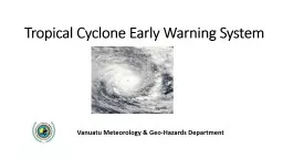
/
Tropical Cyclone Early Warning System Tropical Cyclone Early Warning System

Tropical Cyclone Early Warning System - PowerPoint Presentation

ripplas
ripplas . @ripplas
Follow
350 views
Uploaded On 2020-06-17

Tropical Cyclone Early Warning System - PPT Presentation

Vanuatu Meteorology amp GeoHazards Department OPERATION DURING TC PAM Warnings were issued hourly on midday 13 th of March 2013 and was maintained till TC Pam left Vanuatu Area Media Briefing after every warnings ID: 780366

warning knots high amp knots warning amp high forecaster rain flooding pam damage seas storm heavy winds 117 force

Share:

Link:

Embed:

Download Presentation from below link

Download The PPT/PDF document "Tropical Cyclone Early Warning System" is the property of its rightful owner. Permission is granted to download and print the materials on this web site for personal, non-commercial use only, and to display it on your personal computer provided you do not modify the materials and that you retain all copyright notices contained in the materials. By downloading content from our website, you accept the terms of this agreement.


Presentation Transcript

Slide1

Tropical Cyclone Early Warning System

Vanuatu Meteorology & Geo-Hazards Department

Slide2

Slide3

OPERATION DURING TC PAM

Slide4

Slide5

Warnings were issued hourly on midday 13

th

of March 2013 and was maintained till TC Pam left Vanuatu Area

Media Briefing after every warnings.

Increase number of Forecasters to 6

4 person per shift to answer phones and update on the TC

1 Tropical Cyclone forecaster (Issued all TC Information)

1 marine & Aviation forecaster (updating website & preparing SMS for dissemination (TVL & DIGICEL)

1 Public forecaster

TC Forecaster , Director & Manager WFSD do media briefing (TV, Radio)

Slide6

Type of Warning

Average Winds* Expected

Beaufort

Force

Typical Effects


GALE

WARNING

63

km/h (34 knots) to

87 km/h (47 knots)


8, 9

Very rough to high seas. Normally minor damage on land, mainly to branches and loose materials. Occasional heavy rain and flooding.


STORM

WARNING

88

km/h (48 knots) to

117 km/h (63 knots)


10, 11

High to very high seas. Damage to trees, crops, overhead wires, temporary shelters and weaker structures. Often accompanied by heavy rain and flooding.


HURRICANE

WARNING


Over 117 km/h

(63 knots)


12

Phenomenal seas, heavy surf and abnormally high storm tides. Severe damage to trees, crops, Overhead wires, and many buildings. Accompanied by torrential rain and flooding.


* Winds averaged over a 10-minute period. Momentary gusts will be much higher, at least 10 knots or over.

Slide7

Analysis Track of TC PAM with radius of Gale, Storm and Hurricane force winds

Slide8

THANK YOU