Search Results for 'stream area'
stream area published presentations and documents on DocSlides.
GIS in Water Resources Watershed and Stream Network Delineation
by cadie
CUAHSI Virtual University. David Tarboton. Utah St...

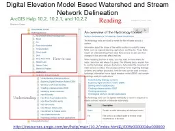
Digital Elevation Model Based Watershed and Stream Network
by olivia-moreira
Understanding. How to use. Reading. http://resour...
Stream Health Outcome Claire Buchanan
by leusemij
Interstate Commission on the Potomac River Basin. ...

watershed outlet modified from Stream Corridor Restoration: Principles, Processes, and Practices, 1
by joyce
Hydrologic Cycle. . Infiltration. –the . proce...
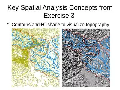
Key Spatial Analysis Concepts from Exercise 3
by susan2
Contours and Hillshade to visualize topography. Zo...

Terrain Analysis Using Digital Elevation Models (
by celsa-spraggs
TauDEM. ). Learning Objectives. To be able to del...
Comparing Vegetation in a Riparian Zone to an Upland Area i
by pamella-moone
By: Abby Branson. Vegetation Ecology, Summer 2013...
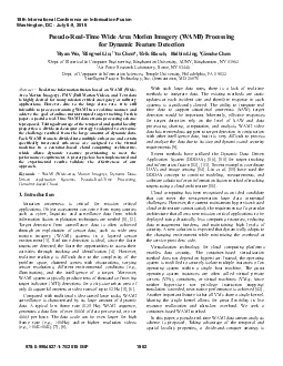
PseudoRealTime Wide Area Motion Imagery WAMI Processing for Dynamic
by gagnon
adopted to overcome the challenge resulted from th...
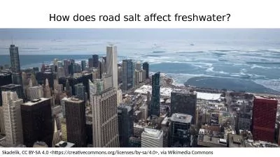
How does road salt affect freshwater?
by harper
Skadelik. , CC BY-SA 4.0 <https://creativecommo...


Extended Hydrologic Terrain Analysis
by tawny-fly
Establishing the terrain flow analysis framework....
Surface Water Earth Science- Chapter 13
by yoshiko-marsland
Mr. Hendricks and Mr. McMahon. Chapter Outline. S...

Steelhead Streamside Incubation Program
by yoshiko-marsland
Lytle P. Denny and David J. Evans. Shoshone-Banno...
Hydrosphere Surface Water and the Water Cycle
by yoshiko-marsland
Goals for This Unit. Explain the structure and pr...
Stream Mitigation Model Examples for Mitigation Category 1 and 2 Streams
by tatiana-dople
Preface. Five example sites are presented from Oh...
Re-Meandering Of Lowland Streams: Will Disobeying the Laws
by kittie-lecroy
Pedersen, . Kristensen. , . Friberg. , 2014, . Pl...
Cub Run Stream Valley Trail Southern Section Route to Compton Road Area covered by this map Location Map Fairfax County Park Authority LEGEND Parkland Trail Bridge Fair weather crossings Roads Stream
by ellena-manuel
This trail runs through much of the Cub Run and R...
COMPLETEING A PRELIMAINRY ASSESSMENT FOR AG.
by olivia-moreira
WATER SUPPLY PONDS. Water Quantity and Conservat...
Stream flow hydrograph separation using end member mixing analysis
by mila-milly
on streams throughout the USA. Tonia Hack. William...

Dan O’Brien School of Public Policy and Urban Affairs, Northeastern University
by catherine
Research Director, Boston Area Research Initiative...

Watershed and Stream Network Delineation on Alaska’s North Slope
by calandra-battersby
Arctic Climate Change. IPCC AR4 Projections (2007...

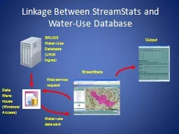
Linkage Between StreamStats and Water-Use Database
by lois-ondreau
SWUDS Water-Use Database (UNIX/. Ingres). Data . ...
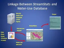
Linkage Between StreamStats and Water-Use Database
by celsa-spraggs
SWUDS Water-Use Database (UNIX/. Ingres). Data . ...

Fraser Island World Heritage Area and Recreation Area Great Sandy National Park Visitor guide Exquisite coastal vistas desertlike sandblows pristine freshwater lakes and streams cool majestic forests
by phoebe-click
Fraser Island Kgari is a natural paradise Departm...

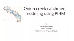
Onion creek catchment modeling using PIHM
by faustina-dinatale
By,. Harish Sangireddy. PhD Candidate. The Univer...
Landforms and Biomes Volcano
by marina-yarberry
An opening in the earth's crust through which mol...
FRPA 101-I Timber Harvesting
by faustina-dinatale
Purpose Unit design. Landings Felling. Yarding ...
FRPA 101-E2 Riparian Management Standards
by tatyana-admore
Region II. Agenda. Background, history, and inten...