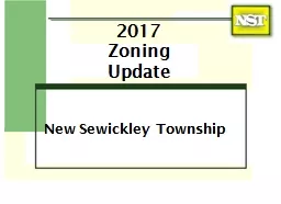
/
2017 Zoning Update New Sewickley Township 2017 Zoning Update New Sewickley Township

2017 Zoning Update New Sewickley Township - PowerPoint Presentation

sherrill-nordquist
sherrill-nordquist . @sherrill-nordquist
Follow
371 views
Uploaded On 2018-02-28

2017 Zoning Update New Sewickley Township - PPT Presentation

Background Current Zoning Established 1973 Established Residential Zoning Districts Encouraged low and high density residential development Districts were carved out of Agricultural District ID: 638850

miles acres zoning residential acres miles residential zoning district development commercial districts established current agricultural rural industrial township density

Share:

Link:

Embed:

Download Presentation from below link

Download Presentation The PPT/PDF document "2017 Zoning Update New Sewickley Townshi..." is the property of its rightful owner. Permission is granted to download and print the materials on this web site for personal, non-commercial use only, and to display it on your personal computer provided you do not modify the materials and that you retain all copyright notices contained in the materials. By downloading content from our website, you accept the terms of this agreement.


Presentation Transcript

Slide1

2017

ZoningUpdate

New Sewickley TownshipSlide2

Background

Current Zoning Established 1973

Established Residential Zoning Districts

Encouraged low and high density residential development.

District(s) were carved out of Agricultural District.

Overwhelming majority fronted major township roads.

Arbitrary District borders not delimited by roads, streams or property lines.

Has directed residential property purchased for the past 43 years.Slide3

Why Revise?

Adjust the residential to non residential zoned land ratio which is approximately 96% to 4%.

Maintain a dominant rural character while providing reasonable opportunities for commercial, retail, service, office and light industrial development.

Support the nonresidential development in appropriate areas closer to higher volumes roadways and possible future utility line extension apart from low-density residential and rural areas.

Eliminate/reduce current non conforming usesSlide4

How Did We Get Here

Held approximately 27 special public work session meetings specifically to address updating the zoning.

Held informational meetings with industry and business executives.

Additional time and effort was provided by each PC member reviewing draft documents and preparing comments.

Provided approximately 1000 man hours in supporting this effort

In addition to the efforts of the Township Staff and Professional Planner, the Planning Commission:Slide5

What have we done?

Comprehensive Plan Completed and adopted by the BOS - 9/2013

Established Zoning Districts

Established Uses for each Zoning District

Permitted Uses Expanded

Conditional Uses Expanded/Special Exemptions Eliminated

Modified the General Terminology

Standards regarding setbacks/parking/screening added and revised

Isolated potentially injurious development

Revised the Oil and Gas Regulations

Allowed residential homes to be built on any legal and usable lot

Streamlined the Ordinance with easier to find standards

Amended the Official Map

What needs to be completed?

Present the plan to the BOS with recommendation to formally adopt

StatusSlide6

Current Zoning Districts

A-1 Agricultural 15,255 acres/23.8 sq. miles

R-1 Suburban Residential 4,075 acres/6.4 sq. miles

R-2 General Residential 665 acres/1 sq. miles

C-1 Local Commercial 370 acres/.5 sq. miles

C-2 Planned Commercial 124 acres/.19 sq. miles

I Industrial 301 acres/.47 sq. milesSlide7

Future Zoning Districts

A-1/ R1 become RA Rural Agricultural

R-2 becomes MDR Mixed Density Residential

C-1/ C2 become GC Neighborhood Commercial

TND – Traditional

Neighdorhood

District

I becomes LI Light Industrial District

8578 acres/13.4 sq. miles

6904 acres/10.74 sq. miles

1255 acres/2.0 sq. miles

2301 acres/3.6 sq. miles

1884 acres/2.9 sq. miles Slide8

Affect On Landowners

Current uses are “grandfathered”

Only affects future development

Most land owners will have new opportunities Slide9

Proposed Zoning Map