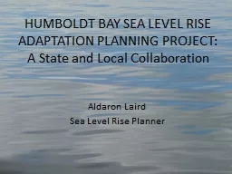
ADAPTATION PLANNING PROJECT A State and Local Collaboration Aldaron Laird Sea Level Rise Planner HUMBOLDT BAY Shoreline Inventory Mapping and Sea Level Rise Vulnerability Assessment Tuluwat Wiyot World Renewal Site 2010 1 sea level rise ID: 134126
Download Presentation The PPT/PDF document "HUMBOLDT BAY SEA LEVEL RISE" is the property of its rightful owner. Permission is granted to download and print the materials on this web site for personal, non-commercial use only, and to display it on your personal computer provided you do not modify the materials and that you retain all copyright notices contained in the materials. By downloading content from our website, you accept the terms of this agreement.
Slide1
HUMBOLDT BAY SEA LEVEL RISE
ADAPTATION PLANNING PROJECT:A State and Local Collaboration
Aldaron Laird
Sea Level Rise PlannerSlide2
HUMBOLDT BAY
Shoreline Inventory, Mapping,
and Sea Level Rise Vulnerability Assessment
Tuluwat Wiyot World Renewal Site, 2010, 1’ sea level riseSlide3
Shoreline Type
Artificial=75%, 77 miles
Natural=25%, 26 milesSlide4
Shoreline Structure
Dike = 53%, 41 miles
Railroad = 14 %, 11 milesSlide5
Shoreline Cover
Exposed = 9 miles
Vegetated = 65 miles
Fortified = 27 milesSlide6
King High Tide and Storm Surge
New Years Eve 2005 Arcata Bay
1.7’ sea level rise, 2005Slide7
Diked Shoreline
2.0’ SLR vs. 3.0’ SLRSlide8
Diked Shoreline Overtopping
(miles)
Sea Level Rise
0’, 1’, 2’, 3’, & 6’Slide9
3.0’ Sea Level RiseSlide10
Purpose:Support informed decision-making and encourage a unified, consistent regional adaptation strategy to address the hazards associated with sea level rise in the Humboldt Bay region.
Partners:
Humboldt County
Cities of Eureka and Arcata
Humboldt Bay Harbor District
North District Coastal Commission
HUMBOLDT BAY SEA LEVEL RISE ADAPTATION PLANNING PROJECTSlide11
WHY COLLABORATE
Coastal Hazards and Sea Level Rise Do Not Recognize Political BoundariesSlide12
Basic Adaptation Planning Strategy
We Cannot
M
anage
or
P
rotect
the Shoreline
P
arcel
by Parcel,
W
e Need to Address
E
ntire
H
ydrologic
UnitsSlide13
WHY COLLABORATE
Sea Level Rise Adaption Planning Will Require Integration of Coastal Commission Development Permit and Local Coastal Program: Policies and Standards.
Complimentary and Overlapping Jurisdictions.Slide14
Mosaic of Permitting and Planning Jurisdictions
Coastal Commission:
Retained and Federal
Humboldt County
City of Eureka
City of ArcataSlide15
Affected Planning Areas
Coastal Hazards vs. Sea Level Rise3.0 meters
6.0 meters
2.0 meters
Tsunami & Flood Zones
6 foot InundationSlide16
Sea Level Rise
Adaptation Planning ProcessSlide17Slide18
Coastal Commission Strategic Plan Climate Change Goal & Objective
Address Climate Change through LCP
Planning
, Coastal
Permitting
, Inter-Agency Collaboration, and Public Education
Develop Planning and Permitting Policy Guidance [Document]
for Addressing the Effects of Climate Change on Coastal ResourcesSlide19
Coastal Planning & Permitting
Planning: Land Use Policies & Standards
Local Coastal Programs : County & Cities
Permitting
: Regulatory Policies & Standards
Retained Jurisdiction Areas: Commission-
Chapter 3 Policies; Coastal Development Permit
Federal Lands/Actions: Commission-
Chapter 3 Policies; Consistency Determination
Local Coastal Programs: County & Cities-
LCP Policies; Coastal Development PermitSlide20