/
Ensemble variability in rainfall forecasts of Hurricane Ire Ensemble variability in rainfall forecasts of Hurricane Ire

Ensemble variability in rainfall forecasts of Hurricane Ire - PowerPoint Presentation

tatyana-admore
tatyana-admore . @tatyana-admore
Follow
401 views
Uploaded On 2017-04-14

Ensemble variability in rainfall forecasts of Hurricane Ire - PPT Presentation

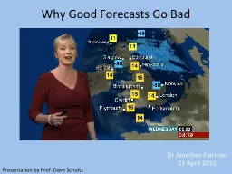
Molly Smith Ryan Torn Kristen Corbosiero and Philip Pegion NWS Focal Points Steve DiRienzo and Mike Jurewicz Fall 2016 CSTAR Meeting 2 November 2016 Motivation Landfalling ID: 537394

anomalies members wetter ensemble members anomalies ensemble wetter precipitation cluster cyclonic irene gfs drier hpa western easterly initialized eastern

Share:

Link:

Embed:

Download Presentation from below link

Download Presentation The PPT/PDF document "Ensemble variability in rainfall forecas..." is the property of its rightful owner. Permission is granted to download and print the materials on this web site for personal, non-commercial use only, and to display it on your personal computer provided you do not modify the materials and that you retain all copyright notices contained in the materials. By downloading content from our website, you accept the terms of this agreement.


Presentation Transcript

Slide1

Ensemble variability in rainfall forecasts of Hurricane Irene (2011)

Molly Smith, Ryan Torn, Kristen Corbosiero, and Philip PegionNWS Focal Points: Steve DiRienzo and Mike Jurewicz Fall 2016 CSTAR Meeting2 November, 2016Slide2

Motivation

Landfalling TCs are often associated with widespread heavy precipitation, which can lead to devastating flood events. Slide3

Motivation

Landfalling TCs are often associated with widespread heavy precipitation, which can lead to devastating flood events. Relatively few studies have explored the sensitivity of precipitation forecasts for such events to model initial conditions. Slide4

Motivation

Landfalling TCs are often associated with widespread heavy precipitation, which can lead to devastating flood events. Relatively few studies have explored the sensitivity of precipitation forecasts for such events to model initial conditions. What modulates precipitation variability in ensemble modeling of heavy rainfall events?Slide5

Motivation

Landfalling TCs are often associated with widespread heavy precipitation, which can lead to devastating flood events. Relatively few studies have explored the sensitivity of precipitation forecasts for such events to model initial conditions. What modulates precipitation variability in ensemble forecasts of heavy rainfall events?This work uses Hurricane Irene (2011) as a case study.Irene featured catastrophic inland flooding caused by widespread rainfall totals of 4–7 inches.The Catskill region of New York received up to 12 inches.Slide6

Methods

An 80-member GFS ensemble was initialized at 0000 UTC 27 August 2011 and run for 48 hours, until 0000 UTC 29 August. These GFS ensemble forecasts were created with the operational version of the GFS in use from 2013–2015.Slide7

GFS Ensemble Mean Precipitation

GFS Predicted Accumulations (mm)

Observed Accumulations (mm)

Observation source: EOLSlide8

GFS Ensemble Mean Precipitation

GFS Predicted Accumulations (mm)

Observed Accumulations (mm)

Observation source: EOLSlide9
Slide10
Slide11

Methods

An 80-member GFS ensemble was initialized at 0000 UTC 27 August 2011 and run for 48 hours, until 0000 UTC 29 August. These GFS ensemble forecasts were created with the operational version of the GFS in use from 2013–2015.Members were ranked by the amount of precipitation they brought to the Catskill region of New York during this time period. Slide12

Methods

An 80-member GFS ensemble was initialized at 0000 UTC 27 August 2011 and run for 48 hours, until 0000 UTC 29 August. These GFS ensemble forecasts were created with the operational version of the GFS in use from 2013–2015.Members were ranked by the amount of precipitation they brought to the Catskill region of New York during this time period. The synoptic characteristics of the ten wettest ensemble members were then compared to those of the ten driest, to see if any large-scale patterns were behind the differences in forecasted precipitation. Slide13

Why did some storms track father west?Slide14

Hypothesis: Differences in storm track are associated with differences in steering flow.Slide15

westerly anomalies

easterly anomalies

Composite Difference Plots

250-850 hPa Zonal Steering Flow at InitializationSlide16

westerly anomalies

easterly anomalies

Comparison of 10 wettest ensemble members and 10 driest

Composite Difference Plots

250-850 hPa Zonal Steering Flow at InitializationSlide17

westerly anomalies

easterly anomalies

Comparison of 10 wettest ensemble members and 10 driest

Vectors: Ensemble mean

Composite Difference Plots

250-850 hPa Zonal Steering Flow at InitializationSlide18

westerly anomalies

easterly anomalies

Comparison of 10 wettest ensemble members and 10 driest

Vectors: Ensemble mean

Colors: Standardized difference between wet and dry members

Warm colors: Wet members have greater value

Cold colors:

Wet members have

lesser value

Composite Difference Plots

250-850 hPa Zonal Steering Flow at InitializationSlide19

westerly anomalies

easterly anomalies

Comparison of 10 wettest ensemble members and 10 driest

Vectors: Ensemble mean

Colors: Standardized difference between wet and dry members

Warm colors: Wet members have greater value

Cold colors: Wet members have lesser value

Stippling: Significant at 95% level

Composite Difference Plots

250-850 hPa Zonal Steering Flow at InitializationSlide20

250-850 hPa Zonal Steering – 00hr

Easterly flow anomalies arise early in the wetter members.

westerly anomalies

easterly anomaliesSlide21

250-850 hPa Zonal Steering – 00hr

Easterly flow anomalies arise early in the wetter members.

westerly anomalies

easterly anomaliesSlide22

Potential vorticity (PV) anomalies are associated with wind flow anomalies. Is that a factor here?Slide23

350K PV – 00hr

Wetter members are initialized with cyclonic PV anomalies to the south and west of Irene. These anomalies help to steer Irene inland.More cyclonic PV

Less cyclonic PVSlide24

350K PV – 00hr

Wetter members are initialized with cyclonic PV anomalies to the south and west of Irene. These anomalies help to steer Irene inland.More cyclonic PV

Less cyclonic PVSlide25

350K PV – 00hr

Wetter members are initialized with cyclonic PV anomalies to the south and west of Irene. These anomalies help to steer Irene inland.More cyclonic PV

Less cyclonic PVSlide26

350K PV – 06hr

Wetter members are initialized with cyclonic PV anomalies to the south and west of Irene. These anomalies help to steer Irene inland.More cyclonic PV

Less cyclonic PVSlide27

350K PV – 18hr

Wetter members are initialized with cyclonic PV anomalies to the south and west of Irene. These anomalies help to steer Irene inland.More cyclonic PV

Less cyclonic PVSlide28

350K PV – 18hr

Wetter members are initialized with cyclonic PV anomalies to the south and west of Irene. These anomalies help to steer Irene inland.More cyclonic PV

Less cyclonic PVSlide29

350K PV – 18hr

Wetter members are initialized with cyclonic PV anomalies to the south and west of Irene. These anomalies help to steer Irene inland.More cyclonic PV

Less cyclonic PVSlide30

350K PV – 36hr

Wetter members are initialized with cyclonic PV anomalies to the south and west of Irene. These anomalies help to steer Irene inland.More cyclonic PV

Less cyclonic PVSlide31

With what mechanism did Irene slow the approaching trough?Slide32

In the wetter members, Irene experienced greater outflow on its western side. This outflow may have contributed to blocking the approaching trough.

250 hPa Divergent U – 15hrwesterly anomalieseasterly anomaliesSlide33

In the wetter members, Irene experienced greater outflow on its western side. This outflow may have contributed to blocking the approaching trough.

250 hPa Divergent U – 15hrwesterly anomalieseasterly anomaliesSlide34

In the wetter members, Irene experienced greater outflow on its western side. This outflow may have contributed to blocking the approaching trough.

250 hPa Divergent U – 15hrwesterly anomalieseasterly anomaliesSlide35

Downscaling

However, the GFS is less than ideal for modeling terrain and mesoscale processes.Our 0.5 degree GFS output was downscaled to 3 km using WRF, with physics comparable to those employed in HRRR.Slide36

Observed Accumulations (mm)

Observation source: EOL

WRF 3km Ensemble

Mean Precipitation

WRF 3km Predicted

Accumulations (mm)Slide37

Observed Accumulations (mm)

Observation source: EOL

WRF 3km Ensemble

Mean Precipitation

WRF 3km Predicted

Accumulations (mm)Slide38

WRF 3km Ensemble

Precipitation SpreadObserved Catskills Precipitation (170 mm)Slide39

Three hypotheses to explain variability:

Wetter members have stronger upslope forcing over the Catskills than drier members.Slide40

Three hypotheses to explain variability:

Wetter members have stronger upslope forcing over the Catskills than drier members.Wetter members have greater moisture convergence over the Catskills than drier members.Slide41

Three hypotheses to explain variability:

Wetter members have stronger upslope forcing over the Catskills than drier members.Wetter members have greater moisture convergence over the Catskills than drier members.Wetter members have stronger Q-vector convergence over the Catskills than drier members.Slide42

Objective Clustering of Ensemble Members

Used k-means algorithm to sort the ensemble members into three clusters, based on the 39-h horizontal distribution of precipitation over the domain 41.5–43.5 N, 73–76.5 W.39-h was the interval of maximum precipitation rates over the Catskills.Three clusters is enough to accurately portray the variability between members.Slide43

Objective Clustering of Ensemble Members

Cluster 1: Low RainfallCluster 2: Eastern Cluster

Cluster

3: Western ClusterSlide44

Hypothesis 1: Upslope Wind Angle

Wetter, Western Cluster

Drier, Eastern Cluster

Forecast Hour: 39

900-hPa Winds

3-hourly PrecipitationSlide45

Hypothesis 1: Upslope Wind Angle

Wetter, Western Cluster

Drier, Eastern Cluster

Forecast Hour: 39

900-hPa Winds

3-hourly PrecipitationSlide46

Hypothesis 2: Moisture Convergence

Wetter, Western ClusterDrier, Eastern Cluster

Forecast Hour: 391000–700-hPa Mean Winds

Integrated Moisture Trans.Slide47

Hypothesis 3: Q-Vector Convergence

Wetter, Western ClusterForecast Hour: 39700-hPa Isotherms700-hPa Q-Vector Conv.Drier, Eastern ClusterSlide48

Wetter, Western Cluster

Drier, Eastern ClusterV10

• ▽Z

sSlide49

Wetter, Western Cluster

Drier, Eastern ClusterV10

• ▽Z

s

Rain initialed by upslope, but primarily forced by Q-vector conv.Slide50

Wetter, Western Cluster

Drier, Eastern ClusterV10

• ▽Z

s

There is strong upslope present initially, but very little moisture available for it to produce rain.Slide51

Wetter, Western Cluster

Drier, Eastern ClusterV10

• ▽Z

s

Although initial upslope is similar to the eastern cluster, it coincides with increased moisture, causing much greater rainfall.Slide52

Wetter, Western Cluster

Drier, Eastern ClusterV10

• ▽Z

s

Q-vector conv. replaces upslope forcing, maintaining high rain rates.Slide53

Precipitation differences in the GFS ensemble are largely due to differences in Irene’s

position.Analysis errors associated with a PV anomaly to the SW of Irene appear to be related to track differences.Initial steering flow anomalies set up a feedback loop with an upstream trough, causing the pattern to amplify.GFS ConclusionsSlide54

When downscaled to 3 km with WRF, precipitation variability in the 80-member ensemble is driven by factors other than storm track (although storm track does play a role).

The WRF ensemble mean does a very good job forecasting precipitation amounts over the Catskills, due to its superior terrain resolution and ability to simulate mesoscale processes. Precipitation in the wetter WRF members appears to be driven by a combination of terrain effects, synoptic forcing, and high available moisture, while precipitation in the drier WRF members appears to be driven primarily by synoptic forcing.WRF ConclusionsSlide55

A small east-west deviation in a member’s storm track can have a huge effect on the amount of rain received by a particular location.

Clustering ensemble members into specific forecast scenarios can reveal more information than just using the ensemble mean and standard deviation.General ConclusionsSlide56

Questions?