PDF-Summary:Students map the arctic inrelation to their home in orderto le
Author : tatyana-admore | Published Date : 2016-02-23
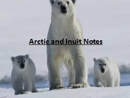
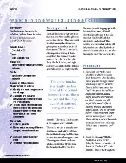
Background Latitude lines are imaginary linesthat run eastwest on the globe inconcentric circles They are usefulgiven point is north or south ofthe equator The arctic
Presentation Embed Code
Download Presentation
Download Presentation The PPT/PDF document "Summary:Students map the arctic inrelati..." is the property of its rightful owner. Permission is granted to download and print the materials on this website for personal, non-commercial use only, and to display it on your personal computer provided you do not modify the materials and that you retain all copyright notices contained in the materials. By downloading content from our website, you accept the terms of this agreement.
Summary:Students map the arctic inrelation to their home in orderto le: Transcript
Download Rules Of Document
"Summary:Students map the arctic inrelation to their home in orderto le"The content belongs to its owner. You may download and print it for personal use, without modification, and keep all copyright notices. By downloading, you agree to these terms.
Related Documents