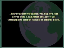
/
This PowerPoint presentation will help you learn how to cr This PowerPoint presentation will help you learn how to cr

This PowerPoint presentation will help you learn how to cr - PowerPoint Presentation

tatyana-admore
tatyana-admore . @tatyana-admore
Follow
397 views
Uploaded On 2017-05-03

This PowerPoint presentation will help you learn how to cr - PPT Presentation

Definitions taken from infopleasecom Weather is the state of the atmosphere at a given place and time For example right now the temperature in Chicago Illinois may be 56 ID: 544359

precipitation average climate temperature average precipitation temperature climate china place data chongqing hometown climograph graph months jan january yearly

Share:

Link:

Embed:

Download Presentation from below link

Download Presentation The PPT/PDF document "This PowerPoint presentation will help y..." is the property of its rightful owner. Permission is granted to download and print the materials on this web site for personal, non-commercial use only, and to display it on your personal computer provided you do not modify the materials and that you retain all copyright notices contained in the materials. By downloading content from our website, you accept the terms of this agreement.


Presentation Transcript

Slide1

This PowerPoint presentation will help you learn how to create a climograph and how to use climographs to compare climates in different places.Slide2

Definitions taken from

infoplease.com

Weather

is the state of the atmosphere at a

given place and time

. For example,

right now

, the temperature in

Chicago, Illinois

may be 56

°

F with rain.Slide3

Climate is the average condition of the atmosphere (such as temperature or precipitation) over a long period

of time.

For example, the

average

temperature

over the past 40 years

for the month of February may be 32

°

F. The average precipitation is 2.8 inches.

Climate is the average of weather conditions in a place.Slide4

Just as the weather differs from day to day, the climate differs from place to place.

Seattle, WA Houston, TX Phoenix, AZ Barrow, AK

Cool Warm Hot Cold

Moist Moist Dry DrySlide5

Just Checking

What is weather?

What is climate?

How are weather and climate different?Slide6

Two important elements of weather and climate are:

precipitation and temperature

Precipitation

includes all forms of moisture falling to the surface of the earth. (Examples: rain, sleet, snow, hail)

Temperature

is how warm or cool the air is outside. * In this activity, mean temperature/precipitation is the same as average temperature/precipitation.

Mean=AverageSlide7

In the following activity you will compare the climate in your area to the climate in Chongqing, China

First, we will learn how to develop a climograph by looking at an example for Orlando, Florida. A climograph is a graph that displays average (mean) precipitation and temperature for an area. A climograph is used to compare the climate in different places.

Next, we will create one climograph for Chongqing, China and another for your hometown.

Finally, you will use the two climographs you created to compare the climate in your hometown with the climate in Chongqing, China.

Slide8

Practice making a climograph for

Orlando, Florida

Find the climate data (average/mean temperature and precipitation) for Orlando, Florida.

Go to

www. worldclimate.com

Type Orlando in the Search Box and click on the search button.

Click on the Orlando/Jetport/FL., United States of America link.

Scroll down to Orlando/Jetport/FL., United States of AmericaSlide9

Noticing Precipitation Patterns

Jan.

Feb.

Mar.

Apr.

May

Jun.

Jul.

Aug.

Sep.

Oct.

Nov.

Dec.

Year

mm

54.6

72.6

86.5

60.0

83.5

72.6

97.368.166.379.352.153.01247.8inches2.12.93.42.43.36.87.86.66.53.12.12.149.1

Click on the average rainfall link. Take note of any patterns you see:

* Note: This website uses the words “average rainfall” instead of “average precipitation”. It is more accurate to use “average precipitation” since this includes all forms of precipitation (such as rain, snow, and sleet).

Is there more precipitation in the summer months (July, August, September) or the winter months (January, February, March)?

What other patterns do you see in the average precipitation data for Orlando, Florida? Slide10

To graph the average precipitation

:Label the x-axis (horizontal) with the months (Jan.-Dec.) and include a space for the yearly average precipitation. Label the y-axis (vertical), on the left side of the graph, with the average precipitation levels in inches.

Next, plot the average precipitation for Jan. by drawing a bar over “Jan” reaching up to the amount of precipitation listed for that month. For our example, the Jan. average precipitation was 2.1 inches, so we drew a bar over Jan reaching the 2.1 level on the y-axis of the graph. Continue graphing the precipitation data in the same manner for each month and for the year. Slide11

Noticing Temperature Patterns

Jan.

Feb.

Mar.

Apr.

May

Jun.

Jul.

Aug.

Sep.

Oct.

Nov.

Dec.

Year

°C

15.5

16.6

19.2

21.9

25.1

27.3

28.028.027.223.819.716.622.4°F59.961.966.671.477.281.182.482.481.074.867.561.972.3

Click the back button and scroll down to Orlando/Jetport/FL., United States of America

Click on the average temperature link.

Is it hotter in the summer (July, August, September) or in the winter months (January, February, March)?

What other patterns do you see in the average temperature data for Orlando, Florida?Slide12

Key

To graph the average temperature

:

Use the same graph on which you plotted the average precipitation for Orlando, FL.

Label the y-axis (vertical), on the right side of the graph, with the average temperature levels in degrees Fahrenheit.

Next, plot the average temperature for Jan. by placing a dot over Jan at the average temperature listed for that month. For our example, the January average temperature was 59.9

°F

, so we placed a dot over Jan at the 59.9 level on the y-axis of the graph. Continue graphing the remaining temperature data in the same manner for each month and for the year.

Last, connect the dots by drawing a line from the dot for January and continue through the dot for December.

Do

not

connect the dot for the year.

Slide13

Key

A

climograph

includes both the average precipitation and the average temperature data. Your climograph should look like the one below. Be sure to include a title for your graph and a key showing the symbols that represent the average precipitation and the average temperature.

Slide14

Now it is your turn…

First, print 2 blank copies of the graph from the next slide. Slide15

KEY

TITLE

Average Precipitation in Inches

Month

Average Temperature in Degree Fahrenheit

J F M A M J J A S O N D

50

45

40

35

30

25

20

15

10

5

0

100

80

60

40201200YearSlide16

Finding the Climate Data for Chongqing, China

To find the climate data (average temperature and precipitation) for Chongqing, China, go to

http://www.worldclimate.com

.

Type Chongqing in the search box and click enter.

Click on Chongqing, China.Be sure to click on both average rainfall and average precipitation data for Chongqing, China. You may want to write this data on a piece of paper or print it out.

Slide17

Graphing the Average Precipitation for

Chongqing, ChinaUsing one of the graphs you printed, plot the average precipitation data. For example, using the precipitation amount for January, create a bar above the J reaching up to the amount of precipitation listed for that month. Be sure to use the scale on the left y-axis for graphing average precipitation. Do the same for all months and the yearly precipitation data. Slide18

Graphing the Average Temperature for

Chongqing, ChinaNext, using the same graph, plot the average temperature data. For example, using the temperature information for January, place a dot above the J using the scale on the right y-axis. Do the same for all months and the yearly total. Draw a line connecting the dots from January to December.

Be sure to put a title at the top of your climograph in the box labeled “title”and a key in the box labeled “key”. Slide19

Climate Patterns in Chongqing, China

What pattern do you see in the average monthly precipitation for Chongqing?What pattern do you see in the average monthly temperature for Chongqing?Slide20

Finding the Climate Data for Your Hometown

To find the average temperature and precipitation for your hometown go to

http://www.worldclimate.com

.

Type the name of your hometown in the search box and click enter.

You may not find your hometown. If your hometown is not listed go to a larger city near your home. Be sure to use the data from a location that has both average temperature and average precipitation. You may want to write this data on a piece of paper or print it out.

Slide21

Graphing the climate in your hometown

Using one of the graphs you printed, plot the average precipitation data. For example, using the precipitation amount for January, create a bar above the J reaching up to the amount of precipitation listed for that month. Be sure to use the scale shown on the left y-axis for graphing average precipitation. Do the same for all the months and for the yearly total.

Slide22

Graphing the Average Temperature for Your Hometown

Next, using the same graph, plot the average temperature data. For example, using the temperature information for January, place a dot above the J using the scale shown on the right y-axis. Do the same for all the months and for the yearly average. Draw a line connecting the dots from January through December.

Do

not

connect the dot for the year. Be sure to put a title at the top of your climograph in the box labeled “title”and a key in the box labeled “key”. Slide23

Using climographs to compare the climate of Chongqing, China to the climate of your hometown:

Which are the warmest months in Chongqing, China?

Which are the warmest months in your hometown?

Which are the coolest months in Chongqing, China?

Which are the coolest months in your hometown?

Which place has the highest average temperature for the year?

Write a sentence comparing the average monthly temperatures in Chongqing to the average monthly temperatures in your hometown.Slide24

Which are the wettest months in Chongqing, China?

Which are the wettest months in your hometown?Which place has the highest yearly precipitation?

Write a sentence comparing the average yearly precipitation in Chongqing with the average yearly precipitation in your hometown. Slide25

Something to think about

Would the average yearly temperature and the average yearly precipitation be a good way to describe the climate of an area?Why or why not?

If you were to live in Chongqing, China for a year, what changes might you make in your clothing or activities because of the climate?Slide26

How Does the Climate Differ Across China?

There are 5 cities listed on the map above: Harbin, Beijing, Guangzhou, Fengdu and Kashi. In the next activity, you will create a series of climographs to compare the climates of these cities.

N

S

E

WSlide27

First, print the next three slides, including the blank climograph and climate data charts.

Slide28

Key

Title

Average Precipitation in Inches

Month

Average Temperature in Degree Fahrenheit

J F M A M J J A S O N D

50

45

40

35

30

25

20

15

10

5

0

100

80

60

40201200YearSlide29

Jan.

Feb.

Mar.

Apr.

May

Jun.

Jul.

Aug.

Sep.

Oct.

Nov.

Dec.

Year

Average Temperature (

°F)

-3.2

4.3

22.6

42.8

57.4

67.6

73.470.357.742.121.03.237.9Average Precipitation (in.)0.20.20.40.91.73.56.14.62.41.10.40.221.8

Harbin, China

Beijing, China

Guangzhou, China

Jan.

Feb.

Mar.

Apr.

May

Jun.

Jul.

Aug.

Sep.

Oct.

Nov.

Dec.

Year

Average Temperature (

°F)

23.7

28.8

40.5

56.5

68.0

75.9

78.8

76.5

67.6

54.7

39.0

27.3

53.2

Average Precipitation (in.)

0.2

0.2

0.3

0.7

1.3

3.1

8.8

6.7

2.3

0.7

0.4

0.1

25.0

Jan.

Feb.

Mar.

Apr.

May

Jun.

Jul.

Aug.

Sep.

Oct.

Nov.

Dec.

Year

Average Temperature (

°F)

56.3

57.7

63.5

71.1

77.9

81.1

82.9

82.8

80.8

75.2

66.9

59.5

71.4

Average Precipitation (in.)

1.6

2.7

3.8

6.7

10.4

10.4

9.7

9.1

6.2

2.5

1.6

1.2

66.1Slide30

Jan.

Feb.

Mar.

Apr.

May

Jun.

Jul.

Aug.

Sep.

Oct.

Nov.

Dec.

Year

Average Temperature (

°F)

46.6

49.6

57.9

66.4

73.0

77.9

84.084.475.966.257.749.665.8Average Precipitation (in.)0.70.81.53.75.86.85.95.05.74.11.90.943.0

Jan.

Feb.

Mar.

Apr.

May

Jun.

Jul.

Aug.

Sep.

Oct.

Nov.

Dec.

Year

Average Temperature (

°F)

21.2

29.8

45.7

59.4

67.6

74.5

78.3

75.9

67.1

53.8

37.9

25.0

53.1

Average Precipitation (in.)

0.1

0.2

0.2

0.2

0.5

0.3

0.3

0.3

0.2

0.1

0.1

0.1

2.5

Fengdu, China

Kashi, ChinaSlide31

After printing out the previous slides, make 5 copies of the blank climograph.

Plot the climate data for each of the cities on a different climograph. Be sure to put a title and a key on each climograph.Slide32

Which place has the lowest average temperature for the year?

Which place has the coldest winter (January, February, March)?

Which place has the warmest winter (January, February, March)?

Which place has the highest average temperature for the year?

Which place has the hottest summer (July, August, Sept)?

Which place has the coolest summer (July, August, Sept)?

Use the graph you just created to compare the climate in different cities across China:Slide33

Which place has the highest yearly precipitation?

Which place has the wettest summer (July, August, Sept)?Which place has the wettest winter (January, February, March)?

Which place has the climate most similar to the climate of your hometown?

Which place has the lowest yearly precipitation?Slide34

Describing Patterns

Look at the map of China on slide 25 and at the climographs you have created

Which parts of China are the coldest? …warmest?

Which parts of China are the driest? …wettest?

What patterns can you see in the climate of China?Slide35

Just Checking

The condition of the atmosphere at a given place and time is called ___________________.

The average condition of the atmosphere over a long period of time is called __________________.

The two main elements of weather and climate are ___________ and ____________.

Another word for average is ________________.

Forms of precipitation include ___________________________________________________________________________________________________.

A graph used to show average temperature and precipitation for a place is called a __________________.