
Clouds Concept & Types Modified Presentation by :


Description: Clouds Concept Types Modified Presentation by : MR. NIHAR DEKA MSc 4TH SEMESTER, DEPT. OF PHYSICS, PUB KAMRUP COLLEGE. Clouds and its Types Presented By : Nazma Sultana and Kaushik Karjee M.Sc Fourth Semester Department of Physics, Pub
Related Topics
Download Presentation
"Clouds Concept & Types Modified Presentation by :" is the property of its rightful owner. Permission is granted to download and print the materials on this website for personal, non-commercial use only, and to display it on your personal computer provided you do not modify the materials and that you retain all copyright notices contained in the materials. By downloading content from our website, you accept the terms of this agreement.
Presentation Transcript
slide1. Clouds Concept & Types Modified Presentation by :
MR. NIHAR DEKA
MSc 4TH SEMESTER,
DEPT. OF PHYSICS,
PUB KAMRUP COLLEGE. Clouds and its Types Presented By :
Nazma Sultana and Kaushik Karjee
M.Sc Fourth Semester
Department of Physics,
Pub Kamrup College<br>
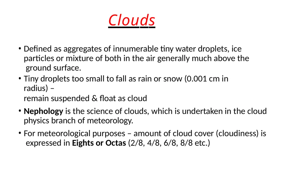
slide2. Clouds Defined as aggregates of innumerable tiny water droplets, ice particles or mixture of both in the air generally much above the ground surface.
Tiny droplets too small to fall as rain or snow (0.001 cm in radius) –
remain suspended & float as cloud
Nephology is the science of clouds, which is undertaken in the cloud physics branch of meteorology.
For meteorological purposes – amount of cloud cover (cloudiness) is expressed in Eights or Octas (2/8, 4/8, 6/8, 8/8 etc.)<br>
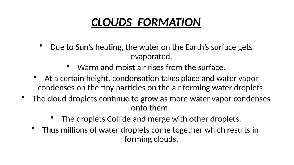
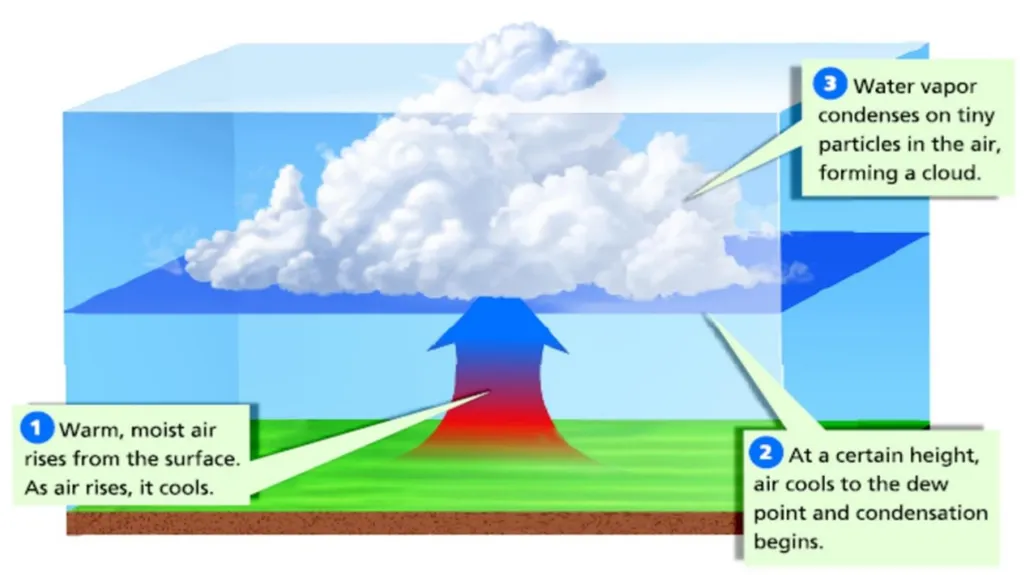
slide3. CLOUDS FORMATIONtion Due to Sun’s heating, the water on the Earth’s surface gets evaporated.
Warm and moist air rises from the surface.
At a certain height, condensation takes place and water vapor condenses on the tiny particles on the air forming water droplets.
The cloud droplets continue to grow as more water vapor condenses onto them.
The droplets Collide and merge with other droplets.
Thus millions of water droplets come together which results in forming clouds.<br>
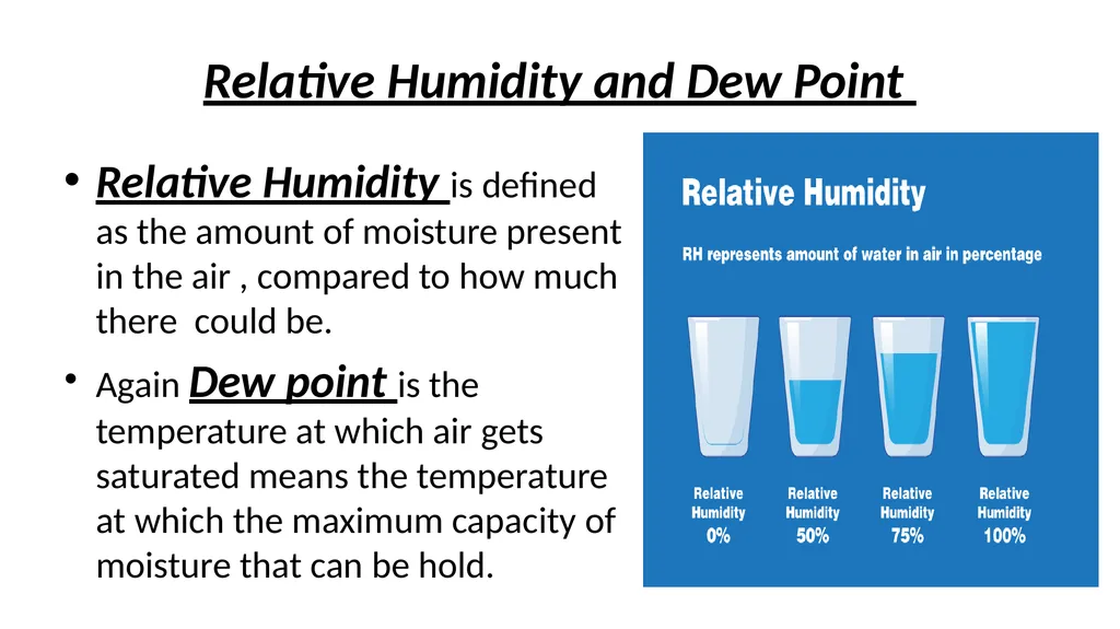
slide5. Relative Humidity and Dew Point Relative Humidity is defined as the amount of moisture present in the air , compared to how much there could be.
Again Dew point is the temperature at which air gets saturated means the temperature at which the maximum capacity of moisture that can be hold.<br>
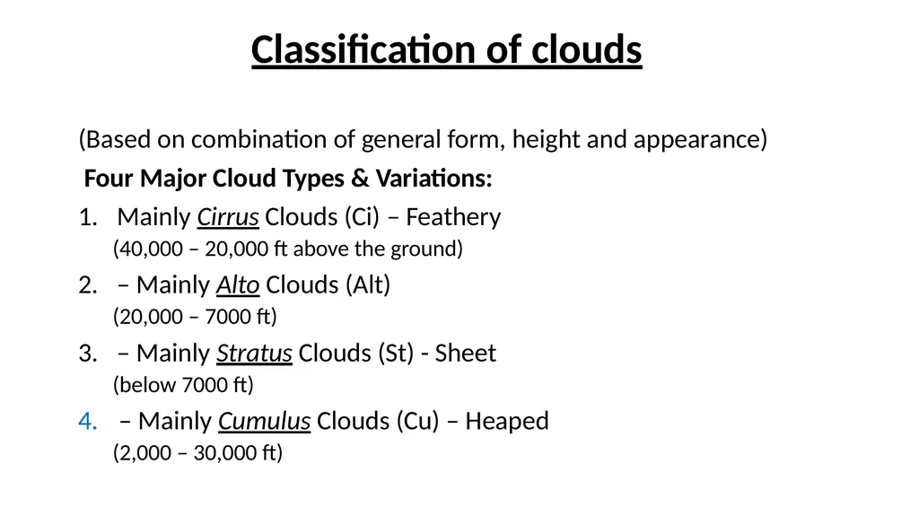
slide6. Classification of clouds (Based on combination of general form, height and appearance)
Four Major Cloud Types & Variations:
Mainly Cirrus Clouds (Ci) – Feathery
(40,000 – 20,000 ft above the ground)
– Mainly Alto Clouds (Alt)
(20,000 – 7000 ft)
– Mainly Stratus Clouds (St) - Sheet
(below 7000 ft)
– Mainly Cumulus Clouds (Cu) – Heaped
(2,000 – 30,000 ft)<br>
slide8. The names for clouds are usually are combinations of the following prefixes or suffixes:
Stratus/strato = flat/layered and smooth
Cumulus/cumulo = like cauliflower
Cirrus/cirro = High up/wispy
Alto = Medium level
Nimbus/Nimbo = Rain-bearing cloud<br>
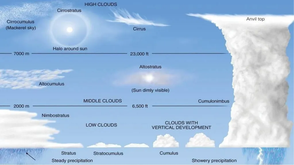
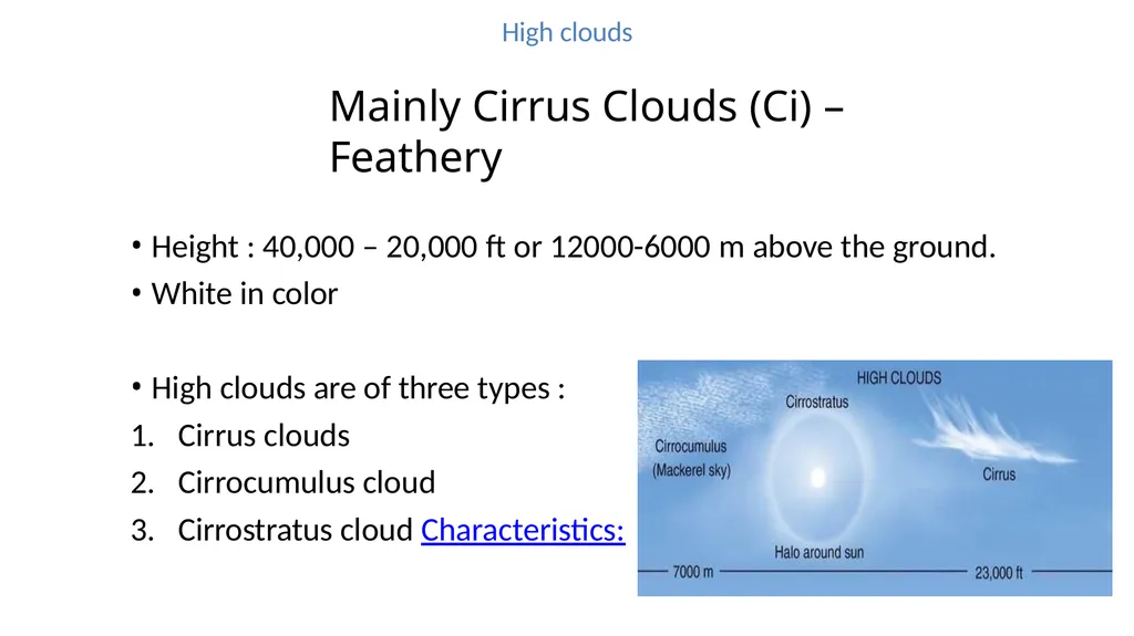
slide9. High clouds Mainly Cirrus Clouds (Ci) – Feathery
Height : 40,000 – 20,000 ft or 12000-6000 m above the ground.
White in color
High clouds are of three types :
Cirrus clouds
Cirrocumulus cloud
Cirrostratus cloud Characteristics:<br>
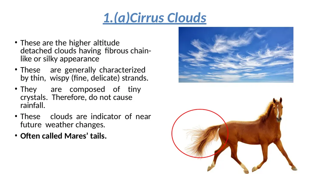
slide10. These are the higher altitude detached clouds having fibrous chain-like or silky appearance
These are generally characterized by thin, wispy (fine, delicate) strands.
They are composed of tiny crystals. Therefore, do not cause rainfall.
These clouds are indicator of near future weather changes.
Often called Mares’ tails. 1.(a)Cirrus Clouds<br>
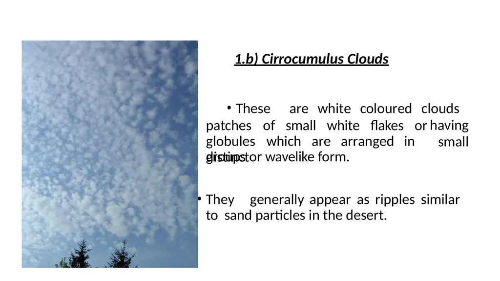
slide11. These are white coloured clouds having
small patches of small white flakes or globules which are arranged in distinct groups or wavelike form.
They generally appear as ripples similar to sand particles in the desert. 1.b) Cirrocumulus Clouds<br>
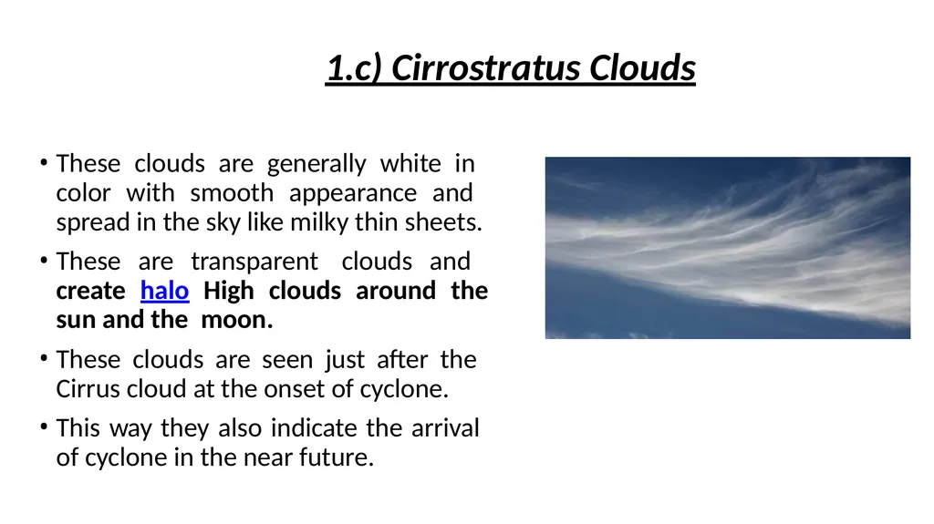
slide12. These clouds are generally white in color with smooth appearance and spread in the sky like milky thin sheets.
These are transparent clouds and create halo High clouds around the sun and the moon.
These clouds are seen just after the Cirrus cloud at the onset of cyclone.
This way they also indicate the arrival of cyclone in the near future. 1.c) Cirrostratus Clouds<br>
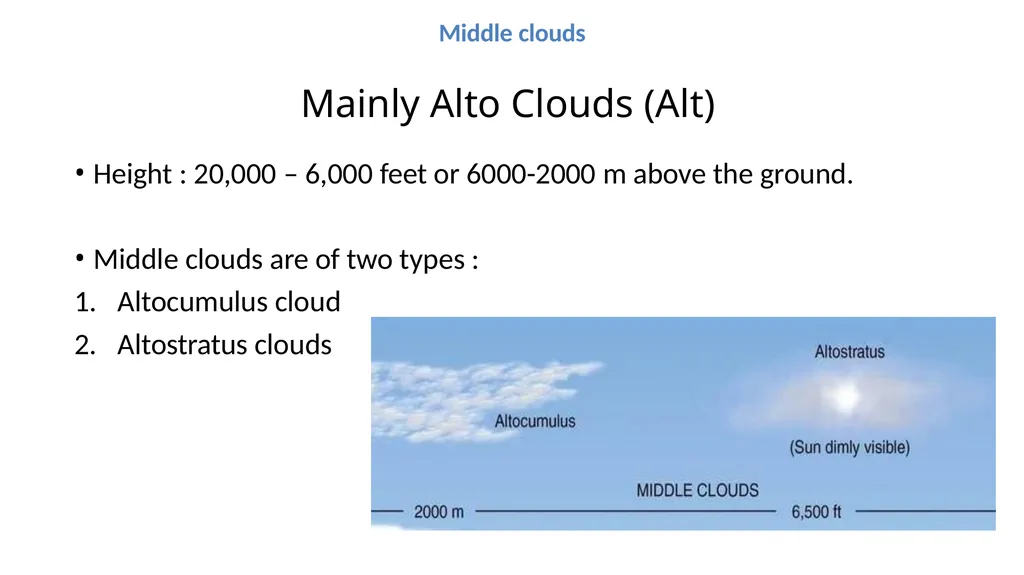
slide13. Middle clouds Mainly Alto Clouds (Alt)
Height : 20,000 – 6,000 feet or 6000-2000 m above the ground.
Middle clouds are of two types :
Altocumulus cloud
Altostratus clouds<br>
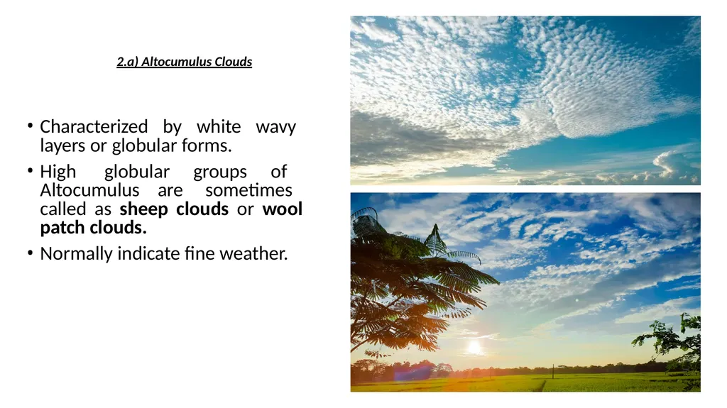
slide14. Characterized by white wavy layers or globular forms.
High globular groups of Altocumulus are sometimes called as sheep clouds or wool patch clouds.
Normally indicate fine weather. 2.a) Altocumulus Clouds<br>
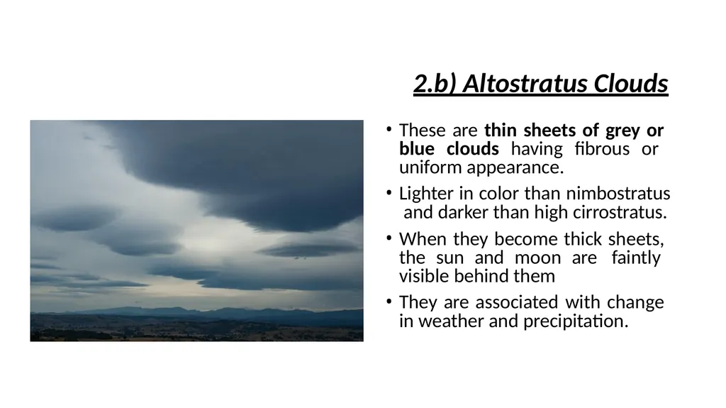
slide15. 2.b) Altostratus Clouds These are thin sheets of grey or blue clouds having fibrous or uniform appearance.
Lighter in color than nimbostratus and darker than high cirrostratus.
When they become thick sheets, the sun and moon are faintly visible behind them
They are associated with change in weather and precipitation.<br>
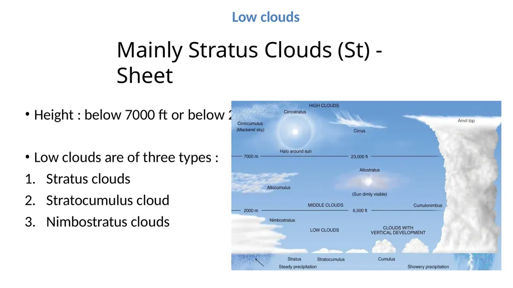
slide16. Low clouds Mainly Stratus Clouds (St) - Sheet
Height : below 7000 ft or below 2000 m
Low clouds are of three types :
Stratus clouds
Stratocumulus cloud
Nimbostratus clouds<br>
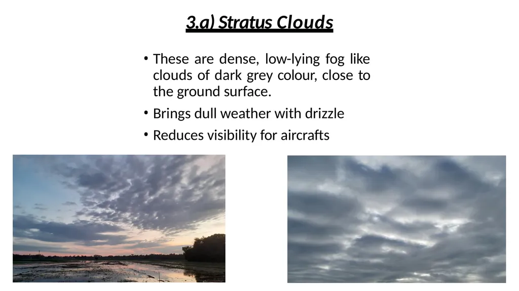
slide17. 3.a) Stratus Clouds These are dense, low-lying fog like clouds of dark grey colour, close to the ground surface.
Brings dull weather with drizzle
Reduces visibility for aircrafts<br>
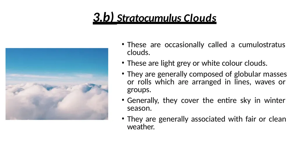
slide18. 3.b) Stratocumulus Clouds These are occasionally called a cumulostratus clouds.
These are light grey or white colour clouds.
They are generally composed of globular masses or rolls which are arranged in lines, waves or groups.
Generally, they cover the entire sky in winter season.
They are generally associated with fair or clean weather.<br>
slide19. 3.c) Nimbostratus Clouds Low clouds of dark colour, clearly layered, very close to the ground surface.
They create darkness because the sunlight is obscured due to high thickness.
These clouds increase the humidity in the atmosphere, known as rain cloud.
Consequently, the precipitation (rain, snow, sleet) starts soon.<br>
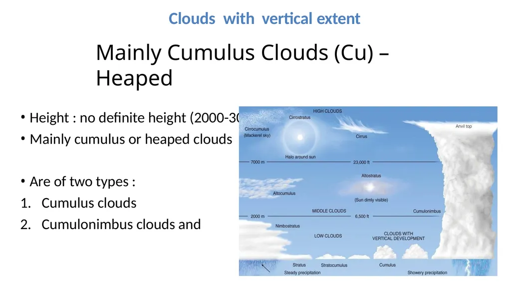
slide20. Clouds with vertical extent Mainly Cumulus Clouds (Cu) – Heaped
Height : no definite height (2000-30,000 ft)
Mainly cumulus or heaped clouds
Are of two types :
Cumulus clouds
Cumulonimbus clouds and<br>
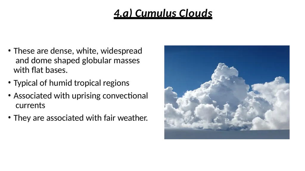
slide21. 4.a) Cumulus Clouds These are dense, white, widespread and dome shaped globular masses with flat bases.
Typical of humid tropical regions
Associated with uprising convectional currents
They are associated with fair weather.<br>
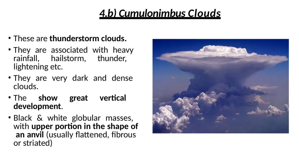
slide22. 4.b) Cumulonimbus Clouds These are thunderstorm clouds.
They are associated with heavy rainfall, hailstorm, thunder, lightening etc.
They are very dark and dense clouds.
The show great vertical development.
Black & white globular masses, with upper portion in the shape of an anvil (usually flattened, fibrous or striated)<br>
slide23. THANK YOU<br>
MR. NIHAR DEKA
MSc 4TH SEMESTER,
DEPT. OF PHYSICS,
PUB KAMRUP COLLEGE. Clouds and its Types Presented By :
Nazma Sultana and Kaushik Karjee
M.Sc Fourth Semester
Department of Physics,
Pub Kamrup College<br>
slide2. Clouds Defined as aggregates of innumerable tiny water droplets, ice particles or mixture of both in the air generally much above the ground surface.
Tiny droplets too small to fall as rain or snow (0.001 cm in radius) –
remain suspended & float as cloud
Nephology is the science of clouds, which is undertaken in the cloud physics branch of meteorology.
For meteorological purposes – amount of cloud cover (cloudiness) is expressed in Eights or Octas (2/8, 4/8, 6/8, 8/8 etc.)<br>
slide3. CLOUDS FORMATIONtion Due to Sun’s heating, the water on the Earth’s surface gets evaporated.
Warm and moist air rises from the surface.
At a certain height, condensation takes place and water vapor condenses on the tiny particles on the air forming water droplets.
The cloud droplets continue to grow as more water vapor condenses onto them.
The droplets Collide and merge with other droplets.
Thus millions of water droplets come together which results in forming clouds.<br>
slide5. Relative Humidity and Dew Point Relative Humidity is defined as the amount of moisture present in the air , compared to how much there could be.
Again Dew point is the temperature at which air gets saturated means the temperature at which the maximum capacity of moisture that can be hold.<br>
slide6. Classification of clouds (Based on combination of general form, height and appearance)
Four Major Cloud Types & Variations:
Mainly Cirrus Clouds (Ci) – Feathery
(40,000 – 20,000 ft above the ground)
– Mainly Alto Clouds (Alt)
(20,000 – 7000 ft)
– Mainly Stratus Clouds (St) - Sheet
(below 7000 ft)
– Mainly Cumulus Clouds (Cu) – Heaped
(2,000 – 30,000 ft)<br>
slide8. The names for clouds are usually are combinations of the following prefixes or suffixes:
Stratus/strato = flat/layered and smooth
Cumulus/cumulo = like cauliflower
Cirrus/cirro = High up/wispy
Alto = Medium level
Nimbus/Nimbo = Rain-bearing cloud<br>
slide9. High clouds Mainly Cirrus Clouds (Ci) – Feathery
Height : 40,000 – 20,000 ft or 12000-6000 m above the ground.
White in color
High clouds are of three types :
Cirrus clouds
Cirrocumulus cloud
Cirrostratus cloud Characteristics:<br>
slide10. These are the higher altitude detached clouds having fibrous chain-like or silky appearance
These are generally characterized by thin, wispy (fine, delicate) strands.
They are composed of tiny crystals. Therefore, do not cause rainfall.
These clouds are indicator of near future weather changes.
Often called Mares’ tails. 1.(a)Cirrus Clouds<br>
slide11. These are white coloured clouds having
small patches of small white flakes or globules which are arranged in distinct groups or wavelike form.
They generally appear as ripples similar to sand particles in the desert. 1.b) Cirrocumulus Clouds<br>
slide12. These clouds are generally white in color with smooth appearance and spread in the sky like milky thin sheets.
These are transparent clouds and create halo High clouds around the sun and the moon.
These clouds are seen just after the Cirrus cloud at the onset of cyclone.
This way they also indicate the arrival of cyclone in the near future. 1.c) Cirrostratus Clouds<br>
slide13. Middle clouds Mainly Alto Clouds (Alt)
Height : 20,000 – 6,000 feet or 6000-2000 m above the ground.
Middle clouds are of two types :
Altocumulus cloud
Altostratus clouds<br>
slide14. Characterized by white wavy layers or globular forms.
High globular groups of Altocumulus are sometimes called as sheep clouds or wool patch clouds.
Normally indicate fine weather. 2.a) Altocumulus Clouds<br>
slide15. 2.b) Altostratus Clouds These are thin sheets of grey or blue clouds having fibrous or uniform appearance.
Lighter in color than nimbostratus and darker than high cirrostratus.
When they become thick sheets, the sun and moon are faintly visible behind them
They are associated with change in weather and precipitation.<br>
slide16. Low clouds Mainly Stratus Clouds (St) - Sheet
Height : below 7000 ft or below 2000 m
Low clouds are of three types :
Stratus clouds
Stratocumulus cloud
Nimbostratus clouds<br>
slide17. 3.a) Stratus Clouds These are dense, low-lying fog like clouds of dark grey colour, close to the ground surface.
Brings dull weather with drizzle
Reduces visibility for aircrafts<br>
slide18. 3.b) Stratocumulus Clouds These are occasionally called a cumulostratus clouds.
These are light grey or white colour clouds.
They are generally composed of globular masses or rolls which are arranged in lines, waves or groups.
Generally, they cover the entire sky in winter season.
They are generally associated with fair or clean weather.<br>
slide19. 3.c) Nimbostratus Clouds Low clouds of dark colour, clearly layered, very close to the ground surface.
They create darkness because the sunlight is obscured due to high thickness.
These clouds increase the humidity in the atmosphere, known as rain cloud.
Consequently, the precipitation (rain, snow, sleet) starts soon.<br>
slide20. Clouds with vertical extent Mainly Cumulus Clouds (Cu) – Heaped
Height : no definite height (2000-30,000 ft)
Mainly cumulus or heaped clouds
Are of two types :
Cumulus clouds
Cumulonimbus clouds and<br>
slide21. 4.a) Cumulus Clouds These are dense, white, widespread and dome shaped globular masses with flat bases.
Typical of humid tropical regions
Associated with uprising convectional currents
They are associated with fair weather.<br>
slide22. 4.b) Cumulonimbus Clouds These are thunderstorm clouds.
They are associated with heavy rainfall, hailstorm, thunder, lightening etc.
They are very dark and dense clouds.
The show great vertical development.
Black & white globular masses, with upper portion in the shape of an anvil (usually flattened, fibrous or striated)<br>
slide23. THANK YOU<br>