
Forest Stack Open Innovation Challenge Round 1
Description: Forest Stack Open Innovation Challenge Round 1 Submission TEAM NAME Illustrative template Template for submission Agenda Illustrative template Template for submission Agenda Ideation Round Problem Statement Solution Overview Describe the
Related Topics
Download Presentation
"Forest Stack Open Innovation Challenge Round 1" is the property of its rightful owner. Permission is granted to download and print the materials on this website for personal, non-commercial use only, and to display it on your personal computer provided you do not modify the materials and that you retain all copyright notices contained in the materials. By downloading content from our website, you accept the terms of this agreement.
Presentation Transcript
slide1. Forest Stack Open Innovation Challenge
Round 1 Submission
TEAM NAME<br>
slide2. Illustrative template Template for submission Agenda<br>
slide3. Illustrative template Template for submission Agenda<br>
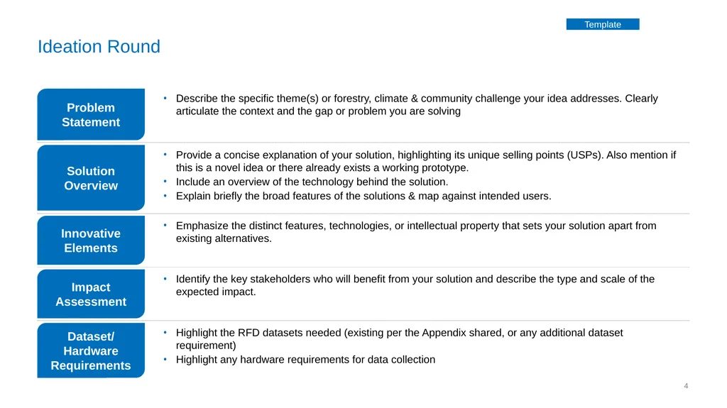
slide4. Ideation Round Problem Statement Solution Overview Describe the specific theme(s) or forestry, climate & community challenge your idea addresses. Clearly articulate the context and the gap or problem you are solving Provide a concise explanation of your solution, highlighting its unique selling points (USPs). Also mention if this is a novel idea or there already exists a working prototype.
Include an overview of the technology behind the solution.
Explain briefly the broad features of the solutions & map against intended users. Dataset/ Hardware Requirements Innovative Elements Impact Assessment Highlight the RFD datasets needed (existing per the Appendix shared, or any additional dataset requirement)
Highlight any hardware requirements for data collection Emphasize the distinct features, technologies, or intellectual property that sets your solution apart from existing alternatives. Identify the key stakeholders who will benefit from your solution and describe the type and scale of the expected impact. Template<br>
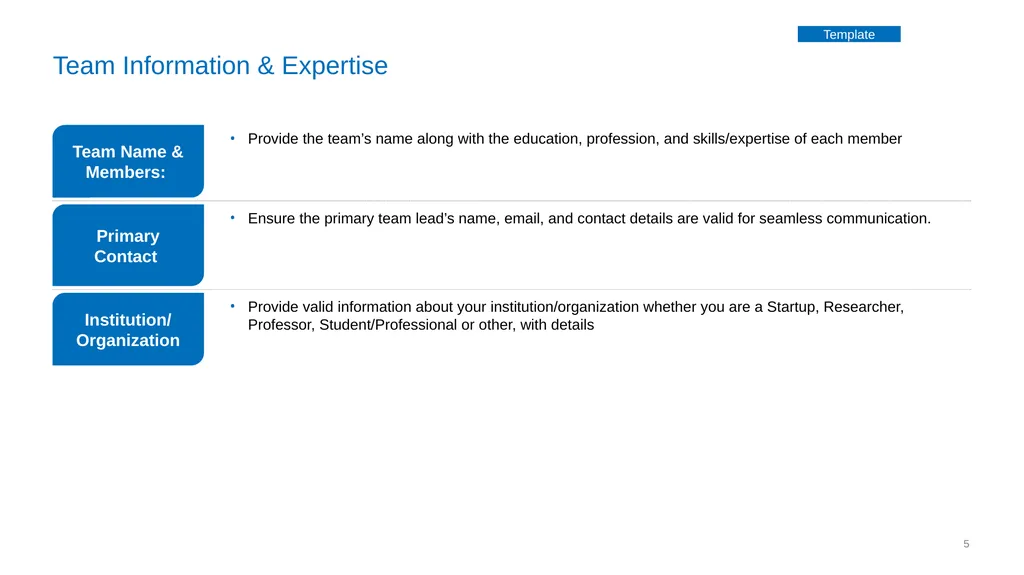
slide5. Team Information & Expertise Team Name & Members: Primary Contact Provide the team’s name along with the education, profession, and skills/expertise of each member Ensure the primary team lead’s name, email, and contact details are valid for seamless communication. Institution/ Organization Provide valid information about your institution/organization whether you are a Startup, Researcher, Professor, Student/Professional or other, with details Template<br>
slide6. Illustrative template Template for submission Agenda<br>
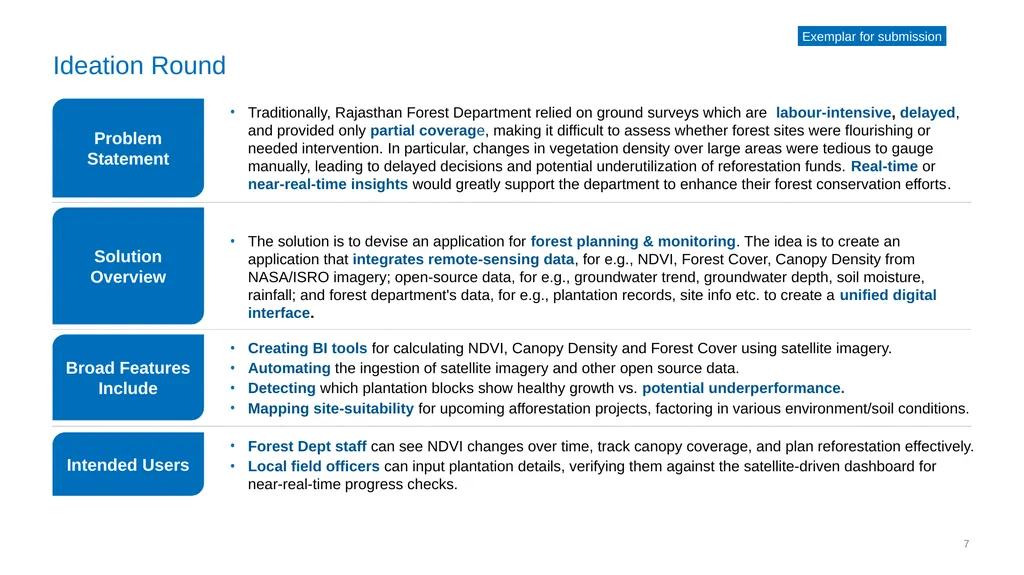
slide7. Ideation Round Problem Statement Solution Overview Traditionally, Rajasthan Forest Department relied on ground surveys which are labour-intensive, delayed, and provided only partial coverage, making it difficult to assess whether forest sites were flourishing or needed intervention. In particular, changes in vegetation density over large areas were tedious to gauge manually, leading to delayed decisions and potential underutilization of reforestation funds. Real-time or near-real-time insights would greatly support the department to enhance their forest conservation efforts. The solution is to devise an application for forest planning & monitoring. The idea is to create an application that integrates remote-sensing data, for e.g., NDVI, Forest Cover, Canopy Density from NASA/ISRO imagery; open-source data, for e.g., groundwater trend, groundwater depth, soil moisture, rainfall; and forest department's data, for e.g., plantation records, site info etc. to create a unified digital interface. Broad Features Include Intended Users Forest Dept staff can see NDVI changes over time, track canopy coverage, and plan reforestation effectively.
Local field officers can input plantation details, verifying them against the satellite-driven dashboard for near-real-time progress checks. Creating BI tools for calculating NDVI, Canopy Density and Forest Cover using satellite imagery.
Automating the ingestion of satellite imagery and other open source data.
Detecting which plantation blocks show healthy growth vs. potential underperformance.
Mapping site-suitability for upcoming afforestation projects, factoring in various environment/soil conditions. Exemplar for submission<br>
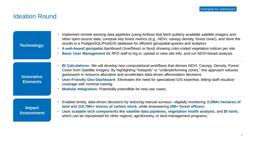
slide8. Ideation Round Technology: Innovative Elements Implement remote-sensing data pipelines (using Airflow) that fetch publicly available satellite imagery and other open-source data, compute key forest metrics (e.g., NDVI, canopy density, forest cover), and store the results in a PostgreSQL/PostGIS database for efficient geospatial queries and analytics
A web-based geospatial dashboard (Vue/React or Nuxt) showing color-coded vegetation indices per site.
Basic User Management for RFD staff to log in, upload or view site info, and run NDVI-based analysis. BI Calculations: We will develop new computational workflows that derives NDVI, Canopy, Density, Forest Cover from Satellite Imagery. By highlighting “hotspots” or “underperforming zones,” this approach reduces guesswork in resource allocation and accelerates data-driven afforestation decisions
User-Friendly Geo-Dashboard: Eliminates the need for specialized GIS expertise, letting staff visualize coverage with minimal training.
Modular Integration: Potentially extendible for new use cases. Impact Assessment Enables timely, data-driven decisions by reducing manual surveys—digitally monitoring 3.29Mn hectares of land and 110.7Mn+ tonnes of carbon stock, while empowering 285+ forest officers.
Uses scalable tech components like satellite data pipelines, vegetation health analysis, and BI tools, which can be repurposed for other regions, agroforestry, or land management programs. Exemplar for submission<br>
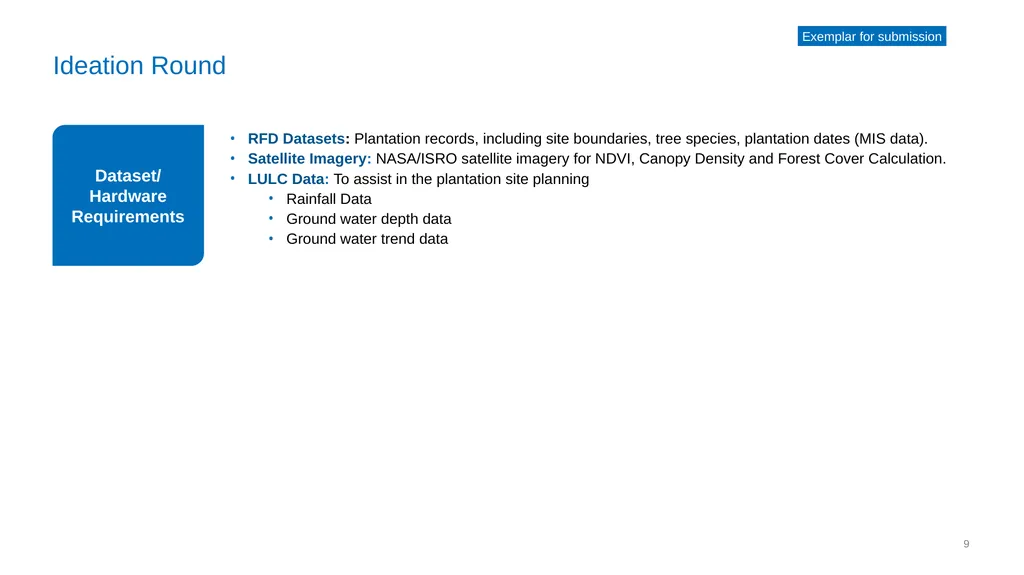
slide9. Ideation Round Dataset/ Hardware Requirements RFD Datasets: Plantation records, including site boundaries, tree species, plantation dates (MIS data).
Satellite Imagery: NASA/ISRO satellite imagery for NDVI, Canopy Density and Forest Cover Calculation.
LULC Data: To assist in the plantation site planning
Rainfall Data
Ground water depth data
Ground water trend data Exemplar for submission<br>
slide10. Thank you<br>
Round 1 Submission
TEAM NAME<br>
slide2. Illustrative template Template for submission Agenda<br>
slide3. Illustrative template Template for submission Agenda<br>
slide4. Ideation Round Problem Statement Solution Overview Describe the specific theme(s) or forestry, climate & community challenge your idea addresses. Clearly articulate the context and the gap or problem you are solving Provide a concise explanation of your solution, highlighting its unique selling points (USPs). Also mention if this is a novel idea or there already exists a working prototype.
Include an overview of the technology behind the solution.
Explain briefly the broad features of the solutions & map against intended users. Dataset/ Hardware Requirements Innovative Elements Impact Assessment Highlight the RFD datasets needed (existing per the Appendix shared, or any additional dataset requirement)
Highlight any hardware requirements for data collection Emphasize the distinct features, technologies, or intellectual property that sets your solution apart from existing alternatives. Identify the key stakeholders who will benefit from your solution and describe the type and scale of the expected impact. Template<br>
slide5. Team Information & Expertise Team Name & Members: Primary Contact Provide the team’s name along with the education, profession, and skills/expertise of each member Ensure the primary team lead’s name, email, and contact details are valid for seamless communication. Institution/ Organization Provide valid information about your institution/organization whether you are a Startup, Researcher, Professor, Student/Professional or other, with details Template<br>
slide6. Illustrative template Template for submission Agenda<br>
slide7. Ideation Round Problem Statement Solution Overview Traditionally, Rajasthan Forest Department relied on ground surveys which are labour-intensive, delayed, and provided only partial coverage, making it difficult to assess whether forest sites were flourishing or needed intervention. In particular, changes in vegetation density over large areas were tedious to gauge manually, leading to delayed decisions and potential underutilization of reforestation funds. Real-time or near-real-time insights would greatly support the department to enhance their forest conservation efforts. The solution is to devise an application for forest planning & monitoring. The idea is to create an application that integrates remote-sensing data, for e.g., NDVI, Forest Cover, Canopy Density from NASA/ISRO imagery; open-source data, for e.g., groundwater trend, groundwater depth, soil moisture, rainfall; and forest department's data, for e.g., plantation records, site info etc. to create a unified digital interface. Broad Features Include Intended Users Forest Dept staff can see NDVI changes over time, track canopy coverage, and plan reforestation effectively.
Local field officers can input plantation details, verifying them against the satellite-driven dashboard for near-real-time progress checks. Creating BI tools for calculating NDVI, Canopy Density and Forest Cover using satellite imagery.
Automating the ingestion of satellite imagery and other open source data.
Detecting which plantation blocks show healthy growth vs. potential underperformance.
Mapping site-suitability for upcoming afforestation projects, factoring in various environment/soil conditions. Exemplar for submission<br>
slide8. Ideation Round Technology: Innovative Elements Implement remote-sensing data pipelines (using Airflow) that fetch publicly available satellite imagery and other open-source data, compute key forest metrics (e.g., NDVI, canopy density, forest cover), and store the results in a PostgreSQL/PostGIS database for efficient geospatial queries and analytics
A web-based geospatial dashboard (Vue/React or Nuxt) showing color-coded vegetation indices per site.
Basic User Management for RFD staff to log in, upload or view site info, and run NDVI-based analysis. BI Calculations: We will develop new computational workflows that derives NDVI, Canopy, Density, Forest Cover from Satellite Imagery. By highlighting “hotspots” or “underperforming zones,” this approach reduces guesswork in resource allocation and accelerates data-driven afforestation decisions
User-Friendly Geo-Dashboard: Eliminates the need for specialized GIS expertise, letting staff visualize coverage with minimal training.
Modular Integration: Potentially extendible for new use cases. Impact Assessment Enables timely, data-driven decisions by reducing manual surveys—digitally monitoring 3.29Mn hectares of land and 110.7Mn+ tonnes of carbon stock, while empowering 285+ forest officers.
Uses scalable tech components like satellite data pipelines, vegetation health analysis, and BI tools, which can be repurposed for other regions, agroforestry, or land management programs. Exemplar for submission<br>
slide9. Ideation Round Dataset/ Hardware Requirements RFD Datasets: Plantation records, including site boundaries, tree species, plantation dates (MIS data).
Satellite Imagery: NASA/ISRO satellite imagery for NDVI, Canopy Density and Forest Cover Calculation.
LULC Data: To assist in the plantation site planning
Rainfall Data
Ground water depth data
Ground water trend data Exemplar for submission<br>
slide10. Thank you<br>