
FRPA 101-E3 Riparian Management Standards Region





















Description: FRPA 101-E3 Riparian Management Standards Region III Agenda Background, history, and intent Types of riparian standards Riparian areas by landowner Allowed uses in riparian areas Other riparian area BMPs Variations from riparian standards
Related Topics
Download Presentation
"FRPA 101-E3 Riparian Management Standards Region" is the property of its rightful owner. Permission is granted to download and print the materials on this website for personal, non-commercial use only, and to display it on your personal computer provided you do not modify the materials and that you retain all copyright notices contained in the materials. By downloading content from our website, you accept the terms of this agreement.
Presentation Transcript
slide1. FRPA 101-E3
Riparian Management Standards
Region III<br>
slide2. Agenda Background, history, and intent
Types of riparian standards
Riparian areas by landowner
Allowed uses in riparian areas
Other riparian area BMPs
Variations from riparian standards<br>
slide3. Background<br>
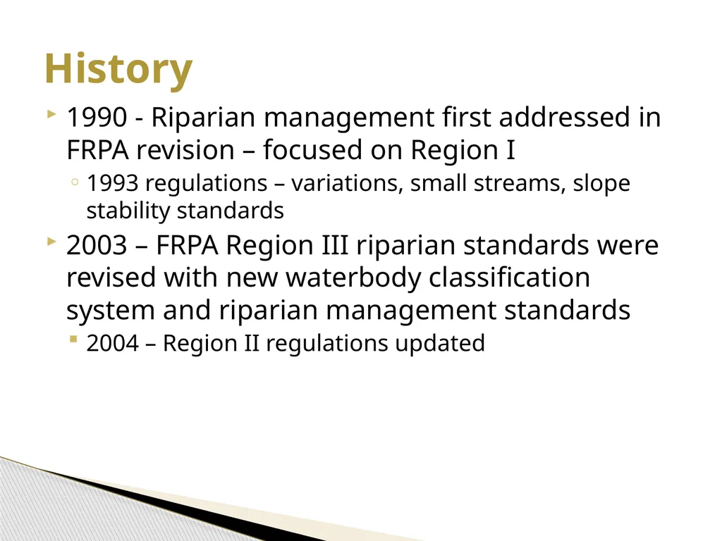
slide4. 1990 - Riparian management first addressed in FRPA revision – focused on Region I
1993 regulations – variations, small streams, slope stability standards
2003 – FRPA Region III riparian standards were revised with new waterbody classification system and riparian management standards
2004 – Region II regulations updated History<br>
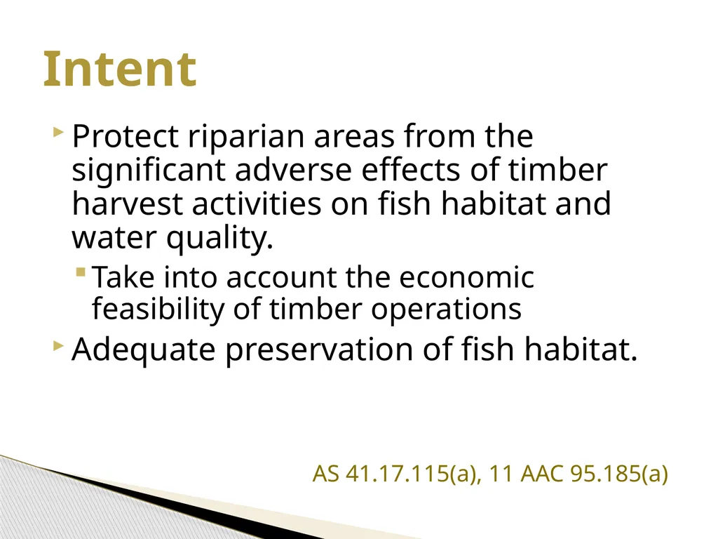
slide5. Protect riparian areas from the significant adverse effects of timber harvest activities on fish habitat and water quality.
Take into account the economic feasibility of timber operations
Adequate preservation of fish habitat.
AS 41.17.115(a), 11 AAC 95.185(a) Intent<br>
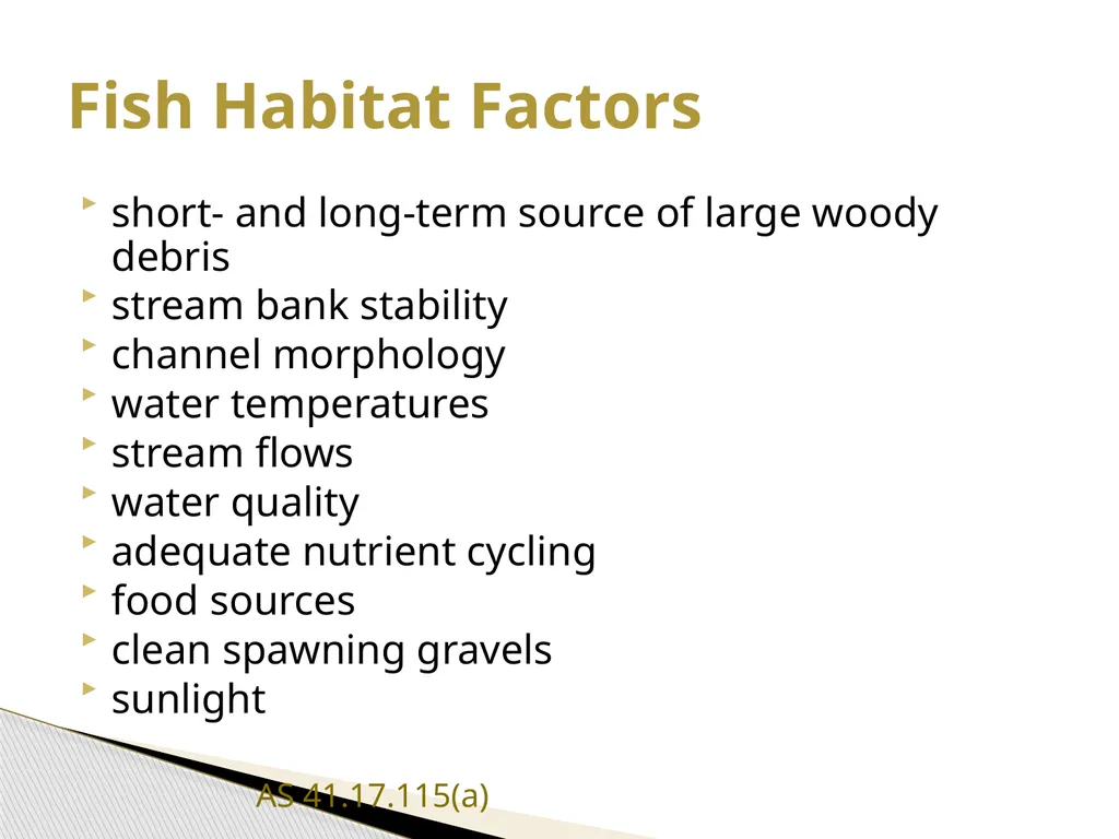
slide6. short‑ and long‑term source of large woody debris
stream bank stability
channel morphology
water temperatures
stream flows
water quality
adequate nutrient cycling
food sources
clean spawning gravels
sunlight
AS 41.17.115(a) Fish Habitat Factors<br>
slide8. On private land: the areas subject to riparian protection standards in AS 41.17.116(c)
On state and other public land: the area 100’ from the shore or bank of an anadromous or high value resident fish water body (AS 41.17.118(a)(3)
AS 41.17.950 (23)(A),(C) Definition: Riparian area - Region III<br>
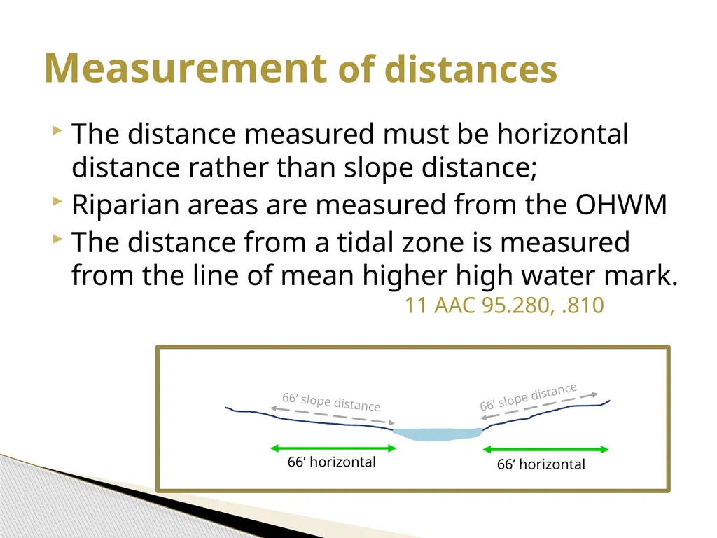
slide9. 66’ horizontal 66’ horizontal 66’ slope distance 66’ slope distance Measurement of distances The distance measured must be horizontal distance rather than slope distance;
Riparian areas are measured from the OHWM
The distance from a tidal zone is measured from the line of mean higher high water mark. 11 AAC 95.280, .810<br>
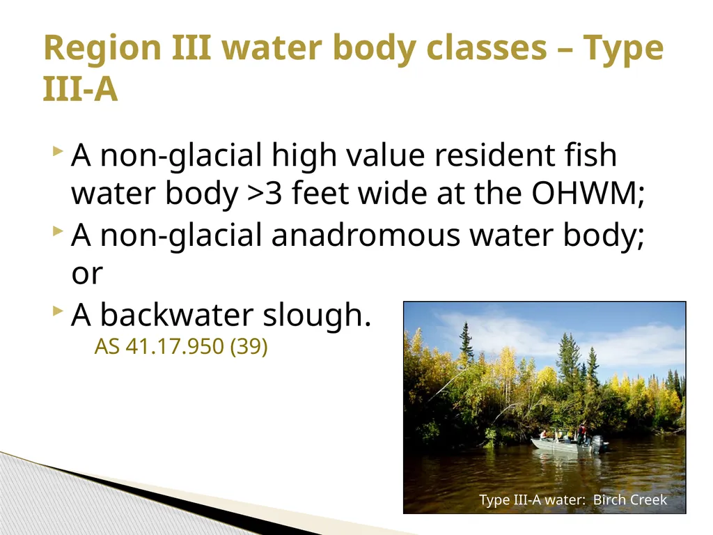
slide10. A non-glacial high value resident fish water body >3 feet wide at the OHWM;
A non-glacial anadromous water body; or
A backwater slough. AS 41.17.950 (39) Region III water body classes – Type III-A Type III-A water: Birch Creek<br>
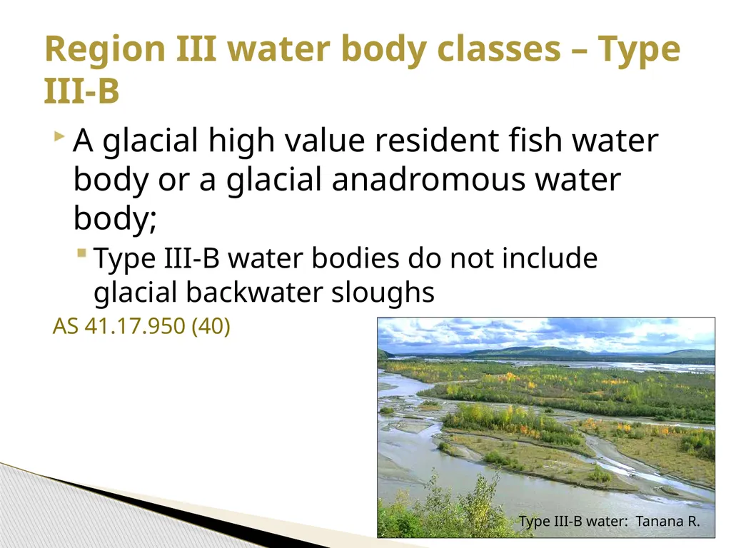
slide11. A glacial high value resident fish water body or a glacial anadromous water body;
Type III-B water bodies do not include glacial backwater sloughs
AS 41.17.950 (40) Region III water body classes – Type III-B Type III-B water: Tanana R.<br>
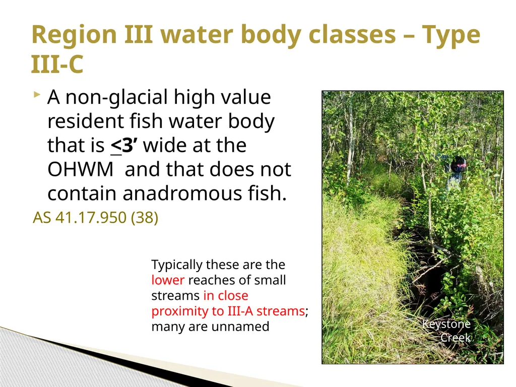
slide12. A non-glacial high value resident fish water body that is <3’ wide at the OHWM and that does not contain anadromous fish.
AS 41.17.950 (38) Region III water body classes – Type III-C Typically these are the lower reaches of small streams in close proximity to III-A streams; many are unnamed Keystone Creek<br>
slide13. Riparian standards<br>
slide14. DPO information
No-cut buffer
Special management zone
Maintain important fish and wildlife habitat
Other riparian BMPs Types of standards<br>
slide15. DPOs must include:
The location and classification of known surface waters adjacent to or within harvest units
Any request for variation from riparian standards
11 AAC 95.220(5)(A),(14),.235 DPOs<br>
slide16. Private lands<br>
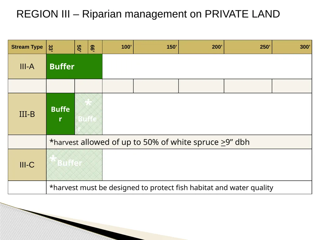
slide17. No timber harvest of timber within 66’ of the water body
AS 41.17.116 (c)(1) Type III-A .<br>
slide18. No timber harvest within 33’ of the water body;
Between 33’ and 66’ from the water body, up to 50% of standing white spruce trees >9” DBH may be harvested without requiring a variation;
AS 41.17.116 (c)(2) Type III-B<br>
slide19. Harvest of timber within 100’ of the water body must be located and designed primarily to protect fish habitat and surface water quality as determined by DNR with due deference to ADF&G.
AS 41.17.116 (c)(3) Type III-C:<br>
slide20. State & other public land<br>
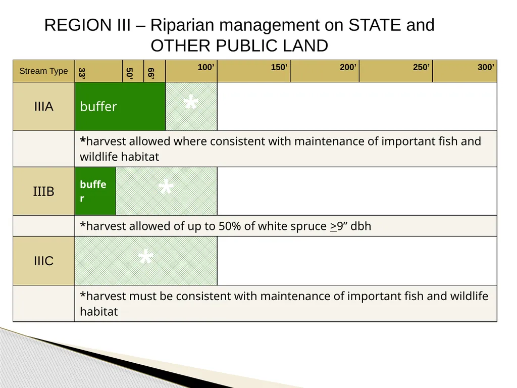
slide21. No timber harvest within 100’ of the water body;
However, between 66’ and 100’ from the water body, harvest of timber may be undertaken where consistent with the maintenance of important fish and wildlife habitat as determined by DNR with the concurrence of ADF&G
AS 41.17.118 (a)(3)(A), .119(3) Type III-A .<br>
slide22. No timber harvest within 50’ of the water body;
Between 50’ and 100’ from the water body, up to 50% of standing white spruce trees >9” DBH may be harvested without requiring a variation;
AS 41.17.118 (a)(3)(B), .119(3) Type III-B<br>
slide23. Harvest of timber within 100’ of the water body must be consistent with the maintenance of important fish and wildlife habitat as determined by DNR with due deference to ADF&G
AS 41.17.118 (a)(3)(B), .119(3) Type III-C:<br>
slide24. DNR area and management plans (adopted under AS 38.04.065) may impose additional riparian protection standards for timber harvest operations
On legislatively designated State Forests, riparian standards adopted by DNR may not exceed the FRPA standards unless the commissioner makes a finding of “compelling state interest.”
AS 41.17.118(b) Planning on state land Bristol Bay AP Tanana Valley SFMP
E. Tanana AP Upper Yukon AP
Kuskokwim AP Yukon-Tanana AP
Northwest AP Eastern Tanana AP<br>
slide25. REGION III – Riparian management on PRIVATE LAND<br>
slide26. REGION III – Riparian management on STATE and OTHER PUBLIC LAND<br>
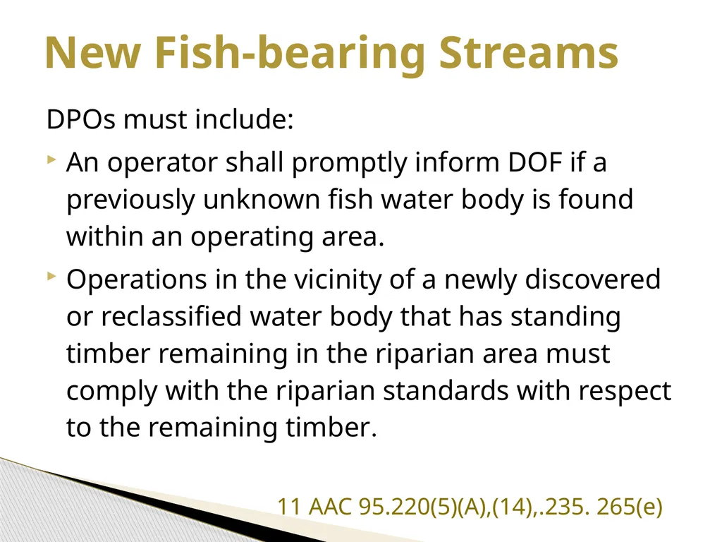
slide27. DPOs must include:
An operator shall promptly inform DOF if a previously unknown fish water body is found within an operating area.
Operations in the vicinity of a newly discovered or reclassified water body that has standing timber remaining in the riparian area must comply with the riparian standards with respect to the remaining timber.
11 AAC 95.220(5)(A),(14),.235. 265(e) New Fish-bearing Streams<br>
slide28. Allowed uses in riparian areas<br>
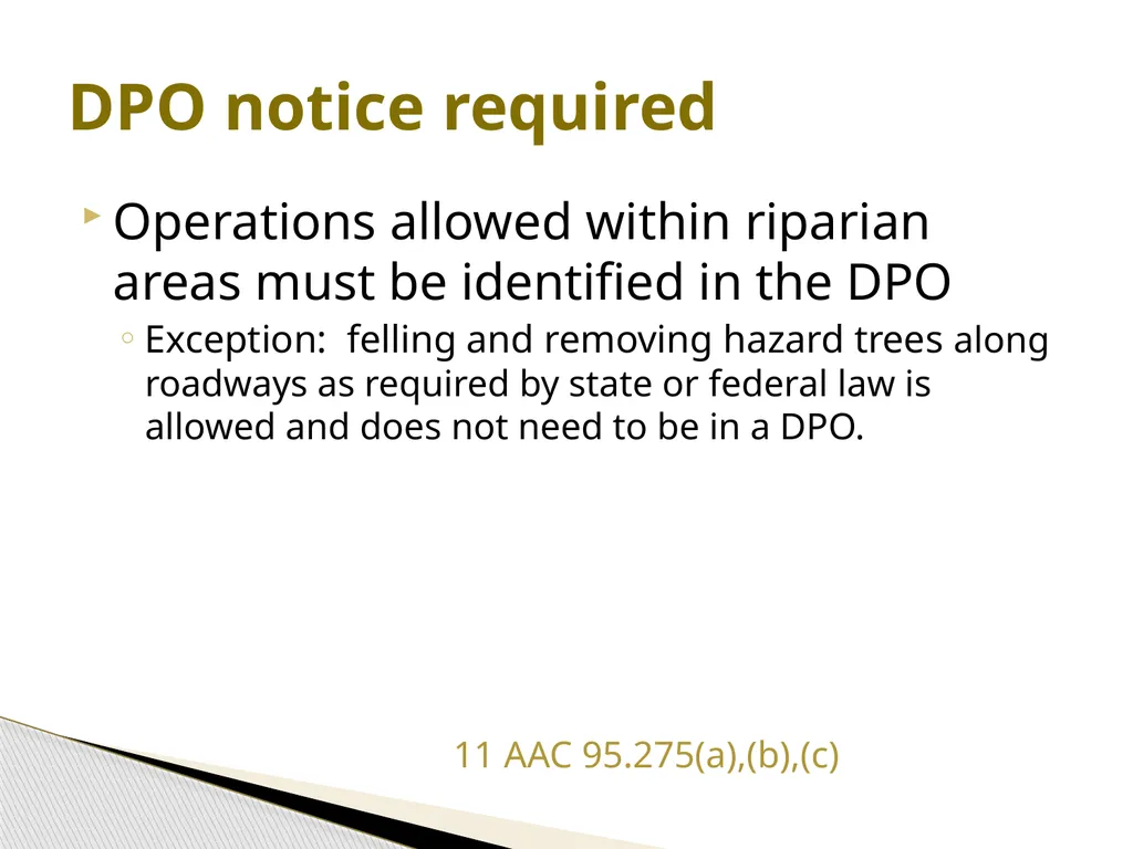
slide29. Operations allowed within riparian areas must be identified in the DPO
Exception: felling and removing hazard trees along roadways as required by state or federal law is allowed and does not need to be in a DPO.
11 AAC 95.275(a),(b),(c) DPO notice required<br>
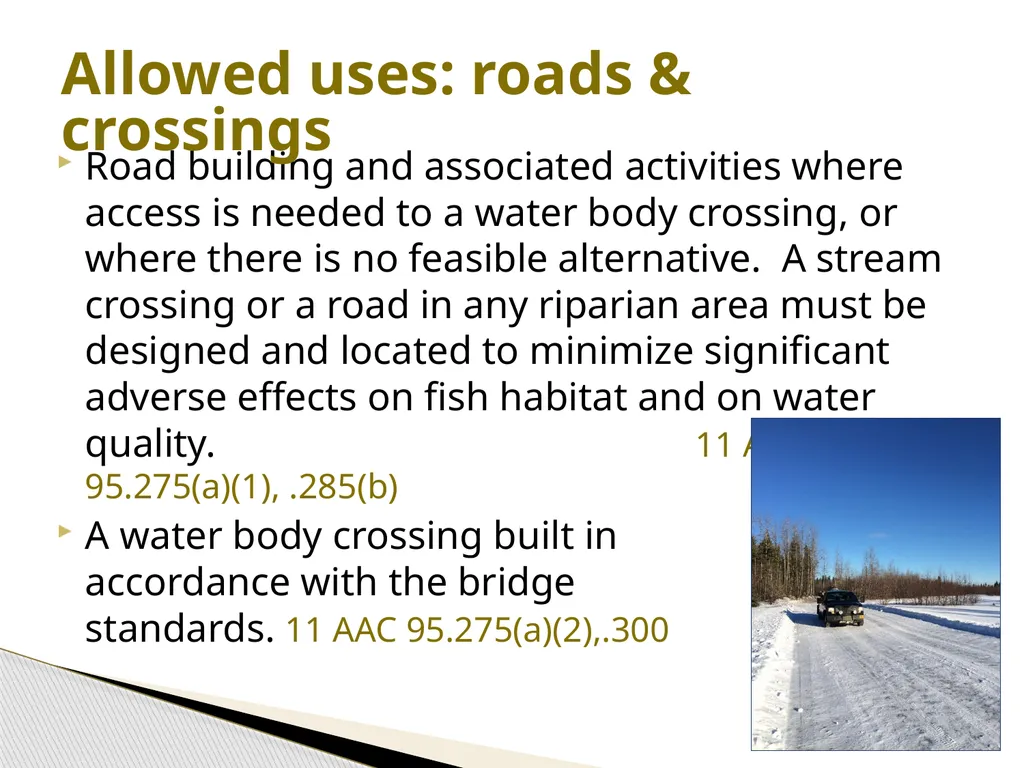
slide30. Road building and associated activities where access is needed to a water body crossing, or where there is no feasible alternative. A stream crossing or a road in any riparian area must be designed and located to minimize significant adverse effects on fish habitat and on water quality. 11 AAC 95.275(a)(1), .285(b)
A water body crossing built in accordance with the bridge standards. 11 AAC 95.275(a)(2),.300 Allowed uses: roads & crossings<br>
slide31. Locating material extraction sites in braided, glacial floodplains in accordance with the regulations for material extraction and disposal sites (11 AAC 95.325); sites must be identified in a DPO.
Installing blocks, or similar devices on a tree required for retention under this chapter if the device is installed to minimize damage to the tree.
11 AAC 95.275(a)(4),(5) Allowed uses: materials, blocks<br>
slide32. The use, as lift trees or tail holds, of trees required for retention under this chapter
Hanging of rigging through the riparian area if necessary to be consistent with operator safety requirements and to have a clear line of sight and working area for the rigging
On state and other public land, yarding corridors and other logging methods that do not cause a significant adverse impact to the riparian habitat
11 AAC 95.275(a)(6)-(8) Allowed uses: lifts, rigging, yarding<br>
slide33. Other riparian BMPs Note: There are additional BMPs in the following sections. This presentation includes only those subsections specific to riparian areas.<br>
slide34. If feasible, an operator may not fell a tree into a riparian timber retention area.
See also the purple book section on 11 AAC 95.355(e)(1) for compliance monitoring procedures
11AAC 95.355(e) Felling and bucking<br>
slide35. Where a riparian timber retention area abuts or is within a harvest unit, mark the limits of the riparian retention area before harvest begins.
Each marking must be visible from adjacent markings;
Marking with flagging, painting, or another identification system.
11AAC95.270 (a),(b) Marking riparian areas<br>
slide36. Mark while the area is free of snow cover that would prevent accuracy, unless a water body is large, incised, or otherwise identifiable when under snow cover.
A tree on a riparian retention area boundary is in the retention area if >50% of the diameter of the bole of the tree is in the riparian retention area as measured at 4-1/2’ feet above the ground or at the top of the root collar, whichever is higher.
11AAC95.270 (c),(d) Marking riparian areas, cont.<br>
slide37. Any discharge of explosives in riparian areas in Region III requires a variation.
11 AAC 95.235, .335(a)(2) Blasting<br>
slide38. In a riparian area, where feasible and necessary, leave high stumps to prevent felled and bucked timber from entering surface waters.
See also the purple book section on 11 AAC 95.350(c) for objectives and compliance monitoring procedures
11 AAC 95.350(c) Bank integrity<br>
slide39. When yarding in or near a riparian area, an operator shall make an effort to minimize soil disturbance and to prevent logs from rolling into surface waters or the riparian area.
See also the purple book section on 11 AAC 95.360(c)(4) for objectives and compliance monitoring procedures
11 AAC 95.360(c)(4) Cable yarding<br>
slide40. Partially or fully suspend logs when yarding.
Select landings to minimize side-hill yarding near the stream or riparian area (e.g., position landings so logs are yarded uphill and away from the stream as much as possible).
Do not locate landings near an incised stream, especially when yarding downhill. A high lead system has limited suspension capabilities.
See also the purple book section on 11 AAC 95.360(c)(4) for objectives and compliance monitoring procedures Cable yarding<br>
slide41. In riparian areas:
Minimize the number of skidding routes
Consistent with good safety practices, log skidding must minimize damage to retained trees, stumps, root systems, understory vegetation, and soils; and
Use one-end suspension of logs.
11 AAC 95.365(b) Tracked & wheeled systems<br>
slide42. Shovel yarding rarely requires a skid trail in the riparian area. Where feasible, position the shovel outside the riparian area and reach into the area to remove the log. Fell and buck trees within a riparian area so any log segment is reachable from outside the riparian area
An operator should be able to lift logs and swing them out of the riparian area with a very little disturbance.
On very wet sites, conduct yarding when the ground is frozen.
Purple book section re 11 AAC 95.365(b) Tracked & wheeled systems<br>
slide43. When slash is disposed of by burning, protect a riparian area from fire, and burn under weather conditions that minimize the chance of air quality degradation and fire escape.
11 AAC 95.370(b) Slash burning<br>
slide44. Variations<br>
slide45. A forest landowner, timber owner, or operator may propose a variation to allow harvesting of specific trees within a riparian area.
DOF shall agree to the proposed variation if it determines that the harm intended to be avoided by the requirement
is not likely to occur because of site‑specific circumstances, and
is not likely to cause significant harm to fish habitat or water quality
AS 41.17.087
AS 41.17.087 Variations<br>
slide46. If DOF does not agree to the proposed variation, the owner or operator may appeal to the DNR commissioner. Appellants must conform to the requirement while the appeal is pending.
DNR shall give due deference to ADF&G and DEC for variation determinations
AS 41.17.087 Variations: appeals & due deference<br>
slide47. DOF will consider the impact of the variation harvest on non-merchantable trees within the riparian retention area, and may condition and document a variation authorization to protect non-merchantable trees that are important to maintain fish habitat and water quality.
11 AAC 95.235(d) Variations: conditions<br>
slide48. Include the following information in DPO:
A map at 1:12,000 scale or finer that clearly shows the water body and the approximate location of the requested trees;
The length of reach along which the variation trees are requested;
The water body classification and average channel width of the reach along which the variation trees are requested;
A description of the species and the DBH range of the trees requested for harvesting;
11 AAC 95.220(14)(B) Region III variations: DPO<br>
slide49. The minimum distance from OHWM to the proposed variation harvest; and
The percentage of trees >9” DBH within the reach for which any variation is sought that the operator is requesting to harvest, and that were harvested under a prior variation request, if any.
11 AAC 95.220(14)(B) Region III variations: DPO, cont.<br>
slide50. QUESTIONS?<br>
slide51. Addenda Key to classification system
Examples of stream types<br>
slide52. Does the waterbody have anadromous or high value resident fish at least seasonally? Is it a glacial water body other than a backwater slough? Is it a non-glacial stream <3’ wide at OHWM with HVR but not anadrmous fish? Type III-C: Small HVR streams Type III-B: Glacial waters other than backwater sloughs Type III-A: Non-glacial HVR waters >3’ wide, non-glacial anadromous waters, & backwater sloughs Other surface waters Key to Region III waterbody classification No No No Yes Yes Yes<br>
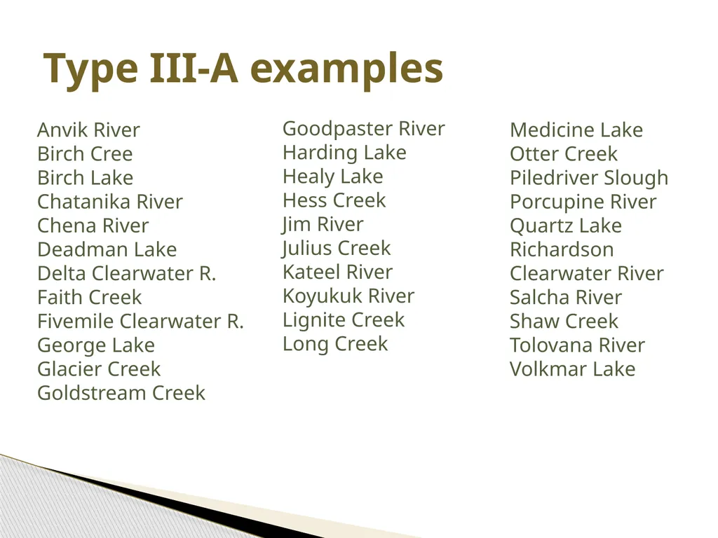
slide53. Type III-A examples Anvik River
Birch Cree
Birch Lake
Chatanika River
Chena River
Deadman Lake
Delta Clearwater R.
Faith Creek
Fivemile Clearwater R.
George Lake
Glacier Creek
Goldstream Creek Goodpaster River
Harding Lake
Healy Lake
Hess Creek
Jim River
Julius Creek
Kateel River
Koyukuk River
Lignite Creek
Long Creek Medicine Lake Otter Creek
Piledriver Slough
Porcupine River
Quartz Lake
Richardson Clearwater River
Salcha River
Shaw Creek
Tolovana River
Volkmar Lake<br>
slide54. Type III-A: Ex. backwater sloughs Totchaket Slough
Unnamed sloughs in the Chena system
Many unnamed backwaters along the Tanana River<br>
slide55. Chisana River
Kuskokwim River
Nenana River
Phelan Creek
Salchaket Slough
17-Mile Slough (Nenana)
Soldier Slough Type III-B examples Swan Neck Slough
Tanana River
Teklanika River
Tok River
Toklat River
Wood River
Yukon River<br>
slide2. Agenda Background, history, and intent
Types of riparian standards
Riparian areas by landowner
Allowed uses in riparian areas
Other riparian area BMPs
Variations from riparian standards<br>
slide3. Background<br>
slide4. 1990 - Riparian management first addressed in FRPA revision – focused on Region I
1993 regulations – variations, small streams, slope stability standards
2003 – FRPA Region III riparian standards were revised with new waterbody classification system and riparian management standards
2004 – Region II regulations updated History<br>
slide5. Protect riparian areas from the significant adverse effects of timber harvest activities on fish habitat and water quality.
Take into account the economic feasibility of timber operations
Adequate preservation of fish habitat.
AS 41.17.115(a), 11 AAC 95.185(a) Intent<br>
slide6. short‑ and long‑term source of large woody debris
stream bank stability
channel morphology
water temperatures
stream flows
water quality
adequate nutrient cycling
food sources
clean spawning gravels
sunlight
AS 41.17.115(a) Fish Habitat Factors<br>
slide8. On private land: the areas subject to riparian protection standards in AS 41.17.116(c)
On state and other public land: the area 100’ from the shore or bank of an anadromous or high value resident fish water body (AS 41.17.118(a)(3)
AS 41.17.950 (23)(A),(C) Definition: Riparian area - Region III<br>
slide9. 66’ horizontal 66’ horizontal 66’ slope distance 66’ slope distance Measurement of distances The distance measured must be horizontal distance rather than slope distance;
Riparian areas are measured from the OHWM
The distance from a tidal zone is measured from the line of mean higher high water mark. 11 AAC 95.280, .810<br>
slide10. A non-glacial high value resident fish water body >3 feet wide at the OHWM;
A non-glacial anadromous water body; or
A backwater slough. AS 41.17.950 (39) Region III water body classes – Type III-A Type III-A water: Birch Creek<br>
slide11. A glacial high value resident fish water body or a glacial anadromous water body;
Type III-B water bodies do not include glacial backwater sloughs
AS 41.17.950 (40) Region III water body classes – Type III-B Type III-B water: Tanana R.<br>
slide12. A non-glacial high value resident fish water body that is <3’ wide at the OHWM and that does not contain anadromous fish.
AS 41.17.950 (38) Region III water body classes – Type III-C Typically these are the lower reaches of small streams in close proximity to III-A streams; many are unnamed Keystone Creek<br>
slide13. Riparian standards<br>
slide14. DPO information
No-cut buffer
Special management zone
Maintain important fish and wildlife habitat
Other riparian BMPs Types of standards<br>
slide15. DPOs must include:
The location and classification of known surface waters adjacent to or within harvest units
Any request for variation from riparian standards
11 AAC 95.220(5)(A),(14),.235 DPOs<br>
slide16. Private lands<br>
slide17. No timber harvest of timber within 66’ of the water body
AS 41.17.116 (c)(1) Type III-A .<br>
slide18. No timber harvest within 33’ of the water body;
Between 33’ and 66’ from the water body, up to 50% of standing white spruce trees >9” DBH may be harvested without requiring a variation;
AS 41.17.116 (c)(2) Type III-B<br>
slide19. Harvest of timber within 100’ of the water body must be located and designed primarily to protect fish habitat and surface water quality as determined by DNR with due deference to ADF&G.
AS 41.17.116 (c)(3) Type III-C:<br>
slide20. State & other public land<br>
slide21. No timber harvest within 100’ of the water body;
However, between 66’ and 100’ from the water body, harvest of timber may be undertaken where consistent with the maintenance of important fish and wildlife habitat as determined by DNR with the concurrence of ADF&G
AS 41.17.118 (a)(3)(A), .119(3) Type III-A .<br>
slide22. No timber harvest within 50’ of the water body;
Between 50’ and 100’ from the water body, up to 50% of standing white spruce trees >9” DBH may be harvested without requiring a variation;
AS 41.17.118 (a)(3)(B), .119(3) Type III-B<br>
slide23. Harvest of timber within 100’ of the water body must be consistent with the maintenance of important fish and wildlife habitat as determined by DNR with due deference to ADF&G
AS 41.17.118 (a)(3)(B), .119(3) Type III-C:<br>
slide24. DNR area and management plans (adopted under AS 38.04.065) may impose additional riparian protection standards for timber harvest operations
On legislatively designated State Forests, riparian standards adopted by DNR may not exceed the FRPA standards unless the commissioner makes a finding of “compelling state interest.”
AS 41.17.118(b) Planning on state land Bristol Bay AP Tanana Valley SFMP
E. Tanana AP Upper Yukon AP
Kuskokwim AP Yukon-Tanana AP
Northwest AP Eastern Tanana AP<br>
slide25. REGION III – Riparian management on PRIVATE LAND<br>
slide26. REGION III – Riparian management on STATE and OTHER PUBLIC LAND<br>
slide27. DPOs must include:
An operator shall promptly inform DOF if a previously unknown fish water body is found within an operating area.
Operations in the vicinity of a newly discovered or reclassified water body that has standing timber remaining in the riparian area must comply with the riparian standards with respect to the remaining timber.
11 AAC 95.220(5)(A),(14),.235. 265(e) New Fish-bearing Streams<br>
slide28. Allowed uses in riparian areas<br>
slide29. Operations allowed within riparian areas must be identified in the DPO
Exception: felling and removing hazard trees along roadways as required by state or federal law is allowed and does not need to be in a DPO.
11 AAC 95.275(a),(b),(c) DPO notice required<br>
slide30. Road building and associated activities where access is needed to a water body crossing, or where there is no feasible alternative. A stream crossing or a road in any riparian area must be designed and located to minimize significant adverse effects on fish habitat and on water quality. 11 AAC 95.275(a)(1), .285(b)
A water body crossing built in accordance with the bridge standards. 11 AAC 95.275(a)(2),.300 Allowed uses: roads & crossings<br>
slide31. Locating material extraction sites in braided, glacial floodplains in accordance with the regulations for material extraction and disposal sites (11 AAC 95.325); sites must be identified in a DPO.
Installing blocks, or similar devices on a tree required for retention under this chapter if the device is installed to minimize damage to the tree.
11 AAC 95.275(a)(4),(5) Allowed uses: materials, blocks<br>
slide32. The use, as lift trees or tail holds, of trees required for retention under this chapter
Hanging of rigging through the riparian area if necessary to be consistent with operator safety requirements and to have a clear line of sight and working area for the rigging
On state and other public land, yarding corridors and other logging methods that do not cause a significant adverse impact to the riparian habitat
11 AAC 95.275(a)(6)-(8) Allowed uses: lifts, rigging, yarding<br>
slide33. Other riparian BMPs Note: There are additional BMPs in the following sections. This presentation includes only those subsections specific to riparian areas.<br>
slide34. If feasible, an operator may not fell a tree into a riparian timber retention area.
See also the purple book section on 11 AAC 95.355(e)(1) for compliance monitoring procedures
11AAC 95.355(e) Felling and bucking<br>
slide35. Where a riparian timber retention area abuts or is within a harvest unit, mark the limits of the riparian retention area before harvest begins.
Each marking must be visible from adjacent markings;
Marking with flagging, painting, or another identification system.
11AAC95.270 (a),(b) Marking riparian areas<br>
slide36. Mark while the area is free of snow cover that would prevent accuracy, unless a water body is large, incised, or otherwise identifiable when under snow cover.
A tree on a riparian retention area boundary is in the retention area if >50% of the diameter of the bole of the tree is in the riparian retention area as measured at 4-1/2’ feet above the ground or at the top of the root collar, whichever is higher.
11AAC95.270 (c),(d) Marking riparian areas, cont.<br>
slide37. Any discharge of explosives in riparian areas in Region III requires a variation.
11 AAC 95.235, .335(a)(2) Blasting<br>
slide38. In a riparian area, where feasible and necessary, leave high stumps to prevent felled and bucked timber from entering surface waters.
See also the purple book section on 11 AAC 95.350(c) for objectives and compliance monitoring procedures
11 AAC 95.350(c) Bank integrity<br>
slide39. When yarding in or near a riparian area, an operator shall make an effort to minimize soil disturbance and to prevent logs from rolling into surface waters or the riparian area.
See also the purple book section on 11 AAC 95.360(c)(4) for objectives and compliance monitoring procedures
11 AAC 95.360(c)(4) Cable yarding<br>
slide40. Partially or fully suspend logs when yarding.
Select landings to minimize side-hill yarding near the stream or riparian area (e.g., position landings so logs are yarded uphill and away from the stream as much as possible).
Do not locate landings near an incised stream, especially when yarding downhill. A high lead system has limited suspension capabilities.
See also the purple book section on 11 AAC 95.360(c)(4) for objectives and compliance monitoring procedures Cable yarding<br>
slide41. In riparian areas:
Minimize the number of skidding routes
Consistent with good safety practices, log skidding must minimize damage to retained trees, stumps, root systems, understory vegetation, and soils; and
Use one-end suspension of logs.
11 AAC 95.365(b) Tracked & wheeled systems<br>
slide42. Shovel yarding rarely requires a skid trail in the riparian area. Where feasible, position the shovel outside the riparian area and reach into the area to remove the log. Fell and buck trees within a riparian area so any log segment is reachable from outside the riparian area
An operator should be able to lift logs and swing them out of the riparian area with a very little disturbance.
On very wet sites, conduct yarding when the ground is frozen.
Purple book section re 11 AAC 95.365(b) Tracked & wheeled systems<br>
slide43. When slash is disposed of by burning, protect a riparian area from fire, and burn under weather conditions that minimize the chance of air quality degradation and fire escape.
11 AAC 95.370(b) Slash burning<br>
slide44. Variations<br>
slide45. A forest landowner, timber owner, or operator may propose a variation to allow harvesting of specific trees within a riparian area.
DOF shall agree to the proposed variation if it determines that the harm intended to be avoided by the requirement
is not likely to occur because of site‑specific circumstances, and
is not likely to cause significant harm to fish habitat or water quality
AS 41.17.087
AS 41.17.087 Variations<br>
slide46. If DOF does not agree to the proposed variation, the owner or operator may appeal to the DNR commissioner. Appellants must conform to the requirement while the appeal is pending.
DNR shall give due deference to ADF&G and DEC for variation determinations
AS 41.17.087 Variations: appeals & due deference<br>
slide47. DOF will consider the impact of the variation harvest on non-merchantable trees within the riparian retention area, and may condition and document a variation authorization to protect non-merchantable trees that are important to maintain fish habitat and water quality.
11 AAC 95.235(d) Variations: conditions<br>
slide48. Include the following information in DPO:
A map at 1:12,000 scale or finer that clearly shows the water body and the approximate location of the requested trees;
The length of reach along which the variation trees are requested;
The water body classification and average channel width of the reach along which the variation trees are requested;
A description of the species and the DBH range of the trees requested for harvesting;
11 AAC 95.220(14)(B) Region III variations: DPO<br>
slide49. The minimum distance from OHWM to the proposed variation harvest; and
The percentage of trees >9” DBH within the reach for which any variation is sought that the operator is requesting to harvest, and that were harvested under a prior variation request, if any.
11 AAC 95.220(14)(B) Region III variations: DPO, cont.<br>
slide50. QUESTIONS?<br>
slide51. Addenda Key to classification system
Examples of stream types<br>
slide52. Does the waterbody have anadromous or high value resident fish at least seasonally? Is it a glacial water body other than a backwater slough? Is it a non-glacial stream <3’ wide at OHWM with HVR but not anadrmous fish? Type III-C: Small HVR streams Type III-B: Glacial waters other than backwater sloughs Type III-A: Non-glacial HVR waters >3’ wide, non-glacial anadromous waters, & backwater sloughs Other surface waters Key to Region III waterbody classification No No No Yes Yes Yes<br>
slide53. Type III-A examples Anvik River
Birch Cree
Birch Lake
Chatanika River
Chena River
Deadman Lake
Delta Clearwater R.
Faith Creek
Fivemile Clearwater R.
George Lake
Glacier Creek
Goldstream Creek Goodpaster River
Harding Lake
Healy Lake
Hess Creek
Jim River
Julius Creek
Kateel River
Koyukuk River
Lignite Creek
Long Creek Medicine Lake Otter Creek
Piledriver Slough
Porcupine River
Quartz Lake
Richardson Clearwater River
Salcha River
Shaw Creek
Tolovana River
Volkmar Lake<br>
slide54. Type III-A: Ex. backwater sloughs Totchaket Slough
Unnamed sloughs in the Chena system
Many unnamed backwaters along the Tanana River<br>
slide55. Chisana River
Kuskokwim River
Nenana River
Phelan Creek
Salchaket Slough
17-Mile Slough (Nenana)
Soldier Slough Type III-B examples Swan Neck Slough
Tanana River
Teklanika River
Tok River
Toklat River
Wood River
Yukon River<br>