
GNSS data from receiver to processing input M. A.


Description: GNSS data from receiver to processing input M. A. Floyd T. A. Herring Massachusetts Institute of Technology, Cambridge, MA, USA GNSS Data Processing and Analysis with GAMITGLOBK and track UNAVCO Headquarters, Boulder, Colorado, USA 2428
Related Topics
Download Presentation
"GNSS data from receiver to processing input M. A." is the property of its rightful owner. Permission is granted to download and print the materials on this website for personal, non-commercial use only, and to display it on your personal computer provided you do not modify the materials and that you retain all copyright notices contained in the materials. By downloading content from our website, you accept the terms of this agreement.
Presentation Transcript
slide1. GNSS data from receiver
to processing input M. A. Floyd T. A. Herring
Massachusetts Institute of Technology, Cambridge, MA, USA
GNSS Data Processing and Analysis with GAMIT/GLOBK and track UNAVCO Headquarters, Boulder, Colorado, USA 24–28 August 2020
http://geoweb.mit.edu/~floyd/courses/gg/202008_UNAVCO/
Material from R. W. King, T. A. Herring, M. A. Floyd (MIT) and S. C. McClusky (now at ANU)<br>
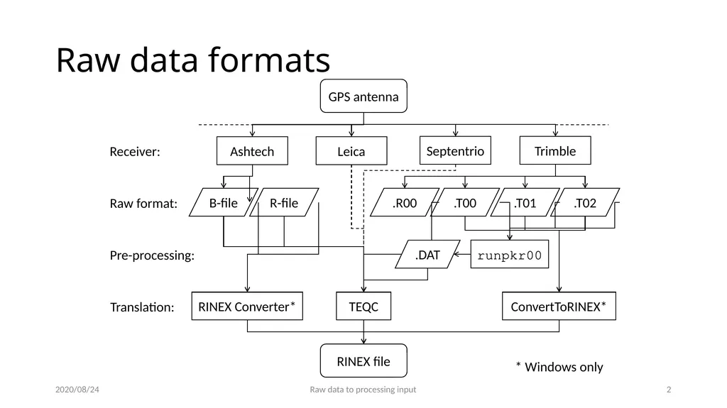
slide2. Raw data formats 2020/08/24 Raw data to processing input 1 Receiver: Raw format: GPS antenna RINEX file Pre-processing: Ashtech Leica Septentrio Trimble B-file R-file .R00 .T02 .T01 .T00 Translation: runpkr00 TEQC RINEX Converter* ConvertToRINEX* * Windows only .DAT<br>
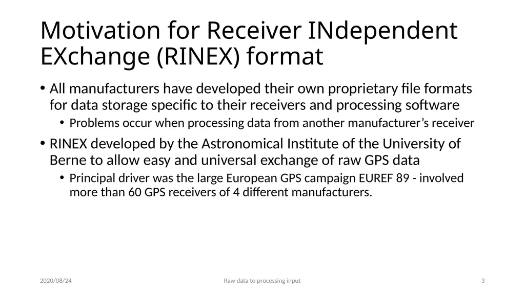
slide3. Motivation for Receiver INdependent EXchange (RINEX) format All manufacturers have developed their own proprietary file formats for data storage specific to their receivers and processing software
Problems occur when processing data from another manufacturer’s receiver
RINEX developed by the Astronomical Institute of the University of Berne to allow easy and universal exchange of raw GPS data
Principal driver was the large European GPS campaign EUREF 89 - involved more than 60 GPS receivers of 4 different manufacturers. 2020/08/24 Raw data to processing input 2<br>
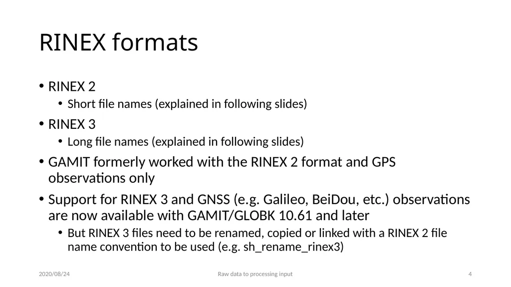
slide4. RINEX formats RINEX 2
Short file names (explained in following slides)
RINEX 3
Long file names (explained in following slides)
GAMIT formerly worked with the RINEX 2 format and GPS observations only
Support for RINEX 3 and GNSS (e.g. Galileo, BeiDou, etc.) observations are now available with GAMIT/GLOBK 10.61 and later
But RINEX 3 files need to be renamed, copied or linked with a RINEX 2 file name convention to be used (e.g. sh_rename_rinex3) 2020/08/24 Raw data to processing input 3<br>
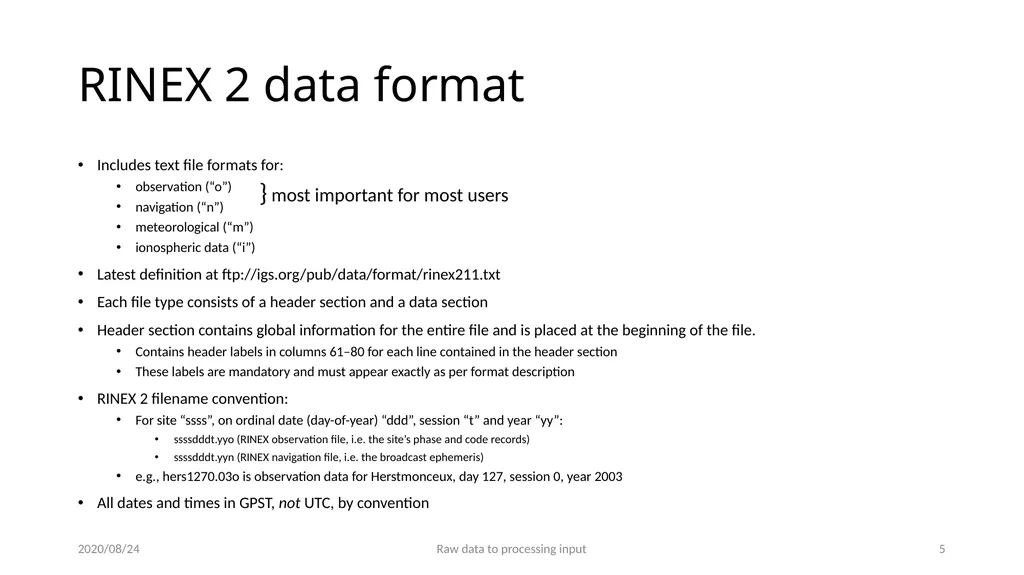
slide5. RINEX 2 data format Includes text file formats for:
observation (“o”)
navigation (“n”)
meteorological (“m”)
ionospheric data (“i”)
Latest definition at ftp://igs.org/pub/data/format/rinex211.txt
Each file type consists of a header section and a data section
Header section contains global information for the entire file and is placed at the beginning of the file.
Contains header labels in columns 61–80 for each line contained in the header section
These labels are mandatory and must appear exactly as per format description
RINEX 2 filename convention:
For site “ssss”, on ordinal date (day-of-year) “ddd”, session “t” and year “yy”:
ssssdddt.yyo (RINEX observation file, i.e. the site’s phase and code records)
ssssdddt.yyn (RINEX navigation file, i.e. the broadcast ephemeris)
e.g., hers1270.03o is observation data for Herstmonceux, day 127, session 0, year 2003
All dates and times in GPST, not UTC, by convention 2020/08/24 Raw data to processing input 4 } most important for most users<br>
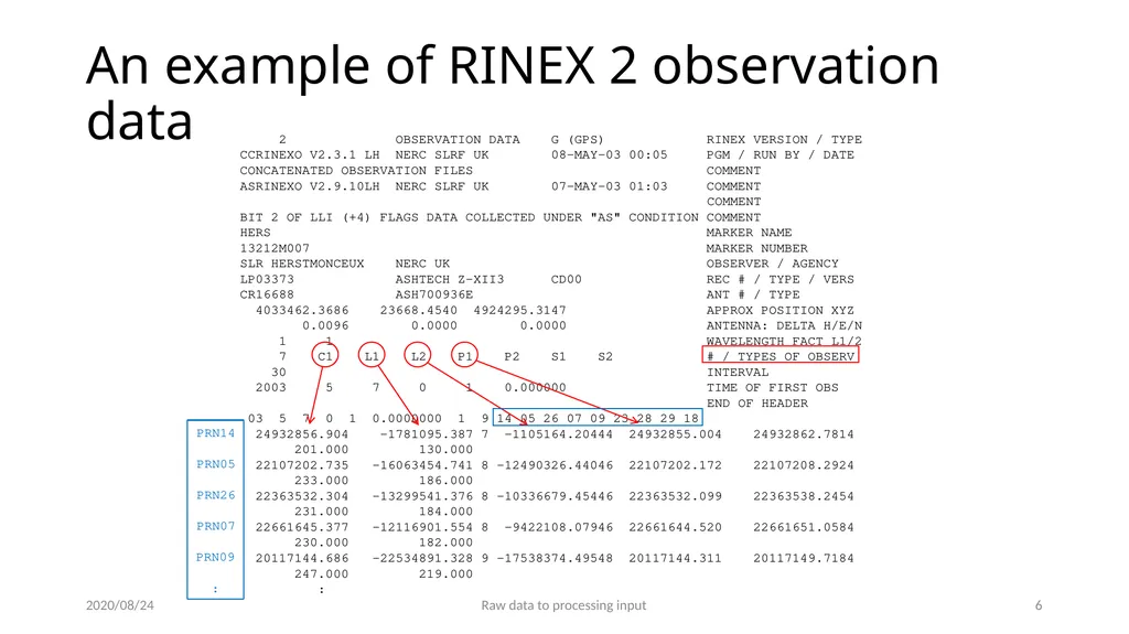
slide6. An example of RINEX 2 observation data 2020/08/24 Raw data to processing input 5 2 OBSERVATION DATA G (GPS) RINEX VERSION / TYPE
CCRINEXO V2.3.1 LH NERC SLRF UK 08-MAY-03 00:05 PGM / RUN BY / DATE
CONCATENATED OBSERVATION FILES COMMENT
ASRINEXO V2.9.10LH NERC SLRF UK 07-MAY-03 01:03 COMMENT
COMMENT
BIT 2 OF LLI (+4) FLAGS DATA COLLECTED UNDER "AS" CONDITION COMMENT
HERS MARKER NAME
13212M007 MARKER NUMBER
SLR HERSTMONCEUX NERC UK OBSERVER / AGENCY
LP03373 ASHTECH Z-XII3 CD00 REC # / TYPE / VERS
CR16688 ASH700936E ANT # / TYPE
4033462.3686 23668.4540 4924295.3147 APPROX POSITION XYZ
0.0096 0.0000 0.0000 ANTENNA: DELTA H/E/N
1 1 WAVELENGTH FACT L1/2
7 C1 L1 L2 P1 P2 S1 S2 # / TYPES OF OBSERV
30 INTERVAL
2003 5 7 0 1 0.000000 TIME OF FIRST OBS
END OF HEADER
03 5 7 0 1 0.0000000 1 9 14 05 26 07 09 23 28 29 18
24932856.904 -1781095.387 7 -1105164.20444 24932855.004 24932862.7814
201.000 130.000
22107202.735 -16063454.741 8 -12490326.44046 22107202.172 22107208.2924
233.000 186.000
22363532.304 -13299541.376 8 -10336679.45446 22363532.099 22363538.2454
231.000 184.000
22661645.377 -12116901.554 8 -9422108.07946 22661644.520 22661651.0584
230.000 182.000
20117144.686 -22534891.328 9 -17538374.49548 20117144.311 20117149.7184
247.000 219.000
: PRN14
PRN05
PRN26
PRN07
PRN09 :<br>
slide7. RINEX 3 data format Must be able to accommodate increased number and complexity of observations from multi-GNSS observations (GPS, GLONASS, Galileo, BeiDou, etc.)
Latest definition at ftp://ftp.igs.org/pub/data/format/rinex304.pdf
Each file type consists of a header section and a data section
Header section contains global information for the entire file and is placed at the beginning of the file.
Contains header labels in columns 61–80 for each line contained in the header section
These labels are mandatory and must appear exactly as per format description
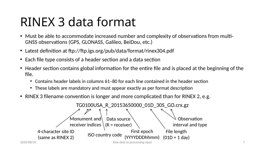
RINEX 3 filename convention is longer and more complicated than for RINEX 2, e.g.
TG0100USA_R_20153650000_01D_30S_GO.crx.gz 2020/08/24 Raw data to processing input 6 4-character site ID (same as RINEX 2) Monument and receiver indices ISO country code Data source (R = receiver) First epoch (YYYYDDDhhmm) File length (01D = 1 day) Observation interval and type<br>
slide8. An example of RINEX 3 observation data 2020/08/24 Raw data to processing input 7 3.02 OBSERVATION DATA GPS(GPS) RINEX VERSION / TYPE
cnvtToRINEX 2.29.0 Michael A Floyd 07-Jan-16 17:28 UTC PGM / RUN BY / DATE
----------------------------------------------------------- COMMENT
TG01 MARKER NAME
GEODETIC MARKER TYPE
M.Floyd / G.Funning MIT / UC Riverside OBSERVER / AGENCY
5049K72210 TRIMBLE NETR9 4.62 REC # / TYPE / VERS
60222738 TRM41249.00 NONE ANT # / TYPE
-2698262.9000 -4182116.4000 3976198.2000 APPROX POSITION XYZ
-0.0160 0.0000 0.0000 ANTENNA: DELTA H/E/N
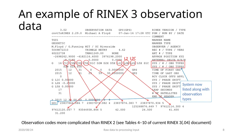
G 16 C1C C2W C2X C5X D1C D2W D2X D5X L1C L2W L2X L5X S1C SYS / # / OBS TYPES
S2W S2X S5X SYS / # / OBS TYPES
2015 12 31 0 0 0.0000000 GPS TIME OF FIRST OBS
2015 12 31 23 59 30.0000000 GPS TIME OF LAST OBS
0 RCV CLOCK OFFS APPL
G L1C 0.00000 SYS / PHASE SHIFT
G L2X -0.25000 SYS / PHASE SHIFT
G L5X 0.00000 SYS / PHASE SHIFT
17 LEAP SECONDS
31 # OF SATELLITES
END OF HEADER
> 2015 12 31 00 00 0.0000000 0 9
G01 23837864.086 7 23837874.082 4 23837874.383 7 23837870.934 5 125268876.649 7 97612114.300 4 97612120.067 7 93544938.844 5 42.000 24.500 41.600 31.200 System now listed along with observation types Observation codes more complicated than RINEX 2 (see Tables 4–10 of current RINEX 3(.04) document) L2 L2C<br>
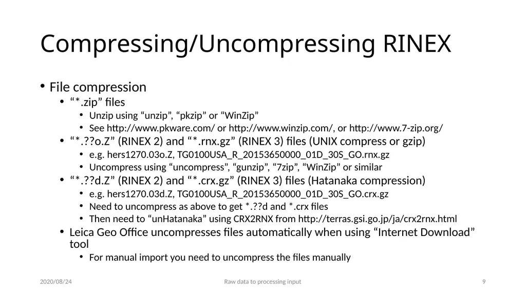
slide9. Compressing/Uncompressing RINEX File compression
“*.zip” files
Unzip using “unzip”, “pkzip” or “WinZip”
See http://www.pkware.com/ or http://www.winzip.com/, or http://www.7-zip.org/
“*.??o.Z” (RINEX 2) and “*.rnx.gz” (RINEX 3) files (UNIX compress or gzip)
e.g. hers1270.03o.Z, TG0100USA_R_20153650000_01D_30S_GO.rnx.gz
Uncompress using “uncompress”, “gunzip”, “7zip”, “WinZip” or similar
“*.??d.Z” (RINEX 2) and “*.crx.gz” (RINEX 3) files (Hatanaka compression)
e.g. hers1270.03d.Z, TG0100USA_R_20153650000_01D_30S_GO.crx.gz
Need to uncompress as above to get *.??d and *.crx files
Then need to “unHatanaka” using CRX2RNX from http://terras.gsi.go.jp/ja/crx2rnx.html
Leica Geo Office uncompresses files automatically when using “Internet Download” tool
For manual import you need to uncompress the files manually 2020/08/24 Raw data to processing input 8<br>
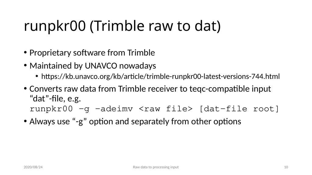
slide10. runpkr00 (Trimble raw to dat) Proprietary software from Trimble
Maintained by UNAVCO nowadays
https://kb.unavco.org/kb/article/trimble-runpkr00-latest-versions-744.html
Converts raw data from Trimble receiver to teqc-compatible input “dat”-file, e.g. runpkr00 -g -adeimv <raw file> [dat-file root]
Always use “-g” option and separately from other options 2020/08/24 Raw data to processing input 9<br>
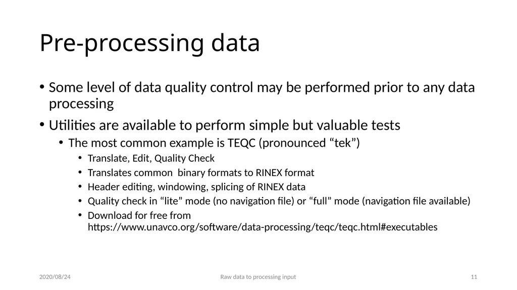
slide11. Pre-processing data Some level of data quality control may be performed prior to any data processing
Utilities are available to perform simple but valuable tests
The most common example is TEQC (pronounced “tek”)
Translate, Edit, Quality Check
Translates common binary formats to RINEX format
Header editing, windowing, splicing of RINEX data
Quality check in “lite” mode (no navigation file) or “full” mode (navigation file available)
Download for free from https://www.unavco.org/software/data-processing/teqc/teqc.html#executables 2020/08/24 Raw data to processing input 10<br>
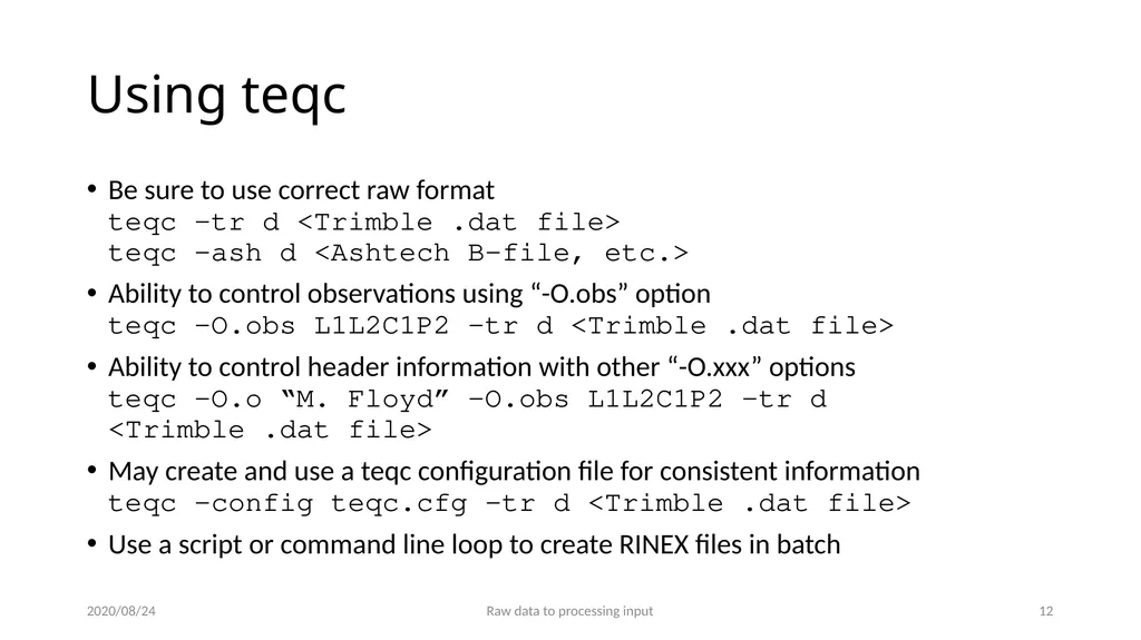
slide12. Using teqc Be sure to use correct raw format teqc -tr d <Trimble .dat file> teqc -ash d <Ashtech B-file, etc.>
Ability to control observations using “-O.obs” option teqc -O.obs L1L2C1P2 -tr d <Trimble .dat file>
Ability to control header information with other “-O.xxx” options teqc -O.o “M. Floyd” -O.obs L1L2C1P2 -tr d <Trimble .dat file>
May create and use a teqc configuration file for consistent information teqc -config teqc.cfg -tr d <Trimble .dat file>
Use a script or command line loop to create RINEX files in batch 2020/08/24 Raw data to processing input 11<br>
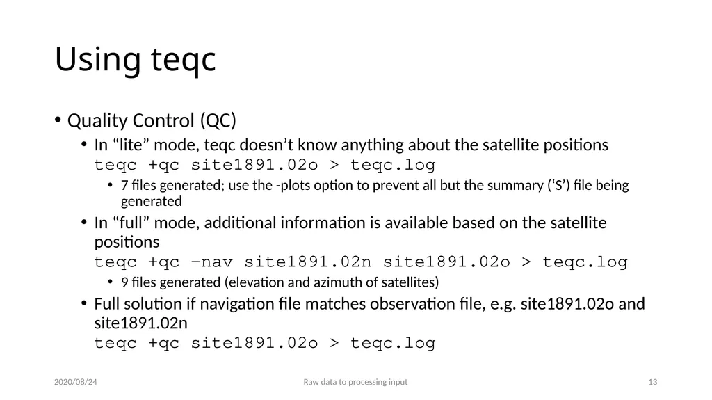
slide13. Using teqc Quality Control (QC)
In “lite” mode, teqc doesn’t know anything about the satellite positions teqc +qc site1891.02o > teqc.log
7 files generated; use the -plots option to prevent all but the summary (‘S’) file being generated
In “full” mode, additional information is available based on the satellite positions teqc +qc –nav site1891.02n site1891.02o > teqc.log
9 files generated (elevation and azimuth of satellites)
Full solution if navigation file matches observation file, e.g. site1891.02o and site1891.02n teqc +qc site1891.02o > teqc.log 2020/08/24 Raw data to processing input 12<br>
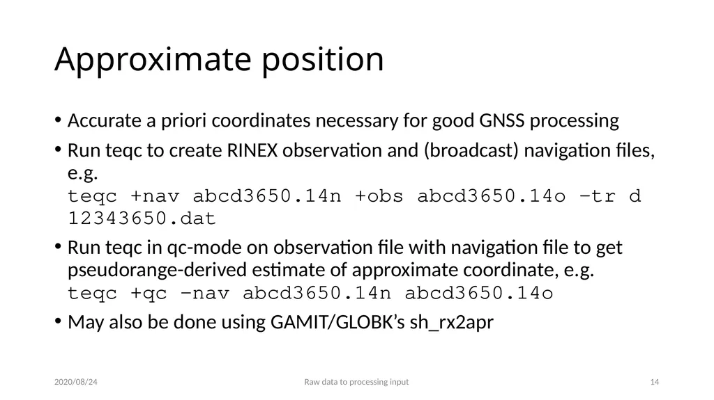
slide14. Approximate position Accurate a priori coordinates necessary for good GNSS processing
Run teqc to create RINEX observation and (broadcast) navigation files, e.g. teqc +nav abcd3650.14n +obs abcd3650.14o -tr d 12343650.dat
Run teqc in qc-mode on observation file with navigation file to get pseudorange-derived estimate of approximate coordinate, e.g. teqc +qc -nav abcd3650.14n abcd3650.14o
May also be done using GAMIT/GLOBK’s sh_rx2apr 2020/08/24 Raw data to processing input 13<br>
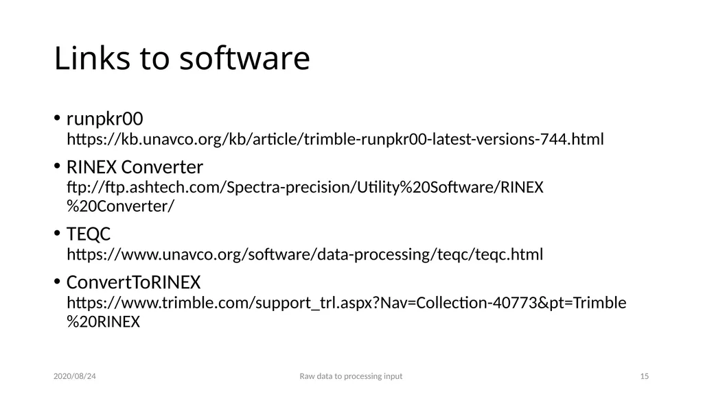
slide15. Links to software runpkr00 https://kb.unavco.org/kb/article/trimble-runpkr00-latest-versions-744.html
RINEX Converter ftp://ftp.ashtech.com/Spectra-precision/Utility%20Software/RINEX%20Converter/
TEQC https://www.unavco.org/software/data-processing/teqc/teqc.html
ConvertToRINEX https://www.trimble.com/support_trl.aspx?Nav=Collection-40773&pt=Trimble%20RINEX 2020/08/24 Raw data to processing input 14<br>
GNSS Data Processing and Analysis with GAMIT/GLOBK and track UNAVCO Headquarters, Boulder, Colorado, USA 24–28 August 2020
http://geoweb.mit.edu/~floyd/courses/gg/202008_UNAVCO/
Material from R. W. King, T. A. Herring, M. A. Floyd (MIT) and S. C. McClusky (now at ANU)<br>
slide2. Raw data formats 2020/08/24 Raw data to processing input 1 Receiver: Raw format: GPS antenna RINEX file Pre-processing: Ashtech Leica Septentrio Trimble B-file R-file .R00 .T02 .T01 .T00 Translation: runpkr00 TEQC RINEX Converter* ConvertToRINEX* * Windows only .DAT<br>
slide3. Motivation for Receiver INdependent EXchange (RINEX) format All manufacturers have developed their own proprietary file formats for data storage specific to their receivers and processing software
Problems occur when processing data from another manufacturer’s receiver
RINEX developed by the Astronomical Institute of the University of Berne to allow easy and universal exchange of raw GPS data
Principal driver was the large European GPS campaign EUREF 89 - involved more than 60 GPS receivers of 4 different manufacturers. 2020/08/24 Raw data to processing input 2<br>
slide4. RINEX formats RINEX 2
Short file names (explained in following slides)
RINEX 3
Long file names (explained in following slides)
GAMIT formerly worked with the RINEX 2 format and GPS observations only
Support for RINEX 3 and GNSS (e.g. Galileo, BeiDou, etc.) observations are now available with GAMIT/GLOBK 10.61 and later
But RINEX 3 files need to be renamed, copied or linked with a RINEX 2 file name convention to be used (e.g. sh_rename_rinex3) 2020/08/24 Raw data to processing input 3<br>
slide5. RINEX 2 data format Includes text file formats for:
observation (“o”)
navigation (“n”)
meteorological (“m”)
ionospheric data (“i”)
Latest definition at ftp://igs.org/pub/data/format/rinex211.txt
Each file type consists of a header section and a data section
Header section contains global information for the entire file and is placed at the beginning of the file.
Contains header labels in columns 61–80 for each line contained in the header section
These labels are mandatory and must appear exactly as per format description
RINEX 2 filename convention:
For site “ssss”, on ordinal date (day-of-year) “ddd”, session “t” and year “yy”:
ssssdddt.yyo (RINEX observation file, i.e. the site’s phase and code records)
ssssdddt.yyn (RINEX navigation file, i.e. the broadcast ephemeris)
e.g., hers1270.03o is observation data for Herstmonceux, day 127, session 0, year 2003
All dates and times in GPST, not UTC, by convention 2020/08/24 Raw data to processing input 4 } most important for most users<br>
slide6. An example of RINEX 2 observation data 2020/08/24 Raw data to processing input 5 2 OBSERVATION DATA G (GPS) RINEX VERSION / TYPE
CCRINEXO V2.3.1 LH NERC SLRF UK 08-MAY-03 00:05 PGM / RUN BY / DATE
CONCATENATED OBSERVATION FILES COMMENT
ASRINEXO V2.9.10LH NERC SLRF UK 07-MAY-03 01:03 COMMENT
COMMENT
BIT 2 OF LLI (+4) FLAGS DATA COLLECTED UNDER "AS" CONDITION COMMENT
HERS MARKER NAME
13212M007 MARKER NUMBER
SLR HERSTMONCEUX NERC UK OBSERVER / AGENCY
LP03373 ASHTECH Z-XII3 CD00 REC # / TYPE / VERS
CR16688 ASH700936E ANT # / TYPE
4033462.3686 23668.4540 4924295.3147 APPROX POSITION XYZ
0.0096 0.0000 0.0000 ANTENNA: DELTA H/E/N
1 1 WAVELENGTH FACT L1/2
7 C1 L1 L2 P1 P2 S1 S2 # / TYPES OF OBSERV
30 INTERVAL
2003 5 7 0 1 0.000000 TIME OF FIRST OBS
END OF HEADER
03 5 7 0 1 0.0000000 1 9 14 05 26 07 09 23 28 29 18
24932856.904 -1781095.387 7 -1105164.20444 24932855.004 24932862.7814
201.000 130.000
22107202.735 -16063454.741 8 -12490326.44046 22107202.172 22107208.2924
233.000 186.000
22363532.304 -13299541.376 8 -10336679.45446 22363532.099 22363538.2454
231.000 184.000
22661645.377 -12116901.554 8 -9422108.07946 22661644.520 22661651.0584
230.000 182.000
20117144.686 -22534891.328 9 -17538374.49548 20117144.311 20117149.7184
247.000 219.000
: PRN14
PRN05
PRN26
PRN07
PRN09 :<br>
slide7. RINEX 3 data format Must be able to accommodate increased number and complexity of observations from multi-GNSS observations (GPS, GLONASS, Galileo, BeiDou, etc.)
Latest definition at ftp://ftp.igs.org/pub/data/format/rinex304.pdf
Each file type consists of a header section and a data section
Header section contains global information for the entire file and is placed at the beginning of the file.
Contains header labels in columns 61–80 for each line contained in the header section
These labels are mandatory and must appear exactly as per format description
RINEX 3 filename convention is longer and more complicated than for RINEX 2, e.g.
TG0100USA_R_20153650000_01D_30S_GO.crx.gz 2020/08/24 Raw data to processing input 6 4-character site ID (same as RINEX 2) Monument and receiver indices ISO country code Data source (R = receiver) First epoch (YYYYDDDhhmm) File length (01D = 1 day) Observation interval and type<br>
slide8. An example of RINEX 3 observation data 2020/08/24 Raw data to processing input 7 3.02 OBSERVATION DATA GPS(GPS) RINEX VERSION / TYPE
cnvtToRINEX 2.29.0 Michael A Floyd 07-Jan-16 17:28 UTC PGM / RUN BY / DATE
----------------------------------------------------------- COMMENT
TG01 MARKER NAME
GEODETIC MARKER TYPE
M.Floyd / G.Funning MIT / UC Riverside OBSERVER / AGENCY
5049K72210 TRIMBLE NETR9 4.62 REC # / TYPE / VERS
60222738 TRM41249.00 NONE ANT # / TYPE
-2698262.9000 -4182116.4000 3976198.2000 APPROX POSITION XYZ
-0.0160 0.0000 0.0000 ANTENNA: DELTA H/E/N
G 16 C1C C2W C2X C5X D1C D2W D2X D5X L1C L2W L2X L5X S1C SYS / # / OBS TYPES
S2W S2X S5X SYS / # / OBS TYPES
2015 12 31 0 0 0.0000000 GPS TIME OF FIRST OBS
2015 12 31 23 59 30.0000000 GPS TIME OF LAST OBS
0 RCV CLOCK OFFS APPL
G L1C 0.00000 SYS / PHASE SHIFT
G L2X -0.25000 SYS / PHASE SHIFT
G L5X 0.00000 SYS / PHASE SHIFT
17 LEAP SECONDS
31 # OF SATELLITES
END OF HEADER
> 2015 12 31 00 00 0.0000000 0 9
G01 23837864.086 7 23837874.082 4 23837874.383 7 23837870.934 5 125268876.649 7 97612114.300 4 97612120.067 7 93544938.844 5 42.000 24.500 41.600 31.200 System now listed along with observation types Observation codes more complicated than RINEX 2 (see Tables 4–10 of current RINEX 3(.04) document) L2 L2C<br>
slide9. Compressing/Uncompressing RINEX File compression
“*.zip” files
Unzip using “unzip”, “pkzip” or “WinZip”
See http://www.pkware.com/ or http://www.winzip.com/, or http://www.7-zip.org/
“*.??o.Z” (RINEX 2) and “*.rnx.gz” (RINEX 3) files (UNIX compress or gzip)
e.g. hers1270.03o.Z, TG0100USA_R_20153650000_01D_30S_GO.rnx.gz
Uncompress using “uncompress”, “gunzip”, “7zip”, “WinZip” or similar
“*.??d.Z” (RINEX 2) and “*.crx.gz” (RINEX 3) files (Hatanaka compression)
e.g. hers1270.03d.Z, TG0100USA_R_20153650000_01D_30S_GO.crx.gz
Need to uncompress as above to get *.??d and *.crx files
Then need to “unHatanaka” using CRX2RNX from http://terras.gsi.go.jp/ja/crx2rnx.html
Leica Geo Office uncompresses files automatically when using “Internet Download” tool
For manual import you need to uncompress the files manually 2020/08/24 Raw data to processing input 8<br>
slide10. runpkr00 (Trimble raw to dat) Proprietary software from Trimble
Maintained by UNAVCO nowadays
https://kb.unavco.org/kb/article/trimble-runpkr00-latest-versions-744.html
Converts raw data from Trimble receiver to teqc-compatible input “dat”-file, e.g. runpkr00 -g -adeimv <raw file> [dat-file root]
Always use “-g” option and separately from other options 2020/08/24 Raw data to processing input 9<br>
slide11. Pre-processing data Some level of data quality control may be performed prior to any data processing
Utilities are available to perform simple but valuable tests
The most common example is TEQC (pronounced “tek”)
Translate, Edit, Quality Check
Translates common binary formats to RINEX format
Header editing, windowing, splicing of RINEX data
Quality check in “lite” mode (no navigation file) or “full” mode (navigation file available)
Download for free from https://www.unavco.org/software/data-processing/teqc/teqc.html#executables 2020/08/24 Raw data to processing input 10<br>
slide12. Using teqc Be sure to use correct raw format teqc -tr d <Trimble .dat file> teqc -ash d <Ashtech B-file, etc.>
Ability to control observations using “-O.obs” option teqc -O.obs L1L2C1P2 -tr d <Trimble .dat file>
Ability to control header information with other “-O.xxx” options teqc -O.o “M. Floyd” -O.obs L1L2C1P2 -tr d <Trimble .dat file>
May create and use a teqc configuration file for consistent information teqc -config teqc.cfg -tr d <Trimble .dat file>
Use a script or command line loop to create RINEX files in batch 2020/08/24 Raw data to processing input 11<br>
slide13. Using teqc Quality Control (QC)
In “lite” mode, teqc doesn’t know anything about the satellite positions teqc +qc site1891.02o > teqc.log
7 files generated; use the -plots option to prevent all but the summary (‘S’) file being generated
In “full” mode, additional information is available based on the satellite positions teqc +qc –nav site1891.02n site1891.02o > teqc.log
9 files generated (elevation and azimuth of satellites)
Full solution if navigation file matches observation file, e.g. site1891.02o and site1891.02n teqc +qc site1891.02o > teqc.log 2020/08/24 Raw data to processing input 12<br>
slide14. Approximate position Accurate a priori coordinates necessary for good GNSS processing
Run teqc to create RINEX observation and (broadcast) navigation files, e.g. teqc +nav abcd3650.14n +obs abcd3650.14o -tr d 12343650.dat
Run teqc in qc-mode on observation file with navigation file to get pseudorange-derived estimate of approximate coordinate, e.g. teqc +qc -nav abcd3650.14n abcd3650.14o
May also be done using GAMIT/GLOBK’s sh_rx2apr 2020/08/24 Raw data to processing input 13<br>
slide15. Links to software runpkr00 https://kb.unavco.org/kb/article/trimble-runpkr00-latest-versions-744.html
RINEX Converter ftp://ftp.ashtech.com/Spectra-precision/Utility%20Software/RINEX%20Converter/
TEQC https://www.unavco.org/software/data-processing/teqc/teqc.html
ConvertToRINEX https://www.trimble.com/support_trl.aspx?Nav=Collection-40773&pt=Trimble%20RINEX 2020/08/24 Raw data to processing input 14<br>