01
Key Research Result: This study examined how wildfires shape habitat quality for mule deer, black bears, and cougars in the American Southwest. Using >30 years of NASA satellite imagery to track vegetation productivity and fire severity, researchers found that low-severity wildfires and prescribed burns create long-lasting, high-quality habitat, improving forage and cover for herbivores like mule deer and supporting prey availability and movement options for carnivores. However, large, high-severity wildfires sharply reduce vegetation productivity and degrade habitat for all three species.
Significance: The work shows that bigger, more intense wildfires reduce beneficial habitat for species of high ecological and economic value, whereas low intensity fires may enhance habitats. NASA’s long-term satellite data were essential for tracking vegetation recovery, mapping fire severity, and revealing how fire regimes reshape western wildlife habitat at landscape scales.
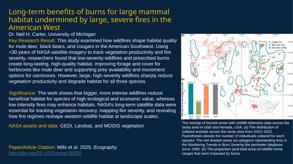
NASA assets and data: GEDI, Landsat, and MODIS vegetation Long-term benefits of burns for large mammal habitat undermined by large, severe fires in the American West�Dr. Neil H. Carter, University of Michigan Paper/Article Citation: Mills et al. 2025. Ecography http://doi.org/10.1002/ecog.08225 The overlap of burned areas with wildlife telemetry data across the study area in Utah and Nevada, USA. (a) The distribution of collared animals across the study area from 2010–2022. Parentheses denote the number of individuals collared for each species. The red shaded areas are polygons representing fires in the Monitoring Trends in Burn Severity fire perimeter database since 1990. (b) The proportion (and total area) of wildlife home ranges that were impacted by burns.<br>