"NWS Hazard Simplification Project: Plain Language" is the property of its rightful owner. Permission is granted to
download and print the materials on this website for personal, non-commercial use only, and to display it
on your personal computer provided you do not modify the materials and that you retain all copyright
notices contained in the materials. By downloading content from our website, you accept the terms of this
agreement.
Share
Embed code
Presentation Transcript
01
NWS Hazard Simplification Project:
Plain Language Coming to NWS’
Watch, Warning, and Advisory System
The NWS “Watch, Warning and Advisory” System
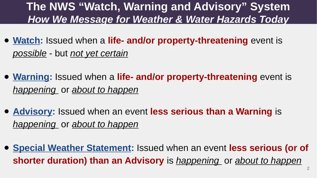
How We Message for Weather & Water Hazards Today Watch: Issued when a life- and/or property-threatening event is possible - but not yet certain
Warning: Issued when a life- and/or property-threatening event is happening or about to happen
Advisory: Issued when an event less serious than a Warning is happening or about to happen
Special Weather Statement: Issued when an event less serious (or of shorter duration) than an Advisory is happening or about to happen 2<br>
03
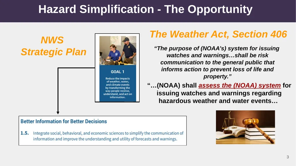
Hazard Simplification - The Opportunity The Weather Act, Section 406 NWS
Strategic Plan “The purpose of (NOAA’s) system for issuing
watches and warnings…shall be risk communication to the general public that informs action to prevent loss of life and property.” “…(NOAA) shall assess the (NOAA) system for issuing watches and warnings regarding hazardous weather and water events… 3<br>
04
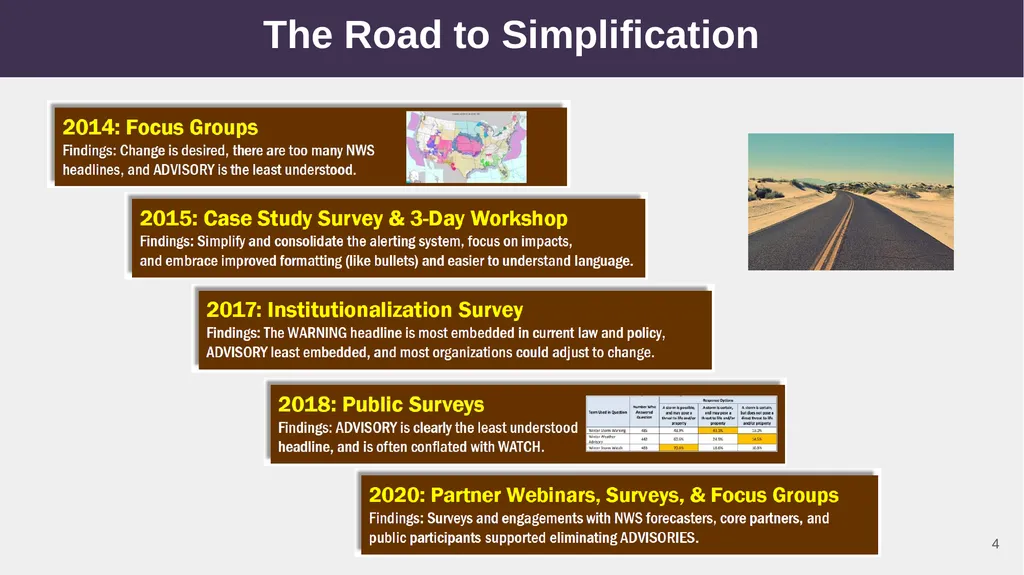
The Road to Simplification 4<br>
05
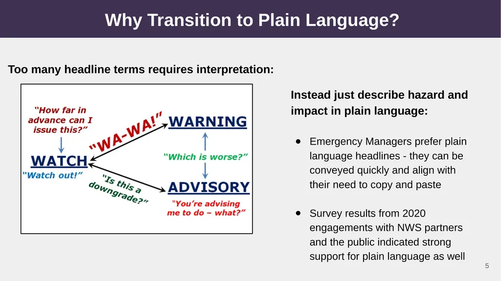
Why Transition to Plain Language? Too many headline terms requires interpretation: Instead just describe hazard and impact in plain language:
Emergency Managers prefer plain language headlines - they can be conveyed quickly and align with their need to copy and paste
Survey results from 2020 engagements with NWS partners and the public indicated strong support for plain language as well 5<br>
06
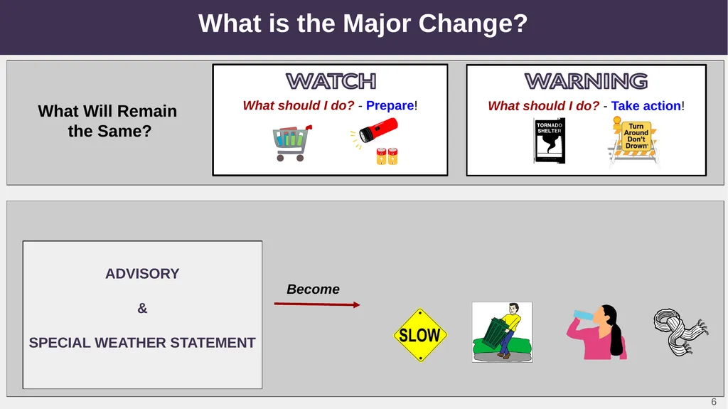
What is the Major Change? What should I do? - Prepare! What should I do? - Take action! PLAIN LANGUAGE HEADLINES
An event less serious than a Warning is happening
What should I do? - Exercise caution to avoid impacts. What Will Remain
the Same? What Will Change? ADVISORY
&
SPECIAL WEATHER STATEMENT Become WATCH WARNING 6<br>
07
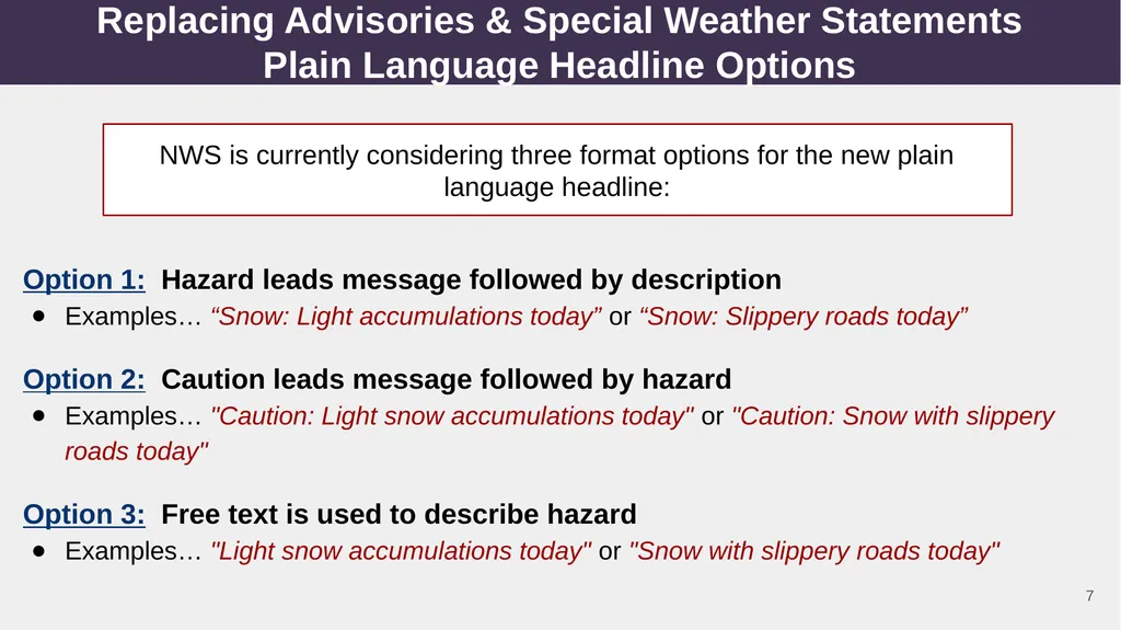
Replacing Advisories & Special Weather Statements
Plain Language Headline Options NWS is currently considering three format options for the new plain language headline: Option 1: Hazard leads message followed by description
Examples… “Snow: Light accumulations today” or “Snow: Slippery roads today”
Option 2: Caution leads message followed by hazard
Examples… "Caution: Light snow accumulations today" or "Caution: Snow with slippery roads today"
Option 3: Free text is used to describe hazard
Examples… "Light snow accumulations today" or "Snow with slippery roads today" 7<br>
08
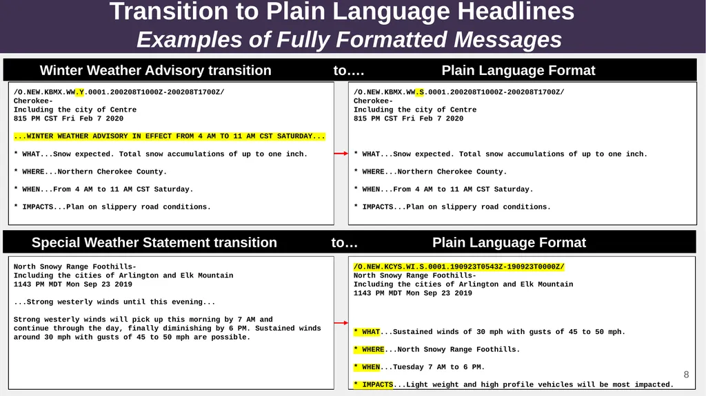
Transition to Plain Language Headlines
Examples of Fully Formatted Messages Special Weather Statement transition to… Plain Language Format VTEC Plain language headline - Specific wording TBD Bullet format Now with VTEC! Now with “3W” bullets! 8 Plain language headline - Specific wording TBD /O.NEW.KCYS.WI.S.0001.190923T0543Z-190923T0000Z/
North Snowy Range Foothills-
Including the cities of Arlington and Elk Mountain
1143 PM MDT Mon Sep 23 2019
* WHAT...Sustained winds of 30 mph with gusts of 45 to 50 mph.
* WHERE...North Snowy Range Foothills.
* WHEN...Tuesday 7 AM to 6 PM.
* IMPACTS...Light weight and high profile vehicles will be most impacted. North Snowy Range Foothills-
Including the cities of Arlington and Elk Mountain
1143 PM MDT Mon Sep 23 2019
...Strong westerly winds until this evening...
Strong westerly winds will pick up this morning by 7 AM and
continue through the day, finally diminishing by 6 PM. Sustained winds around 30 mph with gusts of 45 to 50 mph are possible. /O.NEW.KBMX.WW.S.0001.200208T1000Z-200208T1700Z/
Cherokee-
Including the city of Centre
815 PM CST Fri Feb 7 2020
* WHAT...Snow expected. Total snow accumulations of up to one inch.
* WHERE...Northern Cherokee County.
* WHEN...From 4 AM to 11 AM CST Saturday.
* IMPACTS...Plan on slippery road conditions.
0 /O.NEW.KBMX.WW.Y.0001.200208T1000Z-200208T1700Z/
Cherokee-
Including the city of Centre
815 PM CST Fri Feb 7 2020
...WINTER WEATHER ADVISORY IN EFFECT FROM 4 AM TO 11 AM CST SATURDAY...
* WHAT...Snow expected. Total snow accumulations of up to one inch.
* WHERE...Northern Cherokee County.
* WHEN...From 4 AM to 11 AM CST Saturday.
* IMPACTS...Plan on slippery road conditions. Winter Weather Advisory transition to…. Plain Language Format 8<br>
09
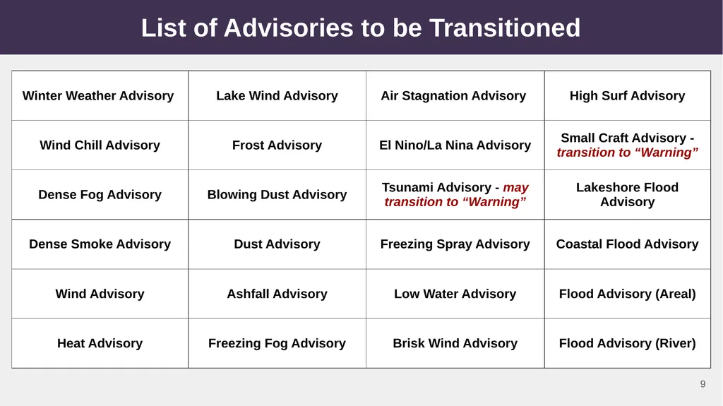
List of Advisories to be Transitioned 9<br>
10
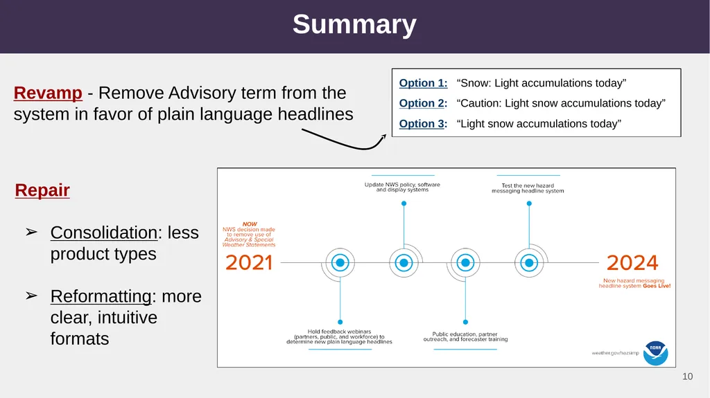
Summary Revamp - Remove Advisory term from the system in favor of plain language headlines Option 1: “Snow: Light accumulations today”