
PART 6 TOPOGRAPHY WHAT IS TOPOGRAPHY? Topography



Description: PART 6 TOPOGRAPHY WHAT IS TOPOGRAPHY? Topography is the lay of the land. It describes the physical features of an area of land. These features include natural formations, such as hills, mountains, valleys, rivers, lakes and plains. Do we
Related Topics
Download Presentation
"PART 6 TOPOGRAPHY WHAT IS TOPOGRAPHY? Topography" is the property of its rightful owner. Permission is granted to download and print the materials on this website for personal, non-commercial use only, and to display it on your personal computer provided you do not modify the materials and that you retain all copyright notices contained in the materials. By downloading content from our website, you accept the terms of this agreement.
Presentation Transcript
slide1. PART 6
TOPOGRAPHY<br>
slide2. WHAT IS TOPOGRAPHY?<br>
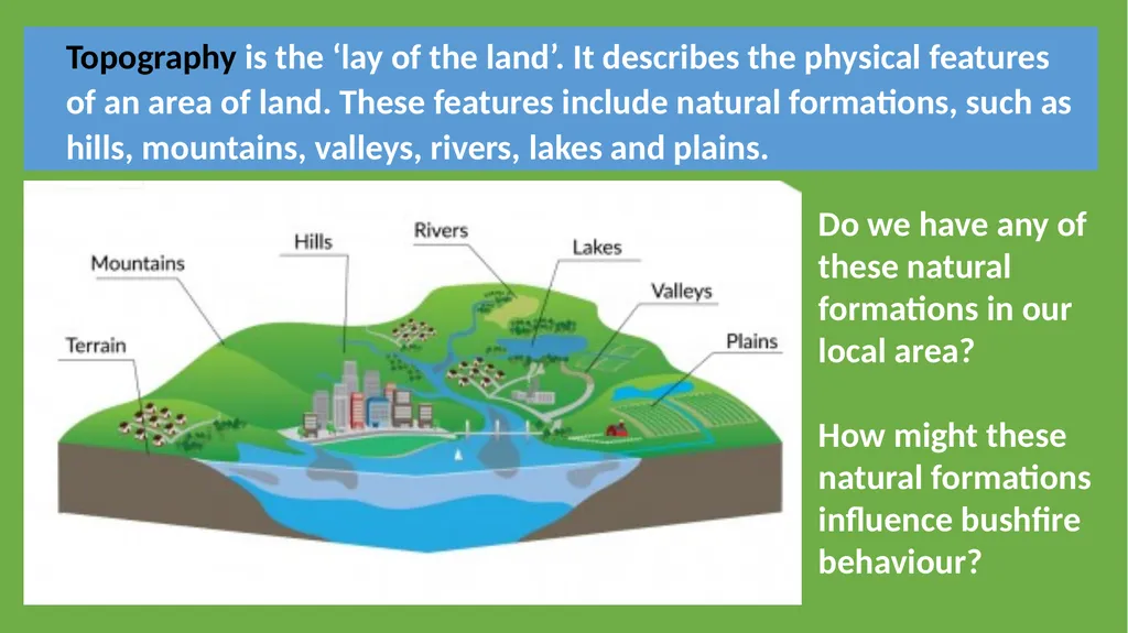
slide3. Topography is the ‘lay of the land’. It describes the physical features of an area of land. These features include natural formations, such as hills, mountains, valleys, rivers, lakes and plains. Do we have any of these natural formations in our local area?
How might these natural formations influence bushfire behaviour?<br>
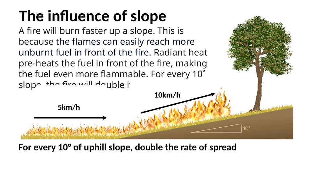
slide4. The influence of slope A fire will burn faster up a slope. This is because the flames can easily reach more unburnt fuel in front of the fire. Radiant heat pre-heats the fuel in front of the fire, making the fuel even more flammable. For every 10˚ slope, the fire will double its speed. For every 10° of uphill slope, double the rate of spread 5km/h 10km/h<br>
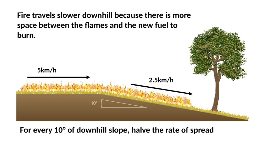
slide5. For every 10° of downhill slope, halve the rate of spread Fire travels slower downhill because there is more space between the flames and the new fuel to burn. 5km/h 2.5km/h<br>
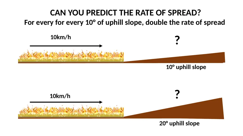
slide6. 10° uphill slope 10km/h 20° uphill slope 10km/h ? ? CAN YOU PREDICT THE RATE OF SPREAD?
For every for every 10° of uphill slope, double the rate of spread<br>
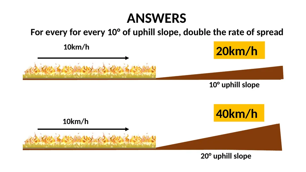
slide7. 10° uphill slope 10km/h 20° uphill slope 10km/h 20km/h 40km/h ANSWERS
For every for every 10° of uphill slope, double the rate of spread<br>
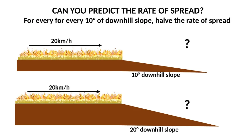
slide8. 20km/h 20° downhill slope 20km/h ? ? CAN YOU PREDICT THE RATE OF SPREAD?
For every for every 10° of downhill slope, halve the rate of spread 10° downhill slope<br>
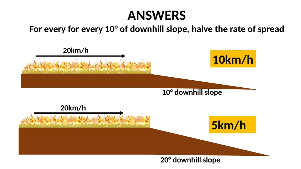
slide9. 20km/h 20° downhill slope 20km/h 10km/h 5km/h ANSWERS
For every for every 10° of downhill slope, halve the rate of spread 10° downhill slope<br>
TOPOGRAPHY<br>
slide2. WHAT IS TOPOGRAPHY?<br>
slide3. Topography is the ‘lay of the land’. It describes the physical features of an area of land. These features include natural formations, such as hills, mountains, valleys, rivers, lakes and plains. Do we have any of these natural formations in our local area?
How might these natural formations influence bushfire behaviour?<br>
slide4. The influence of slope A fire will burn faster up a slope. This is because the flames can easily reach more unburnt fuel in front of the fire. Radiant heat pre-heats the fuel in front of the fire, making the fuel even more flammable. For every 10˚ slope, the fire will double its speed. For every 10° of uphill slope, double the rate of spread 5km/h 10km/h<br>
slide5. For every 10° of downhill slope, halve the rate of spread Fire travels slower downhill because there is more space between the flames and the new fuel to burn. 5km/h 2.5km/h<br>
slide6. 10° uphill slope 10km/h 20° uphill slope 10km/h ? ? CAN YOU PREDICT THE RATE OF SPREAD?
For every for every 10° of uphill slope, double the rate of spread<br>
slide7. 10° uphill slope 10km/h 20° uphill slope 10km/h 20km/h 40km/h ANSWERS
For every for every 10° of uphill slope, double the rate of spread<br>
slide8. 20km/h 20° downhill slope 20km/h ? ? CAN YOU PREDICT THE RATE OF SPREAD?
For every for every 10° of downhill slope, halve the rate of spread 10° downhill slope<br>
slide9. 20km/h 20° downhill slope 20km/h 10km/h 5km/h ANSWERS
For every for every 10° of downhill slope, halve the rate of spread 10° downhill slope<br>