
Starter Where do you think this might be a map
YM
Published · 15 slides · 0 views
1 / 1
Description
Starter Where do you think this might be a map from? Have you been? How might this link to our new topic? If Jersey is a near island, can you think of an example of a far away island? Insert image of map of an island Insert image of a
Related Topics
Share
Embed code
Download this presentation From Below
"Starter Where do you think this might be a map" is the property of its rightful owner. Permission is granted to download and print the materials on this website for personal, non-commercial use only, and to display it on your personal computer provided you do not modify the materials and that you retain all copyright notices contained in the materials. By downloading content from our website, you accept the terms of this agreement.
Presentation Transcript
01
Starter Where do you think this might be a map from?
Have you been?
How might this link to our new topic? If Jersey is a ‘near’ island, can you think of an example of a ‘far away’ island? Insert image of map of an island Insert image of a map showing Jersey<br>
Have you been?
How might this link to our new topic? If Jersey is a ‘near’ island, can you think of an example of a ‘far away’ island? Insert image of map of an island Insert image of a map showing Jersey<br>
02
Islands in the Making L:O – to understand what an island is & how islands are formed. 12/12/2025<br>
03
What is an island? An island is a body of land surrounded by water.
It is estimated that our planet contains almost 670,000 islands, of which around 11,000 are permanently inhabited.<br>
It is estimated that our planet contains almost 670,000 islands, of which around 11,000 are permanently inhabited.<br>
04
How many islands can you name? On your whiteboards, you have 1 minute to list as many islands as you can.<br>
05
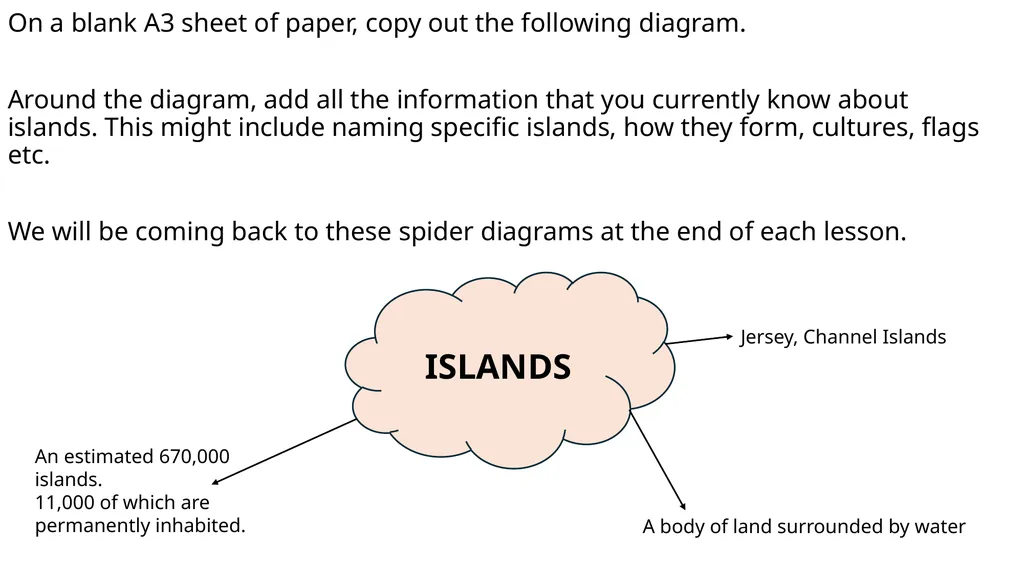
On a blank A3 sheet of paper, copy out the following diagram.
Around the diagram, add all the information that you currently know about islands. This might include naming specific islands, how they form, cultures, flags etc.
We will be coming back to these spider diagrams at the end of each lesson. ISLANDS Jersey, Channel Islands A body of land surrounded by water An estimated 670,000 islands.
11,000 of which are permanently inhabited.<br>
Around the diagram, add all the information that you currently know about islands. This might include naming specific islands, how they form, cultures, flags etc.
We will be coming back to these spider diagrams at the end of each lesson. ISLANDS Jersey, Channel Islands A body of land surrounded by water An estimated 670,000 islands.
11,000 of which are permanently inhabited.<br>
06
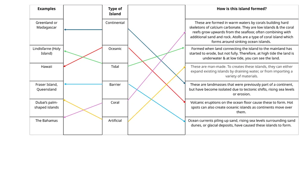
There are many ways that islands can form Here are a few of them. Think back to everything you have learned in geography so far. What do you think each of these might involve?
Continental
Oceanic
Tidal
Barrier
Coral
Artificial<br>
Continental
Oceanic
Tidal
Barrier
Coral
Artificial<br>
07
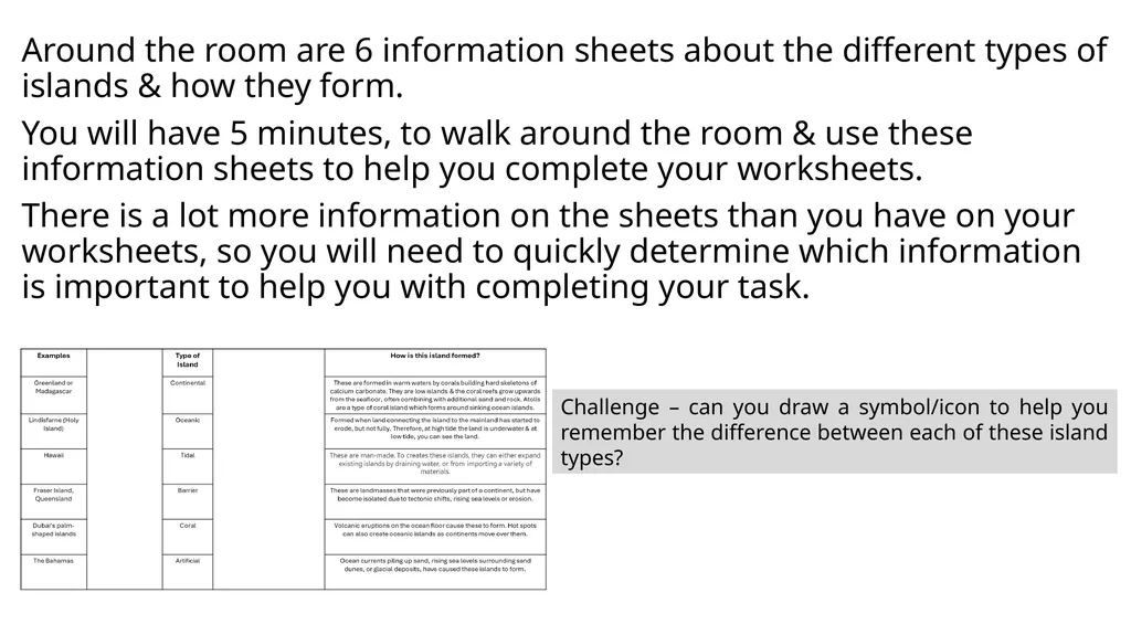
Around the room are 6 information sheets about the different types of islands & how they form.
You will have 5 minutes, to walk around the room & use these information sheets to help you complete your worksheets.
There is a lot more information on the sheets than you have on your worksheets, so you will need to quickly determine which information is important to help you with completing your task. Challenge – can you draw a symbol/icon to help you remember the difference between each of these island types?<br>
You will have 5 minutes, to walk around the room & use these information sheets to help you complete your worksheets.
There is a lot more information on the sheets than you have on your worksheets, so you will need to quickly determine which information is important to help you with completing your task. Challenge – can you draw a symbol/icon to help you remember the difference between each of these island types?<br>
08
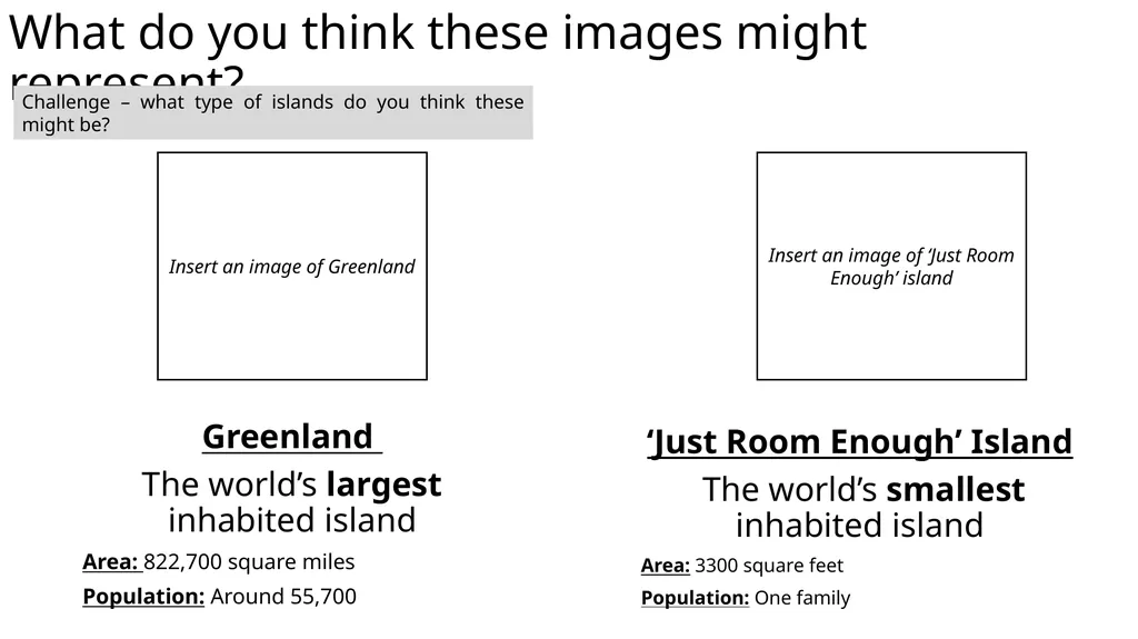
What do you think these images might represent? ‘Just Room Enough’ Island
The world’s smallest inhabited island
Area: 3300 square feet
Population: One family Greenland
The world’s largest inhabited island
Area: 822,700 square miles
Population: Around 55,700 Challenge – what type of islands do you think these might be? Insert an image of Greenland Insert an image of ‘Just Room Enough’ island<br>
The world’s smallest inhabited island
Area: 3300 square feet
Population: One family Greenland
The world’s largest inhabited island
Area: 822,700 square miles
Population: Around 55,700 Challenge – what type of islands do you think these might be? Insert an image of Greenland Insert an image of ‘Just Room Enough’ island<br>
09
‘Just Room Enough’ Can you think of an example of a small-scale island and an example of a large-scale island?
What do you think determines whether it is small or large?
Which factors might determine whether a person chooses to live on a specific island?
What factors might determine whether an island is inhabitable or not?<br>
What do you think determines whether it is small or large?
Which factors might determine whether a person chooses to live on a specific island?
What factors might determine whether an island is inhabitable or not?<br>
10
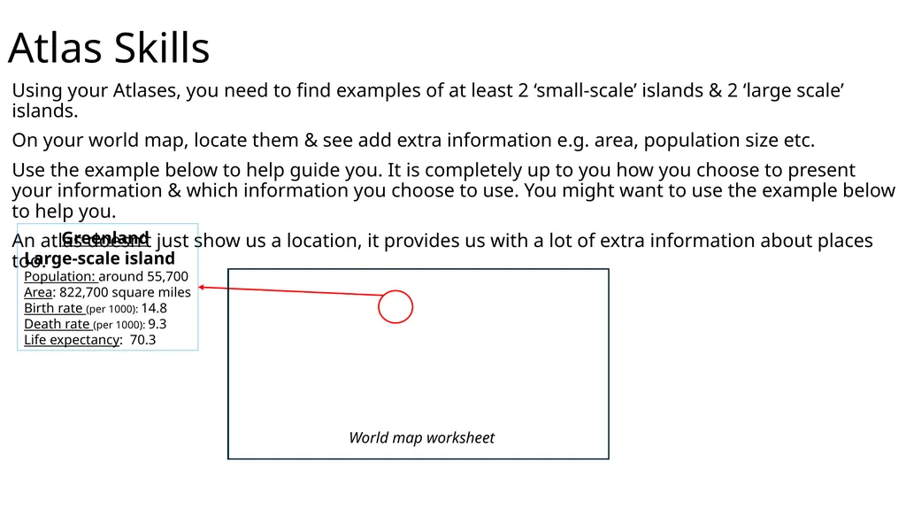
Atlas Skills Using your Atlases, you need to find examples of at least 2 ‘small-scale’ islands & 2 ‘large scale’ islands.
On your world map, locate them & see add extra information e.g. area, population size etc.
Use the example below to help guide you. It is completely up to you how you choose to present your information & which information you choose to use. You might want to use the example below to help you.
An atlas doesn’t just show us a location, it provides us with a lot of extra information about places too. Greenland
Large-scale island
Population: around 55,700
Area: 822,700 square miles
Birth rate (per 1000): 14.8
Death rate (per 1000): 9.3
Life expectancy: 70.3 World map worksheet<br>
On your world map, locate them & see add extra information e.g. area, population size etc.
Use the example below to help guide you. It is completely up to you how you choose to present your information & which information you choose to use. You might want to use the example below to help you.
An atlas doesn’t just show us a location, it provides us with a lot of extra information about places too. Greenland
Large-scale island
Population: around 55,700
Area: 822,700 square miles
Birth rate (per 1000): 14.8
Death rate (per 1000): 9.3
Life expectancy: 70.3 World map worksheet<br>
11
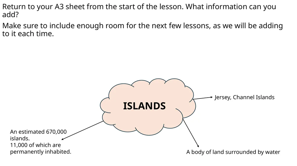
Return to your A3 sheet from the start of the lesson. What information can you add?
Make sure to include enough room for the next few lessons, as we will be adding to it each time. ISLANDS Jersey, Channel Islands A body of land surrounded by water An estimated 670,000 islands.
11,000 of which are permanently inhabited.<br>
Make sure to include enough room for the next few lessons, as we will be adding to it each time. ISLANDS Jersey, Channel Islands A body of land surrounded by water An estimated 670,000 islands.
11,000 of which are permanently inhabited.<br>
12
Homework Find a news article about a ‘near’ and a ‘far’ island OR a news article about a ‘small scale’ or ‘large scale’ island.
It is completely up to you, which news articles you choose.
You should:
Summarise the information from the news article, into one paragraph.
Choose at least 3 geographical key words to link to the article & explain how they link and what they mean.
What do the articles make you want to find out more information about? Write 3 questions you could research further.
Websites like Newsround, BBC news etc, will help you with this.<br>
It is completely up to you, which news articles you choose.
You should:
Summarise the information from the news article, into one paragraph.
Choose at least 3 geographical key words to link to the article & explain how they link and what they mean.
What do the articles make you want to find out more information about? Write 3 questions you could research further.
Websites like Newsround, BBC news etc, will help you with this.<br>
13
Plenary:
Quote of the day “In our changing world, nothing changes more than geography”.
Pearl S. Buck What do you think about this quote?
To what extent do you agree/disagree with it?<br>
Pearl S. Buck What do you think about this quote?
To what extent do you agree/disagree with it?<br>
14
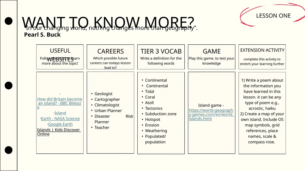
WANT TO KNOW MORE? LESSON ONE USEFUL WEBSITES CAREERS TIER 3 VOCAB GAME EXTENSION ACTIVITY Follow the links to learn more about the topic! Which possible future careers can todays lesson lead to? Write a definition for the following words Play this game, to test your knowledge complete this activity to stretch your learning further “In our changing world, nothing changes more than geography”.
Pearl S. Buck<br>
Pearl S. Buck<br>
15
Information Slides for Lesson Print out one copy of these sheets and place around the room.<br>
16
Continental Islands Continental islands were once connected to a continent. They still sit on the continental shelf. This includes those that formed while the Earth’s shifting continents separated the land.
Scientists say that millions of years ago, there was a supercontinent called Pangaea. Eventually, slow movements of the Earth’s crust broke apart Pangaea into several pieces that began to drift apart. When the breakup occurred, some large chunks of land split. These fragments of land became islands.
Additionally, some continental islands formed because of changes in sea level. At the peak of the most recent glacial period, about 18,000 years ago, ice covered large parts of the Earth. Water was locked in glaciers, and the sea level was much lower than it is today. As glaciers began to melt, the sea level rose. The ocean flooded many low-lying areas, creating islands such as the British Isles, which were once part of mainland Europe.
Greenland and Madagascar are examples of continental islands. https://education.nationalgeographic.org/resource/island/<br>
Scientists say that millions of years ago, there was a supercontinent called Pangaea. Eventually, slow movements of the Earth’s crust broke apart Pangaea into several pieces that began to drift apart. When the breakup occurred, some large chunks of land split. These fragments of land became islands.
Additionally, some continental islands formed because of changes in sea level. At the peak of the most recent glacial period, about 18,000 years ago, ice covered large parts of the Earth. Water was locked in glaciers, and the sea level was much lower than it is today. As glaciers began to melt, the sea level rose. The ocean flooded many low-lying areas, creating islands such as the British Isles, which were once part of mainland Europe.
Greenland and Madagascar are examples of continental islands. https://education.nationalgeographic.org/resource/island/<br>
17
Barrier Islands Barrier islands are narrow and lie parallel to coastlines. Some are a part of the continental shelf (continental islands) and made of sediment—sand, silt, and gravel. Barrier islands can also be coral islands, made from billions of tiny coral skeletons. Barrier islands are separated from shore by a lagoon or a sound. They are called barrier islands because they act as barriers between the ocean and the mainland. They protect the coast from being directly battered by storm waves and winds.
Some barrier islands form when ocean currents pile up sand on sandbars parallel to coastlines. Eventually the sandbars rise above the water as islands.
Other barrier islands formed during the most recent ice age. As glaciers melted, the sea level rose around coastal sand dunes, creating low-lying, sandy islands. The Outer Banks, along the southeastern coast of the United States, are this type of barrier island.
Still other barrier islands were formed of materials deposited by Ice Age glaciers. When glaciers melted, they left piles of the rock, soil, and gravel they had carved out of the landscape. These piles of debris are called moraines. As flooding occurred along coasts after the glaciers melted, these moraines were surrounded by water. Long Island, New York, and Nantucket, Massachusetts, are both barrier islands formed by glacial moraines. https://education.nationalgeographic.org/resource/island/<br>
Some barrier islands form when ocean currents pile up sand on sandbars parallel to coastlines. Eventually the sandbars rise above the water as islands.
Other barrier islands formed during the most recent ice age. As glaciers melted, the sea level rose around coastal sand dunes, creating low-lying, sandy islands. The Outer Banks, along the southeastern coast of the United States, are this type of barrier island.
Still other barrier islands were formed of materials deposited by Ice Age glaciers. When glaciers melted, they left piles of the rock, soil, and gravel they had carved out of the landscape. These piles of debris are called moraines. As flooding occurred along coasts after the glaciers melted, these moraines were surrounded by water. Long Island, New York, and Nantucket, Massachusetts, are both barrier islands formed by glacial moraines. https://education.nationalgeographic.org/resource/island/<br>
18
Oceanic Islands Oceanic islands, also known as volcanic islands, are formed by eruptions of volcanoes on the ocean floor. No matter what their height, oceanic islands are also known as “high islands.” Continental and coral islands, which may be hundreds of meters taller than high islands, are called “low islands.”
As volcanoes erupt, they build up layers of lava that may eventually break the water’s surface. When the tops of the volcanoes appear above the water, an island is formed. While the volcano is still beneath the ocean surface, it is called a seamount.
Oceanic islands can form from different types of volcanoes. One type forms in subduction zones, where one tectonic plate is shifting under another. The island nation of Japan sits at the site of four tectonic plates. Two of these plates, the Eurasian plate to the west and the North American plate to the north, are associated with continental shelves. The other two, the Philippine plate and the Pacific plate, are oceanic. The heavy oceanic plates (the Pacific and the Philippine) are subducting beneath the lighter Eurasian and North American plates. Japan’s islands are some of the most actively volcanic in the world.
Another type of volcano that can create an oceanic island forms when tectonic plates rift, or split apart from one another. In 1963, the island of Surtsey was born when a volcanic eruption spewed hot lava in the Atlantic Ocean near Iceland. The volcano was the result of the Eurasian tectonic plate splitting away from the North American plate. This tiny island is one of the world’s newest natural islands.
Another type of oceanic island forms as a continent shifts over a “hot spot.” A hot spot is a break in the Earth’s crust where material from the mantle bubbles or rushes up. The crust shifts, but the hot spot beneath stays relatively stable. Over millions of years, a single hot spot formed the islands of the U.S. state of Hawaii. Hawaii’s “Big Island” is still being formed by Mauna Loa and Kilauea, two volcanoes currently sitting over the hot spot. The newest Hawaiian island, Loihi, also sits over the hot spot, but is still a seamount about 914 meters (3,000 feet) beneath the Pacific. https://education.nationalgeographic.org/resource/island/<br>
As volcanoes erupt, they build up layers of lava that may eventually break the water’s surface. When the tops of the volcanoes appear above the water, an island is formed. While the volcano is still beneath the ocean surface, it is called a seamount.
Oceanic islands can form from different types of volcanoes. One type forms in subduction zones, where one tectonic plate is shifting under another. The island nation of Japan sits at the site of four tectonic plates. Two of these plates, the Eurasian plate to the west and the North American plate to the north, are associated with continental shelves. The other two, the Philippine plate and the Pacific plate, are oceanic. The heavy oceanic plates (the Pacific and the Philippine) are subducting beneath the lighter Eurasian and North American plates. Japan’s islands are some of the most actively volcanic in the world.
Another type of volcano that can create an oceanic island forms when tectonic plates rift, or split apart from one another. In 1963, the island of Surtsey was born when a volcanic eruption spewed hot lava in the Atlantic Ocean near Iceland. The volcano was the result of the Eurasian tectonic plate splitting away from the North American plate. This tiny island is one of the world’s newest natural islands.
Another type of oceanic island forms as a continent shifts over a “hot spot.” A hot spot is a break in the Earth’s crust where material from the mantle bubbles or rushes up. The crust shifts, but the hot spot beneath stays relatively stable. Over millions of years, a single hot spot formed the islands of the U.S. state of Hawaii. Hawaii’s “Big Island” is still being formed by Mauna Loa and Kilauea, two volcanoes currently sitting over the hot spot. The newest Hawaiian island, Loihi, also sits over the hot spot, but is still a seamount about 914 meters (3,000 feet) beneath the Pacific. https://education.nationalgeographic.org/resource/island/<br>
19
Coral Islands Coral islands are low islands formed in warm waters by corals. Corals build up hard external skeletons of calcium carbonate (also known as limestone).
Colonies of corals may form huge reefs. Some coral reefs may grow up in thick layers from the seafloor, until they break the water’s surface, creating coral islands. Other organic and inorganic material, like rock and sand, helps create coral islands. The islands of the Bahamas, in the Atlantic Ocean and Caribbean Sea, are coral islands.
Another kind of coral island is the atoll. An atoll is a coral reef that begins by growing in a ring around the sides of an oceanic island. As the volcano slowly sinks into the sea, the reef continues to grow. Atolls are found chiefly in the Pacific and Indian Oceans. https://education.nationalgeographic.org/resource/island/<br>
Colonies of corals may form huge reefs. Some coral reefs may grow up in thick layers from the seafloor, until they break the water’s surface, creating coral islands. Other organic and inorganic material, like rock and sand, helps create coral islands. The islands of the Bahamas, in the Atlantic Ocean and Caribbean Sea, are coral islands.
Another kind of coral island is the atoll. An atoll is a coral reef that begins by growing in a ring around the sides of an oceanic island. As the volcano slowly sinks into the sea, the reef continues to grow. Atolls are found chiefly in the Pacific and Indian Oceans. https://education.nationalgeographic.org/resource/island/<br>
20
Artificial Islands Artificial islands are made by people and are created in different ways for different purposes.
Artificial islands can expand part of an already-existing island by draining the water around it. This creates more arable land for development or agriculture. The Nahua people of 14th-century Mexico created their capital, Tenochtitlan, from an artificial island in Lake Texcoco. They expanded an island in the swampy lake and connected it to the mainland through roads. Aqueducts supplied the city’s 200,000 residents with freshwater. Mexico City sits on the remains of Tenochtitlan.
Artificial islands can also be created from material brought in from elsewhere. In Dubai, companies dig (dredge) sand from the Persian Gulf and spray it near shore. Dubai’s huge artificial islands are shaped like palm trees and a map of the world. A new island complex, the Dubai Waterfront, will be the largest man-made development in the world. https://education.nationalgeographic.org/resource/island/<br>
Artificial islands can expand part of an already-existing island by draining the water around it. This creates more arable land for development or agriculture. The Nahua people of 14th-century Mexico created their capital, Tenochtitlan, from an artificial island in Lake Texcoco. They expanded an island in the swampy lake and connected it to the mainland through roads. Aqueducts supplied the city’s 200,000 residents with freshwater. Mexico City sits on the remains of Tenochtitlan.
Artificial islands can also be created from material brought in from elsewhere. In Dubai, companies dig (dredge) sand from the Persian Gulf and spray it near shore. Dubai’s huge artificial islands are shaped like palm trees and a map of the world. A new island complex, the Dubai Waterfront, will be the largest man-made development in the world. https://education.nationalgeographic.org/resource/island/<br>
21
Tidal Islands Continental islands may form through the weathering and erosion of a link of land that once connected an island to the mainland. Tidal islands are a type of continental island where land connecting the island to the mainland has not completely eroded but is underwater at high tide. The famous island of Mont Saint-Michel, France is an example of a tidal island.
In the UK, there is Lindisfarne (Holy Island). https://education.nationalgeographic.org/resource/island/<br>
In the UK, there is Lindisfarne (Holy Island). https://education.nationalgeographic.org/resource/island/<br>