Swot in a nutshell The Swot mission Partnership between NASA, CNES, the Canadian Space Agency and the UK space agency, A new concept, wide-swath interferometric altimetry (KaRIn) two 50-km swaths a bi-dimensional image All weather, night
"Swot in a nutshell The Swot mission Partnership" is the property of its rightful owner. Permission is granted to
download and print the materials on this website for personal, non-commercial use only, and to display it
on your personal computer provided you do not modify the materials and that you retain all copyright
notices contained in the materials. By downloading content from our website, you accept the terms of this
agreement.
Presentation Transcript
01
Swot in a nutshell<br>
02
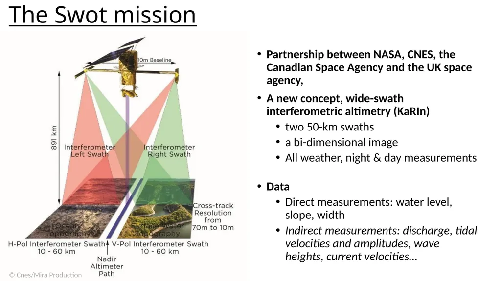
The Swot mission Partnership between NASA, CNES, the Canadian Space Agency and the UK space agency,
A new concept, wide-swath interferometric altimetry (KaRIn)
two 50-km swaths
a bi-dimensional image
All weather, night & day measurements
Data
Direct measurements: water level, slope, width
Indirect measurements: discharge, tidal velocities and amplitudes, wave heights, current velocities…<br>
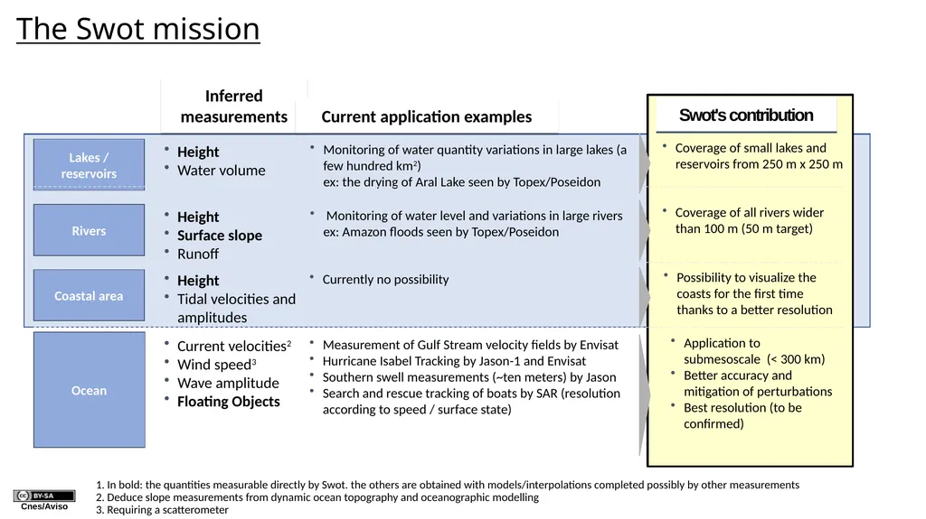
Rivers Coastal area Ocean Lakes / reservoirs Inferred measurements Height
Water volume Height
Surface slope
Runoff Height
Tidal velocities and amplitudes Current velocities2
Wind speed3
Wave amplitude
Floating Objects Current application examples Monitoring of water quantity variations in large lakes (a few hundred km2) ex: the drying of Aral Lake seen by Topex/Poseidon Currently no possibility 1. In bold: the quantities measurable directly by Swot. the others are obtained with models/interpolations completed possibly by other measurements
2. Deduce slope measurements from dynamic ocean topography and oceanographic modelling
3. Requiring a scatterometer Swot's contribution Coverage of small lakes and reservoirs from 250 m x 250 m
Coverage of all rivers wider than 100 m (50 m target) Application to submesoscale (< 300 km)
Better accuracy and mitigation of perturbations
Best resolution (to be confirmed) Possibility to visualize the coasts for the first time thanks to a better resolution Monitoring of water level and variations in large rivers ex: Amazon floods seen by Topex/Poseidon Measurement of Gulf Stream velocity fields by Envisat
Hurricane Isabel Tracking by Jason-1 and Envisat
Southern swell measurements (~ten meters) by Jason
Search and rescue tracking of boats by SAR (resolution according to speed / surface state) The Swot mission<br>
05
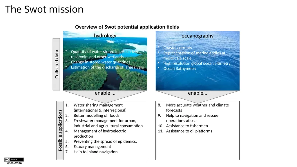
oceanography Collected data Possible applications hydrology Quantity of water stored in lakes, rivers, reservoirs and other wetlands
Change in stored water quantities
Estimation of the discharge of large rivers Water sharing management (international & interregional)
Better modelling of floods
Freshwater management for urban, industrial and agricultural consumption
Management of hydroelectric production
Preventing the spread of epidemics,
Estuary management
Help to inland navigation enable … Coastal currents
Representation of marine eddies at mesoscale scale
High resolution global ocean altimetry
Ocean Bathymetry More accurate weather and climate forecasts
Help to navigation and rescue operations at sea
Assistance to fishermen
Assistance to oil platforms enable… The Swot mission Overview of Swot potential application fields<br>