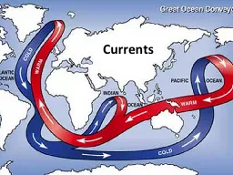
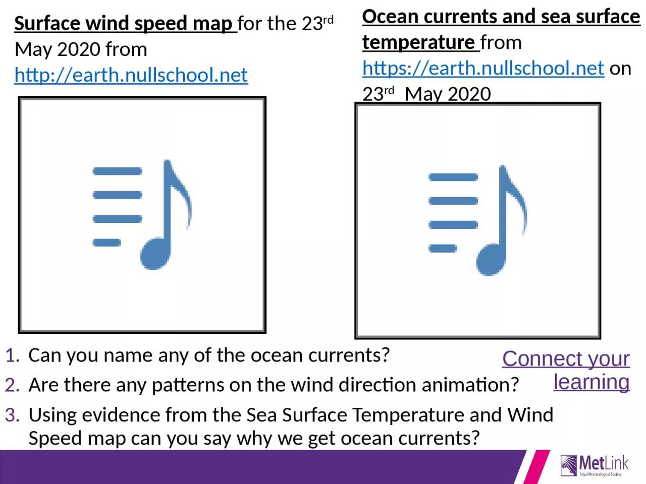
Are there any patterns on the wind direction animation Using evidence from the Sea Surface Temperature and Wind Speed map can you say why we get ocean currents Ocean currents and sea surface temperature ID: 936034
Download Presentation The PPT/PDF document "Connect your learning Can you name any o..." is the property of its rightful owner. Permission is granted to download and print the materials on this web site for personal, non-commercial use only, and to display it on your personal computer provided you do not modify the materials and that you retain all copyright notices contained in the materials. By downloading content from our website, you accept the terms of this agreement.
Slide1
Connect your learning
Can you name any of the ocean currents? Are there any patterns on the wind direction animation?Using evidence from the Sea Surface Temperature and Wind Speed map can you say why we get ocean currents?
Ocean currents and sea surface temperature from https://earth.nullschool.net on 23rd May 2020
Surface wind speed map for the 23rd May 2020 from http://earth.nullschool.net
Slide2What am I?
Hold up your whiteboard with your guessYou’ll know I’m coming up to a week before I arrive
I have many names, but you’ve probably never met meEventually I will slow down and disappearI can destroy most thingsI’m a killer; I can crush you, drown you, and make you sickI can be hundreds of miles acrossI can be more powerful than a nuclear bomb
I’m powered by the SunI only have one eye
Slide3I’m a Tropical Cyclone
(also known as a typhoon or hurricane)
Describe the satellite image – what do you see?
Hurricane Maria, 2017. About 900 miles across.
Slide4Tropical Cyclones
Slide5Tropical cyclones
ObjectivesTo understand what weather and hazards are associated with a Tropical CycloneTo be able to describe the structure of a Tropical cyclone
To be able to explain how and why Tropical cyclones formOutcomes
Completed answers to questions on a video about Hurricane DorianA diagram of a tropical cycloneExplained annotations on your diagram of a tropical cyclone
Slide6What are Tropical Cyclones?
Slide7What are the Impacts of Tropical Cyclones?
Describe the weather during Hurricane Dorian – a tropical cyclone.Describe the effects of this tropical cyclone on
people and the environmenthttps://youtu.be/T-jEj8Bh5Kc
Slide8500 to 2000km
About12KM
Anvil of
clouds
bands
Warm upwelling air
Cooler sinking air
Spiral of fastest winds around the
Spiral bands of
Cross section through a tropical cyclone
Line of cross section
WORD BOX
thunderstorms Cumulonimbus Rain
26°C+ Eye wind
Low
shear
Warm Ocean Water
Complete the diagram below by adding each word from the box into the gaps
Slide9500 to 2000km
EYE
About12KM
Anvil of
CUMULONIMBUS
clouds
RAIN
bands
Warm upwelling air
Cooler sinking air
Spiral of fastest winds around the
EYE WALL
Spiral bands of
THUNDERSTORMS
Cross section through a tropical cyclone
Line of cross section
Low
WIND
shear
Warm Ocean Water
26°C+
Where do TROPICAL CYCLONES occur?
Slide11Tropical Cyclone
s (hurricanes, typhoons) develop as a result of particular physical conditions.Map from memory exercise – Tropical cyclone location. You are in groups of 3, you will get to come to the front of the class and look at the picture for 30 seconds, then go back to your table to reproduce what you saw
5 goes a teamOnce finished;Describe the location of Tropical cyclones
Slide12NORTH AMERICA
EUROPE
AFRICA
SOUTH AMERICA
ASIA
AUSTRALASIA
13
26
9
2
9
7
9
TROPIC OF CANCER (23.5°N)
TROPIC OF CAPRICORN (23.5°S)
EQUATOR
Map of major Tropical Cyclones
KEY
Sea temperatures go above 26°C
Direction of cyclone movement
9
Hurricane Dorian
9
Typhoon Haiyan
HURRICANES
CYCLONES
TYPHOONS
Average number of cyclones a year
HURRICANES
Local basin name for tropical cyclones
Slide13This map shows the tracks of all tropical cyclones which formed worldwide from 1985 to 2005.
Background image: NASA this version:
Nilfanion
/ Public domain
70
°N
60
°N
50
°N
40
°N
30
°N
20
°N
10
°N
0
°
10
°S
20
°S
30
°S40°S50°S5°N5°SWhich areas get the most tropical cyclones?Look carefully between 5°N and 5°S – what do you notice?
Slide14Describe the location of Tropical cyclones
USEFUL SENTENCE STARTERS - Tropical cyclones are found...Most Tropical cyclones occur in.....The least Tropical cyclones occur.....
Many Tropical cyclones occur at the latitudes of.....There are no Tropical cyclones.....Tropical cyclones are called …The countries most affected by Tropical cyclones are…This second map shows that we do not get Tropical cyclones between the latitudes of…
Slide15Skills exercise:
Using GIS to plot tropical cyclone dataUse the Hurricane Dorian Excel data to plot the track of this Hurricane. There is an instructional video opposite to help you.Select all of the data in the table
Click on “3D maps”Click on “new tour”Click on “Flat map”Click on “add field” in “Height” on the right hand menu and add the wind speed data (mph)Change the graph type to a “heat map”
Slide16How do TROPICAL CYCLONES form?
Slide17Tropical Cyclones
Take notes on https://youtu.be/Ik2GPo6-AvY Add some extra annotations to your cross section of a tropical cyclone diagram to explain how they form – the next slide will help too.
Slide18500 to 2000km
Line of cross section
1.
The sun sends incoming solar radiation to Earth which warms our oceans
2.
This warms the oceans to a critical 26°C
3.
This causes warm MOIST air to rise through the air
4.
This air cools as it rises, causing condensation to occur and clouds to form
5.
Some cooled air sinks back down helping to create the EYE
6.
Air rushes in from outside the cyclone creating winds
7.
The whole cyclone rotates because of the Earth’s spin
Slide19Storm surge
: A rise in sea level due to the low pressure and winds pushing water onshore. In 1899’s Cyclone
Mahina
the storm surge was 14.5m. Hurricane Katrina caused a 7.7 to 8.5m storm surge in 2005
Extreme rainfall
: Tropical Cyclone Hyacinthe was associated with over 6m of rainfall. Hurricane Harvey dumped 1.53m of rainfall on Texas in 2017.
High winds
: The 1924 Cuba hurricane had wind speeds of 165 miles per hour. Hurricane Laura in 2020 hit 150 miles per hour
Key Impacts of Tropical Cyclones
Slide20We can prepare for Tropical Cyclones!
Is there enough detail on the poster below?Could anything else be included?
https://www.weather.gov/safety/hurricane-plan
Slide21Review – True or false?1-10 in the back of your books
5 seconds thinking time per questionIf a storm isn’t spinning, it can’t be a tropical cycloneA tropical cyclone will always have a name
A tropical cyclone can form over landThe name for hot air rising is ‘convection’.A tropical cyclone will have winds of at least 74mph.A tropical cyclone can only form over water that is 20oC or warmer
A tropical cyclone would spin clockwise in the North AtlanticA tropical cyclone could form in the Arctic OceanA tropical cyclone near Japan would be called a hurricane.
Tropical cyclones can happen in any month of the year
True
True
False
True
True
False
7. False
8. False
9. False
10. True
<5 The leaves barely rustle
6-8 Getting pretty breezy
9+ Blown away!
OR
https://quizlet.com/_8y59ir?x=1jqt&i=38anvz
Tropical Storms and
c
limat
e chang
e
1850
2018
1900
1950
2000
In a warming world what will the consequences be for people living in areas that suffer tropical cyclones?
Thunk
Question
Thunk question“A Thunk question is a…simple-looking question about everyday things that stops you in your tracks and helps you start to look at the world in a whole new light.” https://www.independentthinking.co.uk/thunks/ n.b. Thunk in this sense is not an official word in the Cambridge English Dictionary!
Does the sky weigh more on a cloudy day?
Slide24Further resources
This lesson was designed to give key stage 3 students a “taster” or introduction to Tropical Cyclones – there are a huge amount of great resources and lesson idea here - https://www.metlink.org/