PPT-A GIS approach to understanding groundwater – surface wat
Author : alexa-scheidler | Published Date : 2017-04-26
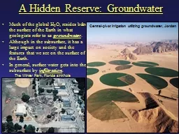
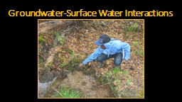
Trinity Stout CEE 6440 Introduction GroundwaterSurface Water GWSW interactions significantly vary temporally and spatially The majority of GW research focuses
Presentation Embed Code
Download Presentation
Download Presentation The PPT/PDF document "A GIS approach to understanding groundwa..." is the property of its rightful owner. Permission is granted to download and print the materials on this website for personal, non-commercial use only, and to display it on your personal computer provided you do not modify the materials and that you retain all copyright notices contained in the materials. By downloading content from our website, you accept the terms of this agreement.
A GIS approach to understanding groundwater – surface wat: Transcript
Download Rules Of Document
"A GIS approach to understanding groundwater – surface wat"The content belongs to its owner. You may download and print it for personal use, without modification, and keep all copyright notices. By downloading, you agree to these terms.
Related Documents