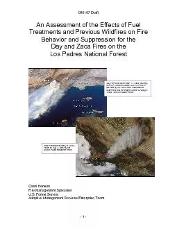
/
An Assessment of the Effects of Fuel Treatments and Previous Wildfires An Assessment of the Effects of Fuel Treatments and Previous Wildfires

An Assessment of the Effects of Fuel Treatments and Previous Wildfires - PDF document

arya
arya . @arya
Follow
344 views
Uploaded On 2021-06-08

An Assessment of the Effects of Fuel Treatments and Previous Wildfires - PPT Presentation

080107 Draft Day Fire photo taken Sept 17 2006 courtesy of NASA Astronaut photo ISSO13E81687 provided by ISS Crew Earth Observations experiment and the Image Science Analysis Group Johnson ID: 838071

forest fire santa fuel fire forest fuel santa burn fuels area behavior burned firefighters areas 080107 draft suppression day

Share:

Link:

Embed:

Download Presentation from below link

Download Pdf The PPT/PDF document "An Assessment of the Effects of Fuel Tre..." is the property of its rightful owner. Permission is granted to download and print the materials on this web site for personal, non-commercial use only, and to display it on your personal computer provided you do not modify the materials and that you retain all copyright notices contained in the materials. By downloading content from our website, you accept the terms of this agreement.


Presentation Transcript

1 080107 Draft An Assessment of the Effec
080107 Draft An Assessment of the Effects of Fuel Treatments and Previous Wildfires on Fire Behavior and Suppression for the Day and Zaca Fires on the Los Padres National Forest Day Fire photo taken Sept. 17, 2006, courtesy of NASA, Astronaut photo ISSO13-E-81687, provided by ISS Crew Earth Observations experiment and the Image Science & Analysis Group, Johnson Space Center. Zaca Fire photo courtesy of NASA. Taken on Aug. 5, 2007 by the MODIS Rapid Response Team. Carol Henson Adaptive Management Services Enterprise Team - 1 - 080107 Draft Executive Summary 3 Introduction 6 Wildland Urban Interface 7 Fire History on the Los Padres National Forest 8 Objectives 9 Methodology 9 2006 Day Fire 9 Description of Fire Environment 10 Fire Danger and Weather 10 Fuels 11 Fuel Treatments 12 Topography 13 Fire Behavior Chronology 13 Fire Effects of Fuel Treatments 15 Fire Behavior 15 Suppression Effectiveness 16 Fire Effects of Non-treatments 16 Fire Behavior 16 2007 Zaca Fire 16 Description of Fire Environment 17 Fire Danger and Weather 17 Fuels 19 Fuel Treatments 19 Topography 22 Fire Behavior Chronology 22 Fire Effects of Fuel Treatments 26 Fire Behavior 26 Suppression Effectiveness 27 Fire Effects of Non-treatments 27 Fire Behavior 27 Summary 28 Acknowledgement 30 Appendices 31 - 2 - 080107 Draft The 2006 Day and 2007 Zaca Fires both occurred on the Los Padres National Forest in The 2006 Day Fire burned over 162,000 acres mostly in rugged terrain

2 with moderate to heavy chaparral and ti
with moderate to heavy chaparral and timber. Repeated episodes of Santa Ana winds kept the fire moving for six weeks during the months of September and October. The fire burned mostly National Forest System lands but also threatened or caused damage to the communities of Pine Mountain Club, Lockwood Valley, and Frazier Park. The 2007 Zaca Fire burned over 240,000 acres in drought stressed and frost-killed chaparral and drought stressed timber. This “fuels driven” fire burned for almost nine weeks during the months of July, August, and the first few days of September. Most of the fire burned on National Forest System lands threatening homes near Los Olivos, Santa Barbara, and Montecito. It also threatened and impacted municipal watersheds that supply water to the communities of Santa Barbara, Montecito, Santa Ynez, Lompoc, Cuyama, and Santa Maria. Tim Sexton, USFS, Washington Office Fire Use Program Manager requested Adaptive Management Services Enterprise Team assess the effectiveness of fuel treatments on The objectives for the assessment were to evaluate: Effects of hazardous fuel treatments on Fire behavior Fire suppression Fire behavior in non-treatment areasFuel treatments within the Day Fire perimeter included hand piling and pile burning, and broadcast burning near the Sespe Wilderness. Fuel treatments reduced fire intensity in timbered areas but did not aid in fire suppression due to their isolated locations. Fuel treatments in the Zaca Fire perimeter included prescribed burning in the Santa Ynez and Cuyama Watersheds. These prescribed burns did not aid firefighters in fire suppression; however, fuelbreaks and road systems were successfully utilized by firefighters in

3 containing the fire. Fuel treatments
containing the fire. Fuel treatments projects were designed to meet resource objectives and not hazardous fuels objectives. Fuel treatments designed with resource objectives provided no benefit to fire suppression efforts. - 3 - 080107 Draft Firefighters that were interviewed felt that a minimum of 70% of a prescribed burn project area needed to burn to be effective in Prescribed burn projects may have slowed fire backing down into Buckhorn Canyon in the Santa Ynez Watershed; however, once the fire reached the bottom of Buckhorn Canyon in the Santa Ynez Watershed the fire realigned itself and made rapid runs back up the canyon in fuels not consumed by the backing fire. Firefighters felt that the regrowth in the older prescribed burn projects in the Santa Ynez Watershed were near a rotational age of 30 years and retreatment of those projects was needed to be Fuel treatments were not designed for and were not effective in extreme conditions such as record low live fuel moistures or extreme fire behavior such as plume dominated fire. Previous wildfires provided barriers and opportunities for fire suppression. The 1994 Marre and the 1998 Ogilvy Fires acted as barriers to the Zaca Fire even under extremely dry conditions. The 2003 Piru and 2002 Wolf Fires acted as barriers for the Day Fire. In addition, fire scars within the Day Fire area burned with lower intensity leaving standing vegetation. Vegetation was completely consumed in areas outside of those wildfires. Isolated fuel treatment projects, such as the Alamo Prescribed Burn Project, need to be landscape level treatments covering larger areas in order to modify fire behavior for large fires such as the Day Fires. Th

4 e Alamo Prescribed Burn Project, even if
e Alamo Prescribed Burn Project, even if all units had been treated, would not have been adequate to aid Fuelbreaks have historically been effective in assisting fire suppression resources in fighting fires. Fuelbreaks have been deteriorating due to inadequate budgets and the need to meet large acre targets. The long-term investment of identifying and maintaining strategic fuelbreaks across the forest would reduce suppression costs in the future (i.e. using 1 dozer for fuelbreak maintenance over several years versus using 6 to 12 dozers to reopen fuelbreaks during a wildfire). Road systems have historically been effective in assisting fire suppression resources. Many of these road systems have been deteriorating due to inadequate budgets. The long-term investment of identifying and maintaining critical road systems would provide the needed access for firefighters and provide cost savings for fire suppression. - 4 - 080107 Draft Road systems that were widened by removing vegetation or masticating fuels from roadsidesopportunities for crews to hold roads. The long-term investment of identifying and maintaining vegetation along strategic road systems will increase opportunities for crews to hold fires and reduce suppression costs in the future (i.e. 2 masticators maintaining road systems versus multiple masticators during a Understory burning in timber on Alamo Fuel and Vegetation Management Project Units 1 and 4 reduced fire intensity and provided protection to timber stands; however, the treatments did not assist in the suppression effort. - 5 - 080107 Draft The Los Padres National Forest encompasses approximately 1.76 million acres in the Coast and Transverse Ranges of Cali

5 fornia. The forest is located south of
fornia. The forest is located south of San Francisco, west of the San Joaquin Valley, and north of Ventura. The forest stretches almost 220 miles from north to south and consists of two separate land divisions. The northern division is within Monterey County and northern San Luis Obispo County and includes the Big Sur Coast and scenic interior areas. The southern division of the forest includes lands within San Luis Obispo, Santa Barbara, Ventura and The Los Padres serves an enormous population base including the San Francisco Bay Area, the greater Los Angeles metropolitan area, the southern San Joaquin Valley and the many communities along the south and central coast. The forest provides the scenic backdrop for many communities and is a significant component of the quality of life in this area. The forest also supplies a substantial portion of the water needs of several downstream communities including Santa Barbara and Montecito. Los Padres National Forest is a major supplier of wildland recreation for southern California and the Bay Area. Visitors are attracted to the variety of terrain, vegetation, and recreational settings. Forest recreation has increased yearly. There are 1,257 miles of maintained trails that provide both day-use and extended backpacking opportunities. The Forest has 459 miles of roads and trails designated for off-highway vehicle use. Road systems within the forest, other than county or state roads, have been poorly maintained due to lack of funding. Much of Los Padres National Forest is unroaded and primitive. Approximately 68% of the forest is inaccessible by vehicles, including fire suppression resources. It has 10 congressionally designated wildernesses com

6 prising approximately 875,000 acres or
prising approximately 875,000 acres or - 6 - 080107 Draft about 48% of the forest. These include the Ventana, Silver Peak, Santa Lucia, Machesna, Garcia, San Rafael, Dick Smith, Sespe, Matilija and Chumash Wildernesses. The forest provides habitat for approximately 468 species of wildlife and 26 listed threatened and endangered plant and animal species. Ecosystems in Los Padres National Forest range from semi-desert in interior areas to redwood forest on the coast. Six major vegetation types cover the Forest's landscape: chaparral, mixed evergreen and oak forest, oak woodland, pinion-juniper woodland, conifer forest, and grassland. Cover types recorded in early 2006 are shown in Table 1. Table 1. Cover Types in Los Padres National Forest Cover Type Estimated Cover (%) Chaparral Mixed evergreen and oak forest Oak woodland 3 Pinion and juniper woodland Coulter, Jeffrey, and Ponderosa Pine Grassland (natural and type conversion) Historic fire-return intervals in chaparral likely ranged from 40 to 60 years (Minnich 1988). As a result of increased human-caused ignitions there has been a decrease in the average fire return interval to 30 to 40 years or less in some areas (Keeley and others 1999a). In much of southern California, human-caused ignitions have increased commensurate with population growth (Keeley and others 1999a). Wildland Urban Interface A large portion of the forest is considered a "wildland-urban interface." The forest has 1,728 miles of private land that borders national forest land. The forest has a number of communities that that lie within, directly adjacent to, or are in a “wildland fire threat zone” of the forest boundary. The communities threa

7 tened by the 2006 Day Fire and 2007 Zaca
tened by the 2006 Day Fire and 2007 Zaca Fire includes: Santa Barbara Ranger District - Goleta, Santa Barbara, Montecito, Ojai Ranger District - Meiners Oaks, Oakview, Ojai, Santa Paula, Mt. Pinos Ranger District - Pine Mountain Club, Lockwood Valley, and A number of fires on the Los Padres pose an imminent threat to communities within and along the forest boundary, especially on the southern division. This threat is magnified during periods of high wind, high temperatures, low humidity, low live fuel moistures, and Fire History on the Los Padres National Forest The Los Padres National Forest is one of the most fire prone forests in the National Forest System. Wildfire has burned over 2.7 million acres in the forest since 1912, with historic averages of about 28,000 acres per year. Most wildfires in the forest are human-caused with the remaining caused by lightning. The average annual wildfires have - 7 - 080107 Draft increased steadily over the last 60 years. This increase in fire occurrence is attributed to urban encroachment and expanded recreational use of the forest. Some of the largest wildfires in California’s history have occurred within or adjacent to the forest (see Table 2). In addition, multiple large fires can occur during the same period of time on the forest. An example of this was in 1985 when the forest had three large fires that started within six days of each other. The Wheeler Fire on the Ojai Ranger District (119,361 acres) and the Las Pilitas Fire on the Santa Lucia Ranger District (74,640 acres) started on July 1st, and the Gorda-Rat Fire on the Monterey Ranger District (55,700 acres) started on July 6th. Table 2. CAL FIRE 20 Largest California Wildla

8 nd Fires The terrain, vegetation and we
nd Fires The terrain, vegetation and weather patterns are such that wildfires in the forest's interior can and do move rapidly. Major fire runs of up to 8.5 miles in a burn period do occur, and these can quickly burn into adjacent communities. An example of this was the 1990 Paint Fire that traveled 5 miles into Santa Barbara and Goleta destroying over 600 Since peak rainfall follows the fire season, the forest and adjacent communities are also often at risk from a fire-flood cycle and attendant erosion after wildfires. The objectives for the assessment were to evaluate: - 8 - 080107 Draft Effects of hazardous fuel treatments on Fire behavior Fire suppression Fire behavior in non-treatment areas and other vegetation management Interviews with firefighters and fire behavior experts on the Day and Zaca Fires were conducted; ground and aerial reconnaissance of both fires occurred before, during and after the fires; video and photographs of both fires were reviewed; and data that was collected by staff on the Los Padres National Forest were all utilized for this report. 2006 Day Fire The Day Fire started on September 4, 2006 at 1:55 p.m. in upper Piru Creek, approximately 16 miles north of Castaic, California. The fire was caused by an individual burning a small amount of material within the Los Padres National Forest. It was contained on October 13, 2006 and burned a total of162,702 acres. Description of Fire Environment Fire Danger and Weather Fire Danger The Los Padres NF had experienced normal to above normal rainfall in the winter and spring of 2005 – 2006. The U.S. Drought Monitor for September 5, 2006 showed that the area was not affected by drought. - 9 - 080107

9 Draft However, temperatures in Califor
Draft However, temperatures in California from May through July were above normal with a return to normal temperatures in August. The increase in temperatures for the three-month period caused fuel moistures in the area to drop significantly. In May, the live fuel moistures at Rose Valley were 80% and at Ozena were 73%, but by the first of September the fuel moistures had dropped to 63% and 57% the Energy Release Component (ERC). This indicated that although it appeared the area was rated moderately moist on the PDSI chart, the fuels were extremely dry and ready to The Energy Release Component (ERC) is a National Fire Danger Rating System (NFDRS) index related to how hot a fire could burn. The ERC serves as a good easonal fire danger trends well. The ERC is a funof the fuel model and live and dead fuel moistures. Fuel loading, woody fuel moistures, and larger fuel moistures all have an influence on the ERC, while the lighter fuels have less influence and wind speed has none. ERC has low variability, and is the fire danger component for indicating the effects of intermediate to long-term drying on fire behavior. percentile was developed from statistical analysis of historical fire weather data and serves as a breakpoint for agencies to determine staffing levels. Percentile levels give an indication of the current situation compared to previous years in the If a day has an index at the 97th percentile level, it means that only 3 percent of the days in the historical database had an higher than this. - 10 - 080107 Draft The Los Padres NF uses the Burning Index (BI) as a basis for determining staffing levels. The National Fire Danger R

10 ating System (NFDRS) BI for on the Mt.
ating System (NFDRS) BI for on the Mt. Pinos Ranger District ranged from 70 with an adjective of Very High to 89 with an adjective rating of Extreme. Each of the indices indicated that there was high potential for very active fire behavior and rowth.During the duration of the Day Fire, the local Remote Automated Weather Stations (RAWS) reported temperatures ranging from 53 to 104 degrees Fahrenheit and relative humidity ranging from 6 to 100 percent. For the most part, temperatures were in the mid to high 80s and relative humidity was in the mid teens to low twenties. Local weather thresholds developed for firefighters on the Los Padres NF to alert them to potential extreme fire behavior are temperatures above 90 degrees and relative humidity of less than 25%. Winds were a significant problem on the Day Fire, switching between a marine influence with west-southwesterly winds, lower temperatures, higher humidity, and lower wind speeds to a very dry north-northeasterly flow or Santa Ana Wind event with high temperatures, single digit humidity, and strong winds with gusts The Day Fire burned approximately 90,000 acres of mostly dense mature chaparral. The major shrub types were dominated by sagebrush, buckwheat, chamise, manzanita, scrub oak, and canyon live oak. It also burned approximately 7,000 acres of Big-Cone Douglas fir, approximately 23,000 acres of Ponderosa Pine and Jeffery Pine, and about 25,000 acres of Pinion Pine There was very little fire history within the perimeter of the Day Fire. Much of the vegetation was mature with a high dead component and large accumulations of live and dead fuels. Approximately 1/3 of the area that had burned in the Day Fire had no recorded fire h

11 istory, about 1/3 of the area had not b
istory, about 1/3 of the area had not burned since the 1932 Matilija Fire (220,000 acres), and about 1/5 of the area hadn’t burned since 1960. There were other smaller fires within the perimeter of the Day Fire, including the 1980 Lockwood Fire (5,640 acres) and the 1987 Fish Fire (4,205 acres). Along the southern edge of the Day Fire was the 2002 Wolf Fire (21,638 acres) and on the western edge was the 2003 Piru Fire (63,720 acres). Live fuel moisture levels taken in chamise were normal for the time of year (See Day Fire Fuel Moistures, Table 3). A rule of thumb for critical fuel moisture levels The Burning Index (BI) is an NFDRS index relating to the flame length at the head of the fire. BI is an estimate of the potentdifficulty of fire control as a function of how fast and how hot a fire could burn. It has been scaled so that the BI value divided by 10 predicts the flame length at the head of a fire. For example, a BI of 75 would predict a flame length of 7.5 feet. BI is a funcSpread Component (how fast a fire will burn) and the Energy Release Component, and has moderate variability. It is sensitive tofuel models, and can trace seasonal trends reasonably well for fuel models with heavy dead or live components. The adjective rating is a public informationcomponent of the NFDRS specific to the rating of fire danger. Adjective ratings are: low (L), moderate (M), high (H), very high (VH) and extreme (E). - 11 - 080107 Draft are 60% in chamise. This level indicates that live fuels will burn as if they are dead and fire can exhibit extreme fire behavior. Table 3. Day Fire Live Fuel Moisture. Date Location Live Fuel Moisture September 1 Hardluck Ozena Rose Valley 63% Sep

12 tember 15 Hardluck Ozena Rose Valley
tember 15 Hardluck Ozena Rose Valley 58% Fuel Treatments Thinning of timber in the upper portions of Alamo Mountain had occurred in the four units, which covered all of Alamo Mountain. This project was part of a series of projects that would treat hazardous fuels around the perimeter of the Sespe Wilderness to provide protection to the communities of Frazier Park, Pine Mountain Club, and Lockwood Valley (See Appendix 1). Unit 1 encompassed the entire west side of Alamo Mountain down into Piru and Alamo Creek. Implementation of the hazardous fuels project in Unit 1 began in 2002 with hand cutting and burning piles along the upper portion of the unit. Subsequent treatment in 2003 consisted of using prescribed fire to create a patchwork or islands of burned and unburned vegetation. Approximately 40% of the area (4,840 acres) was treated creating a mosaic pattern with burned and unburned islands. The timber in the upper portion of Alamo Unit 1 was treated by understory burning while the lower portion of chaparral was ignited using a Treatment of Unit 4, located above the Alamo Mountain Loop Road, began in 2005 with approximately 350 acres treated with understory burning. The Forest had planned to complete Unit 4 treatment when conditions allowed. The forest had planned to implement Units 2 and 3 in subsequent years. - 12 - 080107 Draft The terrain is convoluted and complex, with the main river valley drainages running west to east, significant secondary drainages running north to south, and tertiary drainages running at varying angles from both of these. Slopes are very steep, averaging 50 percent, with some rising from 1,100 feet to 6,000 feet in less than a mile (over 90 percent).

13 Elevations encompassed by the fire ran
Elevations encompassed by the fire ranged from 1,100 feet to 8,000 feet. Fire Behavior Chronology The Day Fire started on September 4, 2006 at 1:55 p.m. southwest of Pyramid Lake in upper Piru Creek. High temperatures, low humidity, and wind gusts of up to 27 miles per hour pushed the fire very quickly in heavy steep and inaccessible. Aerial attack was made using water and retardant but crews were unable to access the fire until September 6. The fire made rapid advances to the southwest and northeast driven by hot temperatures, low humidity, steep slopes, and heavy fuels. 100-foot flame lengths with rapid rates of spread were reported. On the southern portion of the Day Fire burned into the scar of 2003 Piru Fire area. Fire behavior modified in the Piru Fire scar providing opportunities for firefighters to put handline directly on the fire’s edge. through September 11 as the marine layer pushed into the area from the south and west bringing slightly cooler temperatures and higher humidity. The southern perimeter of the fire continued to hold along the 2003 Piru Fire perimeter, which had lighter fuels. The combination of weather and lighter fuels provided opportunity for firefighters to construct handline directly along the southern perimeter. Although fire behavior moderated on the southern portion, the northern edge of the fire continued to move in a northerly direction in heavy fuels and steep, inaccessible terrain. - 13 - 080107 Draft another Santa Ana wind event occurred and fire activity picked up significantly to the south and west. Rates of spread were estimated around 10 mph with spotting distances of up to 200 yards. On the southwest edge of the fire, a spot fi

14 re quickly established in Aqua Blanca Cr
re quickly established in Aqua Blanca Creek and grew to 1,000 acres. through 15, which again moderated fire behavior. Little fire activity was reported during this time. Firefighters took advantage of the conditions to construct handline directly on the fire’s edge. the return of the Santa Ana winds increased fire behavior substantially. The fire made rapid runs to the west, where it crossed Sespe Creek and then moved west and southwest beyond the Topatopa Mountains. westward spread of the fire but the fire remained active. Firefighters were able to take advantage of the lower wind speeds and dropped retardant along the southern edge holding the fire in check. through 19 the fire was very active again, especially on the northwest perimeter near Mutau Flat, Snowy Peak, and Alamo Mountain; and the southern perimeter near Topatopa Bluffs. Fuels in the area included chaparral, mixed conifer, and a pinion-pine/juniper mix. The fire moved steadily towards Lockwood Valley and a spot fire was detected on Alamo Mountain. The east, south, and southeast section of the fire had minimal fire activity, especially in the area that had burned in the 2002 Wolf Fire where fuels were light. and 21 was on the north side of the fire in chaparral at he higher elevations. Intense backing fire on Alamo Mountain occurred with interior uphill runs on the main mountain ridge. An attempt to slow fire spread utilizing aerial ignition along Alamo Mountain towards Black Mountain occurred on the 21Mid day on September 22 and through the 23 Santa Ana Winds occurred over the fire with wind speeds reaching 15 – 30 mph and gusts at 50 to 70 mph. The fire made significant runs of about 3.5 miles to the we

15 st in the Lockwood Valley area. Spot fi
st in the Lockwood Valley area. Spot fires occurred to the southwest. the wind event ended and a more typical onshore weather pattern returned. Fire behavior moderated through the day but picked up on the 25 and the on the northwest perimeter near the community of Lockwood Valley. Nine structures and five vehicles were destroyed. Rapid rates of spread and 300-foot firewhirls were reported. winds were light but conditions remained verydigits. A Red Flag Warning was issued due to the low humidity which extended through Winds remained light through October 2 allowing firefighters to get line around the fire. The fire was declared contained on October 2. The fire burned an area that was 162,702 acres in size. - 14 - 080107 Draft Fire Effects of Fuel Treatments Fire Behavior The timbered areas that were treated in the 2002 Alamo Unit 1 and the 2005 Alamo Unit 4 along the upper portions of Alamo Mountain, burned less severely than portions that were not treated. Flame lengths measured by scorch heights on individual trees had dropped to about 3-feet once fire moved into the treated areas. Although the fire did make several significant runs up into both units, the treatments provided protection to a significant portion of the timber in both units. Untreated Treated emo Mountain because of pockets ofreated in the 2002 Alamo Unit 1 Prescribed Burn - 15 - 080107 Draft Suppression Effectiveness The Alamo Fuel and Vegetation Management Project Units 1 and 4 were not utilized by fire suppression resources in holding, firing, or containing the Day Fire. Both projects were isolated on Alamo Mountain, which allowed fire to burn around the fuel treatments. Fire Effects of Non-t

16 reatments Fire Behavior The Day Fire bu
reatments Fire Behavior The Day Fire burned as a stand replacing fire in most of the chaparral covered areas with over 100-foot flame lengths and rapid rates of spread of up to 3.5 The fire burned into several recent wildfires including the 1980 Lockwood Fire and the 1987 Fish Fire. More vegetation was left standing in the Lockwood and Fish Fire scars, which indicates that the fire burned at lower intensity in those areas. On the southern edge of the fire where the 2002 Wolf and the 2003 Piru Fires burned fire, suppression resources were able to hold the fire due to lighter fuels. The fire burned only 353 acres into the Wolf Fire and only 1,816 acres into the Piru Fire. 2007 Zaca Fire The Zaca Fire started on July 4, 2007 at 10:52 a.m. near Zaca Creek west of Zaca Lake north of Los Olivos, California. The fire was human caused. The fire was contained on September 2, 2007 and burned a total of 240,207 acres. - 16 - 080107 Draft Description of Fire Environment Fire Danger and Weather Fire Danger The Los Padres NF had experienced little rainfall in the winter of 2006 – 2007. Most areas of the forest were the driest on record. Precipitation measurements at three rain gages in or near the fire area are shown in Table 4. Table 4. Precipitation During 2006/2007 Rain Year Rain Gage Location Rainfall Oct. 1, 2006 to May 25, 2007 Rank among Driest Years Years of Record Cuyama Cachuma 1 55 Ojai 1 91 Source: Ventura Co Watershed protection District and County of Santa Barbara The Palmer Drought Severity Index for July 2007 indicated that the fire area was in extreme drought conditions. - 17 - 080107 Draft Adding to the dead fuel load, record to near record cold

17 temperatures in December 2006 and Januar
temperatures in December 2006 and January 2007 resulted in freeze-killed chaparral throughout the forest. Two fuels and fire behavior alerts were issued in May and June of 2007 to alert firefighters that very low fuel moistures were at least two months early in most areas and the samples collected exhibited the lowest fuel moistures on record. The alerts warned firefighters that they would experience increased rates of spread and spotting along with more active nighttime burning in the area. The ERC for the area was 84, which greatly exceeded the 97 percentile and set a new record for ERC’s. The NFDRS BI for the Santa Lucia Ranger District on July 4 was rated at 77, Very High. During the Zaca Fire, the RAWS reported temperatures during the daytime ranging from 70 to 102 degrees Fahrenheit with relative humidity ranging from 2 to 67%. For the most part, temperatures were in the high 80s to mid 90s and relative humidity was in the low to high teens and mid twenties. Local weather thresholds used by firefighters to indicate high potential for extreme fire behavior on the Los Padres NF are set at temperatures above 90 degrees and relative humidity of less than 25%. The winds were generally light throughout the life of the fire. Wind direction varied due to a combination of terrain, coastal and San Joaquin Valley influences, and general weather patterns. The main weather influence was the interaction of the marine layer and the strong thermal trough over the San Joaquin Valley. The marine layer is created when high temperatures in the inland valleys cause air to rise, pulling in moist, cool air from the coast. Lower slope and valley winds were primarily terrain driven but occasiona

18 lly wind speeds were enhanced along west
lly wind speeds were enhanced along west-to-east oriented terrain in the afternoon due to a westerly onshore flow. he west would bring slightly stronger gusty northwest winds across the mountains. This occurred on August 4resulted in a significant increase in fire growth to the south and southeast. A light offshore flow occurred almost every night, through the morning hours along ridgetops, and at some sites winds would gust to 20 mph before sunrise. A typical shallow morning temperature inversion was present over most valley and canyon bottoms but would dissipate by late morning. A mid to upper slope inversion also occurred, indicating a thermal belt at around 4,500 to 5,000 feet. At and above this layer the overnight relative humidity recovery was poor and the - 18 - 080107 Draft Fuels within and adjacent to the fire consisted of grasses and chaparral species including sage, rabbit brush, whitethorn, manzanita, and chamise. Tree species include scrub oak, pinion pine, and juniper at lower elevations; with Jeffrey Pine and mixed conifer islands at the higher elevations. Vegetation was extremely stressed due to the drought. Many species of chaparral had begun to drop leaves and needles. In addition, abnormal frost conditions during the winter had killed large areas of chamise and other chaparral species across much of the forest. Another factor contributing to chaparral combustibility was the amount of extractives that occurred in various chaparral species as the summer progressed. Increasing ether extractives, oils, ash, or mineral content results in increasing combustibility in the various species (Philpot and Mutch 1971). Ether extractives in many species can rise from 8

19 .3 to 15% during the summer, making foli
.3 to 15% during the summer, making foliage more easily ignited (Philpot 1969). An extractive content over 10% indicates high crowning potential (Philpot and Mutch 1971). It is unknown what the levels of extractives were before or after the Zaca Fire. Historically, a number of large fires had burned in the area of the Zaca Fire. These fires included: the 1923 Oso Canyon Fire, 1932 Matilija Fire, 1933 Indians Canyon Fire, 1964 Coyote Fire, 1965 Rancho Fire, 1966 Wellman Fire, 1985 Wheeler Fire,1994 Marre Fire, 1998 Ogilvy Fire, and the 2006 Perkins Fire However, almost half of the fire area had no recorded fire history and areas burned prior to 1985 had recovered fully. The fuels in the area had an extremely Live fuel moisture samples taken in chamise prior to the fire were well below normal for the time of year (See Table 5), and in fact, were at record low-levels. Critical fuel moisture levels of 60% in chamise indicate that live fuels will burn as if they are dead and that fire can exhibit extreme behavior. Table 5. Live Fuel Moisture Table. Date Location Live Fuel Moisture July 1 Upper Oso 58% Ozena 48% July 15 Upper Oso 51% Ozena 47% Fuel Treatments There were four fuel treatment projects within the Zaca Fire perimeter. These included the 1988 Little Pine, 1988 Buckhorn C, 1989 Buckhorn D, and 2002 Diablo A Prescribed Burns. In addition, there were five projects directly adjacent to the fire perimeter including the 1985 Buckhorn B, 1986 Oso, 1992 Pendola, 1996 Cuyama 1, and the 1997 Cuyama 2 Prescribed Burns. (See Appendix 3 for list of all prescribed burns in or near the Zaca Fire). - 19 - 080107 Draft All but the Cuyama 1 and 2 Prescribed Burns, which sit a

20 long the northern perimeter of the Zaca
long the northern perimeter of the Zaca Fire, were part of a large-scale watershed project called the Santa Ynez Flood Prevention Project. These projects were conducted in an effort to reduce erosion and flooding caused by high severity wildfires that would negatively affect urban areas and reservoirs in or below the watershed. These projects targeted burning 50 to 70% of the project areas. The remaining vegetation was left to provide wildlife habitat, to protect riparian areas, and to regenerate vegetation in the burned areas more quickly. The Diablo A Prescribed Burn had an additional constraint in that firing would not occur within 1,000 feet of the riparian areas (See Appendix 2). This reduced the number of acres that were available to burn. The actual burned areas for all of the projects ranged from 40 to 50% of the project areas. Cuyama 1 and 2 Prescribed Burn projects were designed to support the Sierra Madre Fuelbreak, which runs across the top of the ridge above the project units. Objectives for these projects were to burn 50 to 70% of the unit but only about 40% of each unit was burned. All of the prescribed burn projects were burned in the late fall, winter, and early spring under cooler conditions in order to reduce the intensity and severity of the The Sierra Madre Fuelbreak is an existing fuelbreak along the Sierra Madre Ridge, which borders the San Rafael Wilderness. Although this fuelbreak had not been maintained since the 1980s it was still in very good shape. Historically this fuelbreak has held every fire that has burned to it. - 20 - 080107 Draft Photo of Sierra Madre Ridge The Monte Arido Fuelbreak is an existing fuelbreak that runs along the border o

21 f the Santa Barbara and Ojai Ranger Dist
f the Santa Barbara and Ojai Ranger Districts. This fuelbreak had some maintenance work done in 2002 but needed maintenance along other sections of the fuelbreak. This fuelbreak has been successful in assisting firefighters with holding past wildfires. Photo of Monte Arido Fuelbreak There were a number of old fuelbreaks and preattack lines that had been abandoned within and outside the Zaca Fire. Most of these fuelbreaks and - 21 - 080107 Draft preattack lines had not been maintained since the 1960s and 1970s and were in This area is located where the Sierra Madre Mountains and the San Rafael Mountains meet, creating very complex and extremely rugged topography. Elevations range from 1,800 to 6,500 feet. A large saddle shaped area is located to the east between Big Pine Mountain and Monte Arido. The primary drainages are the west and east forks of Santa Cruz Creek and Coche Creek and the upper drainage of the Sisquoc River In the northwestern half of the “saddle” the drainages run north to south including Pie Canyon, Indian Creek, Alamar Creek, Don Victor Creek; while in the southeastern half they run from east to west - Mono Creek, Aqua Caliente Creek, and the upper Santa Ynez River. Fire Behavior Chronology The Zaca Fire was reported on July 4, 2007 at 10:52 a.m. in an area north of Los Olivos, California near Zaca Lake. The fire established itself quickly running through a mix of light and heavy fuels moving rapidly to the east-northeast upslope to the San Rafael Mountains. through the 12 the Zaca Fire moved north towards the Sisquoc River and east into the San Rafael Wilderness. Hot, dry conditions with steep, rugged terrain and drought-stressed fuels created ext

22 reme fire behavior with spotting as the
reme fire behavior with spotting as the fire burned. The fire would make significant runs, backing into canyon and drainage bottoms then make runs when the fire would align with slope and wind. The southern edge of the Zaca Fire moved into and skirted along the 1993 Marre Fire perimeter, but because of lighter fuels within the Marre Fire area, firefighters were able to keep the fire spread in check along that perimeter. The Marre fire continued to act as a barrier to fire spread even during 2007 Zaca Fire 1994 Marre Fire Sca r - 22 - 080107 Draft through the 14, crews were able to use a trail system in the San Rafael Wilderness to backfire from, which held the east flank of the fire. The fire was out of alignment with slope and wind but would back down into canyons and drainages then realign itself and make major runs upslope. Due to the inaccessibility of the terrain and the uncertainty of containment opportunities in the San Rafael Wilderness, firefighters began using up to twelve dozers to reopen abandoned fuelbreaks and preattack lines north toward the community of Tepusquet. Six dozers were used to rebuild fuelbreaks to the south of the fire toward Santa Cruz Peak. The Camino Cielo Fuelbreak was also reopened just north of Santa Barbara as a contingency. Vegetation along road systems that could be used by fire suppression resources were widened using multiple masticators and handcrews, and roadbeds were improved for better access. The 1994 Marre Fire continued to act as a barrier to fire spread even during times of through the 18, winds pushed the fire to the south making a significant run toward Cachuma Saddle. This triggered an evacuation of homes in Peachtree Canyon, Happ

23 y Canyonlos Vistadores. The fire was al
y Canyonlos Vistadores. The fire was also very active to the east and north moving deeper into the San Rafael Wilderness. The northern flank of the fire continued to hold due to the efforts of firefighters. Contingency work continued on abandoned fuelbreaks and preattack lines north of the Santa Ynez River. Fire spread moderated during July 18 to the 25 but the fire remained active to the south and east. Firefighters were able to gain ground along southwest, west, northwest, north, and northeastern flanks of the fire but the fire continued to push east. The northern and western flanks continued to hold well. Warmer and drier conditions during July 26 through the 27 caused an increase in fire activity. Humidity was in the single digit range, but containment lines held. the southeast flank was still uncontained in an area that was inaccessible to crews. The fire became very active with a 500-acre flare-up and spot fires ahead of the main fire. the fire made a significant run to the southeast due to continued hot and dry conditions. The new perimeter was in extremely steep and rocky terrain making access by firefighters impossible. The fire established itself in Black Canyon below Santa Cruz Peak. Evacuation orders were again issued for the Happy Canyon and Peachtree areas due to the renewed threat from the southern progression of the fire. to August 1 an inversion, which resulted in lower temperatures in low-lying areas, moderated fire behavior during the late mornings through the later afternoons at the lower elevations. Fire behavior remained very active above the inversion especially at night when the top of the inversion dropped to the inversion lowered below the fire and fir

24 e behavior increased substantially, movi
e behavior increased substantially, moving fire down through Black Canyon and the upper drainage of Coche Creek that was aligned with the west winds. - 23 - 080107 Draft through the 4 the inversion was gone and the weather changed to drier and more unstable conditions. During this time, the fire raced through Coche Creek and Santa Cruz Canyon. It burned through Old Man Mountain and reached Buckhorn Road leading to Little Pine Mountain. The fire also moved to the northeast into Mission Pine Basin and into the upper portions of the Sisquoc River. Fire burned at high intensity through chaparral and timber stands at the higher elevations. The evacuation warning was expanded to include Paradise Road in the Lower Santa Ynez River up to Gibraltar Dam. Two Type 1 Incident Management Teams and an Area Command Team were ordered due to the size An unseasonably cool mass of air moved across the area on August 5, causing a cooling and moistening trend. The marine layer or inversion deepened to 4,000 feet. The cooler, moister air modified fire behavior below the inversion while the southwest wind flow pushed the fire to the east. Although the weather was cooler and moister, the extremely dry drought-stressed fuels continued to burn actively carrying fire infire behavior was mostly backing fire with short intense uphill runs in continuous fuels. Rolling material contributed significantly to forward fire progression. The fire would often stall on sparsely fueled ridges for up to two days before rolling material would ignite another continuous fuel bed. During this time, firefighters were able to fight the fire directly and start backfiring operations on the southern flank. The work on secondary an

25 d contingency lines continued to the sou
d contingency lines continued to the south and southeast of the fire area. the management of the fire was split into two zones: the Richardson Zone to the north, and the Live Oak Zone to the south. through the 13 a drying and warming trend occurred as high pressure built up across central California. This created a prevailing northeast flow of wind during the night and morning hours that pushed the fire downslope and down canyon. In the later morning hours, daytime onshore winds would assist upslope, up canyon winds in pushing the fire up to the tops of ridges where the fire would slop over into unburned drainages to the east. In the Live Oak Zone firefighters in Buckhorn Canyon observed that the fire backed down more slowly in areas that had burned in the Little Pine, Buckhorn C, and Buckhorn D Prescribed Burns, but realigned itself with slope and wind to make rapid runs east in Indian Creek and Pie Canyons. Spotting occurred in areas to the south and north with spotting distances of up to ½ mile observed. Firing operations were successful along the western and southwestern flanks. In the Richardson Zone, firefighters started reopening abandoned fuelbreaks and preattack lines, improving road systemFuelbreak to the east and south of the fire. Relative humidity dropped to as low as 1%, contributing to extreme fire behavior in Rattlesnake and Sisquoc Canyons with firewhirls and flame lengths of 100 feet observed. Firing from the Sierra Madre Fuelbreak began as the fire made a significant run up Judell Canyon on the east side of the Sisquoc River on the 13 - 24 - 080107 Draft the fire moved into the 1998 Ogilvy Fire. The Ogilvy Fire scar was a significant barrier to fire spread. and a

26 llowed firefighters to construct direct
llowed firefighters to construct direct line. There was some fire activity in the burn scar, which occurred when the fire and spotted into the burn scar, but these spot fires were easily suppressed due to the fire burning at lower intensities. Zaca Fire 1998 Ogy Fire Scar USFSaca Fire and Ogilvy Fire Scar On August 15th through the 16th, the fire was still burning within the secondary or contingency lines completed by firefighters. The fire had moved into the Narrows in Mono Canyon and continued moving east towalderneFirefighters continued with firing operations on a secondary line along the southern flan just east ofthe 1998 Ogilvy Fire. Fire behavior increased substantially during this period. The combination of the wildfire and firing operations created plume dominated5 fire when the fire moved from Mono Canyon into the upper poof Aqua Caliente Canyon. This area had been treated as part of the Diablo Unit A Prescribed Burn, but the treatment did not slow the fire progression and the fire burned as a high intensity stand replacing fire th to the 18th the fire was well established in the Aqua Caliente drainage. A five-acre slopover occurred along the Monte Arido Fuelbreak near Diablo Canyon but was contained by firefighters. An evacuation order was issued for Gibraltar Road east to the Santa Barbara - Ventura County line. Firing continued along the Sierra Madre Fuelbreak down Santa Barbara CanyonHighway 33. 5 Plume dominated fire is a fire whose behavior is governed primarily by the local wind circulation produced in response to the strong convection currents above the fire rather than by regional wind patterns. - 25 - 08010

27 7 Draft the northwest perimeter was we
7 Draft the northwest perimeter was well established in Sweetwater and Foresters Leap Canyons on the north rim of the Sisquoc Canyon where the fire continued to burn very actively. Firefighters on the southeast perimeter had to stop firing along the Pendola Jeepway and in the Ogilvy Ranch area due to unfavorable winds, hot temperatures and low relative humidity. and 21 firing operations continued. Firefighters in the Live Oak Zone were successful in completing handline around Aqua Caliente Springs and firing operations along Pendola Jeepway to the Monte Arido Fuelbreak. Firing continued in the Richardson Zone along Santa Barbara Canyon to Dry the Live Oak Zone of the Zaca Fire was declared contained and all evacuation warnings were lifted. through September 4, crews constructed direct handline containing the northern perimeter of the fire from the Sierra Madre Fuelbreak to the Sisquoc River drainage. Firing was successfully completed from Brubaker Canyon along Highway 33 to Potrero Seco and the Monte Arido Fuelbreak to Highway 33. Spot fires and slopovers occurred but firefighters were able to contain them quickly. There were minor wind events during the life of the fire but for the most part fire behavior was described as “fuels driven”, burning in heavy fuels and very rugged terrain. The fire made significant upslope runs when aligned with slope, fuels, and wind with spotting distances of up to ½ mile. The fire would then back more slowly down into drainages. Fire Effects of Fuel Treatments Fire Behavior The fire burned into the 1985 Little Pine, 1988 Buckhorn C, and the 1989 Buckhorn D Prescribed Burns below Little Pine Mountain in Buckhorn Creek. Firefighters obs

28 erved that the fire backed down more slo
erved that the fire backed down more slowly in the area of these fuel treatments than canyons not treated. However once the fire established itself in the bottom of the canyon it would make significant runs to the top with flame lengths in excess of 50 feet, making the treatments ineffective in helping firefighters. The Zaca Fire did not enter the 1996 Cuyama 1 and 1997 Cuyama 2 Prescribed Burns. The 2002 Diablo A Prescribed Burn did not affect the fire due to extreme, plume dominated fire behavior as it burned through the treatment area. Fuels driven fires are ones that burn in heavy accumulations of very dry live and/or dead vegetation, becoming very active withthe addition of regional winds. As the fire gains momentum burning upslope it creates its own wind and weather. - 26 - 080107 Draft Suppression Effectiveness The prescribed burn units provided no help for fire suppression resources. Although the fire backed downslope more slowly in the area of the fuel treatments, the fire repositioned itself and made significant runs, which didn’t help firefighters. Reopening and maintaining existing and abandoned fuelbreaks and preattack lines were more effective in assisting with suppression efforts. Firefighters utilized the Sierra Madre Fuelbreak for firing operations. The Sierra Madre Fuelbreak has historically been successful in assisting firefighters in holding wildfires, including the 1966 Wellman Fire, the 1997 Spanish Fire, the 2004 Perkins Fire, and the 2006 Bald Fire. Firing from the Sierra Madre Fuelbreak h severely tested, held the fire in check. It too has been a successful fire suppression resource in the past.The fuelbrea1985 Wheeler Fire assisting firefighters

29 with holding the fire on the east side
with holding the fire on the east side of the fuelbreak. were also abd fuelbreaks and preattack lines) and road systems to hold the fire. Once fire moved inmasticators the flame lengths dropped to 1-1/2 feet in height. dFire Effects in Non-treatment Areas iBehavior The fire was a high severity, stand-replacing fire that was driven by extremely drought stressed and frost-killed fuels. For the most part, the fire was out of alignment with slopes and winds, backing down into canyons then realigning itself with slope and wind to make major upslope runs. - 27 - 080107 Draft Spotting distances of up to ½ mile were observed and flame lengths of Interviews with firefighters, forest staff, and fire behavior analysts revealed that: Fuel treatments projects were designed to meet resource objectives and not hazardous fuels objectives. Fuel treatments designed with resource objectives provided no benefit to fire suppression efforts. Firefighters that were interviewed felt that a minimum of 70% of a prescribed burn project area needed to burn to be effective in Prescribed burn projects may have slowed fire backing down into Buckhorn Canyon in the Santa Ynez Watershed; however, once the fire reached the bottom of Buckhorn Canyon in the Santa Ynez Watershed the fire realigned itself and made rapid runs back up the canyon in fuels not consumed by the backing fire. Firefighters felt that the regrowth in the older prescribed burn projects in the Santa Ynez Watershed were near a rotational age of 30 years and retreatment of those projects was needed to be Fuel treatments were not designed for and were not effective in extreme conditions such as record low live fuel moistures or extreme fire b

30 ehavior such as plume dominated fire.
ehavior such as plume dominated fire. Previous wildfires provided barriers and opportunities for fire suppression. The 1994 Marre and the 1998 Ogilvy Fires acted as barriers to the Zaca Fire even under extremely dry conditions. The 2003 Piru and 2002 Wolf Fires acted as barriers for the Day Fire. In addition, fire scars within the Day Fire area burned with lower intensity leaving standing vegetation. Vegetation was completely consumed in areas outside of those wildfires. Isolated fuel treatment projects, such as the Alamo Prescribed Burn Project, need to be landscape level treatments covering larger areas in order to modify fire behavior for large fires such as the Day Fires. The Alamo Prescribed Burn Project, even if all units had been treated, would not have been adequate to aid Fuelbreaks have historically been effective in assisting fire suppression resources in fighting fires. Fuelbreaks have been deteriorating due to inadequate budgets and the need to meet - 28 - 080107 Draft large acre targets. The long-term investment of identifying and maintaining strategic fuelbreaks across the forest would reduce suppression costs in the future (i.e. using 1 dozer for fuelbreak maintenance over several years versus using 6 to 12 dozers to reopen fuelbreaks during a wildfire). Road systems have historically been effective in assisting fire suppression resources. Many of these road systems have been deteriorating due to inadequate budgets. The long-term investment of identifying and maintaining critical road systems would provide the needed access for firefighters and provide cost savings for fire suppression. Road systems that were widened by removing vegetation or masticating f

31 uels from roadsidesopportunities for cre
uels from roadsidesopportunities for crews to hold roads. The long-term investment of identifying and maintaining vegetation along strategic road systems will increase opportunities for crews to hold fires and reduce suppression costs in the future (i.e. 2 masticators maintaining road systems versus multiple masticators during a Understory burning in timber on Alamo Fuel and Vegetation Management Project Units 1 and 4 reduced fire intensity and provided protection to timber stands; however, the treatments did not assist in the suppression effort. - 29 - 080107 Draft Acknowledgements Diane Cross, Forest Fuels Planner, LPF, USFS Steve Davis, Forest Fuels Officer, LPF, USFS Lloyd Simpson, Forest Botanist, LPF, USFS John Bridgwater, Ojai District Ranger, LPF, USFS Anthony Escobar, FAM Chief, LPF, USFS Mark Nunez, Forest Aviation Officer, LPF, USFS Mark von Tillow, Santa Barbara Battalion Chief, LPF, USFS Dana D’Andrea, Santa Barbara Division Chief, LPF, USFS John Abell, Mt. Pinos Division Battalion Chief, LPF, USFS Martin Hinz, Mt. Pinos Division Prevention Technician, LPF, USFS Flemming Bertelsen, Fire Prevention Technician, LPF, USFS Kevin Cooper, Forest Resource Officer, LPF, USFS Gary Montgomery, Forest Range Program Officer, LPF, USFS Jeff Tonkin, IMET, NWS, NOAA Pam Balazer, Fuels Battalion, LPF, USFS Joe Pasinato, Public Information Officer, LPF, USFS Dennis Burns, FBAN, CIIMT 3, Livermore-Pleasanton Fire Department David Kerr, FBAN, CIIMT 5, USFS John Newman, IR Mapping Gail Bakker, Editor, USFS, AMSET Ray Ford, Reporter, The Independent Newspaper, Santa Barbara, CA - 30 - 080107 Draft Appendices Alamo Unit #1 GOALS: Reduce the amount of hazardous vegetation fuels I

32 mprove forest health by reintroduction o
mprove forest health by reintroduction of low intensity fire on a 20 year rotational basis Reduce potential of stand replacement wildfire that would cause damage to wildlife habitat and timber stands Reduce slash from past salvage sales Rejuvenate forbs and brush to produce browse for wildlife. Provide a buffer of treated hazardous fuels on the perimeter of Sespe Wilderness. To provide protection for the communities of Frazier Park, Pine Mountain Club, and PRESCRIBED BURN OBJECTIVES: Reduce the amount of hazardous vegetation fuels Treat approximately 66% of the area by top killing 50-80% of encroaching brush, and Consume 75% of the dead and down less than 9-inches in diameter over multiple entries Do not expose more than 50% of the mineral soil Scorch heights of less than 5-feet in timber Tree mortality of less than 30% of tress 1 – 6-inches and 0% in over 6 inches Alamo Units #2, 3, and 4 GOALS: Improve forest health by reintroduction of low intensity fire on a 20 year rotational basis. Reduce potential of stand replacement wildfire that would cause damage to wildlife habitat, timber stands. 3. Reduce natural fuel accumulations created by past fire suppression policies. 4. Reduce slash from past salvage sales. 5. Rejuvenate forbs and brush to produce browse for wildlife. 6. Manage smoke to mitigate impacts to sensitive target areas. 7. Provide treatment of fuels on perimeter of Sespe Wilderness. PRESCRIBED BURN OBJECTIVES: 1. Top kill 50 to 80% of encroaching brush. 2. Remove skeletons over multiple entries. 3. Consume 75% of the dead and down less than 9 inches in diameter met over multiple entries.

33 - 31 - 080107 Draft
- 31 - 080107 Draft 4. Do not expose more than 50% of the mineral soil. 5. Scorch heights of less than 5 feet in timber. Tree mortality of less than 30 % of trees 1 to 6 inches and 0% in over 6 inches. Table 2 Treatment Objectives by Vegetation/Fuels Condition Vegetation/Fuels Condition Treatment Objective(s) Fuels ch Diameter 70 to 90% Consumption Fuels 1-3 Inches Diameter 50% Consumption Pinyon Woodland Burn brush between trees with light fire intensity around trees and moderate intensity in brush. Retain approximately 85% of trees. Chaparral with Scattered Pinyon and Burn at moderate intensity retaining approximately 50% of trees. Jeffrey Pine with No or Light Dwarf Mistletoe Infection Burn at light to moderate intensity to produce or maintain in an open, park-like stand under tree canopy. Burn approximately of the biomass or about ½ of the smaller trees. Retain large, older trees. Jeffrey Pine with Moderate to Heavy Dwarf Mistletoe Infection Burn at light to moderate intensity to ½ of the biomass or ½ of the smaller trees. Retain large, older trees. Mixed Conifer Forest with Black Oak Burn approximately of the biomass or ½ of the smaller trees to produce or maintain patchy forest cover. North-facing slopes will have larger sized patches of unburned vegetation, while south-facing slopes will have a more complete burn due to drier fuel conditions. Riparian buffer zones will be established prior to project implementation. Fire will not be directly applied within ripariallowed to back slowly toward riparian zones and go out naturally. This will enable the use of land features and natural changes of vegetation and associated fir

34 e resistances to control the edge of the
e resistances to control the edge of the burn and mimic naturally occurring conditions. Table 2 Riparian Buffers for Alamo Mountain II Fuel and Vegetation Treatment Unit Number Riparian Buffers Snowy Creek - 300 feet, Frazier Creek - 150 feet, Piru Creek.- ¼ mile Piru Creek.- ¼ mile No channels requiring buffers. - 32 - 080107 Draft The following guidelines to insure the implementation of wildlife management direction for this management area are: Protect identified Cultural Resources by clearing vegetation and sheltering as identified in environmental documentation. Monitor area after burning. Burning can be conducted after March 15, if a biologist documents the absence of least Establish a specific and safe site for refueling activities on an impenetrable surface and adequately sign this area with specific instructions to prevent ground contamination by gasoline and oil. If the prescribed burn escapes into riparian habitat, utilize water drops and direct suppression activities to limit burning of any riparian habitat to the minimum amount practicable. Do not wash equipment or vehicles in the creeks. Ensure full compliance with all applicable BMPs. Burn no more than 70% of the targeted area. Burn at a light to moderate intensity. No retardant will be deposited into streams. Utilize water drops as alternate suppression A buffer zone will be implemented around riparian areas of approximately 750 feet, to protect riparian species. Do not fire riparian canopy trees as they can provide potential for habitat for Spotted Owls and other sensitive species. Protect Air Quality. California Air Resource Board (ARB) designated burn days will be strictly followed in accordance wit

35 h the requirements of Santa Barbara Coun
h the requirements of Santa Barbara County Air Pollution Control District (APCD) Rule 401.C.4a. and Regulatory Compliance Division policies and procedures VI.A.1. Burning during fall and winter seasons will minimize impacts for smoke intrusion into the Dick Smith and Matilijah Wilderness areas. Minimize disturbance to yellow star thistle. Avoid parking in thistle patches. At end of each day check equipment for seeds and clean out excessive buildup of seed on burn site to prevent transport of seeds to areas outside of the project. Do not burn before October 1st to avoid red-legged frog development in pool areas. - 33 - 080107 Draft Avoid vehicular traffic in riparian habitat crossings. Do not allow traffic off roads to protect burrowing animals, amphibians, and reptiles. No direct firing of non-target areas. Areas used for drafting of water must be approved by a biologist. Prescribed Fire Objectives: Treat the existing chaparral utilizing management ignited prescribed fire. Burn 70% of the area removing all of the 1-hour and 10-hour fuels, 50% of the 100-hour fuels, and 70% of the live fuels. Create coarse mosaic patterns of burned chaparral areas (100 acres +). Avoid direct firing of riparian vegetation. - 34 - 080107 Draft Zaca Fire Prescribed Burns YEARS PROJECT NAME PROJECT AREA DISTRICT Santa Barabara Buckhorn C&D, Little Pine Santa Barabara Buckhorn A Santa Barabara Buckhorn B Santa Barabara Camuesa D & E Santa Barabara Camuesa A & B Santa Barabara Santa Barabara Camuesa B Santa Barabara Caliente Santa Barabara Buckhorn D Santa Barabara Cuyama Front Phase I Unk Cuyama Front Phase II Unk Camuesa D & E Santa Barabara