/
Frank  Marks  NOAA/AOML Hurricane Research Division Frank  Marks  NOAA/AOML Hurricane Research Division

Frank Marks NOAA/AOML Hurricane Research Division - PowerPoint Presentation

backbays
backbays . @backbays
Follow
345 views
Uploaded On 2020-10-22

Frank Marks NOAA/AOML Hurricane Research Division - PPT Presentation

NOAA HFIP Lead 19 August 2011 HFIP Advancements in Hurricane Research The Good Track forecast improvements Errors cut in half over past 15 years 10year improvement As accurate at 48h as we were at 24h in 2000 ID: 815750

aoml amp model hfip amp aoml hfip model intensity hurricane observations improved ifex forecast hrd research noaa hwrfx hedas

Share:

Link:

Embed:

Download Presentation from below link

Download The PPT/PDF document "Frank Marks NOAA/AOML Hurricane Resear..." is the property of its rightful owner. Permission is granted to download and print the materials on this web site for personal, non-commercial use only, and to display it on your personal computer provided you do not modify the materials and that you retain all copyright notices contained in the materials. By downloading content from our website, you accept the terms of this agreement.


Presentation Transcript

Slide1

Frank

Marks

NOAA/AOML Hurricane Research DivisionNOAA HFIP Lead19 August 2011

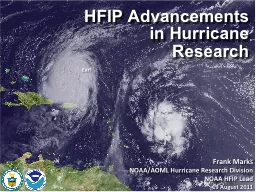
HFIP Advancements in Hurricane Research

Slide2

The Good – Track forecast improvements

Errors cut in half over past 15

years10-year improvement - As accurate at 48h as we were at 24h in 2000No progress with intensity in last 15-20 years24-48h intensity forecast off by 1 categoryOff by 2 categories 5-10% of time

The Bad - Intensity forecasts no real gains

Current Capabilities

Slide3

Goals

Improve Forecast Accuracy

Hurricane impact areas (track) – 50% in 10 yearsSeverity (intensity) – 50% in 10 yearsSpecial Focus on Rapid Intensity Change (RI)Extend forecast reliability out to 7 daysQuantify, bound and reduce forecast uncertainty to enable risk management decisionshttp://www.hfip.org/

Slide4

How to get there?

Science (8 Teams)

Improved understanding from combining observations & modelsHigher resolution coupled models – critical to storm evolution forecasts – especially intensity changesForecast techniques to understand, reduce & communicate uncertaintyInformation TechnologyIncreased computing power - run advanced

hurricane/global

models

& reduce uncertainty

IT infrastructure

for

interagency

data exchange

Observing Strategy

Improved use of existing and planned

systems

Improved Products for Forecasters

Slide5

What: HFIP Activities

Traditional Hurricane Research Activities:

Observations, analysis, database, & instrument R&D (IFEX)Statistical-dynamical model developmentAdvances in operational models (Stream 1)New HFIP Research Thrusts:Experimental global and regional hurricane model development (Stream 2)Data assimilation techniques and observing system strategy analysis development (Stream 1 & 2)Model evaluation tool developmentApplication and tool development for forecastersPartnership: NCEP, AOC, AOML, ESRL, GFDL, DTC, USWRP, NESDIS/STAR

D1

D2

Slide6

HFIP stream 2 (9/3 km resolution)

HWRFx with HWRF IC

HWRFx with HEDAS IC HWRFV3.2 All Storms of 20104 cycles per day431 cases in 24 storms19 main products; e.g.,Synthetic microwave imagerySHIPS predictorsShear and SteeringTime-height cross-sections Swaths (wind and rainfall)

Regional Model Team - Gopal

, Xuejin Zhang, Kevin Yeh, AOML/HRD

http:

//storm.aoml.noaa.gov/realtime

Regional Model Development:

HWRF

Slide7

In-situ

Wind, press., temp.

ExpendablesDropsondesAXBT, AXCP, buoyRemote SensorsDoppler Radar

SFMR/HIRAD

WSRA

Scatterometer/profiler

UAS - LALE

GALE UAS

Improved Use of Observations:

Intensity Forecast experiment (IFEX)

G-IV Tail Doppler Radar

ONR DWL

Observations Team - Rob

Rogers, AOML/HRD

Slide8

Improved Use of Observations:

HFIP 2010 Demo: Earl

5 missions at 12-h intervals00Z 28 – 12Z 30 August, 6 missions at 12-h intervals 00Z 1 September – 00Z 3 September collecting Doppler SO (HEDAS)11 P-3 Flights

28 August – 3 September 2010

HWRFx/HEDAS

20100831 00UTC

Doppler SO (EnKF) transmitted in real-time to HRD for assimilation into HWRFx model

20100830I1

2126-0229 UTC

HWRFx/HEDAS

20100831 00UTC

J.

Gamache,

A.

Aksoy,

T.

Vukicevic

,

Gopal (AOML/HRD)

Slide9

TC impact on upper ocean effect of Hurricanes Gustav and Ike (2008)

Improved Use of Observations:

Air-sea interaction & upper ocean

Targeted upper ocean observations

CBLAST

Waves from 200’ in Isabel

E. Uhlhorn, AOML/HRD

, R. Lumpkin AOML/PhOD

Slide10

What in 2011?

2011 HFIP model demonstrationGlobal model ensemble

80 member GFS hybrid-EnKFRegional model ensemble≥15 HWRF members (2@27:9:3 km, ≥10@9:3 km)≥10 COAMPS-TC members (45:15:5 km)≥10 ARW members (40.5:13.5:4.5 km)IFEX 2011Continuation of IFEX objectives (Rogers et al, 2006)320 flight hours two P-3s & G-IV available in JuneCrews available for 2-per-day missionsIFEX 2011 home page

Slide11

Partnership: AOML, ESRL, GFDL, DTC, USWRP, NESDIS/STAR working closely with Operations (EMC, NHC, AOC) and Federal & Academic Partners (NASA, NSF, ONR, NRL, NCAR, BOEMRE)

More integrated use & support of Testbeds

: JHT, DTC, JCSDABlend Traditional hurricane research activities and HFIP research activitiesManpower (diversity) to evaluate model performance with hurricane data sets is a critical needKeys to SuccessCBLAST

IFEX/RAINEX

DOTSTAR

IFEX/TCSP

IFEX

/PREDICT/GRIP

Slide12

CAUSE3 Collaboration

Earl

NOAA focus –Improved Track, Intensity, and Structure forecastsCAUSE3 focus –Understand energy & momentum transfer in mixed layer beneath tropical cyclones

Slide13

Web Page

Web Portal

Web Log (Blog)

http://

www.aoml.noaa.gov/hrd

/

https://

storm.aoml.noaa.gov/hwrfxprojects/?projectName

=HFIP+Demo+2010

http://

noaahrd.wordpress.com

Outreach