/
Replacing  Bluebooking Modern Data Submission to NGS Replacing  Bluebooking Modern Data Submission to NGS

Replacing Bluebooking Modern Data Submission to NGS - PowerPoint Presentation

briana-ranney
briana-ranney . @briana-ranney
Follow
345 views
Uploaded On 2018-11-10

Replacing Bluebooking Modern Data Submission to NGS - PPT Presentation

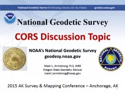
by Dru Smith NSRS Modernization Manager David Zenk Northern Plains Regional Advisor April 25 2107 NGS Geospatial Summit 1 Summary of Intent The overall message is this  Bluebooking ID: 725982

2107ngs geospatial ngs leveling geospatial 2107ngs leveling ngs nsrs data gravity surveys april control opus gps tab future projects

Share:

Link:

Embed:

Download Presentation from below link

Download Presentation The PPT/PDF document "Replacing Bluebooking Modern Data Submi..." is the property of its rightful owner. Permission is granted to download and print the materials on this web site for personal, non-commercial use only, and to display it on your personal computer provided you do not modify the materials and that you retain all copyright notices contained in the materials. By downloading content from our website, you accept the terms of this agreement.


Presentation Transcript

Slide1

Replacing BluebookingModern Data Submission to NGSbyDru Smith NSRS Modernization ManagerDavid ZenkNorthern Plains Regional Advisor

April 25, 2107

NGS Geospatial Summit

1Slide2

Summary of IntentThe overall message is this:  "Bluebooking" as we know it will go away, but a new process of people doing surveys and submitting them to NGS to include in the NSRS database will replace it.  That new process will be built around the general model of OPUS-Projects, which is to say it will be a browser-based analysis, processing and submitting tool.  OPUS-Projects will be expanded to take in the following surveys:  Leveling will come first.  Then, in a priority order that is still to be determined, NGS will add to OPUS-Projects other survey types, including:  Traverse, RTN, Absolute Gravity, Relative Gravity, each one being in a "tab" with the ability for data to flow between tabs.  In this way, mixed-method surveys will be processed in a method-by-method build up.--- Dru SmithApril 25, 2107NGS Geospatial Summit2Slide3

First, a Bit of HistoryThe “Bluebook” has been in effect since October 1980.It has grown with the times, but cannot continue far into the future. Why not?The Future Itself…New DatumNew DatabaseMore Efficient Methods AvailableApril 25, 2107NGS Geospatial Summit3Slide4

A Bit More HistoryThe Integrated Data Base (IDB*) was built by combining previous databasesHorizontalVerticalGravityThe IDB* is not:Spatial Capable of handling time dependenciesBuilt to handle GPS raw data filesApril 25, 2107NGS Geospatial Summit4* Note - NGS IDB will be known in the future as NSRS DBSlide5

NGS Ten Year Plan 2013-2023Goal 2: Modernize and Improve the National Spatial Reference System.Objective 1: Replace NAD 83Objective 2: Replace NAVD 88Objective 3: Re-invent BluebookingObjective 4: Fix the ToolkitObjective 5: Better SurveyingApril 25, 2107NGS Geospatial Summit5

both Short-term and Long-termSlide6

Transformational AccessApril 25, 2107NGS Geospatial SummitNGS will provide transformations between historic datums and the new reference frames, aimed at helping users manage data that is not in the NSRS DB.But, the National Geodetic Survey considers readjustment of actual survey measurements, not coordinate transformations, as best practice.So, if NGS can make it easier to store measurements in the NSRS DB, then NGS can provide better access to the new datums and better customer service.

6Slide7

The future of bluebookingNGS Geospatial Summit

April 25, 2107

data submission:

OPUS PROJECTS

7Slide8

OPUS-Projects into the NSRS DBThe NSRS DB is the official repository of NSRS dataNSRS DB currently may only be populated through the FGCS Bluebook processHorizontal Surveys (Volume 1)GPS Surveys (Annex N)Vertical Surveys (Volume 2)Gravity Surveys (Volume 3)So, the FGCS Bluebook will endure for a while yetApril 25, 2107NGS Geospatial Summit8Slide9

What Else is Being Planned?NGS is taking a broad view that OP is a capable interface that can be adapted to essentially any type of survey data.April 25, 2107NGS Geospatial Summit9Slide10

Leveling DataA leveling project needs mark descriptions, mark locations, mark photos, and the leveling measurements.OP already has the tools to ingest 3 of these 4What’s needed is a Leveling Tab on OP…April 25, 2107NGS Geospatial Summit10Slide11

Leveling Tab…Perhaps like this, with helpful graphics and symbolsApril 25, 2107NGS Geospatial Summit11Slide12

Leveling TabWith support for familiar defined file formatsApril 25, 2107NGS Geospatial Summit12LVL fileR6 fileVERTOBSSlide13

GravityLike leveling, gravity surveys, whether aerial or terrestrial, absolute or relative, need metadata support, but also have special analytical needs.All can be supported within Gravity Tabs in OP.April 25, 2107NGS Geospatial Summit13Slide14

Gravity TabsApril 25, 2107NGS Geospatial Summit14Airborne Data sub-tabWith support for familiar defined input file formatsSlide15

Gravity TabsApril 25, 2107NGS Geospatial Summit15Absolute Gravity sub-tabSlide16

Gravity TabsApril 25, 2107NGS Geospatial Summit16Historical Gravity sub-tabQuality Check Gravity sub-tabSlide17

Traditional Optical SurveysTraditional Optical Surveys can be supported TraverseTriangulationTrilaterationRiver CrossingsCalibration Base LinesApril 25, 2107NGS Geospatial Summit17Slide18

Real Time Kinematic / Real Time NetworksRTK/RTN surveys efficiently produce accurate positions that may be of value in improving or validating other surveys.Therefore, NGS could provide an RTK/RTN Tab to capture these valuable positions.April 25, 2107NGS Geospatial Summit18Slide19

RTK/RTN - Validation NeededRTK/RTN positions must be traceable to NSRSRTK/RTN surveyors would prove that calibration to NSRS was performed using an approved combination of active and passive techniques, which might include:Published passive marksNational CORS OPUS StaticApril 25, 2107NGS Geospatial Summit19Slide20

Synergy - Leveling and GPSApril 25, 2107NGS Geospatial Summit20GPS data  ellipsoid heights

Apply GEOID  orthometric heights

GPS Tab

Leveling Tab

GPS data serve as:

stochastic control in the leveling processing and

improve systematic leveling correctionsSlide21

Synergy – Leveling and TraverseApril 25, 2107NGS Geospatial Summit21Load River Crossing DataCompute differential height across riverTraverse Tab

Leveling Tab

connect the two parts of leveling on either side of the riverSlide22

Synergy – Many More PossibilitiesLeveling with Gravity and GPSThe leveling is now processed using the a-priori processed GPS and a-priori processed gravity to yield orthometric heights.Establish a Calibration Base Line (CBL)Leveling, slope angles, and EDM data are combinedQuality ControlAccess and compare to data within NSRS DBApril 25, 2107NGS Geospatial Summit22Slide23

NSRS DB Flow ChartApril 25, 2107NGS Geospatial Summit23Optional“Submit” ButtonSlide24

April 25, 2107NGS Geospatial Summit

OPUS-Projects of the future?

The 2013 Survey of theWashington Monumenthad GPS, leveling and

traverse components.

An integrated OP might

allow for easier

processing and especially

cross-processing

24Slide25

GPS/geoid control point

Not Leveled

Leveled point

Forward Running

Backward Running

Day 4 – 2014 04 21

OPUS-Projects of the future?

April 25, 2107

NGS Geospatial Summit

25Slide26

The New NSRS databaseTo support the future, the new database must be:Spatially-enabledVelocity-capableHandle all current data types and allow for new future typesNimble and FastReliable (see challenge next slide)April 25, 2107NGS Geospatial Summit26Slide27

Organize Historic FilesTo prepare to populate the new NSRS with existing GPS data:NGS has some 3000 GPS projects on file400,000 receiver files out of 1.2 million filesAny name, any directory…Metadata (receiver, antenna height, PID, times)Once organized, these files will go through OP and build the NSRS database foundationApril 25, 2107NGS Geospatial Summit27Slide28

Old vs New Datums: Passive ControlRole of passive control in the future:Control for projectsDepending on accuracy needs, new coordinates should be freshly determined, rather than relying on published coordinates based on old surveysMonitoring sites for motionCalibrating RTNs

April 25, 2107

NGS Geospatial Summit

28Slide29

Primary AccessApril 25, 2107NGS Geospatial SummitSince 2008, NGS has clearly and publicly stated:“The primary means of accessing this new datum is GNSS technology”29Slide30

Primary Access: GNSSApril 25, 2107NGS Geospatial SummitThis means (at a minimum):CORS positions, velocities and discontinuities in the latest IGS reference frameOPUS-S, OPUS-RS, and variantsAn RTN validation service, quantifying levels of agreement with the NSRSRelationship between the IGS reference frame and new geometric reference frameSpatially and temporally

30Slide31

Secondary AccessApril 25, 2107NGS Geospatial SummitAnd since 2008, NGS has clearly and publicly stated:“While passive control continues to be used asa secondary method to access the NSRS, suchcontrol will be ‘tied to’, not a ‘part of’, theNSRS.”31Slide32

Secondary Access: Passive ControlApril 25, 2107NGS Geospatial SummitThis means (at a minimum):GPS surveys on marks after 2022 can be “bluebooked” and submitted to NGSThis could mean:A complete overhaul for bluebooking, database storage, and time dependencies32Slide33

A GNSS/geoid vertical datumToday2022Step 1:Find passive control in NAVD 88 near you, if it exists. Accept that there has been no validation of the published heights since the points were last occupied.Find or set any new control near your project area.Step 2:Level or “Ht Mod” survey to the new control. This could be tens of kilometers at least.Perform GNSS on your local controlStep 3:Use NGS 58/59 (decades old) and NGS DOS based tools to bluebook and adjust your project (to the possibly outdated NAVD 88 control

Use OPUS, tied to monitored CORS, to get h and H at the epoch of your survey, to cm of accuracy

Step 4:

Perform leveling from your control to your local project

Perform leveling from your control to your local project

April 25, 2107

NGS Geospatial Summit

33Slide34

QuestionsApril 25, 2107NGS Geospatial Summit34