/
TAKAYAMA Reservoir TAKAYAMA Reservoir

TAKAYAMA Reservoir - PDF document

cadie
cadie . @cadie
Follow
347 views
Uploaded On 2021-08-18

TAKAYAMA Reservoir - PPT Presentation

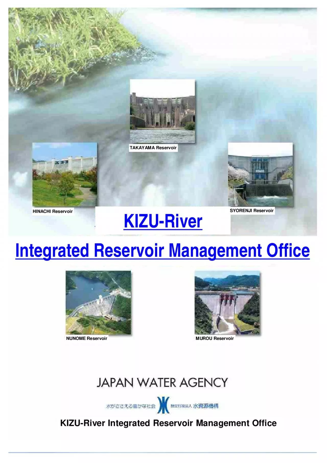
HINACHI ReservoirNUNOME ReservoirMUROU ReservoirKIZURiver Integrated Reservoir Management OfficeKIZURiverIntegrated Reservoir Management OfficeSYORENJI ReservoirOutline of YODO KIZU River Basin YOD ID: 866371

water reservoir area river reservoir water river area kizuriver management flood dam control office body max capacity supply domestic

Share:

Link:

Embed:

Download Presentation from below link

Download Pdf The PPT/PDF document "TAKAYAMA Reservoir" is the property of its rightful owner. Permission is granted to download and print the materials on this web site for personal, non-commercial use only, and to display it on your personal computer provided you do not modify the materials and that you retain all copyright notices contained in the materials. By downloading content from our website, you accept the terms of this agreement.


Presentation Transcript

1 TAKAYAMA Reservoir HINACHI Reservoir NUN
TAKAYAMA Reservoir HINACHI Reservoir NUNOME Reservoir MUROU Reservoir KIZURiver Integrated Reservoir Management Office KIZURiver Integrated Reservoir Management Office SYORENJI Reservoir Outline of YODO (KIZU) River Basin YODO River Basin includes six prefectures, MIE, SHIGA, KYOTO, OSAKA, HYOGO and NARA. Upsteam of the River is divided into UJIRiver, KIZURiver and KATSURARiver. YODORiver flows to OSAKA bay after confluence of these 3 rivers at southeast of KYOTO. Headwaters of KIZURiver is from SUZUKA and NUNOBIKI mountain rag

2 e. KIZURiver meets NABARIRiver at OKAWAR
e. KIZURiver meets NABARIRiver at OKAWARA after through mountanous vally and UENO area. KIZURiver meets WAZUKARiver at KAMO after confluence of NUNOMERiver at KASAGI. Finaly, KIZURiver reaches to confluence point of three rivers at southeast of KYOTO. KIZURiver is 1st class river (management by Natinal Governemnt), Catchment area is 1,596km2. It occupy 21.9% of total catchment area of YODORiver. On KIZURiver basin, TAKAYAMA Dam, SYORENJI Dam, MURO Dam, NUNOME Dam and HINACHI Dan was constructed, these dams have reduced flood and

3 storm risk and suppied water for drinki
storm risk and suppied water for drinking, industry and agriculture. NABARIRiver flows from TAKAMI mountain range. NABARIRiver is 1st class river, catchment area is 615km2. Basin includes three prefectures, KYOTO, NARA and MIE For Rich Living of People Outline of KIZU - River Basin Ratio of YODORiver Catchment area Catchment area and Length of rivers 8,240km INARiver 4.6% Lake BIWA 46.7% UJIRiver 6.1% KIZURiver 19.4% KATSURARiver 13.4% Downstream of YODORiver 9.8% River Lake BIWA UJIRiver KIZURiver NABARIRiver Others KATSURARiver

4 Downstream of YODO INARiver TOTAL Catche
Downstream of YODO INARiver TOTAL Catchement Area Length of River(km) Water Supply Development of water resources by reservoirs dams had been implemented for increase of water demands for domestic and industry during and after high economic growth period (1960s). And, we supply irrigation water for agriculture filed along NABRIRiver and KIZURiver from reservoirs. Domestice water supply plan by reservoirs Domestic water supply area Area / Reservoir OSAKA pref. KYOTO pref. NARA pref. OSAKA city HIRAKATA city MORIGUCHI city HANSHIN

5 area AMAGASAKI city NABARI city NARA ci
area AMAGASAKI city NABARI city NARA city YAMAZOE village TSUGE village TOTAL TAKAYAMA SYORENJI MURO NUNOME HINACHI KYOTO Pref. HYOGO Pref. OSAKA Pref. NARA Pref. SHIGA Pref. MIE Pref. 1 Map of KIZURiver Basin 2 For Effective Management Outline of KIZURiver Basin Outline of Integrated reservoir management office KIZURiver Integrated Reservoir Management Office has managed five reservoirs on upstearm of KIZURiver effeciency and effectively for water resources management. And integrated office have roles as a core office to comuni

6 cate with related agency for management.
cate with related agency for management. Organazational Structure Director ViceDirector (Genral Affairs) ViceDirector (Engineering Affairs) General Affairs Division Reservoir Management Division Electricity and Telecommunication Division Machiner Division TAKAYAMA Reservoir Operation and SORENJI Reservoir Operation and MURO Reservoir Operation and NUNOME Reservoir Operation and HINACHI Reservoir Operation and Maintenance office Flow Chart ofCommunication KIZURiverIntegrated Reservoir Management OfficeCollectand Transfer informationD

7 isaster Response MLIT YODORiver Integrat
isaster Response MLIT YODORiver Integrated Reservoir Management OfficeKIZURiver Upstream River Management Office Japan Water AgencyKansai Regional Japan Water Agency InformationDirectionof operation Information cooperation Information weatherForecastRadarHydrological dataMonitoring Camera TAKAYAMAReservoir SYORENJIReservoir MUROReservoir NUNOMEReservoir HINACHIReservoir Operation and PatrolMaintenanceoacilities 3 Telecommunication System for Integrated Reservoir Management Outline of Telecommunication System KIZURiver Integrated

8 Reservoir Management Office has communi
Reservoir Management Office has communication line with not only five reservoirs but also YODORiver Integrated Reservoir Management Office, KIZU upstream River Management office and Japan Water Agency Headquators and Kansai Regional Office. These communication lines are consist of strong radio signal that is stable against disaster. we manage reservoirs effectively and effeciency with collecting hydorological data (Water Level, Rainfall, etc) for water supply and flood control. Telephoneline and Network Radar,(Rainfall observatio

9 n) Telemer (WaterLevel, Rainfall data) O
n) Telemer (WaterLevel, Rainfall data) Optical Fiber Cable(Monitoriing Video 4 Legend 5 Data and Information Managementfor Interated Reservoir Management It is necessary for 5 reservoirs integrated management to observe and collect hydrological data(River Water Level, Rainfall, Reservoir data) on RealTime. We manage the information and data through telecommunication control facility for 24 hours. TAKAYAMA, SYORENJI, MURO, NUNOME, HINACHI Hydrodata Video Rainfall River Water Meteorology Earthquake RainfallDensity Reservoir

10 Telemeter Meteorological Radar Water
Telemeter Meteorological Radar Water Inflow Discharge Intake Upstream Others Others Downstream Reservoir Rainfall31 stations River Water Level30 stations Satellate Rainfall Forecast Typhoon Whole country KINKI Region YODORiver Basin Forecast Warning Seismic Intensity Rainfall History Reservoir River YODORiver Integrated Reservoir Managemenrt Office (MLIT) Water Inflow Discharge Intake Flow Others Rainfal System Hydrodata KIZURiver Upstream Managemenrt Office (MLIT) Japan Water Agency KANSAI Regional Office Flood ReservoirData Reserv

11 oirVideo Water Inflow Discharge Intake
oirVideo Water Inflow Discharge Intake Upstream Others Others Downstrea Water Mobile data communication River Montoring Reservoir data Reservoir Data River Flow Meteorological Data Radar KIZURiver Integrated Reservoir Management Office Telecommunication Server Display of Reservoir data, River Flow and Reservoir Monitoring Video 6 Location Map of Rainfall and Water Level Stations Water Level Station Rainfall Station Water LevelStation RainfallStation 7 Flood Control (Refer to "Hydrograph of Flood Control Plan) Irrigatio

12 n and Conservation of River Environment
n and Conservation of River Environment Surpply Irrigartion Water (Max 4.8m3s) at OKAWARA point for 3,300ha along KIZURiver Discharge maintenance flow for river environment Domestic Water Surpply domestic water (5.0m3/s) to OSAKA and KOBE area Hydropower 6,000kW (Max 14.0m3.s) managed by KANSAI Electricity Power Company HydroGraph of Flood Control Plan TAKAYAMAReservoir Design High Water3,400m3/s Start of Flood Control1,300m3/s Max. Discharge1,800m3/s Reservoir area Hight of Dam Body Lenght of Dam Body Volume of Dam B

13 ody Reservoir Area Allocation of Reservo
ody Reservoir Area Allocation of Reservoir Capacity 8 Total Reservoir Capacity Usage Reservoir Capacity 9 Flood Control (Refer to "Hydrograph of Flood Control Plan) Irrigation and Conservation of River Environment Supply Irrigartion Water (Max. 1.3m3s) at OKAWARA point for 3,300ha along KIZURiver Supply Irrigation Water (Max. 1.66m3/s) for 125ha along KIZURiver in NABARI area Discharge maintenance flow for river environment Domestic Water Supply domestic water (2.3m3/s) to OSAKA and KOBE area Supply domes

14 tic water (0.19m3/s) to NABARIcity Irrig
tic water (0.19m3/s) to NABARIcity Irrigation Water Supply irrigation water (1.72m3/s) to NABARI area Hydropower 2,000kW (Max 3.9m3.s) managed by MIE Prefecture HydroGraph of Flood Control Plan SYORENJIReservoir Inflow Discharge Reservoir area Hight of Dam Body Lenght of Dam Body Volume of Dam Body Reservoir Area Allocation of Reservoir Capacity 1 Total Reservoir Capacity Usage Reservoir Capacity 1 Flood Control (Refer to "Hydrograph of Flood Control Plan) Irrigation and Conservation of River Environment Supply I

15 rrigartion Water (Max. 2.3m3s) at KADAKA
rrigartion Water (Max. 2.3m3s) at KADAKA point for 348ha along UDARiver Discharge maintenance flow for river environment Domestic Water Supply domestic water (1.6m3/s) to NARA Prefecture (SAKURAI Water Treatment Plants) Hydropower for Reservoir Management Generate power for reservoir operation and manintenance works Max. flow 1.8m3/s Effective Head 43.80m Max. Output 560kW HydroGraph of Flood Control Plan MUROReservoir Inflow Discharge Reservoir area Hight of Dam Body Lenght of Dam Body Volume of Dam Body

16 Reservoir Area Allocation of Reservoir
Reservoir Area Allocation of Reservoir Capacity 1 Total Reservoir Capacity Usage Reservoir Capacity 1 Flood Control (Refer to "Hydrograph of Flood Control Plan) Irrigation and Conservation of River Environment Discharge maintenance flow for river environment including irrigation water Domestic Water Supply domestic water (1.136m3/s) to NARAcity Hydropower for Reservoir Management Generate power for reservoir operation and manintenance works Max. flow 2.2m3/s Effective Head 56.87m Max. Output 99

17 0kW HydroGraph of Flood Control Plan NUN
0kW HydroGraph of Flood Control Plan NUNOMEReservoir Reservoir area Hight of Dam Body Lenght of Dam Body Volume of Dam Body Reservoir Area Allocation of Reservoir Capacity Design High Water460m3/s Start of Flood Control100m3/s Max. Discharge150m3/s 1 Total Reservoir Capacity Usage Reservoir Capacity 1 Flood Control (Refer to "Hydrograph of Flood Control Plan) Irrigation and Conservation of River Environment Discharge maintenance flow for river environment including irrgation water in NABARI area Domestic Water Supply

18 domestic water (1.5m3/s) to NABARIcity,K
domestic water (1.5m3/s) to NABARIcity,KYOTO prefecture and NARAcity Hydropower 1,800kW (Max 3.7m3.s) managed by MIE Prefecture Hydropower for Reservoir Management Generate power for reservoir operation and manintenance works Max. flow 0.3m3/s Effective Head 38.41m Max. Output 77kW HydroGraph of Flood Control Plan HINACHIReservoir Inflow Discharge Reservoir area Hight of Dam Body Lenght of Dam Body Volume of Dam Body Reservoir Area Total Reservoir Capacity Usage Reservoir Capacity Allocation of Reservoir Capa