PPT-Using NASA Satellite Data to Predict Malaria Outbreaks
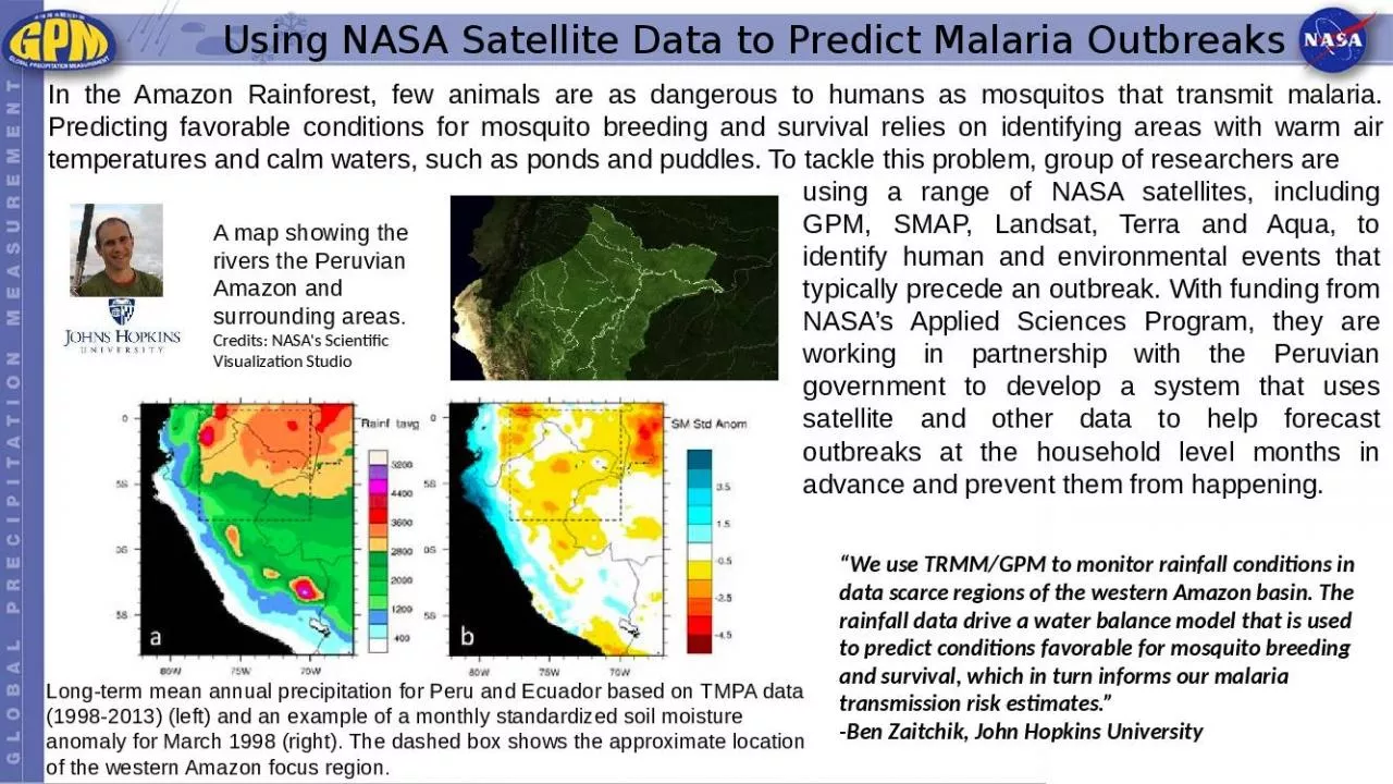
In the Amazon Rainforest few animals are as dangerous to humans as mosquitos that transmit malaria Predicting favorable conditions for mosquito breeding and survival
Download Presentation
"Using NASA Satellite Data to Predict Malaria Outbreaks" is the property of its rightful owner. Permission is granted to download and print materials on this website for personal, non-commercial use only, provided you retain all copyright notices. By downloading content from our website, you accept the terms of this agreement. Download
Presentation Transcript
Transcript not available.