/
MINNESOTA HISTORICAL SOCIETY MINNESOTA HISTORICAL SOCIETY

MINNESOTA HISTORICAL SOCIETY - PDF document

danika-pritchard
danika-pritchard . @danika-pritchard
Follow
395 views
Uploaded On 2016-08-10

MINNESOTA HISTORICAL SOCIETY - PPT Presentation

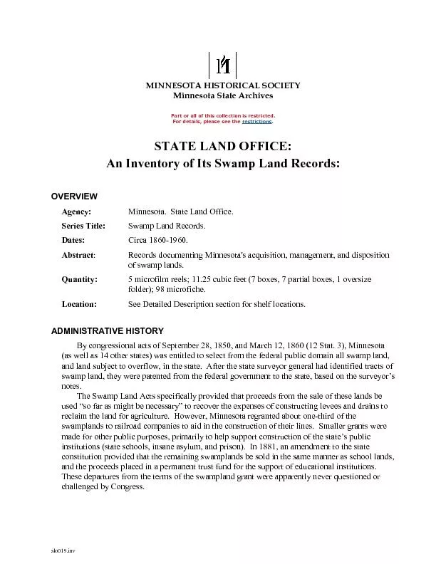
slo019inv Minnesota State Archives Part or all of this collection is restricted For details please see the restrictions STATE LAND O FFICE An Inventory of I ts Swamp Land Records OVERVIEW ID: 440887

slo019.inv Minnesota State Archives Part all

Share:

Link:

Embed:

Download Presentation from below link

Download Pdf The PPT/PDF document "MINNESOTA HISTORICAL SOCIETY" is the property of its rightful owner. Permission is granted to download and print the materials on this web site for personal, non-commercial use only, and to display it on your personal computer provided you do not modify the materials and that you retain all copyright notices contained in the materials. By downloading content from our website, you accept the terms of this agreement.


Presentation Transcript

slo019.inv MINNESOTA HISTORICAL SOCIETY Minnesota State Archives Part or all of this collection is restricted. For details, please see the restrictions . STATE LAND O FFICE : An Inventory of I ts Swamp Land Records : OVERVIEW Agency: Minnesota. State Land Office. Series Title: Swamp L and R ecords . Dates: Circa 1860 - 1960. Abstract : Records documenting Minnesota's acquisition, management, and disposition of swamp lands. Qu antity: 5 microfilm reels ; 11.25 cubic feet (7 boxes, 7 partial boxes, 1 oversize folder) ; 98 microfiche. Location: See Detailed Description section for shelf locations. ADMINISTRATIVE HISTORY By congressional acts of September 28, 1850, and March 12, 186 0 (12 Stat. 3), Minnesota (as well as 14 other states) was entitled to select from the federal public domain all swamp land, and land subject to overflow, in the state. After the state surveyor general had identified tracts of swamp land, they were patent ed from the federal government to the state, based on the surveyor’s notes. The Swamp Land Acts specifically provided that proceeds from the sale of these lands be used “so far as might be necessary” to recover the expenses of constructing levees and drain s to reclaim the land for agriculture. However, Minnesota regranted about one - third of the swamplands to railroad companies to aid in the construction of their lines. Smaller grants were made for other public purposes, primarily to help support construct ion of the state’s public institutions (state schools, insane asylum, and prison). In 1881, an amendment to the state constitution provided that the remaining swamplands be sold in the same manner as school lands, and the proceeds placed in a permanent tr ust fund for the support of educational institutions. These departures from the terms of the swampland grant were apparently never questioned or challenged by Congress. STATE LAND OFFICE. Swamp Land Records. p. 2 slo019.inv SCOPE AND CONTENTS They include lists of swamp lands selected by the state under the terms of the Swamp Land Act of March 12, 1860; patents transferring title in the lands to the state from the federal government; record books noting disposition of each parcel of swamp or overflowed land; maps showing the location of swamp lands; and corr espondence and lists pertaining to transfers, claims, and related matters. ARRANGEMENT These records are arranged in the following sections: Swamp Land Selection Lists, 1875 - 1915 (Unfilmed) Swamp Land Patents: United States to Minnesota, 1865 - 1960 (Mic rofilm SAM 45, Reels 35 - 36) Swamp Land Record, circa 1860 - 1931 (M icrofilm SAM 45, Reels 37 - 39) Swamp Land Record, circa 1860 - 1931 (M icrofilm SAM 45, Reels 37 - 39) Swamp Land Miscellaneous Lists and Correspondence, undated and 1862 - 1923 (Unfilmed) Closed O riginals Closed Master Microfiche INDEX TERMS These records are indexed under the following headings in the catalog of the Minnesota Historical Society. Researchers desiring materials about related topics, persons or places should search the catalog usi ng these headings. Topics: Land grants -- Minnesota. Land titles -- Registration and transfer -- Minnesota. Public lands -- Minnesota. Railroad land grants -- Minnesota. Swamp lands -- Minnesota. Trust fund lands -- Minnesota. Persons: Hill, A. J. (Alfred James), 1823 - 1 895. Types of Documents: Maps -- Minnesota. Microforms. STATE LAND OFFICE. Swamp Land Records. p. 3 slo019.inv ADMINISTRATIVE INFORMATION Restrictions: Microfilmed originals ( 6.0 cubic feet) and master microfiche ( 98 microfiche) are held by the Minnesota Historical Society and closed to general use. In the case of records being illegible on the microfilm, the original records may be consulted. They are located off site in Remote Storage, however, and advance arrangements are required in order to view the files. Preferred Citation: Minnesota . State Land Office. Swamp L and R ecords. [Indicate the cited volume and page or item and folder title here . ] [ For microfilm, add ] SAM 45, [R ee l number] . Minnesota Historical Society. State Archives. See the Chicago Manual of Style for additional examples. Microfilm Producti on: Saint Paul, MN : Minnesota Historical Society, 1982. Microfiche. Burbank, CA and Saint Paul, MN : P.F.A., Inc. and Minnesota Historical Society, 1984. 9 8 microfiche : 16 mm. Microfilm available for sale or interlibrary loan from the Minnesota Historic al Society. Accession Information: Accession numbers: N one; 984 - 41; 985 - 143; 987 - 52; 991 - 14 ; 993 - 22; 2002 - 49 Processing Information: Catalog ID No.: 1735226 DETAILED DESCRIPTION Note to Researchers: To request mat erials, please note the l ocation and, if applicable, reel number shown below . Swamp Land Selection Lists, 1875 - 1915 (Unfilmed) Lists of all swamp lands selected by the state under terms of the Swamp Land Act of March 12, 1860, as compiled from the records of the U. S. Surveyor General's Office. Volumes 1 - 5 were compiled in 1875 and encompass all swamp selections of land that had been surveyed prior to 1875. Later volumes were compiled periodically as the su rveys of portions of the state were completed and selection lists were filed by the state. Annotations made by the registers and receivers of local land offices indicate any claims against the parcels that existed at the time the selections were filed. Fu rther notes by the State Land Office give the eventual disposition of the selected tracts. Arrangement : Arranged by land district office through which the original selection lists were filed. Indexes : Volumes and/or individual lists are indexed by range and township. STATE LAND OFFICE. Swamp Land Records. p. 4 slo019.inv Location 106.K.9.1B Volume I. Winnebago City, Jackson, St. Peter, Redwood Falls, Henderson, Forest City, Litchfield. Volume II. Taylor's Falls. Volume III. Duluth (Northeastern). Volume IV. St. Cloud. Location 106.K.9.1B Volume V. Alexandria, Oak Lake, Detroit. Volume VI. Duluth (1877), St. Cloud (1877), Detroit (1877 - 1878). [ U nnumbered]. St. Cloud (1879 - 1900; includes lists filed in Taylor's Falls office). Volume VII. St. Cloud, Duluth (1879 - 1884), Croo kston (1884). 106.K.9.2F Volume [9]. Crookston (1885 - 1906, mainly swamp land on the White Earth Reservation). Volume 10. Duluth (1877 - 1897). Volume [11]. Duluth (1898 - 1905). Folder 1. Duluth (1906 - 1915). Folder 2. Crookston (1907 - 1910, White Earth n os. 163 and 169). Folder 3. Cass Lake (1905, nos. 153 and 154). Folder 4. Cass Lake (1907 - 1911). Swamp Land Patents: United States to Minnesota, 1865 - 1960 (Microfilm SAM 45, Reels 35 - 36) These patents record the transfer of title to designated swamp l ands from the federal government to the state of Minnesota under the congressional acts of September 28, 1850, and March 12, 1860. A single patent may include from one to more than 100 individual parcels in several townships. Each patent gives the patent or list number; land office through which the patent was issued; legal description of each parcel patented, citing principal meridian, range, township, section, and fractional section; total acreage patented within each township; aggregate acreage in the entire patent; date the governor of Minnesota made application for the patent; and date the patent was executed. The patents were at some point compiled into four volumes corresponding approximately to the four federal land districts existing in Minnesota in 1900: Duluth, St. Cloud, Crookston, and Marshall. Records of predecessor offices that had merged into these are included with the records of the successor office. Patents for the Cass Lake land district, which was established in 1903, are intermingle d with the others. Within each volume the patents are arranged for the most part by land office, and thereunder by chronologically assigned patent number (list number after 1914). The patent numbers, especially in later years, are not necessarily consecu tive. Since these volumes were compiled from various land offices, there is no original pagination. At some point the agency with custody of the records penciled in consecutive page numbers. In a few instances the page numbers disrupt the numerical and c hronological sequence of the patents. However, the pagination has been maintained in order to facilitate the use of those indexes that are keyed to page numbers. STATE LAND OFFICE. Swamp Land Records. p. 5 slo019.inv Indexes : There are three types of indexes to the swamp land patents. (1) A consolidated loc ation index to all parcels in the approved lists on pages 114 - 171 of the United States Land Grant Index, cataloged separately in the State Land Office’s Indexes to State Land Records. A rranged by principal meridian, range, and township, it refers to volume and page numbers. As an aid to researchers, this index appears on the microfilm prior to volume 1. (2) Each volume contains its own index, arranged by location and keyed to patent numbers. (3) The St. Cloud and Crookston volumes also have indexes that a re keyed to page numbers. The indexes to individual volumes seem to be incomplete; they appear on the microfilm at the beginning of the respective volume. Typed transcriptions were prepared for 185 pages that were unable to produce a sharp image when micr ofilmed ; e ach is filmed immediately after the page that it transcribes. Location Reel SAM 45 35 Index to Swamp Land Patents. Original index is cataloged separately in the State Land Office: Indexes to State Land Records. Volume 1. Duluth Land D istrict, 1865 - 1945. Duluth Land Office, 1865 - 1928. Patent Nos. : 1 - 24, 29 - 31, 37, 39 - 40, 44, 50, 54, 57, 60, 68, 74, 78, 81, 87 - 91, 93, 96 - 99, 102 - 104, 109, 113, 117, 119 - 122, 124, 128 - 130, 132, 131, 133, 136 - 138, 140 - 142, 144 - 151, 154, 153, 152, 155 - 157, 164, 160, 162, 165, 172, 175, 178 - 182, 184, 185, 188 - 190, 193, 200, 208. List number: 73. Cass Lake Land Office, 1929 - 1931. List numbers: 225, 227, 194, 226, 229 - 232, 224, 233 - 237. General Land Office, 1945. List number: 248 (Cook County) SAM 45 35 Volu me 2. St. Cloud Land District, 1869 - 1904. St. Cloud Land Office, 1869 - 1904. Patent numbers: 1 - 24, 27, 32, 35, 42, 48, 51, 52, 53, 56, 58, 61, 63, 71, 76, 80, 83, 85, 100, 105, 111, 118, 125, 134, 135, 143, 158. Taylors Falls Land Office, 1871 - 1891. Paten t numbers: 1 - 7, 24. STATE LAND OFFICE. Swamp Land Records. p. 6 slo019.inv Location Reel SAM 45 36 Volume 3. Crookston Land District, 1880 - 1939. Crookston Land Office, 1880 - 1891. Patent numbers: 2 - 7, 28, 41, 49, 58, 65, 72, 73, 77, 82, 84, 86, 92, 95, 106, 110, 112, 126, 127, 139, 163, 167, 169, 170, 174, 176, 197. Cass Lake Land Office, 1932 - 1939. List numbers: 239, 238, 240 - 244, 74 supplement to patent No. 74, vol. 1, pages 308 - 359, 245, 246, supplementary 247. St. Peter Land Office. List numbers: 1 - supplement to patent No. 1, vol. 4, pages 2 12 - 221. Volume 4. Marshall Land District, 1865 - 1960. Cass Lake Land Office, 1904 - 1913. Patent numbers: 204, 207, 206, 205, 203, 201, 189 supplementary, 199, 198, 195, 194, 192, 189, 187, 186, 183, 177, 173, 171, 168, 166, 161, 159. [List numbers: See Ca ss Lake Land Office following Marshall Land Office, below.] Alexandria Land Office, 1873 - 1874. Patent numbers: 1 - 3. Oak Park Land Office, 1877. Patent number: 1. Winnebago City Land Office, 1869 - 1886. Patent numbers: 1 - 4. Also includes Jackson and Wort hington. Forest City Land Office, 1865 - 1877. Patent numbers: 1 - 3. Also includes Litchfield and Benson. Redwood Falls Land Office, 1865 - 1880. Patent numbers: 1 - 4. Also includes Henderson and St. Peter. St. Peter Land Office, 1865 - 1886. Patent numbers: 1 - 4. Also includes New Ulm and Tracy. Marshall Land Office, 1891 - 1901. Patent numbers: 1, 2, 26, 33, 34, 38, 45, 46, 47, 55, 62, 64, 67, 69, 70, 75, 79, 94, 101, 107, 108, 123. Cass Lake Land Office, 1914 - 1960. List numbers: 207 - 223, 198, 249 - 254. STATE LAND OFFICE. Swamp Land Records. p. 7 slo019.inv Swam p Land Record, circa 1860 - 1931 (M icrofilm SAM 45, Reels 37 - 39) An administrative record of the state of Minnesota's acquisition and disposition of swamp and overflowed lands. The volumes were apparently compiled and current entries begun in 1876, at which time prior transactions were recorded retrospectively. Each volume contains records, by county, for individual counties or groups of contiguous counties; in several instances, land in a given county appears in more than one volume. Within each volume the swamp land tracts are listed by legal description (range, town, section, and fractional section). The entry for each parcel gives legal description, acreage, date selected by the surveyor general (apparently all tracts selected prior to 1876 were recorded simply as having been selected as of March 31, 1876), date patented from the United States to Minnesota, by whom selected for the state, to whom deeded by the state, other disposition (such as selection rejected or contested), and occasional explanatory r emarks. Names of private parties to whom swamp lands were sold are not recorded; only the sale date appears in the "Remarks" column. Grantee railroads are indicated by stamped corporate initials in the "to whom deeded" column. In the many instances where the original stamps are very faint, the railroad's initials have been repeated in the "Remarks" column. The initials and the corresponding full name of railroad are: St.P & C. = St. Paul and Chicago. S.M. R.R. = Southern Minnesota Railroad. L.S. & M. = L ake Superior and Minnesota. L.F. & D. = Little Falls and Dakota. St.P. & D. = St. Paul and Duluth. M. & St.C. = Minneapolis and St. Cloud. W.M. & P. = Wisconsin, Minnesota and Pacific. G.N. Ry. = Great Northern Railway. D.& I.R. R.R. = Duluth and Iron Rang e Railroad. D.W. & P. = Duluth, Winnipeg, and Pacific. D.R.L. & W. = Duluth, Rainy Lake, and Winnipeg. M.C. R.R. = Minnesota Central Railroad. C.R. Mf. A. = Cannon River Manufacturing Association. T.F. & L.S. = Taylors Falls and Lake Superior. Indexes: Ea ch volume includes an index by range and township. There is also a consolidated index, located on pages 42 - 113 of the United States Land Grant Index, cataloged separately in the State Land Office’s Indexes to State Land Records. It is organized by range and township and citing the volume(s) and page(s) on which entries in each township are found. As an aid to researchers, this index appears on the microfilm prior to volume 1. STATE LAND OFFICE. Swamp Land Records. p. 8 slo019.inv Location Reel SAM 45 37 Index to Swamp Land Record. Original index is cataloged separately in the State Land Office: Indexes to State Land Records. Volume 1. Southern Part of State. Includes townships to 122 in ranges 3 - 44 and townships to 124 in ranges 45 - 48. Volume 2. Pine, Chisago, Washington, Ramsey, Anoka, Sherburn e, Isanti, Benton, Mille Lacs, Kanabec. Volume 3. Aitkin. Volume 4. Itas circa SAM 45 38 Volume 5. Cass, Crow Wing, Morrison, Hubbard, Wadena, Beltrami. Volume 6. Stearns, Todd, Pope, Douglas, Stevens, Grant, Traverse, Wilkin, Otter Tail, Becker, Clay. Volume 7. Norman, Polk, Marshall, Kittson. Volume 8. Cook, Lake, and eastern parts of St. Louis and Carlton. Volume 9. Western parts of St. Louis and Carlton. Location Reel SAM 45 39 Volume 10. Itasca, Roseau, Koochiching. Volume 11. Cook, Lake, St. Louis. Volume 12. Cass and portions of Itasca, Beltrami, and Hubbard. Volume 13. Indian Reservations. Swamp Land Maps, undated and 1861, 1870 (Unfilmed) Location 106. C .16.3 Swamp Land Plat Book, undated. 1 volume. Plats for townsh ips in north central Minnesota, depicting lands within each section as dry, swamp, or patented. They cover mainly townships 141 - 146 in ranges 25 - 41. A3/ov4,Drawer 4 Maps of Swamp Lands. 1861, 1870. 2 items in oversize folder. Two maps drawn by A. J. Hil l showing locations and relative quantities, by township, of swamp lands granted to the state of Minnesota. One (1861) shows relative amounts of swamp land per township; the other (1871) shows when swamp lands in each township were deeded to railroad comp anies. Neither map details the individual parcels that were considered swamp land. (1) Map of Swamp Lands in Minnesota arranged according to townships, compiled and drawn by A. J. Hill, 1861. 15" x 34". Printed map with manuscript annotations. Annotate d "Property of the Executive Chamber. STATE LAND OFFICE. Swamp Land Records. p. 9 slo019.inv Location A3/ov4,Drawer 4 (2) [State of Minnesota] Map Illustrating Disposition of Swamp Lands Granted by Acts of Congress, Sept. 28, 1858 & Mar. 12, 1860, drawn by A. J. Hill, ex - Clerk, State Land Office . Undated, with annotations to 1870. 26" x 31". Manuscript map on linen. Swamp Land Miscellaneous Lists and Correspondence, undated and 1862 - 1923 (Unfilmed) Lists of swamp lands in Minnesota Indian reservations; miscellaneous correspondence and lists re lating to the selection, approval, and patenting of state swamp lands; various lists and registers created during the process of resolving conflicting claims to swampland tracts; and contest case files, containing letters and documents regarding contests o f the state's claims to particular parcels of swamp land. Location 106.K.10.6F Lists of Swamp Lands in Indian Reservations, undated. 13 packets in 5 folders. Sheets listing legal description and acreage in each parcel of swamp or overflowed l and in the various Minnesota Indian reservations, bradded together in clumps. Each is identified as: List of Swamp Lands in the ----- Indian Reservation, Minnesota, as shown by the field notes of the U.S. Deputy Surveyors. Folder 1. Red Lake, unnumber ed and books 1 and 2. Folder 2. Red Lake, books 3 and 4. Folder 3. Diminished Red Lake. This gives the same type of information on the same printed forms as the previous lists, but was discovered in a different storage box. It is not known whether it wa s originally part of this set. Its cover and probably back page are missing. Folder 4. Leech Lake, White Earth. Folder 5. Bois Forte, Fond du Lac, Mille Lacs, Pigeon River, Vermillion. [Swamp Land Lists?]. 1 folder. Same type of information on the sa me printed forms as "Lists of Swamp Lands in Indian Reservations," but unidentified. STATE LAND OFFICE. Swamp Land Records. p. 10 slo019.inv Location 106.K.10.7B Indian Reservations, undated and circa 1901 - circa 1914. 1 folder. Various lists relating to the state's claim to swamp land in the Whit e Earth and Cass Lake reservations. Miscellaneous Lists, circa 1864 - circa 1916. 2 folders. Various summary lists of swamp land selections and rejected selections. Correspondence, 1862 - 1923. 5 folders. Miscellaneous correspondence relating to select ion and patenting of swamp land, and to and contests brought against the state's claims. Contest Case Files, circa 1875 - circa 1917. 7 folders. Correspondence and documents relating to contests against the state's claim to parcels of swamp land. All d ocumentation pertaining to a particular case has been brought together in a single file. Files may include correspondence, decisions of the commissioner of the U.S. General Land Office or the secretary of the interior, notes outlining the grounds for appe al by the state, and a variety of affidavits. 106.K.10.6F Lists of Swamp Lands in Duluth and Taylors Falls Land Districts Inuring to the Lake Superior and Mississippi Railroad. 1 folder. Two lists (compiled circa 1870?) of lands selected by the registers of the United States land offices in Duluth and Taylors Falls as inuring to the Lake Superior and Mississippi Railroad under its congressional grant of May 5, 1864, and to which the state of Minnesota also had a claim under its swamp land grant of March 1 2, 1860. The lists have been annotated to indicate the eventual disposition of each parcel. Lists of Swamp Lands Preempted or Reserved to Other Purposes. 2 lists. Lists of land which the state claimed as swamp land but on which conflicting claims exist ed. The records are arranged by land district and cite the range, town, section, and fractional section of each tract claimed by the state. The lists also indicate the nature of the conflicting claim, e.g., preemption, homestead, railroad, or Sioux half - breed scrip. The lists were apparently compiled about 1877. STATE LAND OFFICE. Swamp Land Records. p. 11 slo019.inv Location 106.F.19.2F Swamp Land Register, circa 1883. 1 oversize volume. A list of conflicting claims to lands selected as state swamp lands, apparently compiled in 1882 or 1883 an d covering claims dating from 1860 to 1882; a few later annotations run to 1885. The volume records those tracts to which an individual had established a prior claim by right of preemption, homestead, or purchase. The entries are arranged by land distric t and include the following information: land district; description of each parcel on which conflicting claims exist, citing range, town, section, and fractional section; acreage of the parcel; date sold to or located by the claimant; number of original r eceipt or certificate; and number and date of final certificate [patent?] or number of purchase warrant, half breed scrip, military bounty scrip, etc. The volume is also titled: State of Minnesota Swamp Land Lists for Relinquishment. 106.F.19.2F Origin al Selection of Eliminated Tracts of Swamp Land, undated. 1 oversize folder. This is a list, arranged by land district, of the selection lists (identified by date of filing) from which tracts were eliminated because of conflicting claims by right of preem ption, homestead, or other reservation. For those districts in which tracts were eliminated from more than one selection list, the eliminated parcels are cited by range and town, and the date of original selection is given. 112.F.4.10F Swamp Land Claims Record Books, 1907 - 1915. 2 volumes. Records land description (section, township, and range), contestant, hearing date and place (land office), decision, appeals and decisions. 106.C.16.3 Swamp Lands, Unadjusted, June 1915. 1 volume. May include selection list number, page and date; section parts and section, township and range; list number and date approved to the state; date of rejection to the state; Indian allotment number; what conflict, if any; vacant on General Land Office record; and remarks. Close d Originals Access restricted. Closed to general use, researchers are directed to use the microfilm. Location 304.G.3.8F Swamp Land Patents, United States to Minnesota, 1865 - 1960. 4 volumes. Volume 1. Duluth Land District, 1865 - 1945. STATE LAND OFFICE. Swamp Land Records. p. 12 slo019.inv Location 304.G.2.7 Volume 2. St. Cloud Land District, 1869 - 1904. Volume 3. Crookston Land District, 1880 - 1939. Volume 4. Marshall Land District, 1865 - 1960. 304.G.3.2F Swamp Land Record, circa 1860 - 1931. 13 volumes. Volume 1. Southern Part of Stat e (includes townships to 122 in ranges 3 - 44 and townships to 124 in ranges 45 - 48). Volume 2. Pine, Chisago, Washington, Ramsey, Anoka, Sherburne, Isanti, Benton, Mille Lacs, Kanabec. Volume 3. Aitkin. Volume 4. Itas ca . Volume 5. Cass, Crow Wing, Morris on, Hubbard, Wadena, Beltrami. 304.G.3.3B Volume 6. Stearns, Todd, Pope, Douglas, Stevens, Grant, Traverse, Wilkin, Otter Tail, Becker, Clay. Volume 7. Norman, Polk, Marshall, Kittson. Volume 8. Cook, Lake, and eastern parts of St. Louis and Carlton. Volume 9. Western parts of St. Louis and Carlton. Volume 10. Itasca, Roseau, Koochiching. 304.G.3.4F Volume 11. Cook, Lake, St. Louis Volume 12. Cass and portions of Itasca, Beltrami, and Hubbard. Volume 13. Indian Reservations. Closed Master Microfi che Created from the microfilm to distribute to Department of Natural Resources [DNR] field offices. Positive copies were given to the DNR; the Minnesota Historical Society retained the negative copies. Access restricted . Closed to general use, researchers are directed to use the microfilm. Location SAFN 6 circa 1860 - 1960. 98 microfiche. A listing of each microfiche’s contents is housed in the State Archives accession file for these records.