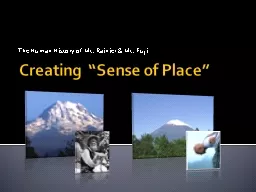
Maps for smartphone natives when the curriculum doesnt include orienteering Build authentic engaging kinesthetic experiences How this year rolled out at BHS 201718 Campus survey and topo ID: 786493
Download The PPT/PDF document "Making Sense of Land Use Maps - CF at BH..." is the property of its rightful owner. Permission is granted to download and print the materials on this web site for personal, non-commercial use only, and to display it on your personal computer provided you do not modify the materials and that you retain all copyright notices contained in the materials. By downloading content from our website, you accept the terms of this agreement.
Slide1
Making Sense of Land Use Maps - CF at BHS
?Maps?
for smart-phone natives … when the curriculum doesn’t include orienteering?
Build authentic, engaging, kinesthetic experiences
Slide2How this year rolled out at BHS - 2017-18:
Campus survey and topo
maps
Local opportunity:
Carriage
Grove
– the
redevelopment of the former Belchertown State School
property
HF
coach: Josh Rapp visits
BHS
Land
Science: MA Audubon & UWisc-Madison virtual
internship
Maps Jigsaw: Expert - Mixed - Expert
Slide3Start from scratch: BHS Campus survey
Land use from the ground and the air: tally marks
Tally
Total
% = Total / Grand Total
Boreal/evergreen
Forest
Woods
Meadow
Plain/grasslandLandscaped Impervious PondBog/swamp/wetlandsGrand Total =
Slide5Creating a topographic map
Objectives:
You will use simple equipment to measure a small section of the BHS grounds
You will use your data to draw a map of a cross section of the BHS grounds
You will combine your data with the rest of the class to produce a topographic map of the area
Slide6Reading topo maps
Chiming in on the development of Carriage Grove
Map Jigsaw:
Expert groups make sense of one CF map
With a dry-erase marker, outline any area the size
of a penny (~2cm) or larger that shows uninterrupted green
Calculate/Estimate the uninterrupted green area on your map in “pennies” units
Slide9Wildland and Woodlands: Changes to the Land …
considering
ecosystem
services
“Recent Trends”
scenario
MA in 2060
Slide10“Opportunistic Growth” scenario
MA in 2060
Maps Jigsaw: Mixed-map groups convene to share Summaries and to learn from each other
Maps Jigsaw - Last steps
Expert groups reform, sharing insight gleaned from listening to other experts
Rewrite/edit Summary, utilizing feedback, questions and clarification from the mixed-map groups
expert group divides into small teams to write a 5-minute lesson
Slide13Student feedback
What worked?
The penny question - it was fun, and took problem solving to complete which was cool.
What didn’t work?
we needed more map copies & more time to work on all the maps
What information did you need that you did not have?
I think I had all the information that I needed throughout except for when we split into the different groups
Suggest either a re-write or redaction of 1 of the questions. State the section and number.
PartA question 3 : we didn’t understand how to find out how long it would take you if you walked an average of 6.5 km/hour … give us miles instead of Km
Suggest either a re-write or redaction of one more of the questionspart C is kinda irrelevant it should just be something to talk about like why should we protect the forest Tell me something that will help the next group of students more easily make sense of these mapsDefinitely show and thoroughly explain what each part of the map was and what each part represents Ok, what did I miss?I think that overall the project was good but there are definitely things that could have been optimized but I know that it was your test run so I think it went as good as it could have.