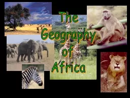
/
AFRICA--Physical Geography AFRICA--Physical Geography

AFRICA--Physical Geography - PowerPoint Presentation

ellena-manuel
ellena-manuel . @ellena-manuel
Follow
430 views
Uploaded On 2016-04-08

AFRICA--Physical Geography - PPT Presentation

httpwwwsnopescomphotossunsetasp Africas Unique Physical Geography Intro Africa is really a plateau continent with escarpments and rift valleys Below is a picture of the Great Escarpment Drakensberg in South Africa ID: 276398

river africa congo amp africa river amp congo rift lake diamond ocean africa

Share:

Link:

Embed:

Download Presentation from below link

Download Presentation The PPT/PDF document "AFRICA--Physical Geography" is the property of its rightful owner. Permission is granted to download and print the materials on this web site for personal, non-commercial use only, and to display it on your personal computer provided you do not modify the materials and that you retain all copyright notices contained in the materials. By downloading content from our website, you accept the terms of this agreement.


Presentation Transcript

Slide1

AFRICA--Physical Geography

http://www.snopes.com/photos/sunset.aspSlide2

Africa’s Unique Physical Geography

Intro

Africa is really a plateau continent with escarpments and rift valleys- . Below is a picture of the Great Escarpment (Drakensberg) in South Africa

( show animation)

Plateaus, Mountains, and Highlands: Africa south of the Sahara is a series of plateaus that rise in elevation from the coast inland and from west to east. ( show book picture)The regions of Africa extend to a sea or ocean in all cardinal directions Atlantic Ocean to the west, Indian Ocean to the east, Mediterranean to the north and Southern Ocean to the south. Slide3

Africa’s mountains

Africa has no major mountain chains. It has scattered volcanic mountains (like the Kilimanjaro), the old & worn Atlas Mts. in Morocco.

The Ruwenzori Mountains, which form the border between Uganda and the Democratic Republic of the Congo, are one of the few mountain ranges in

the region. Slide4

Deserts

Major deserts:

Sahara (

only slightly smaller than the United States)

Kalahari in Botswana and a coastal desert, the Namib in Namibia.Nubian desert in SudanLybian desertSlide5

Africa’s rivers & basins

Niger River basin

:

- Niger river is the main artery in western Africa

it originates in the Guinean highlands & curves southeast to meet the Atlantic coast of Nigeria (2600 mi. long)Major means of transportation, tourism & travelZambezi River basin: Has it’s source near the Zambia/Angola border and flows to the east to meet the Indian Ocean in a delta shape (2,200 mi)Congo River: largest network of navigablewaterways in Africa (2,900 mi). The Congoestuary is 6 miles wide and is easily navigable by ocean vessels Congo River estuarySlide6

Elongated lakes and erratic river courses are common in Africa

Slide7

Section 1-10

Click the mouse button or press the

Space Bar to display the information.

Land of Lakes: Most of the region’s lakes are near the Great Rift Valley.

Lake Victoria, the largest lake in Africa, lies between the eastern and western branches of the Great Rift.

(pages 500–504)

Victoria FallsSlide8

Lake Victoria is not only the source of the Nile, but is also the largest body of fresh water in Africa, and second largest in the world after Lake Superior. It is bigger than many countries

Slide9

Nile River leaves Lake Victoria on a 6,000 kilometer trip.Slide10

Atlantic Ocean in NamibiaSlide11

Ethiopian HighlandsSlide12

Mt. KilimanjaroSlide13

Why is Africa’s physical geography unique?

The theory of plate tectonics whereby mountain chains are created by collision of earth’s crustal plates. (not found in Africa) did have a big influence in forming Africa’s physical geography

When South America and India broke away from Africa, they left escarpments along the coastlines. East Africa is breaking away –creating the Rift Valley. Slide14

Tectonic ActivitySlide15

Great Rift Valley

The Great Rift Valley

,

stretching from Syria to Mozambique, was formed millions of years ago by shifting tectonic plates. Along the axis of the Great Rift Valley, the earths crust is being spread apart in a long, ridge like fashion. The Rift Valley system consists of a large number of finger-like-troughs, each ranging in width from about 30 to 60 km, making up the complex system of plate tectonic activity Slide16

Congo River


                                                   <> Slide17

Niger River

Great Bend of the Niger River

“Where the camel meets the canoe”Slide18

Water is an abundant resource for irrigation and hydroelectric power, but irregular and unpredictable rainfall poses a challenge to the control and use of this power.

Solar power provides a vital source of power to rural areas. Between 1986 and 1996, 20,000 small-scale solar power systems were installed in Kenya.

Natural Resources

Mineral resources of the region include oil, uranium, diamonds, and about half the world’s supply of gold. Slide19

Africa’s Hydroelectric Power

on the Congo RiverSlide20

Africa’s Hydroelectric Power

on the Nile RiverAswan High DamSlide21

Gold

South Africa = ½ World’s Gold

Also found in Zimbabwe, D. R. Congo

Tanzania, and Ghana

Uranium is usually found with gold.Slide22

Diamonds

And nearly half of all the diamond jewelry in the world is sold in the United States. Slide23

Blood Diamonds

Conflict Diamonds

In relation to diamond trading,

conflict diamond

(also called a converted diamond, blood diamond, hot diamond, or war diamond) refers to a diamond mined in a war zone and sold to finance an insurgency, invading army's war efforts, or a warlord’s activity, usually in Liberia, Angola, Sierra Leone ,DRC, Cote D’Ivoire Slide24

Natural Resources

OilAngola, Nigeria, Gabon, Congo

Nigerian women

occupied a Nigerian

Oil terminal of Chevron-Texaco Until they agreed to hire villagers,Build schools, &provideElectric & waterSlide25

Solar Community Kitchen

in Kargi, Kenya, Africa

Getting electricity to the rural poor Slide26

Waterfalls, cataracts & rapidsSlide27

Zambezi RiverSlide28

Cape of Good Hope

Slide29

Increasing drought in the Sahel area and more demand for freshwater for irrigation may mean that Lake Chad will continue shrinking.

Slide30

Lake Volta, Ghana

Man-made lake: irrigation for farms, hydroelectric power 4 Aluminum plants, fishSlide31

Uranium

Iraq sought African UraniumSlide32

Diamonds fund Civil Wars

in Angola, D. R. Congo and Sierra LeoneSlide33

Chromium

S. Africa & Zimbabwe

Iron Ore

Copper & Cobalt Mine

D.R. CongoSlide34

Manganese is used

for dry cell Batteries

Manganese Mine in

South Africa