/
Phased Array Radar Innovative Sensing Experiment 2013 Phased Array Radar Innovative Sensing Experiment 2013

Phased Array Radar Innovative Sensing Experiment 2013 - PowerPoint Presentation

ellena-manuel
ellena-manuel . @ellena-manuel
Follow
457 views
Uploaded On 2015-10-17

Phased Array Radar Innovative Sensing Experiment 2013 - PPT Presentation

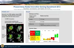
NSSL Lab Review Feb 2527 2015 PARISE 2013 How will 1min PAR updates impact NWS forecasters warning decision processes during severe hail and wind events 12 NWS forecasters ID: 163132

min warning rotation updates warning min updates rotation surface severe tornado school par participants decision experimental wait control lead

Share:

Link:

Embed:

Download Presentation from below link

Download Presentation The PPT/PDF document "Phased Array Radar Innovative Sensing Ex..." is the property of its rightful owner. Permission is granted to download and print the materials on this web site for personal, non-commercial use only, and to display it on your personal computer provided you do not modify the materials and that you retain all copyright notices contained in the materials. By downloading content from our website, you accept the terms of this agreement.


Presentation Transcript

Slide1

Phased Array Radar Innovative Sensing Experiment 2013

NSSL Lab Review Feb 25–27, 2015

PARISE 2013How will 1-min PAR updates impact NWS forecasters’ warning decision processes during severe hail and wind events?12 NWS forecastersControl (5-min updates) and experimental (1-min updates) groups

Katie Bowden1,2, Pam Heinselman1,3, Darrel Kingfield2,3, Rick Thomas41OU School of Meteorology, 2OU Cooperative Institute for Mesoscale Meteorological Studies, 3NOAA National Severe Storms Laboratory, 4GT School of Psychology

Results

Case 1: Marginally severe hail event

Case 2:

Severe hail and wind event

Cases 1 and 2 combined

Median lead timeControl17.3 minExperimental21.5 minDifference4.2 min (Statistically significant, p=0.0252)

Decision Types

Warning Lead Time

Low HighSlide2

Phased Array Radar Innovative Sensing Experiment 2013

NSSL Lab Review Feb 25–27, 2015

Katie Bowden1,2, Pam Heinselman1,3, Darrel Kingfield

2,3, Rick Thomas41OU School of Meteorology, 2OU Cooperative Institute for Mesoscale Meteorological Studies, 3NOAA National Severe Storms Laboratory, 4GT School of Psychology

Example: Tornado Warning Decision

Summary

2 x 5-min PAR updates

10 x 1-min PAR updates

Control-Uninformed

2053 Kidney bean shape, strong midlevel mesocyclone.2058 Circulation tightening and deepening, anticipate mesocylcone will stretch down to surface. Don’t wait until gate-to-gate at 0.5 ° because would be too late.

Issue Tornado Warning

Experimental-Mastery

2053

Broad rotation at higher levels… Going back a couple of frames can see it has strengthened aloft… Too high to issue on but something to watch. Still noticing broad rotation further aloft but nothing yet developing at the surface that would indicate any kind of tornadic issues.

2058

Some rotation with new data at 8

kft

.

Getting closer to the surface. Slight rotation at 0.5°… Mock up a tornado warning. Will wait for new data to come in…Whatever was there at the surface has sort of fallen apart and it’s a little too far south of the hook so still going to wait. Not seeing any tight velocity gradient near the surface. Rotation aloft has diminished and still no sign of rotation at 0.5°. Tornado warning not needed.Correctly Reject Tornado Warning

Experimental participants obtained

a

significantly longer median warning lead time

than control participants

Experimental participants made

more mastery

(i.e., confident and correct)

decisions

than control participants

Information perceived via 1-min PAR updates had a

substantial impact on the warning decision process