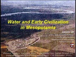
Water in Context Exploring water in the Middle East region through GIS mapping and crossdisciplinary perspectives 28 September 2012 Jason Ur John L Loeb Associate Professor of the Social Sciences ID: 385717
Download Presentation The PPT/PDF document "Water and Early Civilization in Mesopota..." is the property of its rightful owner. Permission is granted to download and print the materials on this web site for personal, non-commercial use only, and to display it on your personal computer provided you do not modify the materials and that you retain all copyright notices contained in the materials. By downloading content from our website, you accept the terms of this agreement.
Slide1
Water and Early Civilization in Mesopotamia
Water in Context: Exploring water in the Middle East region through GIS mapping and cross-disciplinary perspectives
– 28 September 2012
Jason Ur
John L. Loeb Associate Professor
of the Social Sciences
Department of Anthropology
Harvard UniversitySlide2
Foci“Greater Mesopotamia”Water at a Regional ScaleSlide3
Modern MesopotamiaSlide4
Mesopotamia: GeographySlide5
Rainfall
in the Middle EastSlide6
Seasonality of Temperature
& Rainfall(Mosul, Northern
Mesopotamia)Slide7
Mesopotamia
April 2003 (MODIS Image)
Red = Vegetation (agriculture)
Northern Mesopotamia
Southern Mesopotamia
Assyria
UrukSlide8
Northern Mesopotamia: Zagros FoothillsSlide9
Northern Mesopotamia: Rain-Fed
AgricultureSlide10
Mesopotamia
3 Nov 2003Slide11
Topography of
Southern Mesopotamia
(Relict Levees)Slide12
Marshes of southern MesopotamiaSlide13
Water and Mesopotamian Originsca. 3000-1500 BCSlide14
Head of the Gulf?
UrukSlide15
Irrigation in
Southern MesopotamiaSlide16
Why irrigate?
Quantity of water
Timing of waterHigher and more reliable yieldsSlide17
Water TransportSlide18
Mesopotamian
Cities
City of Ur, ca. 1700 BCSlide19
Salinization through Over-IrrigationSlide20
Settlement and Watercourses
ca. 2000 BC
Mesopotamia as a Riverine CivilizationSlide21
Water and Kings
Hammurabi and Shamash, the Sun GodSlide22
The Dynamic EnvironmentSlide23
Small Fluctuations: OxbowsSlide24
Levee FormationSlide25
Dramatic
Shifts: River AvulsionsSlide26
Abandonment of the Central FloodplainSlide27
Water in Northern Mesopotamia
Northern Mesopotamia
Assyria
UrukSlide28
Upper Tigris River ValleySlide29
Capitals of the
Neo-Assyrian
Empireca. 900-600 BC
Sennacherib
(704-681 BC)Slide30
MEDIA
SOUTHERN
MESOPOTAMIA
The Assyrian Empire,
900-700 BC
From Wilkinson
et al
. 2005, based on Roaf 1990Slide31
Assyrian Forced Migration of Conquered Peoples
From Layard,
Monuments of Nineveh
vol. ISlide32
Nimrud
(ancient Kalkhu
)Slide33
Negub
Tunnel
Local
Irrigation
Conforming to Topography
Water for Nimrud?Slide34
Nineveh (ca. 700 BC)Slide35Slide36
The Cross-Watershed Earthwork
near BandwaiSlide37
Sennacherib’s “Northern
System”
Bandwai CanalUskof CanalKisiri Canal
Nineveh
Khorsabad
Dam at
al-Shallalat
Faida Canal
Wadi Milah
Khosr River
Maltai Canal
Cross-Watershed
Earthwork
Cross-Watershed
EarthworkSlide38
Nineveh
Dam at
al-ShallalatCanalhead at Khinis
Aqueduct at JerwanSlide39
Ancient Canals near
Bahrka
Satellite Image (1967)
View on Ground (2012)Slide40
The Collapse of AssyriaSlide41
Qanat
/Karez
IrrigationSlide42
Ancient
Karez
Satellite Image (1967)
View on Ground (2012)Slide43
Concluding PointsWater was always a critical element for early civilizations…but with human ingenuity
Various levels of social organizationSlide44
For more information, please contact:Dr
. Jason Urjasonur@fas.harvard.edu
http://www.fas.harvard.edu/~anthro/ur/