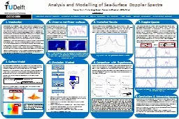
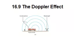
lidar retrievals of nearshore winds Nikola Vasiljević and Michael Courtney WindEurope Resource Assessment Workshop 2017 Edinburgh UK What a lidar measures 2 What a lidar measures ID: 789843
Download The PPT/PDF document "Accuracy of dual-Doppler" is the property of its rightful owner. Permission is granted to download and print the materials on this web site for personal, non-commercial use only, and to display it on your personal computer provided you do not modify the materials and that you retain all copyright notices contained in the materials. By downloading content from our website, you accept the terms of this agreement.
Slide1
Accuracy of dual-Doppler lidar retrievals of near-shore winds
Nikola
Vasiljević
and Michael Courtney
WindEurope Resource Assessment Workshop 2017
Edinburgh, UK
Slide2What a lidar measures?
2
Slide3What a lidar measures?
Beam direction
Line-of-sight
3
Slide4What a lidar measures?
Range gate
Range gate
center
4
Slide5What a lidar measures?
V
r
Radial wind speed or line-of-sight (LOS) wind speed
V
wind
5
Slide6What about two
lidars
?
V
wind
V
r1
V
r2
Two independent LOS measurements => direct retrieval of
u
and
v
6
Slide7What about two
lidars
?
V
wind
V
r1
V
r2
From
u
and
v
horizontal wind speed
V
h
and wind direction
𝚯
can be derived:
7
Slide8Single
lidar
measurement accuracy
How accurately can we determine radial wind speed?
How accurately can we determine where we are probing the atmosphere?
(1
)
LOS speed retrieval
accuracy
(2
) Pointing accuracy
(3
) Ranging accuracy
8
We aim at assessing (1),(2) and (3
) individually!
Slide9How to assess LOS retrieval accuracy
Lidar LOS measurements vs. Mast measurements
V
ane
Cup
Mast
LOS calibration at 5 km range (see [1])
9
Slide10How to assess pointing accuracy
Map hard targets
Acquire reference positions of
lidar
and targets
Compare mapped positions with reference positions
More details in [2,3]
10
Slide11How to assess pointing accuracy
Map hard targets
Acquire reference positions of
lidar
and targets
Compare mapped positions with reference positions
More details
in [2,3]
11
Slide12How to assess pointing accuracy
Elevation error
Azimuth
Map hard targets
Acquire reference positions of lidar and targets
Compare mapped positions with reference positions
12
Slide13How to assess pointing accuracy
Azimuth error
Azimuth
Map hard targets
Acquire reference positions of lidar and targets
Compare mapped positions with reference positions
13
Slide14How to assess ranging accuracy
Hit a hard target with laser light and find distance at which CNR is maximum
Compare this distance with calculated one
CNR max at 957 m, whereas the calculated distance was 947 m
14
Slide15Accuracy of single-Doppler retrievals
V
r
Assuming:
- Uniform wind field
- Wind gradient with height follows power law:
R
15
Slide16Accuracy of single-Doppler
retrievals
V
r
16
Slide17Accuracy of dual-Doppler retrievals
V
wind
V
r1
V
r2
Accuracy of retrieved
V
h
and
𝚯
depends on
U
Vr1
and
U
Vr2
:
17
Slide18Partial
derivatives for
U
Vh
V
r1
V
r2
18
Slide19Partial
derivatives for U
𝚯
V
r1
V
r2
19
Slide20RUNE dual-Doppler setup
Three scan lines (50, 100 and 150 m
asl
)
45 measurement points distributed along each line
20
More
details on RUNE
see
[4]
Slide21RUNE dual-Doppler setup
21
Slide22Intersecting and elevation angles at 100 m
asl
22
Slide23Accuracy simulation for RUNE setup
Uniform horizontal wind speed
V
h
= 10 m/s
Vertical wind speed
w
= 0 m/s
Wind speed gradient with height assumed to follow power law
Shear
exponent:
-
𝛼 =
0.1 (open water)
Wind direction:
-
𝚯
= 270˚
-
𝚯 =
180˚
Trajectory 100 m line
Accuracy:
- U
LOS
= 0.1
m/s
- U
𝚹
=U𝞿= 0.05˚- UR = 1 m23
Slide24H=100 m, 𝛼
=
0.1
,
V
h
=10 m/s
Wind
Wind
24
Not
to trust
Slide25Accuracy map
25
Slide26Accuracy map
26
Slide27Accuracy map for 𝚯 = 270˚ 27
Wind
Infinity
Slide28Accuracy map for 𝚯 = 180˚ 28
Wind
Infinity
Slide29ConclusionsWe derived a very simple and effective accuracy model- we look at biases since they give errors in wind resource assessment
Accuracy of horizontal wind speed and wind direction depends on:
- LOS accuracy- Pointing accuracy- Range accuracy
Beware of intersecting angle between two laser beams !Main accuracy drivers are:- Pointing accuracy in elevation in relation to measurement range- Intersecting angle between two laser beamsRule of thumb, keep keep your intersecting angle bigger than 30˚29
Slide30Future workWe are preparing several publications:- Review of static errors in pointing accuracy
- Method to assess static errors
- Accuracy assessment of dual-Doppler retrievalsFor more detailed presentation on this topic come to
PhD Summer School: Remote Sensing for Wind Energy (see [5])RUNE blind comparison (contact Alfredo Diaz: aldi@dtu.dk)RUNE data will be made publically available through the MARINET II project via the e-WindLidar platform
30
Slide31ReferencesLea, G., & Courtney, M. (2016). Validation of long-range scanning lidars deployed around the
Høvsøre
Test Station. DTU Wind Energy. (DTU Wind Energy E; No. 0114).Vasiljevic
, N. (2014). A time-space synchronization of coherent Doppler scanning lidars for 3D measurements of wind fields. DTU Wind Energy. (DTU Wind Energy PhD; No. 0027(EN)). Vasiljevic, N., Lea, G., Courtney, M., Cariou, J.-P., Mann,J. & Mikkelsen, T. (2016). Long-Range WindScanner System. Remote Sensing, 8(11). DOI: 10.3390/rs8110896
Floors, R. R., Peña, A., Lea, G., Vasiljevic, N., Simon, E., & Courtney, M. (2016). The RUNE Experiment—A Database of Remote-Sensing Observations of Near-Shore Winds. Remote Sensing, 8(11). DOI: 10.3390/rs8110884
PhD Summer School: http://www.vindenergi.dtu.dk/english/Education/PhD-Summer-School
31
Slide32Thank you!32
Nikola Vasiljević
niva@dtu.dk
https://dk.linkedin.com/in/nvasiljevichttp://www.nikolavasiljevic.com
https://www.youtube.com/user/cadenza83/videos
^ youtube videos Jakob Mann mentioned