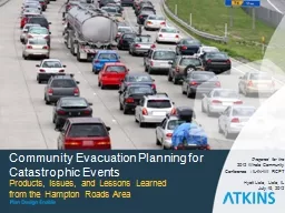
Products Issues and Lessons Learned from the Hampton Roads Area Prepared for the 2012 Whole Community Conference ILINWI RCPT Hyatt Lisle Lisle IL July 19 2012 Presentation Objective ID: 661427
Download Presentation The PPT/PDF document "Community Evacuation Planning for Catast..." is the property of its rightful owner. Permission is granted to download and print the materials on this web site for personal, non-commercial use only, and to display it on your personal computer provided you do not modify the materials and that you retain all copyright notices contained in the materials. By downloading content from our website, you accept the terms of this agreement.
Slide1
Community Evacuation Planning for Catastrophic Events
Products, Issues, and Lessons Learned from the Hampton Roads Area
Prepared for the
2012 Whole Community
Conference
/
IL-IN-WI RCPT
Hyatt Lisle, Lisle, IL
July 19, 2012
Slide2
Presentation Objective
Identify / discuss key community planning issues involved in mass evacuation for catastrophic events and look at specific tasks that the Hampton Roads RCPT undertook to help resolve the issues.Slide3
Southeast VA /
Northeast NC Study AreaSlide4
Community Evacuation Analysis Focal Issues for Catastrophic Events
WHO
needs to / how many will evacuate?WHERE
will evacuees go?WHAT MODES
of transportation are available?
WHAT ROUTES
will evacuees take/does
contraflow
make sense?
HOW LONG
will it take to move the evacuees/what if we don’t have enough time?Slide5
Community Evacuation Analysis Focal Issues for Catastrophic Events
Two Additional Key Issues:
WHAT MESSAGES will we give the community to influence response?
WHAT INTEL will be available to gauge community response and congestion?Slide6
WHO
Needs to / Will Evacuate Issue
Scenario driven – major hurricane, multiple IEDs, anthraxDefining the incident footprint
Dwelling unit and population data
WHO?
WHERE?
WHAT MODES?
WHAT ROUTES?
HOW LONG?
WHAT MESSAGES?
WHAT INTEL?Slide7
IED / Anthrax Event
IED / Anthrax
Locality
Area Max # Evacuees
Max Immediate Shelter Demand
Area Specific Max Traffic Clearance
Scenario / Site
Off Peak
(
in hours)
Peak
(in hours)
Representative Elementary School
Virginia Beach
21,000
4,0001.93.5Walter Hoffman U.S. CourthouseNorfolk 600 Granby St. --With Scope Empty4,0005002.03.9--With Scope Full13,5007003.05.5Hampton Roads Bridge TunnelNorfolk4,9009503.56.9 Hampton27,0005,200Gloucester Courts BuildingGloucester1,9003801.82.57400 Justice Dr.Newport News / Williamsburg AirportNewport News16,0003,1001.94.1900 Bland Blvd.York Co.12,0001,100Accomack County Admin. OfficesAccomack1,8002901.41.723296 Courthouse Ave.Chesapeake Energy Storage YardsChesapeake25,0005,0002.55.2Elizabeth River Southern BranchDare County NC CourthouseDare10,0001,2001.02.0Manteo, NC
WHO?
WHERE?
WHAT MODES?
WHAT ROUTES?
HOW LONG?
WHAT MESSAGES?
WHAT INTEL?Slide8
Evacuation Modeling System
Northumberland County – Category 3
WHO?
WHERE?
WHAT MODES?
WHAT ROUTES?
HOW LONG?
WHAT MESSAGES?
WHAT INTEL?Slide9
WHO
Needs to / Will Evacuate Issue
Evacuation Behavioral AnalysisParticipation rate dilemma
Vehicle ownership and usage
WHO?
WHERE?
WHAT MODES?
WHAT ROUTES?
HOW LONG?
WHAT MESSAGES?
WHAT INTEL?Slide10
Evacuation Survey:
To capture the knowledge, attitudes & intentions of a random sample of
coastal Virginians in response to a catastrophic event such as a hurricane.
Methodology:
Questions developed and approved
Received GIS map of target regions and surge zones
Purchased random sample of phone numbers located in the area with latitude and longitude included for each
Examined Census block group data for population in each region
Located sample numbers that fit within each target region and zone
Attempted to reach someone at each sample number 10 times
Total sample: 1,725, including 300 cell phone interviews
Completion rates (where a qualified person answered and was asked to participate):
53% for landline phones
34% for cell phones
WHO?
WHERE?
WHAT MODES?
WHAT ROUTES?
HOW LONG?WHAT MESSAGES?WHAT INTEL?Slide11
Evacuation Survey:
Sample Location–Completed Interviews
WHO?
WHERE?
WHAT MODES?
WHAT ROUTES?
HOW LONG?
WHAT MESSAGES?
WHAT INTEL?Slide12
Participation Rate Assumptions Comparison
Southside
Percent of Permanent Population Leaving Dwelling Units Recent HES Value/FIU Behavioral Value Incorporated
Zone
Groups
Storm Scenarios
Category 1
Category 2
Category 3
Category 4
Category 1
100/40
100/40
100/76
100/76
Category 2
1/28
100/40100/76100/76Category 31/253/25100/50100/76Category 41/253/255/50100/76Non Surge1/203/205/5010/60WHO?WHERE?WHAT MODES?WHAT ROUTES?HOW LONG?WHAT MESSAGES?WHAT INTEL?Slide13
Region Summary – 24 Hours
Worst Case Scenario Category 3 Hurricane with I-64 ReversalDemand Expressed in Number of People
1
Includes permanent dwelling units, mobile homes, and tourists.
WHO?
WHERE?
WHAT MODES?
WHAT ROUTES?
HOW LONG?
WHAT MESSAGES?
WHAT INTEL?Slide14
WHO
Needs to / Will Evacuate Issue
Special community population groupsAuto-less, disabled, military, medical
Evacuee calculator
WHO?
WHERE?
WHAT MODES?
WHAT ROUTES?
HOW LONG?
WHAT MESSAGES?
WHAT INTEL?Slide15
Special Populations
At-Home Client Zip Code Mapping Purpose to determine with more specificity the scope of the requirement for specialized transportation to evacuate people with access or functional needs who are living at home
Mapping Meals-on-Wheels, Home Delivered Meals, Department of Rehabilitative Services, Dare/Currituck Registry clientsLargest densities of at-home clients were in Hampton, Newport News, Norfolk, Portsmouth, and Suffolk
WHO?
WHERE?
WHAT MODES?
WHAT ROUTES?
HOW LONG?
WHAT MESSAGES?
WHAT INTEL?Slide16
Special Populations
Medical Care Facilities Surveys
Designed to gauge status of facility evacuation planning at assisted living facilities, nursing homes, and group homesApprox. 1/3 of ALF/NH in VA surveyedMost facilities plan to shelter-in-place (62% of ALF/NH and 69% of group homes)
Concerns: Are in-house transportation resources adequate? Are facilities safe from storm surge that are sheltering-in-place?
WHO?
WHERE?
WHAT MODES?
WHAT ROUTES?
HOW LONG?
WHAT MESSAGES?
WHAT INTEL?Slide17
Special Populations
Evacuee Calculator Designed to estimate the number of people who will need transportation assistance to evacuate
Focus = 1) those without access to a vehicle or public transportation, and 2) those with a disability without access to a vehicle or public transportation Used census data, updated with American Community Survey resultsInformation displayed via locality spreadsheets, dot-density mapping by surge zone
Total population in the MSA of 45,971 without vehicles
WHO?
WHERE?
WHAT MODES?
WHAT ROUTES?
HOW LONG?
WHAT MESSAGES?
WHAT INTEL?Slide18
Williamsburg Spreadsheet – Disability Population
WHO?
WHERE?
WHAT MODES?
WHAT ROUTES?
HOW LONG?
WHAT MESSAGES?
WHAT INTEL?Slide19
Dot-Density Maps
WHO?
WHERE?
WHAT MODES?
WHAT ROUTES?
HOW LONG?
WHAT MESSAGES?
WHAT INTEL?Slide20
WHERE
Will Evacuees Go
Evacuation behavioral analysisDestination percentages
Inland cities dataPublic shelter analysis and demand
Tampa Bay parallel
WHO?
WHERE?
WHAT MODES?
WHAT ROUTES?
HOW LONG?
WHAT MESSAGES?
WHAT INTEL?Slide21
Evacuation Survey Results
Eastern Shore more likely to go to public shelter (18%)
Renters more likely to go to public shelter (18%)
Elderly least likely to stay with friends/family in area; more likely to go to a hotel
.025% would require special needs shelter
Q18. If you had to evacuate for any reason such as for a fire, chemical spill, hurricane, where would you MOST likely go?
WHO?
WHERE?
WHAT MODES?
WHAT ROUTES?
HOW LONG?
WHAT MESSAGES?
WHAT INTEL?Slide22
Evacuee Destinations
Destination
Peninsula
Southside
Mid Pen / N Neck
Eastern Shore
Northeast NC
Stay in Local Region
25%
24%
26%
25%
--
Richmond
21%
13%
16%
4%
--North Virginia / DC / Misc. North16%15%19%43%--Western Virginia / Misc. West12%11%16%5%--Virginia Beach / Southside------3%--Emporia / Petersburg0%1%0%----North Carolina / Misc. South5%10%4%3%--Not Sure / Other21%26%19%17%--NC I-95 North Towns / Rocky Mount--------10%NC I-95 South Towns / Fayetteville--------15%Raleigh--------25%Greensboro / Winston Salem--------10%
Charlotte / Western North Carolina
--
--
--
--
10%
Virginia Northward
--
--
--
--
30%
WHO?
WHERE?
WHAT MODES?
WHAT ROUTES?
HOW LONG?
WHAT MESSAGES?
WHAT INTEL?Slide23
Evacuation Survey Results
Q34. If you had to evacuate, how far away would you likely go?
WHO?
WHERE?
WHAT MODES?
WHAT ROUTES?
HOW LONG?
WHAT MESSAGES?
WHAT INTEL?Slide24
Intended Destination
and Distance Expect to Travel
How Far Would Go
Public Shelter 10%
Family / Friends
Inside
Area
17
%
Family / Friends Outside Area 47%
Hotel 21%
Other 6%
< 10 Miles
27%
16%
2%
1%
7%10-50 Miles30%41%11%18%19%50-100 Miles19%21%30%38%29%100-200 Miles17%11%28%26%23%> 200 Miles6%11%30%17%22%WHO?WHERE?WHAT MODES?WHAT ROUTES?HOW LONG?WHAT MESSAGES?WHAT INTEL?Slide25
WHAT MODES
Will Be Used
Modes AvailableGap analysis mass transit resources
Military base interviews
VDOT based roadway / capacity parameters
WHO?
WHERE?
WHAT MODES?
WHAT ROUTES?
HOW LONG?
WHAT MESSAGES?
WHAT INTEL?Slide26
Mass Transportation Resources
Jurisdiction / Agency
Service
Area
MOUs
Type
of
Assets
#
of
A
ssets
Capacity /
Unit
Total Capacity
Wheelchair Access /
Capacity / Unit
Wheelchair AccessCapacityAsset Storage LocationDrivers Available for Emerg UseHRT - BusesVB-Trolley Base Buses32 264 HRT - BusesSouth Side - Norfolk Buses197 2394 HRT - BusesNorth side - Hampton Buses147 2294 HRT - Vans Vans61 3183 WATWilliamsburg-James City CountyNoBuses20357002407239 Pocahontas Trail, Williams-burg, VA 23185Drivers can be called inWAT NoTrolleys3257526WAT NoBody on Chassis51470210WHO?WHERE?WHAT MODES?WHAT ROUTES?HOW LONG?WHAT MESSAGES?WHAT INTEL?Slide27
Mass Transportation
The Transportation Assets Database Identifies local transportation resources that could potentially be used during a mass evacuation
Total capacity (including vehicles which are wheelchair accessible) = 138,039 Concerns: Will schools really be able to offer over 75% of the total (107,093)?
Are drivers available?
Will ambulance capacity be adequate?
WHO?
WHERE?
WHAT MODES?
WHAT ROUTES?
HOW LONG?
WHAT MESSAGES?
WHAT INTEL?Slide28
Stakeholder Meetings
Chesapeake Bay Bridge AuthorityPort AuthorityVirginia Modeling, Analysis, and Simulation Center Old Dominion UniversityHRTPO
Northern Neck PDCMilitary Facilities – Army, Navy, Air Force, Coast Guard
Hampton VA HospitalPortsmouth Naval Hospital
Virginia Department for Aging
Peninsula Agency on Aging
Norfolk Airport Authority
WHO?
WHERE?
WHAT MODES?
WHAT ROUTES?
HOW LONG?
WHAT MESSAGES?
WHAT INTEL?Slide29
WHAT ROUTES
Will Be Used
Destination drivenEvacuation monitoring / modeling locations
VA NC Border Traffic Diversion Plan
Bowers Hill / Southside contra flow / crossover alternatives
WHO?
WHERE?
WHAT MODES?
WHAT ROUTES?
HOW LONG?
WHAT MESSAGES?
WHAT INTEL?Slide30
Traffic Monitoring
& Modeling LocationSouthside Metro
WHO?
WHERE?
WHAT MODES?
WHAT ROUTES?
HOW LONG?
WHAT MESSAGES?
WHAT INTEL?Slide31
Traffic Monitoring
Location ExampleI-264 interchange 22 at
Birdneck Rd. – Southside Metro
DEVICE ID
TYPE
ROUTE
DIRECTION
DESCRIPTION
MILE MARKER
LATITUDE
LONGITUDE
51
CLOSED CIRCUIT TV
N/A
EAST
I-264 EB BIRDNECK RD OVERPASS
N/A
36.84618
-75.99538Available Monitoring Devices within One-Quarter Mile2008 Traffic CountROUTESTARTENDLENGTHDAILY COUNT% 2/4 TIRE VEHICLES% BUSES% TRUCKS 2 AXLE% TRUCKS 3+ AXLE% TRUCKS COMBO (ADD’L TRAILERS) I-264 EASTBIRDNECK RDPARKS AVE0.64 MILES12,00097%0%0%2%1%WHO?WHERE?WHAT MODES?WHAT ROUTES?HOW LONG?WHAT MESSAGES?WHAT INTEL?Slide32
Roadway Evacuation
Service Volumes
Number of vehicles per hour that can be processed given: Facility typeLaneGeometric characteristics
Service volume that deteriorates through the first three quarters of the evacuation
Recovers in the final quarter
WHO?
WHERE?
WHAT MODES?
WHAT ROUTES?
HOW LONG?
WHAT MESSAGES?
WHAT INTEL?Slide33
Evacuation Modeling System
Traffic Monitoring Points
WHO?
WHERE?
WHAT MODES?
WHAT ROUTES?
HOW LONG?
WHAT MESSAGES?
WHAT INTEL?Slide34
Bowers Hill Alternatives
ComparisonComparison of VDOT Bowers Hill Evacuation Improvement Alternatives
VDOT
Option
Description
Max Clearance Time Savings
% Balance of
Evac
& Background Traffic
Normal vs.
Reversed Lanes
Approximate Length of Required Reversal
I-64 GW to BH
Suffolk
Byp
1
Rt
168 crossover
17 hours57% to 43%65% vs 35%18 miles2Rt 168 crossover plus I-264 crossover19 hours57% to 43%49% vs 51%18.3 miles3Route 168 crossover plusI-264 crossover plusI-64 crossover at Battlefield Blvd9 hours38% vs 62%33% vs 67%19.5 miles4(added)Route 168 crossover plusI-64 crossover at Battlefield Blvd19 hours38% vs 62%49% vs 51%19 milesDo NothingNo crossovers or reversals0 hours100% vs 0%100% vs 0%0 milesNote: All options with crossovers assume reversal from Bowers Hill through Suffolk Bypass and maintaining at least two lanes of traffic on the normal and reversed side of the segments through the I-64/I-264/I-664 interchange.WHO?WHERE?WHAT MODES?WHAT ROUTES?HOW LONG?WHAT MESSAGES?WHAT INTEL?Slide35
HOW LONG
the Evacuation Will Last
VIPER integrated evacuation traffic modelTime constrained evacuations/24,36,42 hour durations
Time available / impacts to sheltering and commodities
WHO?
WHERE?
WHAT MODES?
WHAT ROUTES?
HOW LONG?
WHAT MESSAGES?
WHAT INTEL?Slide36
WHAT MESSAGES
to Give the Public
Positive influences on evacuation participationPositive influences on trip length
Positive influences on route choice
WHO?
WHERE?
WHAT MODES?
WHAT ROUTES?
HOW LONG?
WHAT MESSAGES?
WHAT INTEL?Slide37
WHAT INTEL
Do We Need
Evacuation traffic congestion
ITS equipment
Gauging public response
Targeted utilities usage
Real time surveys
WHO?
WHERE?
WHAT MODES?
WHAT ROUTES?
HOW LONG?
WHAT MESSAGES?
WHAT INTEL?Slide38
Monitoring Evacuee Participation
Real TimePublic taking advisories seriously?
Right sub areas / groups getting the evacuation notice?
Significant NC evacuation taking place?
WHO?
WHERE?
WHAT MODES?
WHAT ROUTES?
HOW LONG?
WHAT MESSAGES?
WHAT INTEL?Slide39
Monitoring Evacuee Participation
Real TimeModify public info as needed
Evacuation progress vs. clearance times requirements
Better understanding of potential shelter needs
WHO?
WHERE?
WHAT MODES?
WHAT ROUTES?
HOW LONG?
WHAT MESSAGES?
WHAT INTEL?Slide40
Proposed Methods of Gauging
Community ParticipationTraffic count monitoring vs. expected evacuee traffic flows
Normal electricity usage vs. demand as evacuation progresses
Normal water usage vs. demand during evacuation
WHO?
WHERE?
WHAT MODES?
WHAT ROUTES?
HOW LONG?
WHAT MESSAGES?
WHAT INTEL?Slide41
Normal Electricity
Usage vs. DemandWork with power company to develop protocol for various neighborhoods
Compare hourly normal usage vs. usage at intervals throughout the evacuation
Many positive attributes to this method if doable
Incentives for power providers?
WHO?
WHERE?
WHAT MODES?
WHAT ROUTES?
HOW LONG?
WHAT MESSAGES?
WHAT INTEL?Slide42
Questions & Discussion