/
Or, can we have vitality, sustainability and security all at once? Pro Or, can we have vitality, sustainability and security all at once? Pro

Or, can we have vitality, sustainability and security all at once? Pro - PDF document

karlyn-bohler
karlyn-bohler . @karlyn-bohler
Follow
391 views
Uploaded On 2016-04-23

Or, can we have vitality, sustainability and security all at once? Pro - PPT Presentation

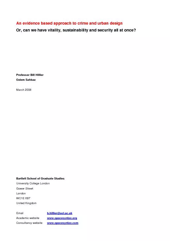
Academic websitewwwspacesyntaxorg Consultancy websitewwwspacesyntaxcom Professor Bill Hillier Ozlem Sahbaz An evidence based approach to crime and urban design PageDesign and crime the open and ID: 290466

Academic websitewww.spacesyntax.org Consultancy websitewww.spacesyntax.com Professor Bill Hillier

Share:

Link:

Embed:

Download Presentation from below link

Download Pdf The PPT/PDF document "Or, can we have vitality, sustainability..." is the property of its rightful owner. Permission is granted to download and print the materials on this web site for personal, non-commercial use only, and to display it on your personal computer provided you do not modify the materials and that you retain all copyright notices contained in the materials. By downloading content from our website, you accept the terms of this agreement.


Presentation Transcript

Or, can we have vitality, sustainability and security all at once? Professor Bill HillierOzlem SahbazMarch 2008 Bartlett School of Graduate Studies University College London Gower Street London United Kingdom Academic websitewww.spacesyntax.org Consultancy websitewww.spacesyntax.com Professor Bill Hillier Ozlem Sahbaz An evidence based approach to crime and urban design PageDesign and crime: the open and closed solutions It is generally agreed that a key priority in the design of cities is, insofar as it is possible, to make life difficult for the criminal. But is that really possible? Different crimes, after all, are facilitated by very different kinds of spaces: picking pockets is easier in crowded high streets, street robbery is easier when victims come one at a time, burglary is helped by secluded access, and so on. In inhibiting one crime, it seems, we might be in danger of facilitating another. Even so, the sense that some environments are safe and others dangerous is persistent, and inspection of crime maps will, as often as not, confirm that people’s fears are not misplaced. So is it possible to make environments generally safer? Strangely, although it is now widely believed that it is, there are two quite different schools of thought about how it should be done. The first is traceable to Jane Jacobs book ‘The Death and Life of the Great American Cities’ in 1962, and advocates open and permeable mixed use environments, in which strangers passing through spaces, as well as inhabitants occupying them, form part of an ‘eyes on the street’ natural policing mechanism which inhibits crime. The second, traceable to Oscar Newman’s book Defensible Space in 1972, argues that having too many people in spaces creates exactly the anonymity that criminals need to access their victims, and so dilutes the ability of residents to police their own environment. Crime can then be expected to be less in low density, single use environments with restricted access to strangers, where inhabitants can recognise strangers as intruders and challenge them. We could call these the ‘open’ and ‘closed’ solutions, and note that each in its way seems to be based on one kind of commonsense intuition, and each proposes a quite precise mechanism for maximizing the social control of crime through design. Yet each seems to imply design and planning solutions which are in many ways the opposite of each other. The problem is further complicated by sustainability. To minimise energy consumption, we are said to need denser environments, which are easier to move about in under personal power, and with more mixing of uses to make facilities more easily accessible. This implies permeable environments in which you can easily go in any direction without too long a detour. From this point of view, the way we expanded towns in the later part of the twentieth century, with large areas of hierarchically ordered cul de sacs in relatively closed-off areas, made trips longer and so more car dependent. So if it were criminogenically neutral, the open solution would be preferable. But its critics say it is not. The open solution, they argue, will facilitate crime and so create a new dimension of unsustainability. So what does the evidence say? The fact is that on the major strategic design and planning questions it says precious little. The points at issue were recently summarised by Stephen Town and Randall O’Toole (Town & O'Toole 2005) in a table of six points where the ‘open’ position, which they say is preferred by Zelinka & Brennan in their book ‘new urbanist’ book ‘Safescape' (Zelimka & Brennan 2001), is contrasted to the closed `defensible space' position, which has dominated most thinking until quite recently. Professor Bill Hillier Ozlem Sahbaz An evidence based approach to crime and urban design Page- Should residential areas be permeable or impermeable? While looking at these questions we will also bear in mind another major unresolved question which may underlie all others: do social factors interact with spatial and physical factors? The existing evidence base Some of these question have of course been addressed before through research, but in terms of compelling empirically based studies, the evidence-base is astonishingly poor, and mixed with anecdote and prejudice. For example, Oscar Newman’s work on social housing projects in New York in the nineteen sixties gave flats a bad name (Newman 1972), but Tracey Budd’s multi-variate analysis of the British Crime Survey data in 1999 (Budd 1999) suggested that once social and economic factors were taken into account, flats were the safest dwelling type, followed by terraced houses, semi-detached houses and finally detached houses, though the more often quoted raw data said the inverse. Subsequent evidence (Hillier & Shu 2002) suggested that the multivariate order of safety with flats safest and detached houses least safe might sometimes be the case even without taking other factors into account. Similarly, density has always been assumed to increase crime, and again Newman’s work was interpreted as inculpating density, although what Newman actually said was that is was not density per se that facilitated crime, but the building form (double loaded corridors) that was necessary to achieve that density (Newman 1972 p 195-7). A series of recent studies has also failed to find any association between higher densities and crime (Haughey 2005, Harries 2006, Li & Rainwater 2006), though none have so far shown it to be unambiguously beneficial On movement, closeness to main roads is widely thought to increase vulnerability to burglary, but recent studies (reviewed in Hillier 2004) have suggested that it may also be the case that away from the main roads and within residential areas roads with more movement potential were actually safer, unless other dwelling-related vulnerability factors, such as basement entrances or back alleys, were in play. The related issue of the safety of cul de sacs again is a core belief in the ‘defensible space’ view, but it is difficult to find hard evidence one way or the other. Before the turn of the century, the British Crime Survey reported lower burglary rates on cul de sacs than side roads, and less on side roads than main roads, but there are no reports that these raw figures were tested by multivariate analysis as they would need to be to take out possible bias due to social variables. The clearest evidence on cul de sacs in fact comes from space syntax studies (Hillier 2004), where it is suggested that simple linear cul de sacs with good intervisibility of dwellings, set into a through-street pattern, can be very safe, but hierarchies of interlinked cul de sacs can be highly vulnerable, especially if connected by poorly used footpaths. On grouping dwellings, again we find belief ascendant over evidence in the form of a widely held view that small numbers of dwelling facing each other around a space will promote community and so inhibit crime (for a critique of this concept see Hillier 1989), but compelling evidence that this is so is hard to find. The same is the case with mixed use, permeability and social factors. Passionately held beliefs abound, but little evidence can be located which would enable a reasoned judgement to be made. It must be said also that the polemic positioning that currently marks this debate is often characterised by claims that an evidence base exists when closer examination shows that it does not. Oscar Newman, for example, whose ‘Defensible Space’ is often referred by the supporters of cul de sacs, provided no evidence about cul de sacs in that research, and indeed expressed the view that well used ‘...streets provide security in the form of prominent paths for concentrated pedestrian and vehicular movement’ (p. 25), adding that ‘the street pattern, with its constant flow of vehicular and pedestrian traffic, does provide an element of safety for every dwelling unit’ (p. 103). Professor Bill Hillier Ozlem Sahbaz An evidence based approach to crime and urban design Page Figure 1 The pattern of street robbery over five years in a London borough set against the background of a space syntax analysis of the street network in which potential movement through each street segment is shown by the colouring form red for high through to blue for low. It is clear that the pattern of robbery relates strongly to the ‘foreground; network of red and orange streets. Professor Bill Hillier Ozlem Sahbaz An evidence based approach to crime and urban design PageFigure 2 The pattern of residential burglary of five years against the same background. Unlike the robbery pattern, the burglary pattern seems diffused throughout the network, in a way that does not suggest an obvious pattern. Professor Bill Hillier Ozlem Sahbaz An evidence based approach to crime and urban design PageThe database The database for the UCL study in made up of 5 years of all the police crime data in a London borough with a population of 263000, 101849 dwellings in 65459 residential buildings, 536 kilometres of road, made up of 7102 street segments, and many centres and sub-centres at different scales, The crime database covers 5 years and has over 13000 burglaries over 6000 street robberies ,all spatially located, to which can be added social and demographic data from the 2001 Census, and local authority data on the building stock, brought in wherever possible, as well as spatial data from the syntax analysis. Bit because different kinds of data are only available at different scales, data tables have been created at four levels: - the 21 Wards (around 12000 people) that make up the borough. At this level, spatial data is numerically accurate, but reflects only broad spatial characteristics of areas. Social data from the 2001 Census is available, but at this level patterns are broad and scene-setting at best. - the 800 Output Areas (around 125 dwellings) from the 2001 Census. At this level, social data is rich and includes full demographic, occupation, social deprivation, unemployment, population and housing densities, and ethnic mix, as well as houses types and forms of tenure, but unfortunately spatial data is fairly meaningless at this level due to the arbitrary shape of Output Areas. - the 7102 street segments (between intersections) that make up the borough. Here we have optimal spatial data, good physical data and ‘council tax band’ data indicating property values which can act as a surrogate for social data; - finally, the 65459 individual residential , comprising 101849 dwellings. Here spatial values are taken from the associated segment. Here we have good spatial and physical data, but no social data, though Council Tax band can be used as a surrogate. So the richest demographic and socio-economic data doesn’t quite overlap with the richest spatial data, but the usefulness of creating data tables at different levels with different contents will become clear below as we switch between levels to seek answers to questions. With this methodology and database we can now address our research questions. But we must first offer a health warning. Although the database is very large, it is confined to one region of London, and the findings would need to be reproduced in other studies for us to be sure that they have any generality, even in one country. Having said this, the area is highly differentiated in terms of social composition and urban type, from inner city to suburban, and this will allow any overall patterns and correlations to be tested by subdividing the data, for example into the 21 wards to see it they hold for each area taken separately. We can do the same with dwellings types or council tax bands (a UK local tax based on property values) to see if patterns hold for each subdivision separately. Some general patternsThe research questions will be addressed largely through the high-resolution (segments and buildings) data tables, but before we begin it worth looking at some broad patterns identified through multi-variate analysis of the low resolution data tables (wards and output areas). Multi-variate analysis is a set of statistical techniques in which the effects of different factors on an outcome (in this case crime) can be considered simultaneously and so allow it to be shown that an apparent relationship between variables disappears when the influence of another factor is taken into account (as in Budd’s study of dwelling types in the British Crime Survey above). For example, at the Ward level, we find that higher residential burglary rates are associated with social factors such as smaller household size and lower rates of owner occupation, but we also find physical factors are strongly represented, including a higher proportion of converted flats, lower proportions of residence at ground level and even a high incidence of basements. Great care must also be taken in interpreting figures at this scale, since there will often be a double effect, in that a high proportion of crimes will be carried out by criminals who also live in the ward, so figure will may index the local Professor Bill Hillier Ozlem Sahbaz An evidence based approach to crime and urban design Page10 Table 2 Professor Bill Hillier Ozlem Sahbaz An evidence based approach to crime and urban design Page12 Table 3 The effect of building-centred density on burglary risk by ward. number of% risk change % risk changenumber of% risk change% risk change Ward dwellingsground+upper ground onlydwellingsground+upperground only12548-41.7 (.0001**)-46.2 (.0001**)541+26.1 (.0295**)+2.4 (.8308)22887-46.3 (.0001**)-51.2 (.0001**)507+13.7 (.1758)+11.3 (.385931574-25.3 (.0141**)-44.9 (.0001**)703+15.7 (.0446*)-31.2 (.0005**)42702-55.9 (.0001**) -61.8 (.0001**)367-.098 (.3059) -24.1 (.0217**)52734-42.4 (.0001**) -49.7 (.0001**)829-25.7 (.0002**) -32.8 (.0001**)62711-32.6 (.0315**) -35.6 (.0001**)580+4.2 (.7254)-25.9 (.0049**)71363-27.6 (.0073**) -45.3 (.0001**)1699-19.9 (.0010**)-34.3 (.0001**)81762-30.7 (.0001**) -34.6 (.0001**)1544-30.6 (.0001**)-35.8 (.0001**)93072-13.0 (.3102) -17.1 (.2586)314+3.4 (.8245)-.4.9 (.7575)10789-14.3 (.3308) -46.4 (.0011**)1343+15.6 (.0033**)-29.8 (.0001**)111295-28.7 (.0029**) -59.6 (.0001**)1305+7.8 (.2471)-20.0 (.0071**)122785-25.2 (.0452**) -23.2 (.0884*)334-30.9 (.0049**)30.2 (.0094**)133026-38.7 (.0003**) -41.1 (.0002**)439-11.7 (.2455)-14.6 (.1381)141945-19.5 (.0790*) -38.4 (.0031**)1524-1.5 (.8559)-24.5 (.0007**)153445-3.7 (.8003) -.02 (.9925)332+9.4 (.4907)-7.2 (.5820)162228-45.3 (.0001**) -55.3 (.0001**)688+2.2 (.7090)-35.9 (.0001**)172578-53.9 (.0001**) -57.8 (.0001**)609+22.8 (.0391**)-1.8 (.8657)182784-24.9 (.0739*) -43.3 (.0013**)434+1.2 (.3545) -7.6 (.4878)192758-28.0 (.0062**) -24.7 (.0247**)787+1.6 (.8666)-11.4 (.2932)202208-24.4 (.0234**) -46.4 (.0001**)648+8.1 (.4437)+3.6 (.6886)211155-27.0 (.0161**) -33.2 (.0050**)1547-21.8 (.0002** )-23.0 (.0001)ALL48350-27.7 (.0001**) -38.9 (.0001**)171032.2 (0.1784)-16.0 .0001SINGLE DWELLINGSMULTIPLE DWELLINGS Table 3 is based on the 65459 buildings data table and shows the reduction in burglary risk with increased building centred density (the number of other dwellings within 30 metres of each residential buildings. The left half of the table deal with single houses, the right with buildings with multiple dwellings. The first column shows the number of building in the sample, and the second column the average increase (+ sign) or decrease (- sign) in burglary risk with increased density, The values in brackets are the statistical significance of each figure, with ** meaning highly significant, and * significant). The first risk column measures the risk change with ground and upper laevel density, and the second for ground level density only. Professor Bill Hillier Ozlem Sahbaz An evidence based approach to crime and urban design Page13 These are quite remarkable results, and the fact that they are so consistent across the great range of social, spatial and physical circumstances found across the borough suggests they might be found elsewhere. How are they to be explained? It could be a surveillance effect: that having many other dwellings close to you inhibits the burglar. But it also might be a statistical effect, though none the less real for that. It could be that burglars do not go to the same target zone too often within a certain time frame, as people might be on their guard, and this could have the effect that having more dwellings in a potential target zone, however defined, would mean that the number of burglaries in the same zone would be a smaller proportion of the number of targets. In the case of the negative effects of off the ground density it could of course simply be that you were more vulnerable because ‘close to the flats’. But it could also be a statistical effect in that having more upper level dwellings, which are less vulnerable to burglary, presumably because they are harder to burgle, will often mean that there are smaller numbers of more easily burgled houses on the ground, so the ones that are there are more likely to be selected as targets within that zone. Whatever is the mechanism, there is little doubt that in this urban area ground level density is a benefit, and upper level density not so, though the degree to which it is a disbenefit remains unclear. Is movement in your street good or bad? Multi-variate analysis on the most high resolution data table also allows us to approach the ‘movement good or bad’ question in a new way. Space syntax allows us to distinguish between two aspects of movement: the accessibility of each street segment as a potential destination from others; and the degree to which movement is likely to pass through each segment on trips between other segments. We can call the first the to-movment potential of a segment i.e. how easy is it to get ; and the second the through-movement potential i.e how much movement is likely to pass through. We can also limit each measure to whatever from each segment we like, meaning that we can ask what the to- and through-movement potential of a segment it within a radius of, say, 400 or 800 metres. In effect, we can use space syntax to measure movement potential either at a localised scale or at the level of the whole city, or anything in between. These are movement potentials, of course, not actual movement rates, but in general there is about a 60-80% correlation between the potentials and observed movement rates. So we again take the highest resolution (buildings) data table, but this time assign to each building values indicating the two types of movement potential at different radii. We then use the same technique as before, multi-variate logistic regression, to find out which, if any, potential movement factors increase or decrease the risk of burglary. The background to this is, as indicated before, that some studies have found that there is more burglary close to main roads, explaining this through dwelling being on the natural search paths of would-be burglars, while others have shown that within residential areas the more important streets have less, rather than more burglary, and this has been assigned to a greater surveillance effect from movement. In fact, with the space syntax analysis, we find a neat reconciliation of these two points of view, and one that makes intuitive sense. In Table 4, the upper table deals, as before, with single houses, and the lower one with multiple dwelling buildings. The key figure are under ‘Exp.coeff’: above 1.0 indicates a percentage increase in risk, below 1.0 a percentage decrease. The figures to the immediate left indicate statistical significance which should be below .05 if the Exp.coeff value is to be taken seriously. As we see, the figures are higher for houses than flats, which is a good start since we would expect houses exposed to the public realm to me more affected by movement than more remote flats.So for houses we find and 18.7% increase in risk from to-movement and a 10.2 increase from through movement from being on a Professor Bill Hillier Ozlem Sahbaz An evidence based approach to crime and urban design Page15 6 5 4 1 2 3 Connectivity of street segments Figure 3. Segment connectedness. Table 5 -.392.144-2.7227.410.0065.676.509.896.225.01613.980195.442.00011.2531.2141.293.009.00110.556111.427.00011.0091.0071.010.062.0115.82433.913.00011.0641.0421.087-.149.036-4.15717.278.0001.862.804.925-.037.014-2.6076.797.0091.963.937.991CoefStd. ErrorCoef/SEChi-SquareP-ValueExp(Coef)95% Lower95% Upper1: constant TOmovCITYscale Tomov300m THRUmovCITYscale THRUmov300m SEGMENTlinks Logistic Model Coefficients Table for Burgled_L Even so, provided we bear these caveats in mind, it still turns out to be useful to proceed by examining segment connectivity in relation to residential burglary. If we aggregate the 1- and 2-connected segments, and assume that they will cover most cul de sacs, we find that on average they have a burglary rate nearly a third lower at .088 compared to an average of .123, and in general higher connectivity is associated with higher burglary rates, though the peak is at 5-connected, with a fall at 6-connected. However, this seemingly clear pattern becomes much more complex when we take into account other variables. First, when we add segment connectedness to the logistic regression analysis we showed in Table 4, we find that in the presence of other movement related spatial variables, higher segment connectivity is marginally beneficialTable 5 Low segment connectedness should not then be taken in itself as automatically More importantly, segment connectedness is dramatically affected by two other variables. The first is Council Tax Band, which we have previously used as a proxy for social affluence. Figure 4 shows the burglary rates for 1-2 up to 6 connections for single occupancy houses in the B-H tax bands (A has too few cases). This shows there is great variation in the direction of shift, in that while rates for the D and G bands rise with segment connectedness, the B, C and H bands tend to fall, though with fluctuations, while the E and F bands both rise and fall. Even more striking is the variation of rates by tax bands, which is greater than the variation by connectedness. Most striking of all are the very high rates for the top H-band, and the fact that the highest of all are in the low connectedness bands. We have already seen in our analysis of dwelling types that increasing affluence increases the vulnerability of houses. Now we see that this is particularly focused on houses lying on street segments with few local connections. Professor Bill Hillier Ozlem Sahbaz An evidence based approach to crime and urban design Page17 number of dwellings per segment .13 .15 .17 .2 .22 .25 .28 .3 .32 .35 .38MA5BURG/HOUSEHOLDS MA5BURG/HOUSEHOLDS Univariate Line Chart Figure 5 The segment data grouped into bands according to the number of dwellings on the segment. Residential burglary rates fall with more dwellings on the segment. The banding avoids the statistical artefact that would occur if we divided the burglaries by the dwellings on each segment on a segment by segment basis. To explore this further, we divide all 4439 segments with at least one dwelling into bands according to their number of dwellings. This gives an average of 94 segments per band, and so a total street length per band of 9.3 kilometres with an average of 1600 dwellings. We then calculate the rates for each band, and plot them on a line chart with dwellings per segment on the horizontal axis and the burglary rate on the vertical (in fact taking the log of each). We see in Figure 5 that the risk of burglary decreases steadily with increasing numbers of neighbours on your street segment. The banding is necessary, since if we calculate rates of burglary on a segment by segment basis, then a random burglary on a segment with more dwellings will appear as a lower rate than one occurring on segment with fewer dwelling. The rates would then be ‘artefacts’ of the way we have made the calculation. With banding we avoid this problem since the number of dwelling on each segment is not involved in each band calculation, and is only an extraneous condition for the band. This is a remarkable effect, but not unexpected to anyone familiar with the history of cities, since in general we find that residential areas have larger blocks sizes, and so more buildings per street segment, than high activity central areas. It is not a surprise that this make sense in terms of security. This does of course argue that the current emphasis on as much permeability as possible can easily be overdone. This result, as with density, could be explained by increased surveillance, but it could also be explained statistically by the ‘safety in numbers’ argument we conjectured for density. The central importance of block scaling in residential areas can be shown by another remarkable result. We noted earlier that higher accessibility for to-movement at the larger scale of movement was associated with higher risk of residential burglary. By bringing the safety in numbers factor into the equation, we can show that it is not so simple. If we take our dwelling on segments bands and plot the burglary rates against Professor Bill Hillier Ozlem Sahbaz An evidence based approach to crime and urban design Page19 .135 .14 .145 .15 .155 .16 .165 .17 .175 countBURG/allRESMA3 2.43 2.44 2.45 2.46 2.47 2.48 2.49 2.52 2.53INTEGRATIONr14MA3Y = .572 - .172 * X; R^2 = .304Regression PlotRow exclusion: RESperSEGcutcolsmiss081105A.xls (imported).svd Figure 6c Is mixed use beneficial or not? Since we are using the street segment level data for the above analysis, we can also test out the effects on street robbery. Again, we must again take care, since, on such a large database as this, if street robberies happen randomly, then longer segments will have more robberies purely as an effect of chance, and longer segments are likely to have more dwellings on them. We can overcome this, as before, by the banding technique, that is by aggregating all the segments into band of a certain length, the calculating the robbery rate at the total robberies over the total length within the band. Again, the length of the segment is not involved in the calculation of the rate, so we have a measure which is independent of this. By plotting this measure within the dwelling per segment banding we find not, as with burglary, a simple fall, but fluctuations within an overall fall. Figure 7 These fluctuations are due to the presence of non-residential uses. This can be shown by dividing the robbery rate by the ratio of residential to non-residential uses Figure 8. The linearity of the relation now shows not only that street robbery is strongly affected by the presence of non-residential uses on the street, which is well known, but also a new phenomenon: that fluctuations in the pattern due to the presence of non-residential uses are overcome to the degree which there is a high ratio of residential to those non-residential uses. In other words, as with burglary, residential numbers seem to be the key to a safer environment. We can use a similar technique to see if a similar pattern is found for burglary. In Figure , we use the dwellings per segment banding to plot first, in blue, the falling rate of burglary for segments without non-residential uses, then in red the rate for segments with between 1 and 2 non-residential uses, and then in green those with 4-10. On the vertical axis is the burglary rate for the band. We see that on the left of the figure when the numbers of dwellings per segment is low, that the burglary rate with 4-10 non-residemntial uses is size time that for the bands without non-residential, and for 1-2 it is twice as high. So when residence is sparse, there is indeed a penalty for mixed use. But as we move right and increase the numbers of dwellings per segment, all the rates not only fall but also converge, so that when we reach about 15 dwelling per segment the penalty for 4-10 non-residential uses has become very small, and for 1-2 is has vanished. The implications of this is very significant. It means that mixed use works security-wise when residential numbers are high, but not when they are low. Professor Bill Hillier Ozlem Sahbaz An evidence based approach to crime and urban design Page21 increasing robberyper unit of street length 3.95 SEGMENTlinks(MA2) SEGMENTlinks(MA2) Univariate Line Chart Mean +1 SD -1 SD Figure 10 But what about robbery in and around the network of linked mixed use centres where we saw in Figure 1 it tended to be concentrated. There are relatively few residents in these areas, so what are the characteristics of the space where it does occur ?. We can take the first step towards an answer by using the banding technique again, but this time banding all the segments according to their rate their density of robbery (robbery per unit of street length), and asking whether the bands with high densities of robbery have different characteristics from those with low rates. We can begin with the simplest spatial variable, segment connectivity. Starting with the lowest rates on the left, Figure 10 shows first a rise with increasing rates, but with the three highest rate bands there is a very sharp fall to less connected segments. Using the same technique, we see that robbery rates increase with the distance of the space from buildings Figure 11, with the ratio on non-residential to residential units Figure 12, and the number of connections for the line of sight on which the segment falls is lowest for the highest robbery rates, Figure 13, but the length of segments increases to peak with the highest rates. Figure 14 In this way, we build a profile of high robbery street segments as being long (in spite of the fact that segments in mixed use areas tend to be shorter) and poorly connected, on poorly connected lines and with very low ratios of residence to non-residence. Professor Bill Hillier Ozlem Sahbaz An evidence based approach to crime and urban design Page23 increasing robberyper unit of street length 60 80 100 120 140 160 180 200 220SEGlengthMA2 SEGlengthMA2 Univariate Line Chart Mean +1 SD -1 SD Figure 14 time periods:early morning to late night 0 400 600 800 1000 1200 countROB number of r o Univariate Line Chart Figure 15 time periods:early morning to late night 7.34 7.36 7.38 7.4 7.42 7.44 7.46 7.48 7.5integ-3 integrati Univariate Line Chart Figure 16 Professor Bill Hillier Ozlem Sahbaz An evidence based approach to crime and urban design Page25 to facilitate movement in all directions, provided the rules about the numbers of dwelling per segment are also in play. In fact, although the ‘wards’ of the borough we well above the scale of anything we might call ‘natural areas’, it is instructive to examine them from the point of view of the ‘potential movement’ variables. At first sight, it seem that there is a weak but consistent positive association between various scale of integration and burglary rates. However, the pattern of integration reflects the order in which the borough was built, from the more urban, and so more integrated, areas closer to the city centre that were built from the early nineteenth century on, through to the more suburban areas constructed for the most part in the decades between the two world wars. It is this that produces the apparent association between the movement potential variables and higher burglary rates, and in fact under multi-variate analysis with the full range of physical and social variables, the association disappears. As Table 6 shows, the only variables that are linked to burglary rate are the proportion of converted flats, which are exceptionally vulnerable, and the proportion of houses with basements. Even the Deprivation Index is excluded in the presence of these two variables. At this level, it seems that we find simple physical variables in the driving seat, and we only need to bring in a fuller social account to explain the historical process which accounts for the higher number of houses divided into flats and the greater frequency of basements in areas built at a certain time. Table 6 .117.007.117293.232.208.034.57037.1471.603.287.52131.121CoefficientStd. ErrorStd. Coeff.F-to-RemoveIntercept %flat(converted) %basement Variables In Model totBURG/allRESa vs. 10 IndependentsStep: 2-.048.039.066.073.091.142.131.297-.160.448-.0012.638E-5-.2441.076-.141.345Partial Cor.F-to-Enter segLENGTH lineLENGTH INTEG-n INTEG-3local density %OWNocc %SOCIALrent IMDscore Variables Not In Model totBURG/allRESa vs. 10 IndependentsStep: 2 Professor Bill Hillier Ozlem Sahbaz An evidence based approach to crime and urban design Page27 argument form part of a larger and more complex picture, and that each side needs to rethink its principles in terms of this more complex picture. The advocates of the closed solution seem to have been too conservative in overstating and over-simplifying the case for cul de sacs and closed areas, in insisting on small rather than larger groupings of residents, and in underestimating the potential for, and the importance of, life outside the cul de sac and the closed-off area. The advocates of the open solution have been too optimistic about exposing the dwelling to the public realm, in not linking permeability to a realistic understanding of movement patterns, and perhaps in not appreciating the interdependence between residential numbers and the safety of mixed use areas. But who is right and who is wrong may not be the most important debate. Throughout the analysis we have presented evidence which calls into question some of the most deeply held assumption that have been made on all sides about the relation between spatial design and security. The most important of these is perhaps the ‘safety in numbers’ argument that re-appears again and again in our evidence. This challenges long held beliefs that small is somehow beautiful in designing for well-working, low-risk communities. On the basis of the evidence we have presented, the contrary may be the case. The benefits of a residential culture become more apparent with larger rather than smaller numbers. Bigger may be stronger. A no less challenging implication of this body of evidence is that the relation between crime and spatial design may not pass through the intervening variable of community formation. Again and again, the evidence suggests that the simple fact of human co-presence in space, coupled to simple physical features of buildings or spaces is enough to explain differences in victimisation rates in different types of location and area, albeit with variations due to social factors. It is not clear from our evidence where we would need to look for further clarification through such variables as community formation. There is a plausible alternative argument here: that simple human co-presence, coupled to such features as the presence of entrances opening on to space, are enough to create the sense that space is civilised and safe. The idea that community formation is the intervening variable between spatial design and urban security may be an unnecessary hypothesis. Other features of the evidence also suggest modifications to current paradigms. One is that features of environments that relate to crime risk rarely work on their own but inter-depend with other features, social as well as spatial and physical. We cannot introduce one feature at a time and expect good results. Good design must reflect the interdependence of features as we have outlined them. Similarly, local areas rarely work on their own. Every area, closed or open, inter-depends with its context, and both design and research must reflect this. Most important of all perhaps is the need to recognise that the urban environment is a continuous whole. It is not a set of discrete areas that are somehow joined together to form a whole, but a continuous structure in which the connecting tissue between recognisable areas is as critical as the areas themselves. This is perhaps where space syntax can make its most significant contribution. It tells us that the whole pattern of urban space is involved in the sense of civilised and safe existence, which it is the aim of all urban design to create. This most elementary of urban facts should be reflected in future research as well as in spatial design and planning.