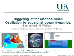
Jeremiah Brown and Ralph F Milliff NWRA Colorado Research Associates CoRA Division Boulder CO USA IOVWST Barcelona May 2010 MultiPlatform Analyses of MJO Convection on SubDaily Timescales ID: 793148
Download The PPT/PDF document "Multi-Platform Analyses of MJO Convectio..." is the property of its rightful owner. Permission is granted to download and print the materials on this web site for personal, non-commercial use only, and to display it on your personal computer provided you do not modify the materials and that you retain all copyright notices contained in the materials. By downloading content from our website, you accept the terms of this agreement.
Slide1
Multi-Platform Analyses of MJO Convection on Sub-Daily Timescales
Jeremiah Brown and Ralph F. MilliffNWRA, Colorado Research Associates (CoRA) DivisionBoulder, CO USA
IOVWST Barcelona, May 2010
Slide2Multi-Platform Analyses of MJO Convection on Sub-Daily Timescales
Jeremiah Brown and Ralph F. MilliffNWRA, Colorado Research Associates (CoRA) DivisionBoulder, CO USA
IOVWST Barcelona, May 2010
Tropics as a source region for important weather and climate events
(e.g. moisture supply to mid-latitudes, easterly waves, monsoons, TC’s , MJO, ENSO)
Shorter timescales, unique phenomena associated with tropical deep convection
(
organization
; e.g. mesoscale convective systems or MCS, tropical waves)
Human impacts (e.g. agriculture, fisheries, fresh water supply, drought, flood, fire,…)
Slide3Multi-Platform Analyses of MJO Convection on Sub-Daily Timescales
Jeremiah Brown and Ralph F. MilliffNWRA, Colorado Research Associates (CoRA) DivisionBoulder, CO USA
IOVWST Barcelona, May 2010
Tropics as a source region for important weather and climate events
(e.g. moisture supply to mid-latitudes, easterly waves, monsoons, TC’s , MJO, ENSO)
Shorter timescales, unique phenomena associated with tropical deep convection
(
organization
; e.g. mesoscale convective systems or MCS, tropical waves)
Human impacts (e.g. agriculture, fisheries, fresh water supply, drought, flood, fire,…)
Madden-Julian Oscillation (MJO) as a marker for observation and model capabilities for
tropical processes (slow eastward propagation, large scale, unknown initiation and
propagation mechanisms)
What are the limits imposed by temporal sampling inherent in multiple polar-orbiting
satellite systems?
Slide4Outgoing Longwave Radiation (OLR) Estimates fromClouds and Earth’s Radiant Energy System (CERES) on
Terra (1030) and Aqua (1330)daily average, 2.5 degreeSynoptic scale synthesis OLR product (SYN) from NASA Langley (LaRC)Combines GOES and CERES observations3-hourly, 1 degree
Blended
QuikSCAT
and NCEP Reanalysis (BLN) surface vector winds (SVW) from
Milliff et al., (2004); Chin et al., (1998) (old Level 3 product)
6-hourly (really 12), 0.5 degree
ASCAT L2 NRT retrievals from OSI SAF via JPL PODAAC
12-hourly, 12.5km (really 25)
Datasets from Multi-Sensor Satellite Observations
Convective Cloud Signatures
Zonal Wind and Surface Convergence
Wielicki
, B. A., B. R.
Barkstrom
, E. F. Harrison, R. B. Lee III, G. L. Smith, and J. E. Cooper, "Clouds and the Earth's Radiant Energy System (CERES): An Earth Observing System Experiment,"
Bull. Amer. Meteor. Soc
.,
77
, 853-868, 1996.
Slide5MJO Signal in OLR Anomaly Time vs. Longitude Diagram
November 2002
Indian Ocean
Western Pacific Ocean
Slide6MJO in Plan View: 3-hourly OLR anomaly from SYN (top) and running 24hr mean (bottom)
November 2002
MCS organization and variability embedded within MJO cloud shield
smaller, faster, westward difference signals at leading edges, throughout MJO
supercluster
active synoptic background affects and is affected by MJO
Slide7Recent Conceptual Models of the MJO:
Upscale transfers
Convective cloud source
Slide8Recent Conceptual Models of the MJO:
Upscale transfers
Momentum source
Slide9MJO in Plan View: 12-hourly zonal wind (top) and divergence (bottom) from QuikSCAT
L3November 2002
Anomalous easterlies (red) propagate slowly eastward
Divergence
extrema
associated with leading edge of MJO
propagation
zonal wind and divergence associated with background state as well
Slide10MJO in Plan View
: 3-hourly OLR (SYN; top) and 12-hourly DIV (QuikSCAT L3; bottom)
November 2002
Divergence
extrema
associated with MCS, embedded within MJO
Slide11MJO Signal in OLR Anomaly Time vs. Longitude Diagram
Indian Ocean
Western Pacific Ocean
October 2009
November 2009
Dec
ember 2009
January 2010
Slide12MJO in Plan View
: 2x-daily zonal wind from ASCAT (L2)
Need L3 products, sufficiently accurate to yield reliable divergence,
vorticity
fields (CCMP?)
Slide13Tropical events have important weather and climate-scale implications
multiple, nested temporal and spatial scales deep convective plume to MJO, monsoon, ENSO, etc. MCS building blocks resolvable, organization processes not well understood
challenge to space-borne observing systems
Require s
imultaneous
,
O(hourly
), high-resolution observations of critical quantities
multi-scale convective cloud systems and momentum (as shown)
moisture (humidity,
precip), temperature coarse resolution vertical structure (i.e. 2-layer) Bayesian Hierarchical Model (BHM) approach to MJO propagation mechanism in the tropical Indo-Pacific data stage inputs from multi-platform satellite observations
new
process models (upscale transfers)
Summary:
Slide14Supplementary Slides
Slide15Slide16active/passive microwave instrument
low-inclination orbit
wide swath, MCS resolution
SVW (convergence, curl)
SST,
T(z
)
Total column H
2
O, rain
cloud
TROPSAT Concept: seeking community interest/input
Image courtesy S. Nesbitt via B.
Mapes
2004