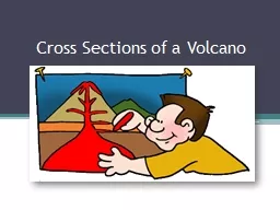
/
Drawing Cross Sections of a Topographical Map Drawing Cross Sections of a Topographical Map

Drawing Cross Sections of a Topographical Map - PowerPoint Presentation

kittie-lecroy
kittie-lecroy . @kittie-lecroy
Follow
397 views
Uploaded On 2017-01-18

Drawing Cross Sections of a Topographical Map - PPT Presentation

Specific Skill What you need Ruler Pencil Grid Paper Topographical map Step 1 Taking your ruler measure the length of the area you want to cross section in this case the length of the red line ID: 511302

skill step students line step skill line students contour paper curriculum map topographical mark grid links cross piece learn

Share:

Link:

Embed:

Download Presentation from below link

Download Presentation The PPT/PDF document "Drawing Cross Sections of a Topographica..." is the property of its rightful owner. Permission is granted to download and print the materials on this web site for personal, non-commercial use only, and to display it on your personal computer provided you do not modify the materials and that you retain all copyright notices contained in the materials. By downloading content from our website, you accept the terms of this agreement.


Presentation Transcript

Slide1

Drawing Cross Sections of a Topographical Map

Specific SkillSlide2

What you need

Ruler

Pencil

Grid Paper

Topographical mapSlide3

Step 1

Taking your ruler, measure the length of the area you want to cross section – in this case the length of the red line.

On a piece of grid paper draw this lineSlide4

Step 1Slide5

Step 2

On the vertical axis draw a line on the left hand side – every 2 squares on the grid should equal 100m in height. Label each 2 squares with an altitude.

Note: You will need to start with the lowest contour altitude and go to the highest – In this case the lowest being 100m and the highest 700m.Slide6

Step 2Slide7

Step 3

Using a blank piece of paper along the line on the contour map mark the two end points and then place a mark on the paper every time you reach a contour making sure that you mark the height of the contour.Slide8

Step 3Slide9

Step 4

Take that piece of paper and line it along the bottom of your graph. Mark the corresponding contour heights to those on your graph with a dot.Slide10

Step 4Slide11

Step 5

Join the dots with a line. You now have a cross section of a topographical map!

The next step is to label any relevant points. Slide12

Step 5

Kuriwao

Peak

Old Coach RoadSlide13

Links to the New Zealand Curriculum

Vision

– this skill enables students to be confident, connected, actively involved, live long learners.

Principles

– this skill directly related to all areas of the curriculum especially high expectations and learning to learn.

Values

– through this skill students will live up to all of the values listed in the curriculum – they will be encouraged to value excellence and innovation, inquiry and curiosity.Slide14

Links to the New Zealand Curriculum

Key Competencies

Thinking

– this is a hard skill to grasp so students will need to use creative and critical thinking.

Using language, symbols and text

– students will develop skills to read symbols on a topographical map and interpret them.

Managing self

– students will need to set high standards and develop a strategy to meet challenges.Slide15

Links to the Social Studies Curriculum

Topographical mapping is an important skill in Social Studies. Students may use this task when looking at environments or learn the task prior to moving onto Geography where the skill becomes extremely important.